18 UTC Best Track
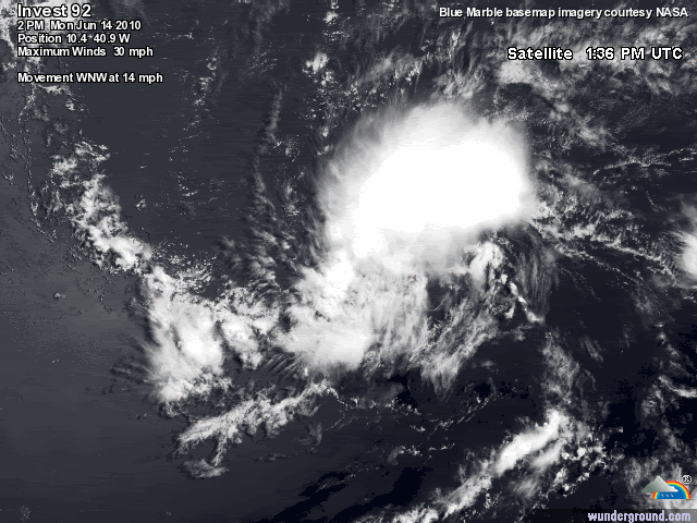
Center is at the lower end of convection.
AL, 92, 2010061418, , BEST, 0, 104N, 409W, 25, 1011, DB
ftp://ftp.tpc.ncep.noaa.gov/atcf/tcweb/ ... 010.invest
ATL : INVEST 92L - DISCUSSION
Moderator: S2k Moderators
-
cycloneye

- Admin

- Posts: 149514
- Age: 69
- Joined: Thu Oct 10, 2002 10:54 am
- Location: San Juan, Puerto Rico
Re: ATL : INVEST 92L - Discussion
0 likes
Visit the Caribbean-Central America Weather Thread where you can find at first post web cams,radars
and observations from Caribbean basin members Click Here
and observations from Caribbean basin members Click Here
-
Blown Away

- S2K Supporter

- Posts: 10253
- Joined: Wed May 26, 2004 6:17 am
Re: ATL : INVEST 92L - Discussion
Do you see the elongated LLC? There is still some convection along the N side of the LLC.
http://www.ssd.noaa.gov/goes/flt/t1/loop-vis.html

http://www.ssd.noaa.gov/goes/flt/t1/loop-vis.html
0 likes
Hurricane Eye Experience: David 79, Irene 99, Frances 04, Jeanne 04, Wilma 05… Hurricane Brush Experience: Andrew 92, Erin 95, Floyd 99, Matthew 16, Irma 17, Ian 22, Nicole 22…
-
cycloneye
- Admin
- Posts: 149514
- Age: 69
- Joined: Thu Oct 10, 2002 10:54 am
- Location: San Juan, Puerto Rico
Re: ATL : INVEST 92L - Discussion
From this afternoon's discussion by the NWS in San Juan:
TROPICAL DISTURBANCE LIKELY HAD ITS BEST CHANCE OF BECOMING THE
FIRST TROPICAL DEPRESSION OF THE YEAR LAST NIGHT. VISIBLE IMAGERY
SHOWS THAT DRY AIR HAS ENTRAINED INTO THE CIRCULATION AND IR
IMAGERY SHOWS SIGNIFICANT WARMING OF THE CLOUD TOPS AND CONVECTION
GETTING DISPLACED TO THE NORTHEAST. THUS IT APPEARS WE WONT SEE
ANY IMMEDIATE DEVELOPMENT AT LEAST IN THE SHORT TERM. NEW 18Z
SHIPS GUIDANCE MAINTAINS 15-20 KT SHEAR OVER THE NEXT FIVE DAYS
MAKING DEVELOPMENT/INTENSIFICATION VERY UNLIKELY. REGARDLESS OF
WHETHER THIS SYSTEM DEVELOPS OR NOT...GLOBAL MODELS PAINT A VERY
WET FORECAST BEGINNING SAT AND CONTINUING INTO EARLY NEXT WEEK AS
TROPICAL WAVE/DISTURBANCE MOVES ACROSS THE REGION AND MOIST
SOUTHEAST FLOW DEVELOPS AND INTERACTS WITH AN UPPER LEVEL TROUGH
TO THE NORTH OF PR.
http://forecast.weather.gov/product.php ... glossary=1
0 likes
Visit the Caribbean-Central America Weather Thread where you can find at first post web cams,radars
and observations from Caribbean basin members Click Here
and observations from Caribbean basin members Click Here


LOoks like the systems heading right for the throat of the higher shear, odds of development much reduced right now, but I'd still keep an eye on the systems remains if it can get to about 20-25N around 65-75W. Shear could be fairly low in that area...
But that is rather assuming it even gets that far north, which certainly isn't too likely if it remains weak and open like it probably will now.
But that is rather assuming it even gets that far north, which certainly isn't too likely if it remains weak and open like it probably will now.
0 likes
Personal Forecast Disclaimer:
The posts in this forum are NOT official forecast and should not be used as such. They are just the opinion of the poster and may or may not be backed by sound meteorological data. They are NOT endorsed by any professional institution or storm2k.org. For official information, please refer to the NHC and NWS products
The posts in this forum are NOT official forecast and should not be used as such. They are just the opinion of the poster and may or may not be backed by sound meteorological data. They are NOT endorsed by any professional institution or storm2k.org. For official information, please refer to the NHC and NWS products
-
USTropics
- Professional-Met

- Posts: 2739
- Joined: Sun Aug 12, 2007 3:45 am
- Location: Florida State University
Re: ATL : INVEST 92L - Discussion
Invest 92L with shear overlay (image taken at 4:45PM ET). 20-30 knots of shear evident to the north and west, with the northern part of the convection already experiencing 20+ knots.

0 likes
Anyone who thinks this system has much of a chance of surviving should have a look at just how high the shear is to the NW of the system, in the range of 30-50kts quite widely and 92L will likely get into at least the lower end of the range at some point.
0 likes
Personal Forecast Disclaimer:
The posts in this forum are NOT official forecast and should not be used as such. They are just the opinion of the poster and may or may not be backed by sound meteorological data. They are NOT endorsed by any professional institution or storm2k.org. For official information, please refer to the NHC and NWS products
The posts in this forum are NOT official forecast and should not be used as such. They are just the opinion of the poster and may or may not be backed by sound meteorological data. They are NOT endorsed by any professional institution or storm2k.org. For official information, please refer to the NHC and NWS products
-
vbhoutex

- Storm2k Executive
- Posts: 29149
- Age: 74
- Joined: Wed Oct 09, 2002 11:31 pm
- Location: Cypress, TX
- Contact:
Re: ATL : INVEST 92L - Discussion
It will be interesting to see if 92L can survive the shear in front of it. I haven't taken a good look at the shear forecasts, but if 92L's energy makes it past the shear I see no reason that it couldn't become a player again. One thing I have learned is NEVER SAY NEVER in the tropics. Time will tell.
0 likes
Skywarn, C.E.R.T.
Please click below to donate to STORM2K to help with the expenses of keeping the site going:

Please click below to donate to STORM2K to help with the expenses of keeping the site going:
-
Nederlander
- S2K Supporter
- Posts: 1259
- Joined: Sat Jul 19, 2008 4:28 pm
- Location: Conroe, TX
Re: ATL : INVEST 92L - Discussion
convection is weak, with most of it to the northeast side of the center of circulation. while the system does have decent rotation, that center of circulation is going to be exposed to more and more shear over the next couple of days..
0 likes
Will probably be close to nearly totally exposed if it decides to take a trip through that 40-50kts shear, thats really true cyclone killing material.
0 likes
Personal Forecast Disclaimer:
The posts in this forum are NOT official forecast and should not be used as such. They are just the opinion of the poster and may or may not be backed by sound meteorological data. They are NOT endorsed by any professional institution or storm2k.org. For official information, please refer to the NHC and NWS products
The posts in this forum are NOT official forecast and should not be used as such. They are just the opinion of the poster and may or may not be backed by sound meteorological data. They are NOT endorsed by any professional institution or storm2k.org. For official information, please refer to the NHC and NWS products
-
USTropics
- Professional-Met
- Posts: 2739
- Joined: Sun Aug 12, 2007 3:45 am
- Location: Florida State University
Re: ATL : INVEST 92L - Discussion
It's interesting to note that the SHIPS model has backed off on the strength of the shear that Invest 92L will experience from yesterday, in fact only the 48-60 hour period does 92L experience 20 knots of shear before backing down to 14-18 knots thereafter. I just took a look at the latest 850mb-200mb shear run from the GFS, and it suggests the subtropical jet stream may begin to lift north after 48 hours (where as yesterday it suggested this in the 100 hour time frame).
0 likes
-
Ivanhater

- Storm2k Moderator

- Posts: 11221
- Age: 39
- Joined: Fri Jul 01, 2005 8:25 am
- Location: Pensacola
Re: ATL : INVEST 92L - Discussion
USTropics wrote:It's interesting to note that the SHIPS model has backed off on the strength of the shear that Invest 92L will experience from yesterday, in fact only the 48-60 hour period does 92L experience 20 knots of shear before backing down to 14-18 knots thereafter. I just took a look at the latest 850mb-200mb shear run from the GFS, and it suggests the subtropical jet stream may begin to lift north after 48 hours (where as yesterday it suggested this in the 100 hour time frame).
Looks like the GFS is lifting shear out a lot sooner than earlier forecast.


0 likes
Michael

-
USTropics
- Professional-Met
- Posts: 2739
- Joined: Sun Aug 12, 2007 3:45 am
- Location: Florida State University
Re: ATL : INVEST 92L - Discussion
It's way to early to pull the plug on 92L, even with disruptive shear imminent in the next 36 hours, a weaker system generally tends to track more westward, and with decreasing shear in the central and western Caribbean along with high SST/TCHP, any remnant energy could fire back up. Climatology, for a first, would suggest this. However, short term I would say 92L has about 24-36 hours of marginal conditions to organize.
0 likes
-
tolakram
- Admin
- Posts: 20186
- Age: 62
- Joined: Sun Aug 27, 2006 8:23 pm
- Location: Florence, KY (name is Mark)
Re: ATL : INVEST 92L - Discussion
This is a good opportunity to see first hand just how bad sheer forecasts can be. 

0 likes
M a r k
- - - - -
Join us in chat: Storm2K Chatroom Invite. Android and IOS apps also available.
The posts in this forum are NOT official forecasts and should not be used as such. Posts are NOT endorsed by any professional institution or STORM2K.org. For official information and forecasts, please refer to NHC and NWS products.
-
HURRICANELONNY
- Category 5

- Posts: 1392
- Joined: Wed May 07, 2003 6:48 am
- Location: HOLLYWOOD.FL
Re: ATL : INVEST 92L - Discussion
I think the NHC jumped the gun when giving 92L a code red. Without looking ahead at the shear. It's only June. Hopefully they'll get this straight before we ramp up. 
0 likes
hurricanelonny
-
alienstorm

- Category 1

- Posts: 496
- Joined: Tue Jul 31, 2007 1:29 pm
- Location: Miami Fla western suburb
Lets wait and see how it looks tomorrow morning, it is holding on and the circulation seems more defined now then earlier in the day.
0 likes
Personal Forecast Disclaimer:The posts in this forum are NOT official forecast and should not be used as such. They are just the opinion of the poster and may or may not be backed by sound meteorological data. They are NOT endorsed by any professional institution or storm2k.org. For official information, please refer to the NHC and NWS products.
Well a couple of models are a little more favourable in the Caribbean then they have been in previous runs, but as others have said in the past its way too early to know.
Still its pretty obvious there is no way its going to miss the shear, its even easy to see on the Vis imagery at the moment...any development is highly unlikely over the next 3-4 days and if it somehow does manage to survive, its going to have to go right to square one again.
Still its pretty obvious there is no way its going to miss the shear, its even easy to see on the Vis imagery at the moment...any development is highly unlikely over the next 3-4 days and if it somehow does manage to survive, its going to have to go right to square one again.
0 likes
Personal Forecast Disclaimer:
The posts in this forum are NOT official forecast and should not be used as such. They are just the opinion of the poster and may or may not be backed by sound meteorological data. They are NOT endorsed by any professional institution or storm2k.org. For official information, please refer to the NHC and NWS products
The posts in this forum are NOT official forecast and should not be used as such. They are just the opinion of the poster and may or may not be backed by sound meteorological data. They are NOT endorsed by any professional institution or storm2k.org. For official information, please refer to the NHC and NWS products
-
cycloneye
- Admin
- Posts: 149514
- Age: 69
- Joined: Thu Oct 10, 2002 10:54 am
- Location: San Juan, Puerto Rico
Re: ATL : INVEST 92L - Discussion
Latest microwave image late this afternoon shows a system that has not gone poof as some would think by only looking at regular sat images. Lets see if D-MAX cause it to get better or this is the last gas.

0 likes
Visit the Caribbean-Central America Weather Thread where you can find at first post web cams,radars
and observations from Caribbean basin members Click Here
and observations from Caribbean basin members Click Here
-
bob rulz
- Category 5
- Posts: 1711
- Age: 36
- Joined: Sat Jan 28, 2006 7:30 pm
- Location: Salt Lake City, Utah
Re: ATL : INVEST 92L - Discussion
HURRICANELONNY wrote:I think the NHC jumped the gun when giving 92L a code red. Without looking ahead at the shear. It's only June. Hopefully they'll get this straight before we ramp up.
Conditions were very favorable at the time and the shear forecasts showed the shear far enough away to give 92L plenty of time to develop.
The NHC doesn't have to get anything "straight".
0 likes
Who is online
Users browsing this forum: No registered users and 30 guests