ENSO Updates (2007 thru 2023)

This is the general tropical discussion area. Anyone can take their shot at predicting a storms path.

Moderator: S2k Moderators

Forum rules

The posts in this forum are NOT official forecasts and should not be used as such. They are just the opinion of the poster and may or may not be backed by sound meteorological data. They are NOT endorsed by any professional institution or STORM2K. For official information, please refer to products from the National Hurricane Center and National Weather Service.

Help Support Storm2K
Message
Author
hcane27
Tropical Storm
Tropical Storm
Posts: 231
Joined: Tue Jan 31, 2006 7:33 pm

Re: ENSO Updates

#1461 Postby hcane27 » Tue Jun 08, 2010 3:04 pm

cycloneye wrote:This transition from El Nino to La Nina with Neutral being there only for a short period is not seen often.

Image


Actually , if one examines the transition years from nino to nina in the past ... since 1950 ... this year is actually transitioning at about the same rate as the others .. those years being 1964 , 1973 , 1983 , 1988 , 1995 , 1998 , and 2007
0 likes   

User avatar
cycloneye
Admin
Admin
Posts: 145299
Age: 68
Joined: Thu Oct 10, 2002 10:54 am
Location: San Juan, Puerto Rico

Re: ENSO=Read Dr Jeff Masters discussion (La Nina by July?)

#1462 Postby cycloneye » Tue Jun 08, 2010 4:18 pm

I found an error in the El Nino years list by Dr Master's post as 2002 was in an El Nino year and not 2001 that was Neutral.


Image
0 likes   
Visit the Caribbean-Central America Weather Thread where you can find at first post web cams,radars
and observations from Caribbean basin members Click Here

User avatar
cycloneye
Admin
Admin
Posts: 145299
Age: 68
Joined: Thu Oct 10, 2002 10:54 am
Location: San Juan, Puerto Rico

Re: ENSO Updates

#1463 Postby cycloneye » Wed Jun 09, 2010 5:55 am

Australian ENSO Wrap-Up update at 6/9/10

No big changes from their past update 2 weeks ago.

http://www.bom.gov.au/climate/enso/


Issued on Wednesday 9 June 2010

Neutral conditions persist in the Equatorial Pacific Ocean. Sea surface temperatures in the central Pacific have cooled by around half a degree in the last month, but remain within neutral thresholds. Trade winds and cloudiness near the date line have fluctuated around normal values.

The majority of international computer models are forecasting continued cooling of the tropical Pacific to below La Niña thresholds in the coming months. Some current indicators are consistent with these forecasts. In particular, temperatures below the surface of the equatorial Pacific continue to be around 3 to 4 degrees cooler than normal. The Southern Oscillation Index remains in positive territory, and is currently around +8.0. Sustained positive values above +8.0 are a typical indicator of La Niña.

Historically, about 35~40% of El Niño events are followed by a La Niña within the same year. Further cooling of central Pacific sea surface temperatures, coupled with a persistence of sub-surface cooling and positive SOI values in the next two months would further increase the chance of a La Niña in 2010.

Image
0 likes   
Visit the Caribbean-Central America Weather Thread where you can find at first post web cams,radars
and observations from Caribbean basin members Click Here

User avatar
cycloneye
Admin
Admin
Posts: 145299
Age: 68
Joined: Thu Oct 10, 2002 10:54 am
Location: San Juan, Puerto Rico

Re: ENSO=Australian 6/9/10=La Nina chance continues to grow

#1464 Postby cycloneye » Wed Jun 09, 2010 10:31 am

I found this in another board quoting JB about a brief stall of La Nina.

A significant burst of west wind is interrupting the La Nina onslaught and this is a sign that the MJO is alive and kicking. Forecasted pressures in the SOI determination area are reversing later this week, but something significant is moving through there and its effect on the tropics may be something to deal with in a couple of weeks.

Joe B
0 likes   
Visit the Caribbean-Central America Weather Thread where you can find at first post web cams,radars
and observations from Caribbean basin members Click Here

User avatar
Aquawind
Category 5
Category 5
Posts: 6714
Age: 62
Joined: Mon Jun 16, 2003 10:41 pm
Location: Salisbury, NC
Contact:

#1465 Postby Aquawind » Wed Jun 09, 2010 10:41 am

I am glad to see the La Nina coming fast. I wouldn't call it a fly in the ointment but a flea works..lol I know I know..it only takes one.
0 likes   

User avatar
cycloneye
Admin
Admin
Posts: 145299
Age: 68
Joined: Thu Oct 10, 2002 10:54 am
Location: San Juan, Puerto Rico

Re:

#1466 Postby cycloneye » Wed Jun 09, 2010 7:14 pm

Aquawind wrote:I am glad to see the La Nina coming fast. I wouldn't call it a fly in the ointment but a flea works..lol I know I know..it only takes one.


The only question that is left is,how strong La Nina will be,weak,moderate or strong.
0 likes   
Visit the Caribbean-Central America Weather Thread where you can find at first post web cams,radars
and observations from Caribbean basin members Click Here

User avatar
cycloneye
Admin
Admin
Posts: 145299
Age: 68
Joined: Thu Oct 10, 2002 10:54 am
Location: San Juan, Puerto Rico

Re: ENSO Updates=CPC 6/14/10=Nino 3.4 down to -0.5

#1467 Postby cycloneye » Mon Jun 14, 2010 9:56 am

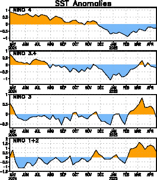
Climate Prediction Center 6/14/10 weekly update

Nino 3.4 area has reached -0.5 and that means it has arrived at La Nina threshold.

Last Week Numbers

Niño 4 +0.2C
Niño 3.4 -0.4C
Niño 3 -0.5C
Niño1+2 -0.2C

This Week Numbers

Niño 4= +0.1ºC
Niño 3.4= -0.5ºC
Niño 3= -0.6ºC
Niño1+2= -0.2ºC


http://www.cpc.ncep.noaa.gov/products/a ... ts-web.pdf


Image
0 likes   
Visit the Caribbean-Central America Weather Thread where you can find at first post web cams,radars
and observations from Caribbean basin members Click Here

User avatar
KWT
Category 5
Category 5
Posts: 31415
Joined: Tue Aug 17, 2004 11:02 am
Location: UK!!!

#1468 Postby KWT » Mon Jun 14, 2010 3:20 pm

Now we have to see how low we go, it does seem to have levelled off somewhat in the last few weeks though I think a further drop is likely soon.
0 likes   
Personal Forecast Disclaimer:
The posts in this forum are NOT official forecast and should not be used as such. They are just the opinion of the poster and may or may not be backed by sound meteorological data. They are NOT endorsed by any professional institution or storm2k.org. For official information, please refer to the NHC and NWS products

User avatar
P.K.
Professional-Met
Professional-Met
Posts: 5149
Joined: Thu Sep 23, 2004 5:57 pm
Location: Watford, England
Contact:

Re: ENSO Updates=CPC 6/14/10=Nino 3.4 reaches La Nina threshold

#1469 Postby P.K. » Tue Jun 15, 2010 6:45 am

I don't think it is quite right to say it has reached the La Nina threshold. It has to average -0.5C or lower (-0.8C or lower for the BoM) over a period of 3 months rather than just one week.
0 likes   

User avatar
cycloneye
Admin
Admin
Posts: 145299
Age: 68
Joined: Thu Oct 10, 2002 10:54 am
Location: San Juan, Puerto Rico

Re: ENSO Updates

#1470 Postby cycloneye » Wed Jun 16, 2010 10:07 am

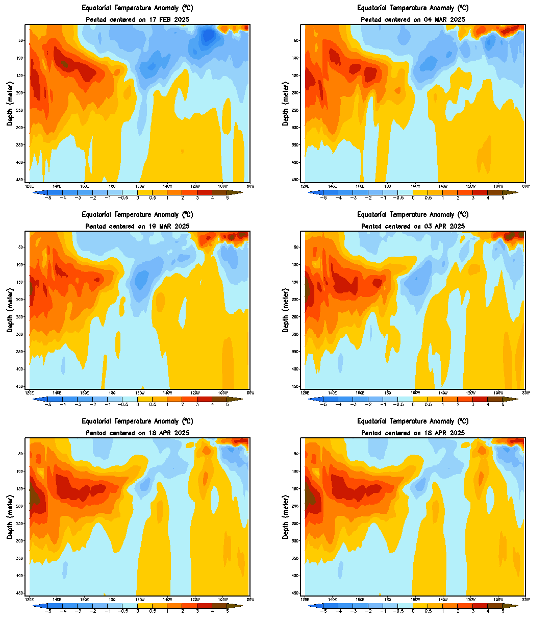
Only you have to see this loop of the subsurface waters in the equatorial Pacific how the colder waters have expanded. This signals that La Nina is expanding it's control slowly but surely and it will be declared officially in a few weeks by CPC.

Image
0 likes   
Visit the Caribbean-Central America Weather Thread where you can find at first post web cams,radars
and observations from Caribbean basin members Click Here

User avatar
KWT
Category 5
Category 5
Posts: 31415
Joined: Tue Aug 17, 2004 11:02 am
Location: UK!!!

Re: ENSO Updates=CPC 6/14/10=Nino 3.4 reaches La Nina threshold

#1471 Postby KWT » Wed Jun 16, 2010 1:11 pm

P.K. wrote:I don't think it is quite right to say it has reached the La Nina threshold. It has to average -0.5C or lower (-0.8C or lower for the BoM) over a period of 3 months rather than just one week.


In fact I think its longer then that for the CFS, I believe they like to have 5 tri-monthly figures below -0.5C for it to be La Nina offically, though your right in that for it to have reached the threshold it does need to last 3 months as well...

Still I think that is pretty likely to occur.
0 likes   
Personal Forecast Disclaimer:
The posts in this forum are NOT official forecast and should not be used as such. They are just the opinion of the poster and may or may not be backed by sound meteorological data. They are NOT endorsed by any professional institution or storm2k.org. For official information, please refer to the NHC and NWS products

User avatar
cycloneye
Admin
Admin
Posts: 145299
Age: 68
Joined: Thu Oct 10, 2002 10:54 am
Location: San Juan, Puerto Rico

Re: ENSO Updates

#1472 Postby cycloneye » Wed Jun 16, 2010 3:04 pm

The POAMA model (Australian) forecasts between Weak to Moderate La Nina status during all summer and fall.

http://www.bom.gov.au/climate/coupled_model/poama.shtml

Image
0 likes   
Visit the Caribbean-Central America Weather Thread where you can find at first post web cams,radars
and observations from Caribbean basin members Click Here

User avatar
KWT
Category 5
Category 5
Posts: 31415
Joined: Tue Aug 17, 2004 11:02 am
Location: UK!!!

#1473 Postby KWT » Wed Jun 16, 2010 3:49 pm

Well interestingly the ECM ensembles have slightly changed with the idea of the La Nina peaking July/August then slowly weakening again into the Autumn...

That is a unusual evolution however for it to get as strong as it progs then to weaken back towards nuetral.
0 likes   
Personal Forecast Disclaimer:
The posts in this forum are NOT official forecast and should not be used as such. They are just the opinion of the poster and may or may not be backed by sound meteorological data. They are NOT endorsed by any professional institution or storm2k.org. For official information, please refer to the NHC and NWS products

User avatar
cycloneye
Admin
Admin
Posts: 145299
Age: 68
Joined: Thu Oct 10, 2002 10:54 am
Location: San Juan, Puerto Rico

Re: ENSO Updates

#1474 Postby cycloneye » Wed Jun 16, 2010 3:59 pm

:uarrow: And KWT,here it is.I dont believe ENSO will swing like that in reallity.

Image
0 likes   
Visit the Caribbean-Central America Weather Thread where you can find at first post web cams,radars
and observations from Caribbean basin members Click Here

User avatar
cycloneye
Admin
Admin
Posts: 145299
Age: 68
Joined: Thu Oct 10, 2002 10:54 am
Location: San Juan, Puerto Rico

Re: ENSO Updates

#1475 Postby cycloneye » Thu Jun 17, 2010 8:54 am

Below is DR Jeff Masters discussion about La Nina starting in July. Will the 2010 Atlantic season be a repeat of 1998?

La Niña likely by July
El Niño rapidly dissipated in May, with sea surface temperatures (SSTs) over the tropical Eastern Pacific in the area 5°N - 5°S, 120°W - 170°W, also called the "Niña 3.4 region", falling to 0.50°C below average by June 14, according to NOAA.. The Australian Bureau of Meteorology is reporting that this number was 0.31°C below average (as of June 13.) Since La Niña conditions are defined as occurring when this number reaches 0.50°C below average, we are right at the threshold of a La Niña. NOAA's Climate Prediction Center has issued a La Niña watch, and it is likely that a full-fledged La Niña will emerge by July. Ten of the 23 El Niño models (updated as of May 19) are predicting La Niña conditions for hurricane season. However, as NOAA's Climate Prediction Center commented in their June 3 advisory, a number of the more reliable models are now calling for La Niña to develop this summer. They comment, "there is an increasing confidence in these colder model forecasts, which is supported by recent observations that show cooling trends in the Pacific Ocean and signs of coupling with the atmospheric circulation."

It is interesting to note that the last time we had a strong El Niño event, in 1998, El Niño collapsed dramatically in May, and a strong La Niña event developed by hurricane season. History appears to be repeating itself, and the emergence of La Niña will likely occur by July. The demise of El Niño, coupled with sea surface temperatures in the tropical Atlantic that are currently at record levels, suggest that a much more active Atlantic hurricane season that usual likely in 2010. The 1998 Atlantic hurricane season was about 40% above average in activity, with 14 named storms, 10 hurricanes, and 3 intense hurricanes. The season was relatively late-starting, with only one named storm occurring before August 20.
0 likes   
Visit the Caribbean-Central America Weather Thread where you can find at first post web cams,radars
and observations from Caribbean basin members Click Here

User avatar
cycloneye
Admin
Admin
Posts: 145299
Age: 68
Joined: Thu Oct 10, 2002 10:54 am
Location: San Juan, Puerto Rico

Re: ENSO Updates=IRI June update of all ENSO models

#1476 Postby cycloneye » Thu Jun 17, 2010 11:28 am

Here is the June IRI update of all the ENSO models and almost all forecast some kind of La Nina (Weak,Moderate or Strong) event later this summer.

http://iri.columbia.edu/climate/ENSO/cu ... pdate.html

Image

Image

ENSO Update
17 June 2010
Summary
Following the dissipation of the 2009/10 El Niño in early May 2010, ENSO-neutral conditions were observed. However, borderline La Niña conditions have just recently appeared in mid-June. For the June-August season in progress, there is an approximately 58% probability for developing La Niña conditions, and a 41% probability for maintaining neutral ENSO conditions. Probabilities for La Niña conditions increase to approximately 62% from the August-October season through the remainder of 2010.

General Discussion

By mid-June, the NINO3.4 SST anomaly index decreased to values near the borderline of weak La Niña levels. Since early March zonal wind anomalies in the equatorial Pacific have assumed near-average to slightly stronger than average easterlies, while subsurface heat content rapidly decreased through average to now well below-average levels as cooler than average subsurface sea temperatures occupied the central and east-central tropical Pacific.

Out of a large set of dynamical and statistical prediction models, 61% indicate development of La Niña conditions during the upcoming July-August-September season, while 39% indicate maintenance of ENSO-neutral conditions. Overall, based on model predictions and current observations of the ocean surface and subsurface, for the coming August-October season and throughout the remainder of 2010 the probability for La Niña conditions is estimated at 62%, and for ENSO-neutral conditions approximately 37%. Probabilities for a return to El Niño conditions are negligible through early northern spring 2011.
0 likes   
Visit the Caribbean-Central America Weather Thread where you can find at first post web cams,radars
and observations from Caribbean basin members Click Here

User avatar
cycloneye
Admin
Admin
Posts: 145299
Age: 68
Joined: Thu Oct 10, 2002 10:54 am
Location: San Juan, Puerto Rico

Re: ENSO Updates

#1477 Postby cycloneye » Mon Jun 21, 2010 11:12 am

Climate Prediction Center 6/21/10

Nino 3.4 at -0.5C,at the borderline of La Nina,but will not declared officially until the next few weeks.

Last Week Numbers

Niño 4= +0.1ºC
Niño 3.4= -0.5ºC
Niño 3= -0.6ºC
Niño1+2= -0.2ºC

This Week Numbers

Niño 4= 0.0ºC
Niño 3.4= -0.5ºC
Niño 3= -0.6ºC
Niño1+2= -0.7ºC

http://www.cpc.ncep.noaa.gov/products/a ... ts-web.pdf

Image
0 likes   
Visit the Caribbean-Central America Weather Thread where you can find at first post web cams,radars
and observations from Caribbean basin members Click Here

User avatar
KWT
Category 5
Category 5
Posts: 31415
Joined: Tue Aug 17, 2004 11:02 am
Location: UK!!!

#1478 Postby KWT » Mon Jun 21, 2010 3:19 pm

Yeah, if we don't drop much below that then I don't think there is much to prevent a huge season to be honest, 18-20 type season.
0 likes   
Personal Forecast Disclaimer:
The posts in this forum are NOT official forecast and should not be used as such. They are just the opinion of the poster and may or may not be backed by sound meteorological data. They are NOT endorsed by any professional institution or storm2k.org. For official information, please refer to the NHC and NWS products

User avatar
cycloneye
Admin
Admin
Posts: 145299
Age: 68
Joined: Thu Oct 10, 2002 10:54 am
Location: San Juan, Puerto Rico

Re: ENSO Updates=Australian 6/23/10 update=La Nina almost here

#1479 Postby cycloneye » Wed Jun 23, 2010 5:34 am

Australian 6/23/10 update

The Aussies in their update of ENSO say the odds of La Nina continue to increase.IMO,both them and Climate Prediction Center will officially proclaim the inevitable sometime in July.

http://www.bom.gov.au/climate/enso/

Odds firm for a La Niña event in 2010.
Issued on Wednesday 23 June 2010

Sea surface temperatures in the central equatorial Pacific have continued to cool over the past fortnight, and are now generally cooler than average in areas east of the date-line. Below the surface of the tropical Pacific, temperatures are now more than 4°C cooler than average in some areas. Trade winds in the western Pacific have strengthened, while cloudiness near the date-line has reduced. These indicators, together with the Southern Oscillation Index (SOI) which has been consistently positive since April, are consistent with the developing stages of a La Niña event.

The majority of climate models surveyed by the Bureau suggest current patterns and trends will continue, with a significant likelihood of further ocean cooling beyond La Niña thresholds before the end of the southern winter.

Historically, about 35 to 40% of El Niño events (such as occurred in 2009/10) are followed by a La Niña within the same year. The combination of current trends and model outlooks suggest the chance of a La Niña in 2010 is now clearly more likely than not.
0 likes   
Visit the Caribbean-Central America Weather Thread where you can find at first post web cams,radars
and observations from Caribbean basin members Click Here

User avatar
cycloneye
Admin
Admin
Posts: 145299
Age: 68
Joined: Thu Oct 10, 2002 10:54 am
Location: San Juan, Puerto Rico

Re: ENSO Updates

#1480 Postby cycloneye » Sat Jun 26, 2010 5:26 am

Look how those cold waters continue to rise to the surface meaning,La nina if it's not here already,is comming very soon.

Image
0 likes   
Visit the Caribbean-Central America Weather Thread where you can find at first post web cams,radars
and observations from Caribbean basin members Click Here


Return to “Talkin' Tropics”

Who is online

Users browsing this forum: kevin, Ulf and 18 guests