ATL : INVEST 92L - DISCUSSION
Moderator: S2k Moderators

Re: ATL : INVEST 92L - Discussion
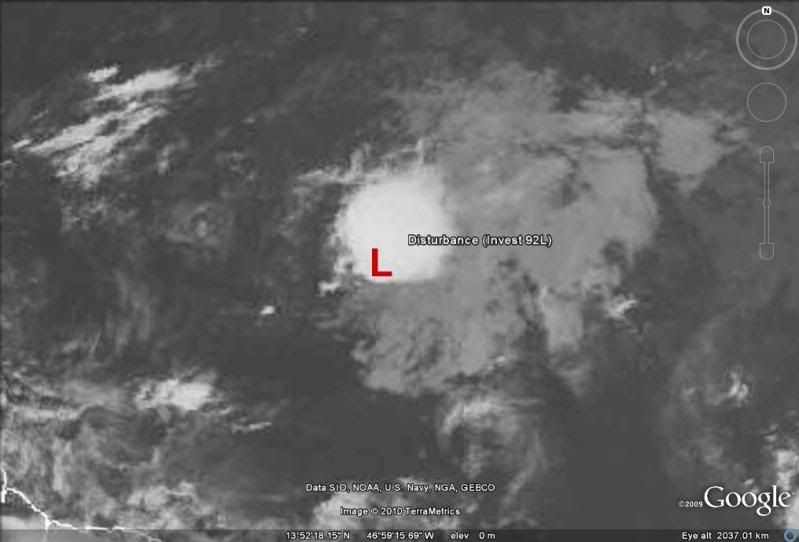
cycloneye wrote:First time I have seen this TRIMM image but 92L looks good right now.Maybe in a couple of hours,this burst ends but as of now,is doing good.
Very nice image, one more evidence that convection is very close to the LLC with its very evident circulation.
0 likes


-
wxman57

- Moderator-Pro Met

- Posts: 23175
- Age: 68
- Joined: Sat Jun 21, 2003 8:06 pm
- Location: Houston, TX (southwest)
Re:
NDG wrote:Yes, convection is now to the east but is not that far away from the LLC that I have been tracking all day as some might think. In fact Navy/NRL site has it centered at 14.1N/47.5W as of 00z.
Well, they had it in the wrong place this morning, as the weak LLC had shot out west of the convection. I'd put it closer to 49.0 or 49.5 now, if it still exists at all. Looking like an open wave.
0 likes

-
cycloneye

- Admin

- Posts: 149508
- Age: 69
- Joined: Thu Oct 10, 2002 10:54 am
- Location: San Juan, Puerto Rico
Re: ATL : INVEST 92L - Discussion
NDG wrote:
Exactly,where best track had it at 00 UTC.
0 likes
Visit the Caribbean-Central America Weather Thread where you can find at first post web cams,radars
and observations from Caribbean basin members Click Here
and observations from Caribbean basin members Click Here

-
dixiebreeze
- S2K Supporter

- Posts: 5140
- Joined: Wed Sep 03, 2003 5:07 pm
- Location: crystal river, fla.
Re: ATL : INVEST 92L - Discussion
cycloneye wrote:00 UTC Best Track
Hey,they saw the data from bouy!
AL, 92, 2010061600, , BEST, 0, 141N, 475W,30, 1010, DB
ftp://ftp.tpc.ncep.noaa.gov/atcf/tcweb/
Rather auspicious tonight Luis.
0 likes
-
ozonepete
- Professional-Met

- Posts: 4743
- Joined: Mon Sep 07, 2009 3:23 pm
- Location: From Ozone Park, NYC / Now in Brooklyn, NY
Re: ATL : INVEST 92L - Discussion
All I'd like to add at this early stage is that you just can't rely on shear forecasts. They are, and have been, awful many times. The reason why is obvious - there's very little good data out there over the open ocean. We just can't intialize the models well, and that is why the models have such a hard time making good shear forecasts: the input is so poor. I look at the CIMSS shear and forecast shear and shear tendency like everybody else, but they can't be relied on very much.
If you were looking at the very busy typhoon season last year, and relied on the model forecasts for shear, you would have made some really bad forecasts (like I did, haha). They completely overforecasted the shear last year for the Pacific and completely underforecasted it for the Atlantic. What will happen this season? The models will still get the shear wrong. They won't do a good job on shear until the storm is near land or the days when we have better readings out over the ocean with better satellite sensors.
So we should watch this one carefully until it's over, especially because it caught us by surprise to begin with.
Last edited by ozonepete on Tue Jun 15, 2010 9:31 pm, edited 1 time in total.
0 likes
-
cycloneye
- Admin
- Posts: 149508
- Age: 69
- Joined: Thu Oct 10, 2002 10:54 am
- Location: San Juan, Puerto Rico
Re: ATL : INVEST 92L - Discussion
Latest mircowave shows it has not crossed the 48W longitud but very close.

0 likes
Visit the Caribbean-Central America Weather Thread where you can find at first post web cams,radars
and observations from Caribbean basin members Click Here
and observations from Caribbean basin members Click Here

-
Ivanhater

- Storm2k Moderator

- Posts: 11221
- Age: 39
- Joined: Fri Jul 01, 2005 8:25 am
- Location: Pensacola
Re: ATL : INVEST 92L - Discussion
wxman57 wrote:That convection is well to the east of what's left of the LLC. It appears to be opening up and shearing apart. Chances of it surviving the shear over the next 3-5 days are slim.
Well east of the center? Not based on the 00Z position

I also don't think it is opening up, at least not yet. In fact with the buoy data today it is likely that it is a TD now. I've seen worse classified.

0 likes
Michael
-
cycloneye
- Admin
- Posts: 149508
- Age: 69
- Joined: Thu Oct 10, 2002 10:54 am
- Location: San Juan, Puerto Rico
Re: ATL : INVEST 92L - Discussion
The latest at 0215z.

0 likes
Visit the Caribbean-Central America Weather Thread where you can find at first post web cams,radars
and observations from Caribbean basin members Click Here
and observations from Caribbean basin members Click Here


Re: ATL : INVEST 92L - Discussion
It doesn't want to die yet, we can tell it's a fighter. Although I think the chances of development are low tonight I also think it may survive the shear and may become a player once it reaches the Caribbean as some models have been showing.
0 likes
-
bvigal

- S2K Supporter
- Posts: 2276
- Joined: Sun Jul 24, 2005 8:49 am
- Location: British Virgin Islands
- Contact:
Re:
Now why am I not surprised to hear you are on 3rd accountHURAKAN wrote:...First image of my 3rd photobucket account! LOL
Hey Hurakan, am I reading that shear map wrong? I was looking at the same thing, and 92 looks to me close to 30kt, then 40kt in a few hrs. Here, I've marked it on the pic you posted:

0 likes
-
Ivanhater
- Storm2k Moderator
- Posts: 11221
- Age: 39
- Joined: Fri Jul 01, 2005 8:25 am
- Location: Pensacola
Re: ATL : INVEST 92L - Discussion
Very impressive..even if it does not last, this kind of activity in June is a bad sign

0 likes
Michael
-
HURAKAN

- Professional-Met
- Posts: 46084
- Age: 39
- Joined: Thu May 20, 2004 4:34 pm
- Location: Key West, FL
- Contact:
Re: Re:
bvigal wrote:Hey Hurakan, am I reading that shear map wrong? I was looking at the same thing, and 92 looks to me close to 30kt, then 40kt in a few hrs. Here, I've marked it on the pic you posted:
Good observation. I missed that!
0 likes
Who is online
Users browsing this forum: No registered users and 63 guests