A1A wrote:Can someone explain to me the significance of the the red area and the blue zig zag area?
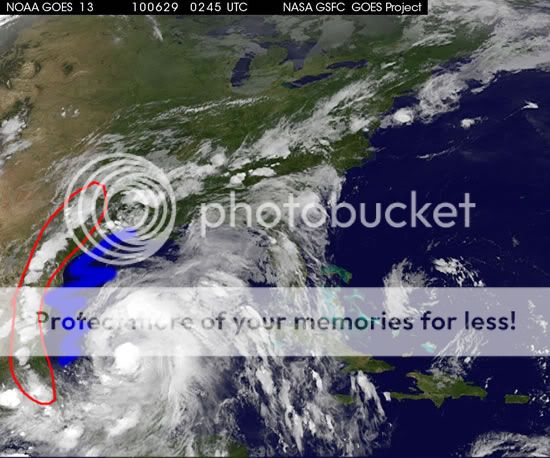
The blue area is dry air, not exactly sure about the red spot. Could it be a front or just a line of storms?
Moderator: S2k Moderators

A1A wrote:Can someone explain to me the significance of the the red area and the blue zig zag area?


A1A wrote:Can someone explain to me the significance of the the red area and the blue zig zag area?
Ivanhater wrote:


HouTXmetro wrote:That looks NNW and forward speed has really picked upped.

Evil Jeremy wrote:tailgater wrote::uarrow: Can't tell direction from IR loops.
I'm a little surprised that no TS warnings are up for the NW Yucatan coast.
No need.


mvtrucking wrote:Jeremy,
Do you have a link to where you got that graphic? Thanks in advance
MV
minter45 wrote:I haven't heard any talk about possible storm surge. I was just curious if I need to start getting ready for a massive surge, I live on galveston bay, and since Ike get a little uneasy with storm surges!!
minter45 wrote:I haven't heard any talk about possible storm surge. I was just curious if I need to start getting ready for a massive surge, I live on galveston bay, and since Ike get a little uneasy with storm surges!!

Good thing I decided to check the thread before posting this up. Looks like the NW is behind a bit due to that little pocket of dry air it's been dealing with, but the core is really starting to come together nowHURAKAN wrote:[img]http://www.nrlmry.navy.mil/tcdat/tc10/ATL/01L.ALEX/tc_ssmis/91hw/20100629.0208.f18.x.91hw.01LALEX.55kts-987mb-207N-916W.85pc.jpg[img]
Getting THAT look

A1A wrote:Can someone explain to me the significance of the the red area and the blue zig zag area?
Users browsing this forum: No registered users and 24 guests


