 So now we also know Jeff Masters' opinion of the NAM, to add to wxman's and others expressed here (my opinion, too)!
Strong wave near Leeward Islands - Is Invest 97L
Moderator: S2k Moderators
Forum rules

The posts in this forum are NOT official forecasts and should not be used as such. They are just the opinion of the poster and may or may not be backed by sound meteorological data. They are NOT endorsed by any professional institution or STORM2K. For official information, please refer to products from the National Hurricane Center and National Weather Service.
-
bvigal

- S2K Supporter

- Posts: 2276
- Joined: Sun Jul 24, 2005 8:49 am
- Location: British Virgin Islands
- Contact:
Re: Large wave approaching the Leeward Islands - Code Yellow
"none of the reliable computer models is calling for tropical cyclone development" So now we also know Jeff Masters' opinion of the NAM, to add to wxman's and others expressed here (my opinion, too)!
So now we also know Jeff Masters' opinion of the NAM, to add to wxman's and others expressed here (my opinion, too)!
0 likes
-
Gustywind

- Category 5

- Posts: 12334
- Joined: Mon Sep 03, 2007 7:29 am
- Location: Baie-Mahault, GUADELOUPE
From Crownweather discussion this morning:
 http://www.crownweather.com/?page_id=325
Tropical Weather Discussion
Issued: Sunday, July 18, 2010 645 am EDT/545 am CDT
Would you like this tropical weather discussion e-mailed to you each day? If so, just send an e-mail to: crownweatherservices-subscribe@yahoogroups.com and you will be added to our mailing list.
Discussion
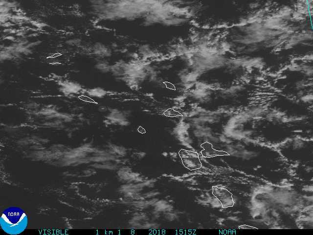
I am updating this discussion, so that I can discuss with you a broad area of low pressure that is located a little less than 600 miles east of the Windward Islands. Satellite imagery early this morning is producing some shower and thunderstorm activity, however, there is a lack of deep thunderstorm activity and development seems unlikely over at least the next couple of days. Environmental conditions right now are favorable in terms of wind shear, however, dry air will likely prevent development from happening today through at least Monday. Development may become more of a concern as we head into Tuesday and Wednesday and beyond that as it pushes north of Puerto Rico and Hispaniola.
The model guidance as a whole does not forecast development, however, it keeps this system pretty robust and strong. The GFS Parallel model forecasts that this low pressure system will track across the Florida Straits on Thursday and Thursday night and into the central Gulf of Mexico by Saturday before heading for the Texas-Louisiana border next Sunday. The European model forecasts that the ridge of high pressure will break down over the southeastern United States and thus brings this system across the Louisiana coast next Sunday and Monday.
Here is my thinking this morning: I think this system has a pretty good chance of developing later this week (Probably Thursday or beyond). One caveat to this is that if this system ends up tracking right over the Greater Antilles, the development chances would drop dramatically. Looking at the upper level winds and matching it to where this system is right now, it stands to reason that this system may end up tracking over Puerto Rico before tracking north of the rest of the Greater Antilles. Environmental conditions look favorable down the road when it gets into the Florida Straits late this weekend and then the Gulf of Mexico next weekend as a large upper level high pressure system builds and creates a favorable environment.
This system’s eventual track will largely depend on how far west a ridge of high pressure will build. The GFS model builds the high pressure system far enough west to put the Texas coast at risk; while, the European model is weaker with the high pressure system and puts the northern and northeastern Gulf coast at risk (from Louisiana to the Florida Panhandle).
At this point, this is something to watch over the next few days and should not be something to worry about, since it has not begun to develop and probably wont for at least the next 3 to 4 days or so.
Tropical Weather Discussion
Issued: Sunday, July 18, 2010 645 am EDT/545 am CDT
Would you like this tropical weather discussion e-mailed to you each day? If so, just send an e-mail to: crownweatherservices-subscribe@yahoogroups.com and you will be added to our mailing list.
Discussion
I am updating this discussion, so that I can discuss with you a broad area of low pressure that is located a little less than 600 miles east of the Windward Islands. Satellite imagery early this morning is producing some shower and thunderstorm activity, however, there is a lack of deep thunderstorm activity and development seems unlikely over at least the next couple of days. Environmental conditions right now are favorable in terms of wind shear, however, dry air will likely prevent development from happening today through at least Monday. Development may become more of a concern as we head into Tuesday and Wednesday and beyond that as it pushes north of Puerto Rico and Hispaniola.
The model guidance as a whole does not forecast development, however, it keeps this system pretty robust and strong. The GFS Parallel model forecasts that this low pressure system will track across the Florida Straits on Thursday and Thursday night and into the central Gulf of Mexico by Saturday before heading for the Texas-Louisiana border next Sunday. The European model forecasts that the ridge of high pressure will break down over the southeastern United States and thus brings this system across the Louisiana coast next Sunday and Monday.
Here is my thinking this morning: I think this system has a pretty good chance of developing later this week (Probably Thursday or beyond). One caveat to this is that if this system ends up tracking right over the Greater Antilles, the development chances would drop dramatically. Looking at the upper level winds and matching it to where this system is right now, it stands to reason that this system may end up tracking over Puerto Rico before tracking north of the rest of the Greater Antilles. Environmental conditions look favorable down the road when it gets into the Florida Straits late this weekend and then the Gulf of Mexico next weekend as a large upper level high pressure system builds and creates a favorable environment.
This system’s eventual track will largely depend on how far west a ridge of high pressure will build. The GFS model builds the high pressure system far enough west to put the Texas coast at risk; while, the European model is weaker with the high pressure system and puts the northern and northeastern Gulf coast at risk (from Louisiana to the Florida Panhandle).
At this point, this is something to watch over the next few days and should not be something to worry about, since it has not begun to develop and probably wont for at least the next 3 to 4 days or so.
0 likes

-
cycloneye

- Admin

- Posts: 148736
- Age: 69
- Joined: Thu Oct 10, 2002 10:54 am
- Location: San Juan, Puerto Rico
Re: Large wave approaching the Leeward Islands - Code Yellow
You can see the leading edge of wave starting to appear at the San Juan NWS long range.

0 likes
Visit the Caribbean-Central America Weather Thread where you can find at first post web cams,radars
and observations from Caribbean basin members Click Here
and observations from Caribbean basin members Click Here
-
Gustywind
- Category 5
- Posts: 12334
- Joined: Mon Sep 03, 2007 7:29 am
- Location: Baie-Mahault, GUADELOUPE
Re: Large wave approaching the Leeward Islands - Code Yellow
bvigal wrote:"none of the reliable computer models is calling for tropical cyclone development"

0 likes

Re: Large wave approaching the Leeward Islands - Code Yellow
Good question Vortex.
I'm going with it forming just north of the Islands and PR.
I don't like when they form in this area. Watching this one closely in MIA
I'm going with a TD/Bonnie in 24 to 36 hrs.
I'm going with it forming just north of the Islands and PR.
I don't like when they form in this area. Watching this one closely in MIA
I'm going with a TD/Bonnie in 24 to 36 hrs.
0 likes
-
cycloneye
- Admin
- Posts: 148736
- Age: 69
- Joined: Thu Oct 10, 2002 10:54 am
- Location: San Juan, Puerto Rico
Re: Large wave approaching the Leeward Islands - Code Yellow
See all later as I am going to church. Maybe is 97L in 2 hours. 
0 likes
Visit the Caribbean-Central America Weather Thread where you can find at first post web cams,radars
and observations from Caribbean basin members Click Here
and observations from Caribbean basin members Click Here
-
Gustywind
- Category 5
- Posts: 12334
- Joined: Mon Sep 03, 2007 7:29 am
- Location: Baie-Mahault, GUADELOUPE
Re: Large wave approaching the Leeward Islands - Code Yellow
cycloneye wrote:See all later as I am going to church. Maybe is 97L in 2 hours.
Ok Luis no problem
Gustywind
0 likes

I'd imagine 97L can't be far off with this system, whilst the odds of development are slim in the short term it does deserve to be watched given some of the models do come close to developing it...
0 likes
Personal Forecast Disclaimer:
The posts in this forum are NOT official forecast and should not be used as such. They are just the opinion of the poster and may or may not be backed by sound meteorological data. They are NOT endorsed by any professional institution or storm2k.org. For official information, please refer to the NHC and NWS products
The posts in this forum are NOT official forecast and should not be used as such. They are just the opinion of the poster and may or may not be backed by sound meteorological data. They are NOT endorsed by any professional institution or storm2k.org. For official information, please refer to the NHC and NWS products
-
SFLcane

- S2K Supporter
- Posts: 10281
- Age: 48
- Joined: Sat Jun 05, 2010 1:44 pm
- Location: Lake Worth Florida
Re:
KWT wrote:I'd imagine 97L can't be far off with this system, whilst the odds of development are slim in the short term it does deserve to be watched given some of the models do come close to developing it...
Can you access the navy site? Seems to be down
0 likes


Re: Large wave approaching the Leeward Islands - Code Yellow
wxman57 wrote:boca wrote:It still the NAM I don't believe that model unless the system is already developed. That model cries wolf all summer long usually.
And then i STILL don't believe it.
It's going to take a few days for the disturbance to consolidate and have a shot at developing. What gets my attention is the tremendous amount of moisture available across the Caribbean now. It's far greater than pre-Alex (I'll just post the loop links here):
pre-Alex:
http://cimss.ssec.wisc.edu/tropic/real- ... anim72.gif
Current:
http://cimss.ssec.wisc.edu/tropic/real- ... t72hrs.gif
Both GFS and Euro build a ridge over the SE U.S. in 3 days. However, both weaken it rather quickly. This could allow for an increasing risk to the northern Gulf coast vs. NE Mexico/south TX (should it develop).
Caribbean definitely seems primed for development. We'll just have to watch and wait now...
Would you include Houston / Galveston in that risk area.
Last edited by perk on Sun Jul 18, 2010 10:20 am, edited 1 time in total.
0 likes
-
Gustywind
- Category 5
- Posts: 12334
- Joined: Mon Sep 03, 2007 7:29 am
- Location: Baie-Mahault, GUADELOUPE
Re: Re:
SFLcane wrote:KWT wrote:I'd imagine 97L can't be far off with this system, whilst the odds of development are slim in the short term it does deserve to be watched given some of the models do come close to developing it...
Can you access the navy site? Seems to be down
Same problem!!! This link is downhttp://www.nrlmry.navy.mil/tc_pages/tc_home.html
Let's wait a bit...
0 likes
Lots of convection popping for sure right now close to the southern side of the ULL, its not lacking on that side of things (didn't pre-Alex also see a similar blow up in the E.Caribbean?)
Also the Navy site isn't working for me either right now.
Also the Navy site isn't working for me either right now.
0 likes
Personal Forecast Disclaimer:
The posts in this forum are NOT official forecast and should not be used as such. They are just the opinion of the poster and may or may not be backed by sound meteorological data. They are NOT endorsed by any professional institution or storm2k.org. For official information, please refer to the NHC and NWS products
The posts in this forum are NOT official forecast and should not be used as such. They are just the opinion of the poster and may or may not be backed by sound meteorological data. They are NOT endorsed by any professional institution or storm2k.org. For official information, please refer to the NHC and NWS products
-
SFLcane
- S2K Supporter
- Posts: 10281
- Age: 48
- Joined: Sat Jun 05, 2010 1:44 pm
- Location: Lake Worth Florida
Re: Large wave approaching the Leeward Islands - Code Yellow
http://www.nhc.noaa.gov/reconlist.shtml
000
NOUS42 KNHC 181515
WEATHER RECONNAISSANCE FLIGHTS
CARCAH, NATIONAL HURRICANE CENTER, MIAMI, FL.
1115 AM EDT SUN 18 JULY 2010
SUBJECT: TROPICAL CYCLONE PLAN OF THE DAY (TCPOD)
VALID 19/1100Z TO 20/1100Z JULY 2010
TCPOD NUMBER.....10-048
I. ATLANTIC REQUIREMENTS
1. NEGATIVE RECONNAISSANCE REQUIREMENTS.
2. SUCCEEDING DAY OUTLOOK: POSSIBLE LOW LEVEL
INVEST NEAR 21.0N 71.5W AT 20/1800Z. BEGIN
6-HRLY FIXES AT 21/0600Z IF SYSTEM DEVELOPS.
0 likes
Ah so we could well have recon with this system in a few days time and I think whenever you get recon tasking plus a system that is developing decent convection suggests 97L really can't be far off now.
0 likes
Personal Forecast Disclaimer:
The posts in this forum are NOT official forecast and should not be used as such. They are just the opinion of the poster and may or may not be backed by sound meteorological data. They are NOT endorsed by any professional institution or storm2k.org. For official information, please refer to the NHC and NWS products
The posts in this forum are NOT official forecast and should not be used as such. They are just the opinion of the poster and may or may not be backed by sound meteorological data. They are NOT endorsed by any professional institution or storm2k.org. For official information, please refer to the NHC and NWS products
-
Blown Away

- S2K Supporter
- Posts: 10253
- Joined: Wed May 26, 2004 6:17 am
Re: Large wave approaching the Leeward Islands - Code Yellow
0 likes
Hurricane Eye Experience: David 79, Irene 99, Frances 04, Jeanne 04, Wilma 05… Hurricane Brush Experience: Andrew 92, Erin 95, Floyd 99, Matthew 16, Irma 17, Ian 22, Nicole 22…
-
HURAKAN

- Professional-Met

- Posts: 46086
- Age: 38
- Joined: Thu May 20, 2004 4:34 pm
- Location: Key West, FL
- Contact:
Re: Large wave approaching the Leeward Islands - Code Yellow
Blown Away wrote::uarrow: Well I guess they think the low will form N of the big islands. Would they plan a flight for an invest tomorrow w/o declaring it today?
The flight is scheduled for the 20th, not tomorrow. Today is July 18.
0 likes
-
Ivanhater

- Storm2k Moderator

- Posts: 11166
- Age: 39
- Joined: Fri Jul 01, 2005 8:25 am
- Location: Pensacola
Re: Large wave approaching the Leeward Islands - Code Yellow
You just never know when the NHC is going to tag an invest..Recon is scheduled so I would think sometime today we will have 97L. Wxman57's thought on possible track is a bit concerning so keeping an eye out
0 likes
Michael
-
srainhoutx

- S2K Supporter
- Posts: 6919
- Age: 68
- Joined: Sun Jan 14, 2007 11:34 am
- Location: Haywood County, NC
- Contact:
Re: Large wave approaching the Leeward Islands - Code Yellow
0 likes
Carla/Alicia/Jerry(In The Eye)/Michelle/Charley/Ivan/Dennis/Katrina/Rita/Wilma/Ike/Harvey
Member: National Weather Association
Wx Infinity Forums
http://wxinfinity.com/index.php
Facebook.com/WeatherInfinity
Twitter @WeatherInfinity
Member: National Weather Association
Wx Infinity Forums
http://wxinfinity.com/index.php
Facebook.com/WeatherInfinity
Twitter @WeatherInfinity
Who is online
Users browsing this forum: cajungal, Hurricane2022, WaveBreaking, wwizard and 109 guests