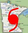
Reviewng High Resolution satellite loop the center appear to be forming north of the Mona Passage (20.5 - 20.7N). This system has now started it consolidation process and would be surpressing to see a TD later tonight and a TS tomorrow.
Hurricane is not out of the question here.
The lid is now coming off and the tropics will becom very active.
ATL: TROPICAL DEPRESSION BONNIE - DISCUSSION
Moderator: S2k Moderators
-
alienstorm

- Category 1

- Posts: 496
- Joined: Tue Jul 31, 2007 1:29 pm
- Location: Miami Fla western suburb
0 likes
Personal Forecast Disclaimer:The posts in this forum are NOT official forecast and should not be used as such. They are just the opinion of the poster and may or may not be backed by sound meteorological data. They are NOT endorsed by any professional institution or storm2k.org. For official information, please refer to the NHC and NWS products.

I don't think anyone is dismissing the panhandle, I happen to think though the odds are going down, esp when the models are probably under-doing the upper high again, as they have done over and over again recently...
0 likes
Personal Forecast Disclaimer:
The posts in this forum are NOT official forecast and should not be used as such. They are just the opinion of the poster and may or may not be backed by sound meteorological data. They are NOT endorsed by any professional institution or storm2k.org. For official information, please refer to the NHC and NWS products
The posts in this forum are NOT official forecast and should not be used as such. They are just the opinion of the poster and may or may not be backed by sound meteorological data. They are NOT endorsed by any professional institution or storm2k.org. For official information, please refer to the NHC and NWS products
-
alienstorm
- Category 1
- Posts: 496
- Joined: Tue Jul 31, 2007 1:29 pm
- Location: Miami Fla western suburb
Reviewng High Resolution satellite loop the center appear to be forming north of the Mona Passage (20.5 - 20.7N). This system has now started it consolidation process and would be surpressing to see a TD later tonight and a TS tomorrow.
Hurricane is not out of the question here.
The lid is now coming off and the tropics will becom very active.
Hurricane is not out of the question here.
The lid is now coming off and the tropics will becom very active.
0 likes
Personal Forecast Disclaimer:The posts in this forum are NOT official forecast and should not be used as such. They are just the opinion of the poster and may or may not be backed by sound meteorological data. They are NOT endorsed by any professional institution or storm2k.org. For official information, please refer to the NHC and NWS products.
Re: ATL: INVEST 97L - DISCUSSION
StormClouds63 wrote:Still looks like the system is getting sheared ... from the south to the north. Cloud tops being blown off toward the north. Not ready for TD status yet.
Nope its not quite there yet, they won't bother till recon now probably anyway, though no doubt unless this one rapidly implodes recon will go into this one...
0 likes
Personal Forecast Disclaimer:
The posts in this forum are NOT official forecast and should not be used as such. They are just the opinion of the poster and may or may not be backed by sound meteorological data. They are NOT endorsed by any professional institution or storm2k.org. For official information, please refer to the NHC and NWS products
The posts in this forum are NOT official forecast and should not be used as such. They are just the opinion of the poster and may or may not be backed by sound meteorological data. They are NOT endorsed by any professional institution or storm2k.org. For official information, please refer to the NHC and NWS products

-
Lowpressure

- S2K Supporter

- Posts: 2032
- Age: 59
- Joined: Sun Sep 14, 2003 9:17 am
- Location: Charlotte, North Carolina
Man, there is a lot going on in the sat loop posted above. Still do not see a defined LLC. Storms clearly developing in the area deemed as the center. Tons of afternoon storms of DR and Haiti- enhanced but not directly related to the system. Cirrus blowing everywhere, but no west direction observed imo. ULL moving away slowly. Still looks like a sharp wave axis to me- for now anyway. JMO.
0 likes
-
Lowpressure
- S2K Supporter
- Posts: 2032
- Age: 59
- Joined: Sun Sep 14, 2003 9:17 am
- Location: Charlotte, North Carolina
Re:
HURAKAN wrote:http://img709.imageshack.us/img709/4474/14535797.jpg
Requested by djones65 (David)
Enjoy!
The storm name you can't see is Bertha, 1996.
That helps- Azores to Texas. JK
0 likes
-
Aric Dunn
- Category 5

- Posts: 21238
- Age: 43
- Joined: Sun Sep 19, 2004 9:58 pm
- Location: Ready for the Chase.
- Contact:
Re: ATL: INVEST 97L - DISCUSSION
here is a rough look at the current wind field and the location of greatest vorticity or where we should see a low for overnight and tomorrow. A wnw motion should persist for at least the next few days as the high maintains or shifts slightly east. The strength of the system once it forms will help determine it long term path to florida. a far southerly track is unlikely but possible especially if the system stays weaker. the thing to remember is that the current setup will not hold exactly from day to day. although the ridge is forecast to remain the western extent of the ridge( which is more variable) is likely to erode slightly as a weak trough over the mid west tries to push south. the timing is of course important and models vary differently on what will happen some take it farther south and keep it weaker with little bend to the right. while other models keep it wnw for the next few days and bend it more right once in the gulf. with the low likely to develop a few hundred miles north of hispanola minimal island interaction should occur which should allow it to strengthen once a center is well defined. so for the next 24 hours until a well defined surface circ develops the models really are not going to offer much in the way of a good forecast beyond a general motion. So far the majority of the models keep a wnw motion through the period which would bring the system very near or to the florida coast by friday night.

0 likes
-
OverlandHurricane
- S2K Supporter
- Posts: 58
- Joined: Thu Aug 28, 2008 4:50 pm
- Location: Minnesota
Re: ATL: INVEST 97L - DISCUSSION
Nice work on those historical pics, HURAKAN. Do you make those yourself?
0 likes
-
HURAKAN

- Professional-Met

- Posts: 46084
- Age: 39
- Joined: Thu May 20, 2004 4:34 pm
- Location: Key West, FL
- Contact:
Re: ATL: INVEST 97L - DISCUSSION
OverlandHurricane wrote:Nice work on those historical pics, HURAKAN. Do you make those yourself?
Yep, very easy with "Eye of the Storm" + Paint!
0 likes
Aric, yeah until we get a solid center estimate we can't really assume anything other than it'll be heading towards S.florida/Straits more then likely within the next few days.
As for storm history, remember whilst they are useful, in every case we had at least a TS in this area, thus far we don't even have a TD...
As for storm history, remember whilst they are useful, in every case we had at least a TS in this area, thus far we don't even have a TD...
0 likes
Personal Forecast Disclaimer:
The posts in this forum are NOT official forecast and should not be used as such. They are just the opinion of the poster and may or may not be backed by sound meteorological data. They are NOT endorsed by any professional institution or storm2k.org. For official information, please refer to the NHC and NWS products
The posts in this forum are NOT official forecast and should not be used as such. They are just the opinion of the poster and may or may not be backed by sound meteorological data. They are NOT endorsed by any professional institution or storm2k.org. For official information, please refer to the NHC and NWS products
-
Lowpressure
- S2K Supporter
- Posts: 2032
- Age: 59
- Joined: Sun Sep 14, 2003 9:17 am
- Location: Charlotte, North Carolina
Re:
KWT wrote:Aric, yeah until we get a solid center estimate we can't really assume anything other than it'll be heading towards S.florida/Straits more then likely within the next few days.
As for storm history, remember whilst thwey are useful, in every case we had at least a TS in this area, thus far we don't even have a TD...
Good point, I can show you just as many systems that had high expectations in this area only to poof- sometimes without much explanation.
0 likes


-
Ivanhater

- Storm2k Moderator

- Posts: 11221
- Age: 39
- Joined: Fri Jul 01, 2005 8:25 am
- Location: Pensacola
Re: ATL: INVEST 97L - DISCUSSION
Looks like HPC and NHC(based on OFCI track) are thinking the Central Gulf coast.....as of now
0 likes
Michael
-
cycloneye

- Admin

- Posts: 149514
- Age: 69
- Joined: Thu Oct 10, 2002 10:54 am
- Location: San Juan, Puerto Rico
Re: ATL: INVEST 97L - DISCUSSION
wxman57, a couple of quick questions. How do you see things evolving? and what % do you have at this time.
0 likes
Visit the Caribbean-Central America Weather Thread where you can find at first post web cams,radars
and observations from Caribbean basin members Click Here
and observations from Caribbean basin members Click Here
-
Aric Dunn
- Category 5
- Posts: 21238
- Age: 43
- Joined: Sun Sep 19, 2004 9:58 pm
- Location: Ready for the Chase.
- Contact:
Re:
KWT wrote:Aric, yeah until we get a solid center estimate we can't really assume anything other than it'll be heading towards S.florida/Straits more then likely within the next few days.
As for storm history, remember whilst they are useful, in every case we had at least a TS in this area, thus far we don't even have a TD...
well I understand the general usage of climatology.. it is never a substitute for actual present synoptics.. climatology does not determine the motion of a system the synoptic setup does. so yes we can say pre season or when there is nothing out there that a system will form in these general areas and they typically move is certain directions but at this point the only forecast reasoning should be actual synoptic setup.
0 likes
-
Cryomaniac
- Category 5
- Posts: 1289
- Joined: Tue Aug 15, 2006 2:26 pm
- Location: Newark, Nottinghamshire, UK
- Contact:
Re: ATL: INVEST 97L - DISCUSSION
wzrgirl1 wrote:Never say never in the world of forecasting strength!!
Or better yet, don't forecast strength until a system has already developed, and even then take the forecasts with a pinch of salt.
The following is the opinion of Cryomaniac and is not backed by any evidence, meteorological, geological, economic or otherwise. As such it should not be used for any purpose.
I think this has a pretty good shot at developing, especially if the shear drops in the next 24 hours. Track is a pretty major guessing game at the moment, which means that the oil platforms will have to watch it closely. Of course, in that case the impact on the oil spill will have to be taken into account as well.
0 likes
-
johngaltfla

- Category 5
- Posts: 2073
- Joined: Sun Jul 10, 2005 9:17 pm
- Location: Sarasota County, FL
- Contact:
Re:
HURAKAN wrote:HPC:
(Canceling the images but referring to them)
FYI, HURAKAN, if those forecast models hold, that would be bad for SW Florida; we are super-saturated over the last month. Flooding would be the bigger issue.
0 likes
-
Nederlander
- S2K Supporter
- Posts: 1259
- Joined: Sat Jul 19, 2008 4:28 pm
- Location: Conroe, TX
Re: ATL: INVEST 97L - DISCUSSION
how does this system's track correspond to 'the box' (cant remember the correct name for it).. the idea behind this box is something to the effect of, historically storms that have formed into a TC have traveled through this region.. (not saying that a system passing through this region has a better chance of forming).. am I recalling this correctly??
0 likes
Who is online
Users browsing this forum: No registered users and 35 guests