
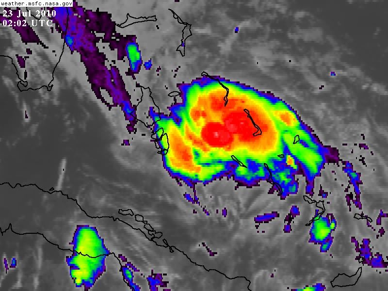
http://www.ssd.noaa.gov/goes/flt/t1/flash-ir2.html
feeder bands drying up also.....last gasp?...we shall see...
ATL: TROPICAL DEPRESSION BONNIE - DISCUSSION
Moderator: S2k Moderators
Re: ATL: TROPICAL STORM BONNIE - DISCUSSION
Florida1118 wrote:I heard from TWC the Tornado Threat was low. The NHC doesn't say anything about it. is there anyone who knows the tornado threat for tomorrow?
From the SPC:
Day 1 outlook
...S FL...
TS BONNIE IS FORECAST TO CONTINUE NWWD BY THE NHC TONIGHT WITH THE
CENTER FORECAST TO BE WITHIN 150 MI SE OF THE FL KEYS BY 12Z FRIDAY.
SOME INCREASE IN LOW LEVEL SHEAR WILL OCCUR TONIGHT...AND A MODEST
THREAT FOR AN ISOLATED TORNADO OR TWO MAY DEVELOP LATE IN
ASSOCIATION WITH STORMS LOCATED WITHIN OUTER BANDS.
HOWEVER...OVERALL THREAT DOES NOT APPEAR SUFFICIENT TO WARRANT A
CATEGORICAL RISK AT THIS TIME.
http://www.spc.noaa.gov/products/outlook/day1otlk.html
Day 2 outlook
...S FL DURING THE DAY...
TROPICAL DEPRESSION THREE COULD ATTAIN WEAK TROPICAL STORM STATUS
BEFORE CROSSING THE FL STRAITS TOMORROW /SEE LATEST NHC ADVISORIES
FOR DETAILS/. SOME ENHANCEMENT OF THE LOW-MIDLEVEL SHEAR IS
EXPECTED OVER S FL TO THE E/NE OF THE CYCLONE CENTER...AND A COUPLE
OF SUPERCELLS/BRIEF TORNADOES MAY OCCUR. WILL MAINTAIN ONLY LOW
SEVERE PROBABILITIES FOR THIS AREA BASED ON THE MARGINAL INTENSITY
OF THE CYCLONE AND TYPICAL UNCERTAINTIES IN STORM EVOLUTION.
http://www.spc.noaa.gov/products/outlook/day2otlk.html
0 likes
-
ConvergenceZone
.gif)
- Category 5

- Posts: 5241
- Joined: Fri Jul 29, 2005 1:40 am
- Location: Northern California
Re: Re:
wxman57 wrote:StormClouds63 wrote:Is it too late to rule out the possibility that the system dissipates or becomes just an
open wave? I thought it might be consolidating, but it appears in a much weaker state than 3-4 hours ago.
If the models are right and the system manages to stay at TS strength, landfall near Barataria Bay (near Grand Isle) or Terrebone Bay (near Houma) would not be good for our Louisiana wetlands and intrusion of oil further inland.
It's quite possible it could lose its LLC tonight. It does appear to be struggling now.
Wow, wouldn't that be a turn of events!!...I agree that it does appear to be struggling. On most satellite pics, you can't even tell if it's a tropical storm...It might just have too much going against it right now to survive in the short term. We'll see.
0 likes
Re: ATL: TROPICAL STORM BONNIE - DISCUSSION
sandwich...pancake...I think I mentioned that earlier.... 

0 likes

-
AdamFirst

- S2K Supporter

- Posts: 2490
- Age: 36
- Joined: Thu Aug 14, 2008 10:54 am
- Location: Port Saint Lucie, FL
Re:
HURAKAN wrote:How many times has been this system in death's door? and how many times has it come back? Never forget that!
Indeed.
It's not even here yet and I want it out of here.
0 likes
Dolphins Marlins Canes Golden Panthers HEAT
Andrew 1992 - Irene 1999 - Frances 2004 - Jeanne 2004 - Wilma 2005 - Fay 2008 - Isaac 2012 - Matthew 2016 - Irma 2017 - Dorian 2019 - Ian 2022 - Nicole 2022 - Milton 2024
Andrew 1992 - Irene 1999 - Frances 2004 - Jeanne 2004 - Wilma 2005 - Fay 2008 - Isaac 2012 - Matthew 2016 - Irma 2017 - Dorian 2019 - Ian 2022 - Nicole 2022 - Milton 2024
-
thetruesms

- Professional-Met

- Posts: 844
- Age: 42
- Joined: Thu Aug 16, 2007 1:14 pm
- Location: Tallahasee, FL
- Contact:
Since it never did seem to be answered, here's the deal on the "mismatch" of nearshore and offshore tropical storm warnings. Marine forecasts are zone based, so any watch/warning applied to any part of the zone is applied to the entire zone. Offshore zones also happen to be huge, and cover wide swaths of open water. So when the whole zone gets painted a tropical storm warning while nearshore zones have nothing, it's simply an artifact of the zone based warning system.
0 likes


Re:
HURAKAN wrote:How many times has been this system in death's door? and how many times has it come back? Never forget that!
Oh I have faith but there was a reason guidance suggested an opening up of the system....it fixin to book it west or south of west tonight or die trying to move NW...one of the 2....JMO of course....
0 likes


Re: ATL: TROPICAL STORM BONNIE - DISCUSSION
I think the LLC is right where this new convective burst is in the middle of the "cdo."
0 likes
-
ConvergenceZone
- Category 5
- Posts: 5241
- Joined: Fri Jul 29, 2005 1:40 am
- Location: Northern California

Re: ATL: TROPICAL STORM BONNIE - DISCUSSION
Well we should be able to track any MID level circ. in about 3 hrs. on this radar, be sure to uncheck the legend box so you can pick up the echos on the outer edge of the radar scope.
http://radar.weather.gov/radar.php?prod ... x&loop=yes
http://radar.weather.gov/radar.php?prod ... x&loop=yes
0 likes
The following post is NOT an official forecast and should not be used as such. It is just the opinion of the poster and may or may not be backed by sound meteorological data. It is NOT endorsed by any professional institution including storm2k.org For Official Information please refer to the NHC and NWS products.
-
HurricaneQueen

- S2K Supporter
- Posts: 1011
- Age: 80
- Joined: Sat Oct 12, 2002 7:36 pm
- Location: No. Naples, Fl (Vanderbilt Beach area)
Re: ATL: TROPICAL STORM BONNIE - DISCUSSION
While Bonnie is not looking very healthy right now, what effect could D Max have on her? Sorry for the amateurish question but when I see this getting written off, it begs the question. Thanks in advance.
Lynn
Lynn
0 likes
GO FLORIDA GATORS
-
sphelps8681
- Category 2

- Posts: 785
- Joined: Thu Aug 16, 2007 5:37 pm
- Location: Somewhere over the rainbow
Re: ATL: TROPICAL STORM BONNIE - DISCUSSION
From a post from AFM:
I think its hard to say whether or not it is well north of the points. I thought the initial location was probably too far SW to begin with. Until recon gets there and we have several fixes...its going to be difficult to say which was its moving. One thing is for sure...it will bump into the high. Whether or not you get some center relocations closer to the convection (which is likley)...the overall movement will be WNW and then W as it gets near the base of the ridge. I doubt the impacts for Fl will vary much...regardless of where the center is right now...
I think its hard to say whether or not it is well north of the points. I thought the initial location was probably too far SW to begin with. Until recon gets there and we have several fixes...its going to be difficult to say which was its moving. One thing is for sure...it will bump into the high. Whether or not you get some center relocations closer to the convection (which is likley)...the overall movement will be WNW and then W as it gets near the base of the ridge. I doubt the impacts for Fl will vary much...regardless of where the center is right now...
0 likes
-
wxgirl69

- Tropical Storm

- Posts: 120
- Age: 56
- Joined: Wed Nov 18, 2009 9:32 pm
- Location: Deer Park, Texas
Re: ATL: TROPICAL STORM BONNIE - DISCUSSION
From learning from all you wonderful people.. The storm has been upgraded from a depression to a TS.. I guess that means we may see a more north/west movement.. Just my amateur opinion..
0 likes
-
Air Force Met
- Military Met

- Posts: 4372
- Age: 57
- Joined: Tue Jul 08, 2003 9:30 am
- Location: Roan Mountain, TN
Re: ATL: TROPICAL STORM BONNIE - DISCUSSION
sphelps8681 wrote:
I read in one of your post that you thought the ridge would be to strong and (correct me If I am wrong) but there would be a weakness but the ridge would build back in. Is that still the case? And will the track move more to the left when that happens back to the original NHC track Tx/LA.
I think the ridge will remain very strong. The main factor in the eventual landfall will be center reformations toward convection. When that finally stops...I look for a more westward motion for a while. Whether or not this menas it ends up in W LA...I think is too early to say. I think we will probably know the answer to that tomorrow afternoon or evening.
0 likes
Re: ATL: TROPICAL STORM BONNIE - DISCUSSION
Air Force Met wrote:sphelps8681 wrote:
I read in one of your post that you thought the ridge would be to strong and (correct me If I am wrong) but there would be a weakness but the ridge would build back in. Is that still the case? And will the track move more to the left when that happens back to the original NHC track Tx/LA.
I think the ridge will remain very strong. The main factor in the eventual landfall will be center reformations toward convection. When that finally stops...I look for a more westward motion for a while. Whether or not this menas it ends up in W LA...I think is too early to say. I think we will probably know the answer to that tomorrow afternoon or evening.
So AF Met you think it holds together overnight or gets ripped up?
0 likes
-
Stormcenter
- S2K Supporter
- Posts: 6689
- Joined: Wed Sep 03, 2003 11:27 am
- Location: Houston, TX
Re:
I'm not worrying about Bonnie's survival. I personally hope
it goes poof.
it goes poof.
ConvergenceZone wrote:Now if that one remaining blob of convection starts to lose it's intensity and shrinks away, THEN I would really start worrying about its survival. The next few hours will be interesting.
0 likes
-
gboudx

- S2K Supporter
- Posts: 4090
- Joined: Thu Sep 04, 2003 1:39 pm
- Location: Rockwall, Tx but from Harvey, La
Houston met Larry Cosgrove's thoughts.
http://www.examiner.com/x-3775-Houston- ... iner-email
http://www.examiner.com/x-3775-Houston- ... iner-email
The ragged disturbance approaching South Florida has been declared "Tropical Storm Bonnie" by the National Hurricane Center. The TUTT signature to the left of the warped circulation did move away enough to lessen vertical wind shear on Thursday. But now that the upper low is running into the huge tropical thunderstorm complex stretching from Texas into the Bay of Campeche, another slowing-down process will occur. This arrangement will favor an erratic development scenario for "Bonnie" as the low enters the Gulf of Mexico. Following the lead of the numerical models on intensity (weak through the next 96 hours) but not track (I suspect that High Island TX will be the final stop on Monday morning), this feature could be a big rainmaker for parts of TX and LA before cyclolysis sets in later on July 26.
Yet another impulse is following "Bonnie", and the ECMWF scheme seems to hint at a substantial rain/thunder event in Texas during the middle of next week. the presence of so much tropical moisture will be a deterrent to extreme heat, which will be a force to be reckoned with in much of the Old South during the medium range.
An abundance of Saharan dust (and a suppressed ITCZ track should limit tropical cyclone potential from the "Cape Verde" arena through the remainder of July. I did notice, however, that the GFS model suite was showing convective circulations over the equatorial Atlantic Ocean in the first week of August. So while the near term is strictly a "tropical wave vs. the ridge" pattern, something of a stronger disturbed weather entity may appear nearing U.S. shores in about 2 to 3 weeks.
0 likes
-
tolakram
- Admin

- Posts: 20186
- Age: 62
- Joined: Sun Aug 27, 2006 8:23 pm
- Location: Florence, KY (name is Mark)
Re: ATL: TROPICAL STORM BONNIE - DISCUSSION
I would recommend people stop guessing about the LLC and instead look at the numerous observations plus the nighttime visible available at http://rammb.cira.colostate.edu/ramsdis ... opical.asp

Loop: http://rammb.cira.colostate.edu/ramsdis ... _floater_2
Loop: http://rammb.cira.colostate.edu/ramsdis ... _floater_2
0 likes
M a r k
- - - - -
Join us in chat: Storm2K Chatroom Invite. Android and IOS apps also available.
The posts in this forum are NOT official forecasts and should not be used as such. Posts are NOT endorsed by any professional institution or STORM2K.org. For official information and forecasts, please refer to NHC and NWS products.
Who is online
Users browsing this forum: No registered users and 138 guests