ENSO Updates (2007 thru 2023)

This is the general tropical discussion area. Anyone can take their shot at predicting a storms path.

Moderator: S2k Moderators

Forum rules

The posts in this forum are NOT official forecasts and should not be used as such. They are just the opinion of the poster and may or may not be backed by sound meteorological data. They are NOT endorsed by any professional institution or STORM2K. For official information, please refer to products from the National Hurricane Center and National Weather Service.

Help Support Storm2K
Message
Author
User avatar
cycloneye
Admin
Admin
Posts: 145295
Age: 68
Joined: Thu Oct 10, 2002 10:54 am
Location: San Juan, Puerto Rico

Re: Enso Updates=30 day SOI Index very positive=+17.0

#1521 Postby cycloneye » Sun Jul 25, 2010 7:59 am

The 30 day SOI index continues to shoot up fast,meaning La Nina continues to grow at a good pace. Brunota, I know that you follow the 90 day SOI and that is also going up.

http://www.longpaddock.qld.gov.au/seaso ... soivalues/

Image
0 likes   
Visit the Caribbean-Central America Weather Thread where you can find at first post web cams,radars
and observations from Caribbean basin members Click Here

User avatar
cycloneye
Admin
Admin
Posts: 145295
Age: 68
Joined: Thu Oct 10, 2002 10:54 am
Location: San Juan, Puerto Rico

Re: Enso Updates=30 day SOI Index very positive=+17.0

#1522 Postby cycloneye » Sun Jul 25, 2010 9:57 am

It looks like a Moderate La Nina right now by those numbers at graphic.

Image
0 likes   
Visit the Caribbean-Central America Weather Thread where you can find at first post web cams,radars
and observations from Caribbean basin members Click Here

User avatar
Portastorm
Storm2k Moderator
Storm2k Moderator
Posts: 9914
Age: 63
Joined: Fri Jul 11, 2003 9:16 am
Location: Round Rock, TX
Contact:

Re: Enso Updates=30 day SOI Index very positive=+17.0

#1523 Postby Portastorm » Sun Jul 25, 2010 10:57 am

As for right now, sure seems like an east-based Nina ... despite comments online in various places about this Nina ending up being west-based. I'm still reading/learning about the differences between the two.
0 likes   

User avatar
KWT
Category 5
Category 5
Posts: 31415
Joined: Tue Aug 17, 2004 11:02 am
Location: UK!!!

#1524 Postby KWT » Sun Jul 25, 2010 11:38 am

Yeah looks like its moderate, and moderate La Ninas tend to lead to surpressed numbers compared to what other background factors would prog (this year it'll probably be the difference between 14-16NS and 18-20NS...) with a greater threat south and west as we've already seen with Alex...
0 likes   
Personal Forecast Disclaimer:
The posts in this forum are NOT official forecast and should not be used as such. They are just the opinion of the poster and may or may not be backed by sound meteorological data. They are NOT endorsed by any professional institution or storm2k.org. For official information, please refer to the NHC and NWS products

User avatar
cycloneye
Admin
Admin
Posts: 145295
Age: 68
Joined: Thu Oct 10, 2002 10:54 am
Location: San Juan, Puerto Rico

Re:

#1525 Postby cycloneye » Sun Jul 25, 2010 3:08 pm

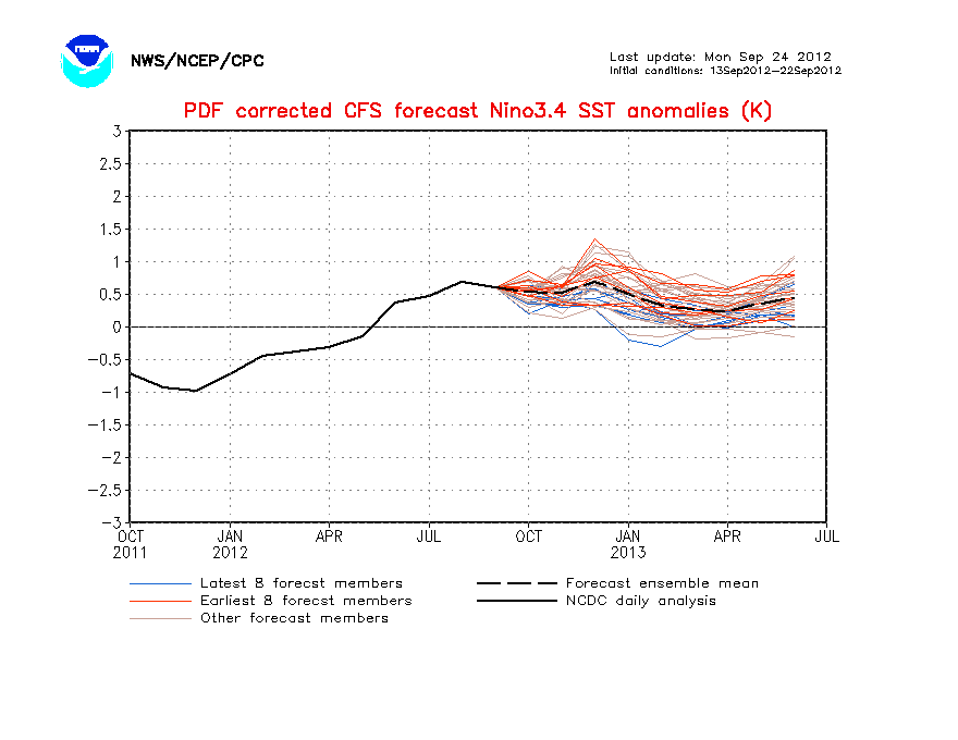
KWT wrote:Yeah looks like its moderate, and moderate La Ninas tend to lead to surpressed numbers compared to what other background factors would prog (this year it'll probably be the difference between 14-16NS and 18-20NS...) with a greater threat south and west as we've already seen with Alex...


Agree 100% on that.
0 likes   
Visit the Caribbean-Central America Weather Thread where you can find at first post web cams,radars
and observations from Caribbean basin members Click Here

User avatar
cycloneye
Admin
Admin
Posts: 145295
Age: 68
Joined: Thu Oct 10, 2002 10:54 am
Location: San Juan, Puerto Rico

Re: Enso Updates=30 day SOI Index very positive=+17.0

#1526 Postby cycloneye » Sun Jul 25, 2010 3:13 pm

I notice a little kink by September on the POAMA and CFS models. Maybe by the real peak of the season,La Nina may not be too moderate going to strong at that month.

Image

Image
0 likes   
Visit the Caribbean-Central America Weather Thread where you can find at first post web cams,radars
and observations from Caribbean basin members Click Here

User avatar
cycloneye
Admin
Admin
Posts: 145295
Age: 68
Joined: Thu Oct 10, 2002 10:54 am
Location: San Juan, Puerto Rico

Re: Enso Updates=30 day SOI Index very positive=+17.0

#1527 Postby cycloneye » Sun Jul 25, 2010 3:39 pm

Below is a very interesting read about ENSO and US Landfalls.

http://www.coaps.fsu.edu/papers/regiona ... 20Steering

ABSTRACT

The effects of El Niño-Southern Oscillation on hurricane activity in the Atlantic Basin as a whole have been well established. It is known that El Niño suppresses hurricane activity while La Niña enhances it. Regional differences in the impact of El Niño/La Niña on hurricane landfalls have been observed in the Caribbean. The present study focuses on regional differences in the impact of ENSO on hurricane landfalls in the United States.

Hurricane landfall frequencies for Florida and the U.S. East Coast (Georgia to Maine) for El Niño, neutral, and La Niña years are presented. An increase compared to neutral years in Florida landfalling hurricanes for La Niña years is not observed; however, there are more hurricanes making landfall in Florida than along the East Coast during neutral years. Results for the Gulf Coast (Alabama through Texas) are nearly identical to those for Florida. La Niña appears to only increase hurricane landfall activity relative to neutral years from Georgia northward in the United States.

Most previous ENSO impact studies have shown differences in hurricane activity between El Niño , neutral, and La Niña phases. In this study, differences are only observed in one out of the three phases. Along the East Coast, the effects of the El Niño and neutral phases are essentially the same, such that the scenario becomes El Niño/neutral vs. La Niña. Along the coasts of the Gulf of Mexico and Florida, there is a similar scenario. In this case, the effects of the La Niña and neutral phases are nearly identical, creating a La Niña/neutral vs. El Niño scenario.

Examination of the origin points and tracks of landfalling hurricanes for both regions are examined and results show that storms making landfall along the East Coast are more likely to form in the central Atlantic while those that make landfall in Florida usually form further west, in the Caribbean and the Gulf of Mexico. Also, there are fewer storms forming in the neutral phase in the usual origin regions for East Coast landfalling hurricanes than there are in the cold phase. Possible explanations for the regional variation in the impact of ENSO on hurricane landfalls, such as the North Atlantic Oscillation and steering patterns, are suggested.
0 likes   
Visit the Caribbean-Central America Weather Thread where you can find at first post web cams,radars
and observations from Caribbean basin members Click Here

User avatar
cycloneye
Admin
Admin
Posts: 145295
Age: 68
Joined: Thu Oct 10, 2002 10:54 am
Location: San Juan, Puerto Rico

Re: ENSO=CPC 7/26/10=Nino 3.4=-1.1 / Nino 3=-1.1 / Nino 1-2=-2.0

#1528 Postby cycloneye » Mon Jul 26, 2010 9:18 am

Climate Prediction Center 7/26/10 Weekly Update

The numbers continue to go down in all the areas suggesting that La Nina continues to get stronger, although officially CPC has not declared it yet.

Last Week Numbers

Niño 4= -0.4ºC
Niño 3.4= -1.0ºC
Niño 3= -1.0ºC
Niño1+2= -1.8ºC


This Week Numbers

Niño 4= -0.6ºC
Niño 3.4= -1.1ºC
Niño 3= -1.1ºC
Niño1+2= -2.0ºC


http://www.cpc.ncep.noaa.gov/products/a ... ts-web.pdf


Image
0 likes   
Visit the Caribbean-Central America Weather Thread where you can find at first post web cams,radars
and observations from Caribbean basin members Click Here

User avatar
cycloneye
Admin
Admin
Posts: 145295
Age: 68
Joined: Thu Oct 10, 2002 10:54 am
Location: San Juan, Puerto Rico

Re: ENSO=CPC 7/26/10=Nino 3.4 -1.1 / Nino 3 -1.1 / Nino 1+2 -2.0

#1529 Postby cycloneye » Mon Jul 26, 2010 4:26 pm

By only looking at the subsurface, La Nina may stay for many months, maybe to influence the 2011 season?

Image
0 likes   
Visit the Caribbean-Central America Weather Thread where you can find at first post web cams,radars
and observations from Caribbean basin members Click Here

User avatar
KWT
Category 5
Category 5
Posts: 31415
Joined: Tue Aug 17, 2004 11:02 am
Location: UK!!!

#1530 Postby KWT » Mon Jul 26, 2010 4:28 pm

Hard to say just now, we all saw how quickly the previous El nino imploded, that beinmg said its quite possible we will see a weak reflection still in 2011...probably much colder Atl SSTs as well...

Be grateful La nina has come on so strong, its really helping to cap those storms and limit the risk thus far. Looiking increasingly likely that whilst it'll be busy it won't be the exceptional season feared.
0 likes   
Personal Forecast Disclaimer:
The posts in this forum are NOT official forecast and should not be used as such. They are just the opinion of the poster and may or may not be backed by sound meteorological data. They are NOT endorsed by any professional institution or storm2k.org. For official information, please refer to the NHC and NWS products

User avatar
cycloneye
Admin
Admin
Posts: 145295
Age: 68
Joined: Thu Oct 10, 2002 10:54 am
Location: San Juan, Puerto Rico

Re: ENSO=CPC 7/26/10=Nino 3.4 -1.1 / Nino 3 -1.1 / Nino 1+2 -2.0

#1531 Postby cycloneye » Mon Jul 26, 2010 4:38 pm

Until I saw this graphic a few weeks ago when Dr Jeff Masters posted it at Wunderground, I was always in the thinking that La Nina seasons were more active than Neutral ones because of the less shear La Nina causes. I guess not. :)

Image
0 likes   
Visit the Caribbean-Central America Weather Thread where you can find at first post web cams,radars
and observations from Caribbean basin members Click Here

User avatar
KWT
Category 5
Category 5
Posts: 31415
Joined: Tue Aug 17, 2004 11:02 am
Location: UK!!!

#1532 Postby KWT » Mon Jul 26, 2010 4:44 pm

yeah its really complicated, the twaddle NOAA puts out about La ninas being more active is IMO based on perhaps cold ATL era...and doesn't work nearly so well in the warm phase when there is more juice anyway...

Who knows!
0 likes   
Personal Forecast Disclaimer:
The posts in this forum are NOT official forecast and should not be used as such. They are just the opinion of the poster and may or may not be backed by sound meteorological data. They are NOT endorsed by any professional institution or storm2k.org. For official information, please refer to the NHC and NWS products

hurricaneCW
Category 5
Category 5
Posts: 1794
Joined: Wed Mar 03, 2010 6:20 am
Location: Toms River, NJ

Re: ENSO=CPC 7/26/10=Nino 3.4 -1.1 / Nino 3 -1.1 / Nino 1+2 -2.0

#1533 Postby hurricaneCW » Mon Jul 26, 2010 4:49 pm

There's something called having too much of a good thing and it applies to La Nina as well. We all know that La Nina's favor more active hurricane seasons, but we should also know that if the La Nina becomes too strong, that the effects change as well. Even though this season will probably feature storms in the 14-16 range, a lot of them could become very strong due to well above normal SST's and favorable conditions that are likely to set in the next few weeks. Also, like in 2007, we will probably see quite a few low riders plus more Cape Verde storms due to well above normal water temps in the MDR and weakening SAL conditions from mid August-mid October.

Next year could be very active as well with a weakening La Nina to neutral conditions the most likely bet. In fact, next season we may feature a trade-off of record warm SST's to more favorable upper level winds. If climatology is correct, next season could feature even more storms than this season especially if the ENSO conditions go cold neutral, but we may also be talking more about quantity than quality unlike what I feel will happen this season.

I'm banking on a few more gulf storms, maybe a couple of Mexico or Central America hits, and one that affects either Florida or someone on the east coast. The season is just beginning and I'm dying to see what becomes of it.
0 likes   

User avatar
KWT
Category 5
Category 5
Posts: 31415
Joined: Tue Aug 17, 2004 11:02 am
Location: UK!!!

#1534 Postby KWT » Mon Jul 26, 2010 5:02 pm

hurricaneCW, yeah I agree with that. If there is one location that totally sticks out like a sore thumb in moderate La Nina years, its the Yucatan, that country has had many huge hits in those seasons, the list is actually pretty amazing and if you extend that down the whole of the Caribbean facing CA coast, you get a pretty insane list of cat-4/5s...
0 likes   
Personal Forecast Disclaimer:
The posts in this forum are NOT official forecast and should not be used as such. They are just the opinion of the poster and may or may not be backed by sound meteorological data. They are NOT endorsed by any professional institution or storm2k.org. For official information, please refer to the NHC and NWS products

User avatar
cycloneye
Admin
Admin
Posts: 145295
Age: 68
Joined: Thu Oct 10, 2002 10:54 am
Location: San Juan, Puerto Rico

Re: ENSO=CPC 7/26/10=Nino 3.4 -1.1 / Nino 3 -1.1 / Nino 1+2 -2.0

#1535 Postby cycloneye » Mon Jul 26, 2010 5:22 pm

KWT, do you think that there may be a lag in time and the real Moderate La Nina effects in the Atlantic may be seen by mid to late September and October? In other words, late season developments going into November and maybe December.
0 likes   
Visit the Caribbean-Central America Weather Thread where you can find at first post web cams,radars
and observations from Caribbean basin members Click Here

User avatar
Macrocane
Category 5
Category 5
Posts: 4218
Age: 36
Joined: Sun May 24, 2009 5:35 pm
Location: El Salvador

Re: ENSO=CPC 7/26/10=Nino 3.4 -1.1 / Nino 3 -1.1 / Nino 1+2 -2.0

#1536 Postby Macrocane » Mon Jul 26, 2010 6:07 pm

I've made a thread with some statistics about overall numbers of TS, hurricanes and major hurricanes during different phases of the ENSO: http://www.storm2k.org/phpbb2/viewtopic.php?f=31&t=108731
0 likes   

User avatar
cycloneye
Admin
Admin
Posts: 145295
Age: 68
Joined: Thu Oct 10, 2002 10:54 am
Location: San Juan, Puerto Rico

Re: ENSO=CPC 7/26/10=Nino 3.4 -1.1 / Nino 3 -1.1 / Nino 1+2 -2.0

#1537 Postby cycloneye » Mon Jul 26, 2010 7:19 pm

Wow,the 30 day SOI index continues to go up (See graphic at first post of this page) from +17.0 yesterday to tonight at +18.9. It hasn't been this high since April 2008.
0 likes   
Visit the Caribbean-Central America Weather Thread where you can find at first post web cams,radars
and observations from Caribbean basin members Click Here

User avatar
abajan
S2K Supporter
S2K Supporter
Posts: 4230
Joined: Sun Sep 07, 2003 5:10 am
Location: Barbados

Re: ENSO=CPC 7/26/10=Nino 3.4 -1.1 / Nino 3 -1.1 / Nino 1+2 -2.0

#1538 Postby abajan » Mon Jul 26, 2010 8:54 pm

cycloneye wrote:Until I saw this graphic a few weeks ago when Dr Jeff Masters posted it at Wunderground, I was always in the thinking that La Nina seasons were more active than Neutral ones because of the less shear La Nina causes. I guess not. :)

Image
Still, it’s not that much data on which to make a definitive deduction. If the records in the graphic spanned (say) a 50 year period, I would be more confident in the assumption of La Niña seasons producing less cyclones than Neutral ones.
0 likes   

User avatar
cycloneye
Admin
Admin
Posts: 145295
Age: 68
Joined: Thu Oct 10, 2002 10:54 am
Location: San Juan, Puerto Rico

Re: Enso Updates=30 day SOI index very positive up to +18.9

#1539 Postby cycloneye » Mon Jul 26, 2010 9:11 pm

Still, it’s not that much data on which to make a definitive deduction. If the records in the graphic spanned (say) a 50 year period, I would be more confident in the assumption of La Niña seasons producing less cyclones than Neutral ones.


Yes,I also would like to see the comparisons from way back to really see the trend.
0 likes   
Visit the Caribbean-Central America Weather Thread where you can find at first post web cams,radars
and observations from Caribbean basin members Click Here

User avatar
thetruesms
Professional-Met
Professional-Met
Posts: 844
Age: 41
Joined: Thu Aug 16, 2007 1:14 pm
Location: Tallahasee, FL
Contact:

Re: ENSO=CPC 7/26/10=Nino 3.4 -1.1 / Nino 3 -1.1 / Nino 1+2 -2.0

#1540 Postby thetruesms » Tue Jul 27, 2010 7:53 am

abajan wrote:
cycloneye wrote:Until I saw this graphic a few weeks ago when Dr Jeff Masters posted it at Wunderground, I was always in the thinking that La Nina seasons were more active than Neutral ones because of the less shear La Nina causes. I guess not. :)

[img]http://www.wunderground.com/hurricane/2010/since1995_dean.jpg[img]
Still, it’s not that much data on which to make a definitive deduction. If the records in the graphic spanned (say) a 50 year period, I would be more confident in the assumption of La Niña seasons producing less cyclones than Neutral ones.
Not to mention that each category has a fairly significant outlier - especially the outlier of all outliers, 2005. Truthfully, just from that data, you can really only make an argument for a difference between El Nino and not El Nino, and even that's stretching things. I like that Dr. Masters had the thought to compare the three phases, but I wish he had done a more complete job of it
0 likes   


Return to “Talkin' Tropics”

Who is online

Users browsing this forum: Google Adsense [Bot], RomP, Stormybajan and 51 guests