ATL: Ex COLIN - Discussion
Moderator: S2k Moderators
-
Dean4Storms
- S2K Supporter

- Posts: 6358
- Age: 63
- Joined: Sun Aug 31, 2003 1:01 pm
- Location: Miramar Bch. FL
Also, note the ULL just west of the upper portion of the wave and the TUTT-like feature north of the Bahamas - not the most favorable environment for redevelopment:
http://www.goes.noaa.gov/HURRLOOPS/huwvloop.html
just a guess, but it seems the convection is flaring due to the interaction of the wave and the ULL...
http://www.goes.noaa.gov/HURRLOOPS/huwvloop.html
just a guess, but it seems the convection is flaring due to the interaction of the wave and the ULL...
0 likes

Yep its a good call Frank IMO, but that sometimes does give systems a chance of surival, as we saqw with pre Bonnie, they can set-up the MLC which eventually does help to get things going.
0 likes
Personal Forecast Disclaimer:
The posts in this forum are NOT official forecast and should not be used as such. They are just the opinion of the poster and may or may not be backed by sound meteorological data. They are NOT endorsed by any professional institution or storm2k.org. For official information, please refer to the NHC and NWS products
The posts in this forum are NOT official forecast and should not be used as such. They are just the opinion of the poster and may or may not be backed by sound meteorological data. They are NOT endorsed by any professional institution or storm2k.org. For official information, please refer to the NHC and NWS products
-
hurricaneCW
- Category 5

- Posts: 1799
- Joined: Wed Mar 03, 2010 6:20 am
- Location: Toms River, NJ
Re: ATL : Tropical Storm Colin - DISCUSSION
I'm ready for this thing to just go away. There are better storms to come in the future, I hope. 92L has much better potential.
0 likes
Thanks - true, the MLC might get going but it's going to be tough with the environment as it is...
The past few seasons are very similar to the seasons of the 1980's when it comes to struggling tropical cyclones (not counting Alex, of course - which was in the "comfort zone" for hurricanes (also known as the BOC))...
LOL
The past few seasons are very similar to the seasons of the 1980's when it comes to struggling tropical cyclones (not counting Alex, of course - which was in the "comfort zone" for hurricanes (also known as the BOC))...
LOL
0 likes
-
pepeavilenho
- Tropical Storm

- Posts: 171
- Joined: Thu Jul 09, 2009 12:01 pm


Re: ATL : Tropical Storm Colin - DISCUSSION
This looks more impressive now compared to yesterday, but I don't see any sign of an LLC. I think this has a decent shot at redevelopment (maybe 50-60%), but this looks like it will take the "field goal" route between the US and Bermuda, and remain a fish.
0 likes
Re:
KWT wrote:Someone told me earlier that they think they spotted the lower level circulation, way out at 19/63....and looking at the loops its quite obvious actually.
If thats the case, boy is the shear severe right now, though it does have some convection nearby still
Recon will probably end up investigating the MLC instead bt they might sample both areas if there is time.
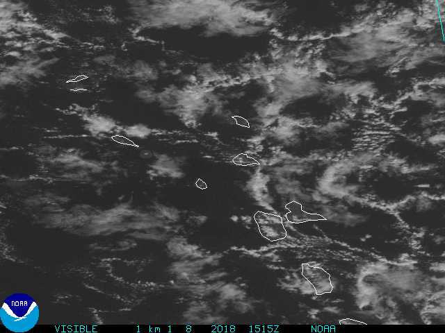
Not obvious at all by surface obs, but agree that if present it's getting slapped by shear. Map made from CIMSS TCTrak:

0 likes

Re: ATL : Tropical Storm Colin - DISCUSSION
Reviewing the latest dynamical models, I think Ex-Colin will become the 2nd hurricane of the 2010 season. The 06Z GFS global, HWRF, and GFDL all rapidly intensify ex-Colin east of the Bahamas and approach or stay west of Bermuda at Hurricane strength. Probably some baroclinic enhancement from the NE US trough.
0 likes
-
pepeavilenho
- Tropical Storm
- Posts: 171
- Joined: Thu Jul 09, 2009 12:01 pm

Re: Re:
HURAKAN wrote:pepeavilenho wrote:If it develops, it would be Colin?
I think so, but some of my friends think it would be Danielle....
It will be Colin
From NWSI (National Weather Service Instruction) 10-601: Tropical Cyclone Products
Within a basin, if the remnant of a tropical cyclone redevelops into a tropical cyclone, it is assigned its original number or name.
So as long as the system retains sufficient continuity between its new and former self, then a regenerated system would indeed be Colin.
The confusion arises from the case of Katrina. As the TCR states:
The depression was designated Tropical Depression Twelve rather than “Ten” because a separate tropical wave appeared to be partially responsible for the cyclogenesis, and, more importantly, the low-level circulation of Tropical Depression Ten was clearly not involved.
Again, if you believe the model evolution will play out, then ex-Colin would be Colin again.
0 likes
Re: ATL : Tropical Storm Colin - DISCUSSION
ronjon wrote:Reviewing the latest dynamical models, I think Ex-Colin will become the 2nd hurricane of the 2010 season. The 06Z GFS global, HWRF, and GFDL all rapidly intensify ex-Colin east of the Bahamas and approach or stay west of Bermuda at Hurricane strength. Probably some baroclinic enhancement from the NE US trough.
Wow thats a bold call for sure, from where it is now to a category-1.
I don't think frpom now on its going to lose its sheared presentation and probably will be quick to beocme extratropical further north given the sheared look, but still its looking increasingly like Pre-Bonnie.
I doubt it gets to hurricane, but I certainly wouldn't rule out a TS out of this...for the 2nd time, if only briefly as it starts to get caught by the jet further north.
0 likes
Personal Forecast Disclaimer:
The posts in this forum are NOT official forecast and should not be used as such. They are just the opinion of the poster and may or may not be backed by sound meteorological data. They are NOT endorsed by any professional institution or storm2k.org. For official information, please refer to the NHC and NWS products
The posts in this forum are NOT official forecast and should not be used as such. They are just the opinion of the poster and may or may not be backed by sound meteorological data. They are NOT endorsed by any professional institution or storm2k.org. For official information, please refer to the NHC and NWS products
-
Gustywind

- Category 5
- Posts: 12334
- Joined: Mon Sep 03, 2007 7:29 am
- Location: Baie-Mahault, GUADELOUPE
92L and Colin's remains worth watching
Posted by: JeffMasters, 14:38 GMT le 04 août 2010
Tropical Storm Colin was ripped apart by wind shear yesterday, and the storm's remnants are passing just north of the northernmost Lesser Antilles Islands today. Most of the heaviest thunderstorms are passing north of the islands, as seen on Guadeloupe radar. Long range radar out of Puerto Rico also shows this. Colin's remains are in a rather unfavorable environment for re-development, since the disturbance is passing beneath an upper-level low pressure system with dry air and high wind shear. Wind shear is a high 20 - 25 knots over Colin's remains this morning. Recent satellite imagery shows that heavy thunderstorm activity has increased in intensity and areal coverage over the past few hours, though, and Colin's remnants will need to be monitored for re-development.
Forecast for Colin's remains
The latest SHIPS model forecast predicts that wind shear will drop from 15 - 25 knots today to a moderate 15 - 20 knots on Thursday. Wind shear will continue to decline over the weekend, and this relaxation of shear prompts most of the major models to predict re-development of Colin sometime in the next four days. NHC is giving Colin's remain a 20% chance of developing into a tropical depression by Friday morning. A major trough of low pressure is expected to move off the U.S. East Coast on Friday, and this trough will pull Colin to the northwest and cause it to slow down. By Friday, Colin will be moving at half of its current speed. All of the major forecast models are predicting that the trough of low pressure will be strong enough to fully recurve Colin out to sea early next week. Colin's remains may pass close to Bermuda on Saturday, with the latest 06Z (2am EDT) run of the GFDL model predicting that Bermuda will experience tropical storm force winds on Saturday as Colin passes to the west of the island. The Hurricane Hunters are scheduled to investigate Colin's remains at 8pm EDT tonight. It currently appears that Colin will only be a threat to Bermuda and Canada.
0 likes
-
pepeavilenho
- Tropical Storm
- Posts: 171
- Joined: Thu Jul 09, 2009 12:01 pm
-
Blown Away

- S2K Supporter
- Posts: 10253
- Joined: Wed May 26, 2004 6:17 am
Re: ATL : Tropical Storm Colin - DISCUSSION
If ex-Colin stays weak/shallow wouldn't continue more west? The models sure do turn a weak low NW then N pretty quick?
0 likes
Hurricane Eye Experience: David 79, Irene 99, Frances 04, Jeanne 04, Wilma 05… Hurricane Brush Experience: Andrew 92, Erin 95, Floyd 99, Matthew 16, Irma 17, Ian 22, Nicole 22…
Who is online
Users browsing this forum: No registered users and 33 guests