ATL: EX-Tropical Depression FIVE - Discussion
Moderator: S2k Moderators
-
blazess556
- Professional-Met

- Posts: 250
- Joined: Mon Aug 31, 2009 10:51 pm
- Location: Germantown, MD


-
SFLcane

- S2K Supporter

- Posts: 10281
- Age: 48
- Joined: Sat Jun 05, 2010 1:44 pm
- Location: Lake Worth Florida
Re: ATL : INVEST 94L - Discussion
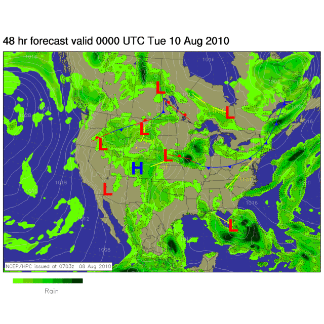
This system will bring about some significant rainfall totals across the florida peninsula during the next 1-2 days.
(Flood Watch) currently in affect for SFL
(Flood Watch) currently in affect for SFL
0 likes
-
cycloneye

- Admin

- Posts: 149583
- Age: 69
- Joined: Thu Oct 10, 2002 10:54 am
- Location: San Juan, Puerto Rico
Re: ATL : INVEST 94L - Discussion
It may resemble somewhat what TS Edouard did in 2002 but maybe a bit south of that track.

0 likes
Visit the Caribbean-Central America Weather Thread where you can find at first post web cams,radars
and observations from Caribbean basin members Click Here
and observations from Caribbean basin members Click Here
-
johngaltfla

- Category 5

- Posts: 2073
- Joined: Sun Jul 10, 2005 9:17 pm
- Location: Sarasota County, FL
- Contact:
Re: ATL: INVEST 94L - Discussion
Local mets are not dismissing this one out of hand. Saying it has potential when it reaches the gulf but until it gets there, it's just a blob of summer thunderstorms.
0 likes
-
srainhoutx

- S2K Supporter
- Posts: 6919
- Age: 68
- Joined: Sun Jan 14, 2007 11:34 am
- Location: Haywood County, NC
- Contact:
Re: ATL: INVEST 94L - Discussion
Stalled boundaries/troughs draped across the SE and Gulf in August can bring a surprise or two. Hard to deny the guidance over several days IMO.
0 likes
Carla/Alicia/Jerry(In The Eye)/Michelle/Charley/Ivan/Dennis/Katrina/Rita/Wilma/Ike/Harvey
Member: National Weather Association
Wx Infinity Forums
http://wxinfinity.com/index.php
Facebook.com/WeatherInfinity
Twitter @WeatherInfinity
Member: National Weather Association
Wx Infinity Forums
http://wxinfinity.com/index.php
Facebook.com/WeatherInfinity
Twitter @WeatherInfinity
-
Aric Dunn
- Category 5
- Posts: 21238
- Age: 43
- Joined: Sun Sep 19, 2004 9:58 pm
- Location: Ready for the Chase.
- Contact:
very interesting for sure and luckily we can watch evolve on radar which was easier 
0 likes
Note: If I make a post that is brief. Please refer back to previous posts for the analysis or reasoning. I do not re-write/qoute what my initial post said each time.
If there is nothing before... then just ask
Space & Atmospheric Physicist, Embry-Riddle Aeronautical University,
I believe the sky is falling...
If there is nothing before... then just ask
Space & Atmospheric Physicist, Embry-Riddle Aeronautical University,
I believe the sky is falling...
-
ColinDelia

- S2K Supporter
- Posts: 918
- Joined: Mon Aug 29, 2005 5:52 am
- Location: The Beach, FL

Re: ATL: INVEST 94L - Discussion
once cleared of FL will have to watch it closely.....LC is hot and with right conditions aloft you never know...
0 likes
-
CYCLONE MIKE
- Category 5
- Posts: 2183
- Joined: Tue Aug 31, 2004 6:04 pm
- Location: Gonzales, LA
Re: ATL: INVEST 94L - Discussion
Why did they tag the invest at 30.3N? I would have thought something working its way down in the persistant blob of convection between 25 and 28N.
0 likes
Re: ATL: INVEST 94L - Discussion
I was going to come in and point out the possibility of development from the hanging trough but 94L beat me to it. We really need the rain. We had green grass in dry season and browning grass now in the middle of wet season.
This homebrew is forming in the location where some models originally thought Colin would get pulled.
This homebrew is forming in the location where some models originally thought Colin would get pulled.
0 likes
-
srainhoutx
- S2K Supporter
- Posts: 6919
- Age: 68
- Joined: Sun Jan 14, 2007 11:34 am
- Location: Haywood County, NC
- Contact:
Re: ATL: INVEST 94L - Discussion
000
NOUS42 KNHC 081500 COR
WEATHER RECONNAISSANCE FLIGHTS
CARCAH, NATIONAL HURRICANE CENTER, MIAMI, FL.
1100 AM EDT SUN 08 AUGUST 2010
SUBJECT: TROPICAL CYCLONE PLAN OF THE DAY (TCPOD)
VALID 09/1100Z TO 10/1100Z AUGUST 2010
TCPOD NUMBER.....10-070 CORRECTION
I. ATLANTIC REQUIREMENTS
1. NEGATIVE RECONNAISSANCE REQUIREMENTS.
2. OUTLOOK FOR SUCCEEDING DAY: POSSIBLE LOW LEVEL
INVEST IN E. GULF NEAR 26.5N 83.5W AT 10/1800Z.
0 likes
Carla/Alicia/Jerry(In The Eye)/Michelle/Charley/Ivan/Dennis/Katrina/Rita/Wilma/Ike/Harvey
Member: National Weather Association
Wx Infinity Forums
http://wxinfinity.com/index.php
Facebook.com/WeatherInfinity
Twitter @WeatherInfinity
Member: National Weather Association
Wx Infinity Forums
http://wxinfinity.com/index.php
Facebook.com/WeatherInfinity
Twitter @WeatherInfinity
-
wzrgirl1

- S2K Supporter
- Posts: 1360
- Joined: Sat Sep 04, 2004 6:44 am
- Location: Pembroke Pines, Florida
Re: ATL: INVEST 94L - Discussion
What the....???? Where did this come from? I was just talking about these homebrewed systems in another thread. Should be extremely rainy here for a couple of days. I love watching the rain.
0 likes
-
thetruesms

- Professional-Met
- Posts: 844
- Age: 42
- Joined: Thu Aug 16, 2007 1:14 pm
- Location: Tallahasee, FL
- Contact:
Who is online
Users browsing this forum: No registered users and 54 guests