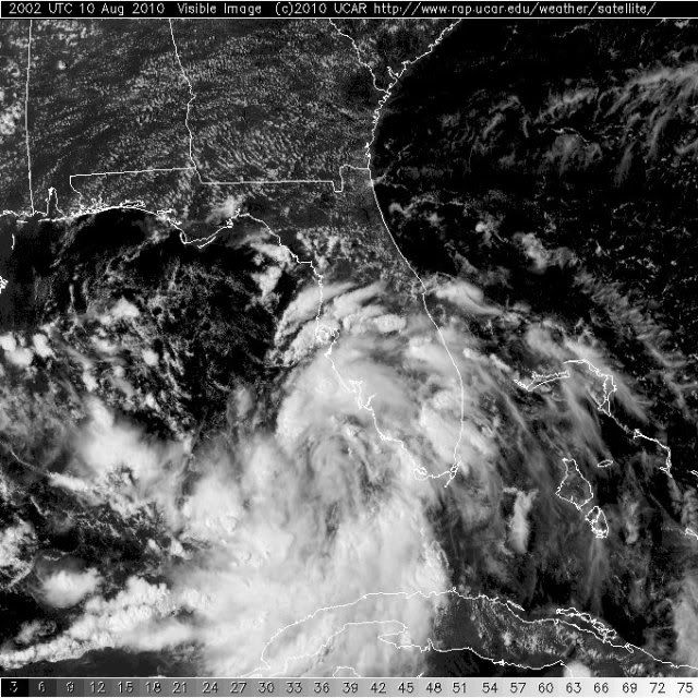
#612 Postby Aric Dunn » Tue Aug 10, 2010 3:24 pm
Stormcenter wrote:Looking at that radar loop would make you think 94L was headed northward right into
the FL. west coast.
Ivanhater wrote:
well I mentioned this earlier but there is a lot of vorticity with the MLC and most of the convective mass is associated with the MLC and the southerly flow is very much stronger than the westerly and NW. this is causes a similar phenomenon and a top when you first spin it.. it makes circles before staying in place... The LLC is too weak and not defined enough and convection is increasing away from the weak LLC so all this vorticity and convection is pulling on it and will eventually if enough convection develops with the MLC the LLC will consolidate under it and the whole thing will complete this "cyclonic loop" type motion. This will be the time when strengthening could occur.
just a note: the fluid dynamics that are behind the formation of tropical systems are not simply basic dynamics but have many parallels.
Last edited by
Aric Dunn on Tue Aug 10, 2010 3:25 pm, edited 1 time in total.
0 likes
Note: If I make a post that is brief. Please refer back to previous posts for the analysis or reasoning. I do not re-write/qoute what my initial post said each time.
If there is nothing before... then just ask

Space & Atmospheric Physicist, Embry-Riddle Aeronautical University,
I believe the sky is falling...