Disturbed weather in Eastern Atlantic (Is invest 95L)
Moderator: S2k Moderators
Forum rules
The posts in this forum are NOT official forecasts and should not be used as such. They are just the opinion of the poster and may or may not be backed by sound meteorological data. They are NOT endorsed by any professional institution or STORM2K. For official information, please refer to products from the National Hurricane Center and National Weather Service.
- cycloneye
- Admin

- Posts: 149596
- Age: 69
- Joined: Thu Oct 10, 2002 10:54 am
- Location: San Juan, Puerto Rico
Re: Strong Wave PGI-30L in West Africa (Models develop it)
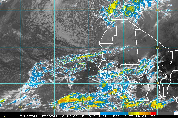
Here is a panoramic image of the whole African Continent where you may pick up the next wave that GFS,ECMWF and CMC develop behind our wave we are watching here.Of course, that one will have a new thread.


0 likes
Visit the Caribbean-Central America Weather Thread where you can find at first post web cams,radars
and observations from Caribbean basin members Click Here
and observations from Caribbean basin members Click Here
Re:
hurricanetrack wrote:Remember when the GFS showed Bill last year over and over running south and in to the Gulf? And it did not. Well, if the GFS is showing a system curing out over and over at this point, perhaps it could end up being just as wrong about that as it was about Bill. Yes, new GFS, but it seems to want to knock down heights as soon as it can. Maybe that will be the case, maybe not. Here we go though....lots of long nights ahead.
Of course, but what needs to be noted is the ECM also looks very troughy over the W.Atlantic and looks pretty similar to the GFS on its 12z run, but there is indeed plenty of time for the models to flip yet for sure!
0 likes
Personal Forecast Disclaimer:
The posts in this forum are NOT official forecast and should not be used as such. They are just the opinion of the poster and may or may not be backed by sound meteorological data. They are NOT endorsed by any professional institution or storm2k.org. For official information, please refer to the NHC and NWS products
The posts in this forum are NOT official forecast and should not be used as such. They are just the opinion of the poster and may or may not be backed by sound meteorological data. They are NOT endorsed by any professional institution or storm2k.org. For official information, please refer to the NHC and NWS products
- cycloneye
- Admin

- Posts: 149596
- Age: 69
- Joined: Thu Oct 10, 2002 10:54 am
- Location: San Juan, Puerto Rico
Re: Strong Wave PGI-30L in West Africa (Models develop it)
Is not even out of Africa and already, the colors are elevated.


0 likes
Visit the Caribbean-Central America Weather Thread where you can find at first post web cams,radars
and observations from Caribbean basin members Click Here
and observations from Caribbean basin members Click Here
- MiamiHurricanes10
- S2K Supporter

- Posts: 260
- Joined: Mon Jul 19, 2010 7:56 pm
- Location: Miami, Florida
-
JonathanBelles
- Professional-Met

- Posts: 11430
- Age: 35
- Joined: Sat Dec 24, 2005 9:00 pm
- Location: School: Florida State University (Tallahassee, FL) Home: St. Petersburg, Florida
- Contact:
- cycloneye
- Admin

- Posts: 149596
- Age: 69
- Joined: Thu Oct 10, 2002 10:54 am
- Location: San Juan, Puerto Rico
Re:
fact789 wrote:I havent been on a lot today. Can somebody tell me what a PGI is or stands for, and why this wave is being given special attention as a test invest?
Johnnathan, at link below you will get the whole explanation about this new concept of testing tropical waves. Is a neat site with many tools for each individual test invest. In this case is test invest PGI-30L. Also below is the link to this test being done for this particular wave.
http://met.nps.edu/~mtmontgo/marsupial.html
http://www.met.nps.edu/~mtmontgo/PGI30L.html
0 likes
Visit the Caribbean-Central America Weather Thread where you can find at first post web cams,radars
and observations from Caribbean basin members Click Here
and observations from Caribbean basin members Click Here
Re: Strong Wave PGI-30L in West Africa (Models develop it)
I am sure this one if it becomes a hurricane will recurve and become a fish storm. Any reasons why a develop tropical cyclone will be more likely to be influenced by upper level high pressure than a tropical wave?
0 likes
-
hurricaneCW
- Category 5

- Posts: 1799
- Joined: Wed Mar 03, 2010 6:20 am
- Location: Toms River, NJ
Re: Strong Wave PGI-30L in West Africa (Models develop it)
Wouldn't a developing storm or a strong storm more likely feel the high to its north. I think a meteorologist before explained that a stronger storm is more likely to go further west than a weaker one (unless it's a wave) because it sharpens the gradient and strengthens the high to its north. Anyone may feel free to correct me.
0 likes
Re: Strong Wave PGI-30L in West Africa (Models develop it)
the 18z is developing this way to fast IMO.....vs the 12z....not sold on a recurve just yet...
0 likes
- cycloneye
- Admin

- Posts: 149596
- Age: 69
- Joined: Thu Oct 10, 2002 10:54 am
- Location: San Juan, Puerto Rico
Re: Strong Wave PGI-30L in West Africa (Models develop it)
ROCK wrote:the 18z is developing this way to fast IMO.....vs the 12z....not sold on a recurve just yet...
Lets see what the 00z package brings.
0 likes
Visit the Caribbean-Central America Weather Thread where you can find at first post web cams,radars
and observations from Caribbean basin members Click Here
and observations from Caribbean basin members Click Here
- ConvergenceZone
- Category 5

- Posts: 5241
- Joined: Fri Jul 29, 2005 1:40 am
- Location: Northern California
Re: Strong Wave PGI-30L in West Africa (Models develop it)
Here she comes..., some decent convection offshore as well, not sure if anything will become of it though...


0 likes
- cycloneye
- Admin

- Posts: 149596
- Age: 69
- Joined: Thu Oct 10, 2002 10:54 am
- Location: San Juan, Puerto Rico
Re: Strong Wave PGI-30L in West Africa (Models develop it)
Fast foward from the above image that updates every six hours is the below one that updates every 15 minutes, that you can see in real time the latest on how the test invest PGI-30L wave looks and where it is.

0 likes
Visit the Caribbean-Central America Weather Thread where you can find at first post web cams,radars
and observations from Caribbean basin members Click Here
and observations from Caribbean basin members Click Here
- cycloneye
- Admin

- Posts: 149596
- Age: 69
- Joined: Thu Oct 10, 2002 10:54 am
- Location: San Juan, Puerto Rico
Re: Strong Wave PGI-30L in West Africa (Models develop it)
14 runs in a row from GFS developing this wave
Here we go with the 00z run. It starts at 54 hours.

Here we go with the 00z run. It starts at 54 hours.

0 likes
Visit the Caribbean-Central America Weather Thread where you can find at first post web cams,radars
and observations from Caribbean basin members Click Here
and observations from Caribbean basin members Click Here
- cycloneye
- Admin

- Posts: 149596
- Age: 69
- Joined: Thu Oct 10, 2002 10:54 am
- Location: San Juan, Puerto Rico
Re: Strong Wave PGI-30L in West Africa (Models develop it)
90 hours.


0 likes
Visit the Caribbean-Central America Weather Thread where you can find at first post web cams,radars
and observations from Caribbean basin members Click Here
and observations from Caribbean basin members Click Here
- MiamiHurricanes10
- S2K Supporter

- Posts: 260
- Joined: Mon Jul 19, 2010 7:56 pm
- Location: Miami, Florida
Re: Strong Wave PGI-30L in West Africa (Models develop it)
114 hours, a very spread out subtropical ridge indicative of a negative NAO.


0 likes
- cycloneye
- Admin

- Posts: 149596
- Age: 69
- Joined: Thu Oct 10, 2002 10:54 am
- Location: San Juan, Puerto Rico
Re: Strong Wave PGI-30L in West Africa (Models develop it)
132 hours.


0 likes
Visit the Caribbean-Central America Weather Thread where you can find at first post web cams,radars
and observations from Caribbean basin members Click Here
and observations from Caribbean basin members Click Here
- cycloneye
- Admin

- Posts: 149596
- Age: 69
- Joined: Thu Oct 10, 2002 10:54 am
- Location: San Juan, Puerto Rico
Re: Strong Wave PGI-30L in West Africa (Models develop it)
150 hours. The wave behind begins to take shape.


0 likes
Visit the Caribbean-Central America Weather Thread where you can find at first post web cams,radars
and observations from Caribbean basin members Click Here
and observations from Caribbean basin members Click Here
- cycloneye
- Admin

- Posts: 149596
- Age: 69
- Joined: Thu Oct 10, 2002 10:54 am
- Location: San Juan, Puerto Rico
Re: Strong Wave PGI-30L in West Africa (Models develop it)
174 hours. We have a strong hurricane at this point.


0 likes
Visit the Caribbean-Central America Weather Thread where you can find at first post web cams,radars
and observations from Caribbean basin members Click Here
and observations from Caribbean basin members Click Here
Who is online
Users browsing this forum: No registered users and 191 guests


