Disturbed weather in Eastern Atlantic (Is invest 95L)

This is the general tropical discussion area. Anyone can take their shot at predicting a storms path.

Moderator: S2k Moderators

Forum rules

The posts in this forum are NOT official forecasts and should not be used as such. They are just the opinion of the poster and may or may not be backed by sound meteorological data. They are NOT endorsed by any professional institution or STORM2K. For official information, please refer to products from the National Hurricane Center and National Weather Service.

Help Support Storm2K
Message
Author
Hugo1989
Tropical Storm
Tropical Storm
Posts: 147
Joined: Mon Jun 14, 2010 9:09 am

Re: Wave PGI-30L in Eastern Atlantic (Models develop it)

#761 Postby Hugo1989 » Tue Aug 17, 2010 11:43 am

srainhoutx wrote:Much further W this run. The trend continues day after day via guidance. For those that have been impatient regarding this season, we often forget that La Nina years bring later activity that can linger into November and even beyond IMO.


Strongly agree!
0 likes   

Wx_Warrior
Category 5
Category 5
Posts: 2718
Joined: Thu Aug 03, 2006 3:58 pm
Location: Beaumont, TX

Re: Wave PGI-30L in Eastern Atlantic (Models develop it)

#762 Postby Wx_Warrior » Tue Aug 17, 2010 11:44 am

Still a ways off. 300+ on models can be screwy.
0 likes   

User avatar
ronjon
Category 5
Category 5
Posts: 4822
Joined: Fri Aug 19, 2005 5:17 pm
Location: Hernando Beach, FL

Re: Wave PGI-30L in Eastern Atlantic (Models develop it)

#763 Postby ronjon » Tue Aug 17, 2010 11:45 am

That run of the GFS would be devastating. A major hurricane into northern Leewards, PR, moving over eastern Hispanola, the Bahamas, and N FL. Of course, its way out so its fantasy now but the trend is westward with more ridging over the Atlantic. Wonder what 12Z Euro will show.

Image
0 likes   

User avatar
srainhoutx
S2K Supporter
S2K Supporter
Posts: 6919
Age: 67
Joined: Sun Jan 14, 2007 11:34 am
Location: Haywood County, NC
Contact:

Re: Wave PGI-30L in Eastern Atlantic (Models develop it)

#764 Postby srainhoutx » Tue Aug 17, 2010 11:45 am

Wx_Warrior wrote:Still a ways off. 300+ on models can be screwy.


Concerning the Islands? 180 hours isn't that long. Regarding GA/FL? Certainly.
0 likes   
Carla/Alicia/Jerry(In The Eye)/Michelle/Charley/Ivan/Dennis/Katrina/Rita/Wilma/Ike/Harvey

Member: National Weather Association
Wx Infinity Forums
http://wxinfinity.com/index.php

Facebook.com/WeatherInfinity
Twitter @WeatherInfinity

User avatar
petit_bois
Tropical Storm
Tropical Storm
Posts: 227
Joined: Tue Jun 22, 2010 12:04 pm
Location: Petit Bois Island Mississippi

Re: Wave PGI-30L in Eastern Atlantic (Models develop it)

#765 Postby petit_bois » Tue Aug 17, 2010 11:47 am

srainhoutx wrote:
Wx_Warrior wrote:Still a ways off. 300+ on models can be screwy.


Concerning the Islands? 180 hours isn't that long. Regarding GA/FL? Certainly.


anything over 72 hrs gets very very iffy...
0 likes   
Resident of the Atlantic Basin's Major Hurricane Hit Capital!
Camille (200+winds), Frederic, Goerges, Katrina... and many many more.

Disclaimer: I'm likely the smartest guy here... but I have no idea where a tropical cyclone will go. I suggest you take my opinion as a grain of salt. I suggest you look to the National Hurricane Center for accurate info.

User avatar
cycloneye
Admin
Admin
Posts: 145330
Age: 68
Joined: Thu Oct 10, 2002 10:54 am
Location: San Juan, Puerto Rico

Re: Wave PGI-30L in Eastern Atlantic (Models develop it)

#766 Postby cycloneye » Tue Aug 17, 2010 11:47 am

For me is below the long range so that concerns me of course. :eek:
0 likes   
Visit the Caribbean-Central America Weather Thread where you can find at first post web cams,radars
and observations from Caribbean basin members Click Here

User avatar
Bocadude85
Category 5
Category 5
Posts: 2991
Age: 38
Joined: Mon Apr 18, 2005 2:20 pm
Location: Honolulu,Hi

Re: Wave PGI-30L in Eastern Atlantic (Models develop it)

#767 Postby Bocadude85 » Tue Aug 17, 2010 11:47 am

ronjon wrote:That run of the GFS would be devastating. A major hurricane into northern Leewards, PR, moving over eastern Hispanola, the Bahamas, and N FL. Of course, its way out so its fantasy now but the trend is westward with more ridging over the Atlantic. Wonder what 12Z Euro will show.

Image


Not to mention very rare.. a hurricane has not made landfall in Northeast Florida since Dora in 1964
0 likes   

hurricaneCW
Category 5
Category 5
Posts: 1794
Joined: Wed Mar 03, 2010 6:20 am
Location: Toms River, NJ

Re: Wave PGI-30L in Eastern Atlantic (Models develop it)

#768 Postby hurricaneCW » Tue Aug 17, 2010 11:49 am

That run could be too far west. There remains a lot of weakness off the east coast that would tend to bring storms further north. I feel the gfs will correct itself in the next few runs, unless the ridge actually does strengthen in which we could see the devastating run portrayed. Don't forget, the gfs showed a distinct recurve around Bermuda just a day or so ago.
0 likes   

User avatar
Vortex
S2K Supporter
S2K Supporter
Posts: 4644
Age: 53
Joined: Fri Aug 01, 2003 9:34 pm
Location: Hilton Head, SC

#769 Postby Vortex » Tue Aug 17, 2010 11:50 am

If the trends continue with the remaining guidance it will be interesting to read the disco out of san juan later today or Wednesday
0 likes   

User avatar
srainhoutx
S2K Supporter
S2K Supporter
Posts: 6919
Age: 67
Joined: Sun Jan 14, 2007 11:34 am
Location: Haywood County, NC
Contact:

Re: Wave PGI-30L in Eastern Atlantic (Models develop it)

#770 Postby srainhoutx » Tue Aug 17, 2010 11:51 am

petit_bois wrote:
srainhoutx wrote:
Wx_Warrior wrote:Still a ways off. 300+ on models can be screwy.


Concerning the Islands? 180 hours isn't that long. Regarding GA/FL? Certainly.


anything over 72 hrs gets very very iffy...


Patterns and trends can certainly be recognized via guidance. I suspect that some folks are just a bit antsy for something to form. I strongly suggest that the wait is almost over. Stay safe Island neighbors and keep informed.
0 likes   
Carla/Alicia/Jerry(In The Eye)/Michelle/Charley/Ivan/Dennis/Katrina/Rita/Wilma/Ike/Harvey

Member: National Weather Association
Wx Infinity Forums
http://wxinfinity.com/index.php

Facebook.com/WeatherInfinity
Twitter @WeatherInfinity

User avatar
Bocadude85
Category 5
Category 5
Posts: 2991
Age: 38
Joined: Mon Apr 18, 2005 2:20 pm
Location: Honolulu,Hi

Re: Wave PGI-30L in Eastern Atlantic (Models develop it)

#771 Postby Bocadude85 » Tue Aug 17, 2010 11:52 am

hurricaneCW wrote:That run could be too far west. There remains a lot of weakness off the east coast that would tend to bring storms further north. I feel the gfs will correct itself in the next few runs, unless the ridge actually does strengthen in which we could see the devastating run portrayed. Don't forget, the gfs showed a distinct recurve around Bermuda just a day or so ago.


Yes the models will continue to change but I am wondering if the models arent signaling a pattern change with stronger high pressure as we move into september.
0 likes   

User avatar
ronjon
Category 5
Category 5
Posts: 4822
Joined: Fri Aug 19, 2005 5:17 pm
Location: Hernando Beach, FL

Re: Wave PGI-30L in Eastern Atlantic (Models develop it)

#772 Postby ronjon » Tue Aug 17, 2010 11:52 am

JAX Landfall? Almost unheard of.

Image
0 likes   

User avatar
MiamiHurricanes10
S2K Supporter
S2K Supporter
Posts: 260
Joined: Mon Jul 19, 2010 7:56 pm
Location: Miami, Florida

Re: Wave PGI-30L in Eastern Atlantic (Models develop it)

#773 Postby MiamiHurricanes10 » Tue Aug 17, 2010 11:54 am

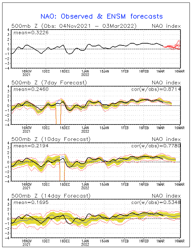
Never was bought on the recurvature, and I still ain't. Lol. Check out the NAO, not only will we have weaker and flatter troughs if that verified but the subtropical ridge would be positioned further south and west than normal. That's what the GFS is seeing when it brought PGI30L to the east coast. Now, this is still long ways off and is margin the very, very large errors, but it is something to watch for. If and when it develops we'll have a better clue as to its path and intensity. By the way, SAL is not what's having its role on PGI30L, its the cool SSTs it emerged on to. I think we'll have to wait another 36-48 hours before the system really begins to organize and intensify. And yes the system looks to be running into heavy SAL, no, it will not run into it. Notice how several global models and the pouch tracking all point towards a WSW turn as the subtropical ridge influences its steering. Also, as it moves towards the WSW it will be encountering much warmer SSTs.

Image
0 likes   

Aric Dunn
Category 5
Category 5
Posts: 21238
Age: 42
Joined: Sun Sep 19, 2004 9:58 pm
Location: Ready for the Chase.
Contact:

#774 Postby Aric Dunn » Tue Aug 17, 2010 11:55 am

I Think the most important aspect to take from the GFS is not that its forecasting a hurricane into the islands or the US but rather that its forecasting a major pattern shift. for the last month or so its had a consistent western atlantic trough and a weak bermuda high. This is the time of year where we would expect to see a strong sub tropical ridge to be in place and finally the GFS (which does the best with large synoptic patterns) is seeing a change. This change coupled with the warm SST (and many other factors that have led forecasters to see a very active season) will have a huge effect on the upper environment as well. when we have fairly strong sub tropical ridge the flow is more streamline so instead of having a bunch of ULL moving slowly around the atlantic we will see everything essentially flow from east to west and thats when we typically need to watch out.
0 likes   
Note: If I make a post that is brief. Please refer back to previous posts for the analysis or reasoning. I do not re-write/qoute what my initial post said each time.
If there is nothing before... then just ask :)

Space & Atmospheric Physicist, Embry-Riddle Aeronautical University,
I believe the sky is falling...

User avatar
KWT
Category 5
Category 5
Posts: 31415
Joined: Tue Aug 17, 2004 11:02 am
Location: UK!!!

#775 Postby KWT » Tue Aug 17, 2010 12:02 pm

Yeah but let see the ECM fall in line as it shows a rather different upper pattern with the upper troughing holding and given its been there for the last month, its thr form horse to back really. Still what the GFS is showing IS going to come in at some point I feel, not sure it'll be soon enough for this wave but you never know...GFS is a little progressive IMO.

Also I'd like to see something other then the GFS actually *develop* this system, none of the models really like this one anymore and are paying more attention to the 2nd system...which in some ways could be worse for risk down the line...
0 likes   
Personal Forecast Disclaimer:
The posts in this forum are NOT official forecast and should not be used as such. They are just the opinion of the poster and may or may not be backed by sound meteorological data. They are NOT endorsed by any professional institution or storm2k.org. For official information, please refer to the NHC and NWS products

Aric Dunn
Category 5
Category 5
Posts: 21238
Age: 42
Joined: Sun Sep 19, 2004 9:58 pm
Location: Ready for the Chase.
Contact:

#776 Postby Aric Dunn » Tue Aug 17, 2010 12:09 pm

well like in many situation when we get development there are 2 waves that merge to develop something. the models do not do well with that scenario and the second wave is close behind. so again I would not focus on development as a certainty rather a change in the pattern.
0 likes   
Note: If I make a post that is brief. Please refer back to previous posts for the analysis or reasoning. I do not re-write/qoute what my initial post said each time.
If there is nothing before... then just ask :)

Space & Atmospheric Physicist, Embry-Riddle Aeronautical University,
I believe the sky is falling...

floridasun78
Category 5
Category 5
Posts: 3755
Joined: Sun May 17, 2009 10:16 pm
Location: miami fl

Re:

#777 Postby floridasun78 » Tue Aug 17, 2010 12:17 pm

KWT wrote:Yeah but let see the ECM fall in line as it shows a rather different upper pattern with the upper troughing holding and given its been there for the last month, its thr form horse to back really. Still what the GFS is showing IS going to come in at some point I feel, not sure it'll be soon enough for this wave but you never know...GFS is a little progressive IMO.

Also I'd like to see something other then the GFS actually *develop* this system, none of the models really like this one anymore and are paying more attention to the 2nd system...which in some ways could be worse for risk down the line...

i disagree i do see first one that off Africa to be hurr by weekend and one you talking about be maybe ts if dont get to close to first one gfs forecast one off Africa to be strong hurr this time year for it so i do see it becoming hurr as gfs show this not june this aug
0 likes   

curtadams
S2K Supporter
S2K Supporter
Posts: 1122
Joined: Sun Aug 28, 2005 7:57 pm
Location: Orange, California
Contact:

#778 Postby curtadams » Tue Aug 17, 2010 12:18 pm

The GFS has been predicting, for almost a week, that this would develop into a healthy TS shortly after coming off the coast. Other models have generally disagreed. Well, the other models were right and the GFS flat wrong. So, I'd bet that for the next few days, the GFS will continue to be wrong and the other models right and we won't see any substantial development of this system.
0 likes   

User avatar
cycloneye
Admin
Admin
Posts: 145330
Age: 68
Joined: Thu Oct 10, 2002 10:54 am
Location: San Juan, Puerto Rico

Re: Wave PGI-30L in Eastern Atlantic (Models develop it)

#779 Postby cycloneye » Tue Aug 17, 2010 12:19 pm

Off Topic=There is a new test invest (PGI-31L) in front of the wave of this topic. Maybe it develops from this one?

http://www.met.nps.edu/~mtmontgo/PGI31L.html

Image
0 likes   
Visit the Caribbean-Central America Weather Thread where you can find at first post web cams,radars
and observations from Caribbean basin members Click Here

Frank2
Category 5
Category 5
Posts: 4061
Joined: Mon Jul 25, 2005 12:47 pm

Re: Wave PGI-30L in Eastern Atlantic (Models develop it)

#780 Postby Frank2 » Tue Aug 17, 2010 12:19 pm

Just a guess, but the models are going to flip flop back and forth unless something really gets going (as others have mentioned, nothing really out there at this moment), so anything at this point is bascially fiction - we all remember those crazy model runs of September 2008 (Ike) that had everyone in South Florida upset for a number of days, until the system unexpectedly dipped southward (a very bad season for Haiti, as some here might recall), so lettuce (it's lunchtime) wait and see...

Frank
0 likes   


Return to “Talkin' Tropics”

Who is online

Users browsing this forum: southmdwatcher, Steve H. and 40 guests