Gulf of Mexico Disturbance--PGI37L

This is the general tropical discussion area. Anyone can take their shot at predicting a storms path.

Moderator: S2k Moderators

Forum rules

The posts in this forum are NOT official forecasts and should not be used as such. They are just the opinion of the poster and may or may not be backed by sound meteorological data. They are NOT endorsed by any professional institution or STORM2K. For official information, please refer to products from the National Hurricane Center and National Weather Service.

Help Support Storm2K
Message
Author
rockyman
Category 5
Category 5
Posts: 1967
Joined: Thu Jun 26, 2003 12:24 pm
Location: Dauphin Island, AL

Gulf of Mexico Disturbance--PGI37L

#1 Postby rockyman » Tue Aug 17, 2010 7:57 pm

The 18z GFS, 12z CMC, and the 12z Euro show the possibility of another round of north central Gulf of Mexico home cooking:

12z CMC for Sunday night:
Image

12z Euro for Tuesday morning (south of Mobile):
Image
Last edited by rockyman on Wed Aug 25, 2010 6:05 pm, edited 4 times in total.
0 likes   

Wx_Warrior
Category 5
Category 5
Posts: 2718
Joined: Thu Aug 03, 2006 3:58 pm
Location: Beaumont, TX

Re: Gulf of Mexico Homebrew early next week?

#2 Postby Wx_Warrior » Tue Aug 17, 2010 11:21 pm

Image
0 likes   

Wx_Warrior
Category 5
Category 5
Posts: 2718
Joined: Thu Aug 03, 2006 3:58 pm
Location: Beaumont, TX

Re: Gulf of Mexico Homebrew early next week?

#3 Postby Wx_Warrior » Tue Aug 17, 2010 11:28 pm

Image
0 likes   

User avatar
SouthFloridawx
S2K Supporter
S2K Supporter
Posts: 8346
Age: 46
Joined: Tue Jul 26, 2005 1:16 am
Location: Sarasota, FL
Contact:

Re: Gulf of Mexico Homebrew early next week?

#4 Postby SouthFloridawx » Tue Aug 17, 2010 11:39 pm

The ghost of TD05? :wink:
0 likes   

User avatar
LaBreeze
Category 5
Category 5
Posts: 1497
Joined: Thu Sep 04, 2003 1:57 pm
Location: SW Louisiana

Re: Gulf of Mexico Homebrew early next week?

#5 Postby LaBreeze » Tue Aug 17, 2010 11:43 pm

Are you serious? Where and when?
0 likes   

Wx_Warrior
Category 5
Category 5
Posts: 2718
Joined: Thu Aug 03, 2006 3:58 pm
Location: Beaumont, TX

Re: Gulf of Mexico Homebrew early next week?

#6 Postby Wx_Warrior » Tue Aug 17, 2010 11:43 pm

NOT AGAIN :grr:
0 likes   

User avatar
LaBreeze
Category 5
Category 5
Posts: 1497
Joined: Thu Sep 04, 2003 1:57 pm
Location: SW Louisiana

Re: Gulf of Mexico Homebrew early next week?

#7 Postby LaBreeze » Tue Aug 17, 2010 11:44 pm

Do I continue to hear the song, "Another one bites the dust?"
0 likes   

Wx_Warrior
Category 5
Category 5
Posts: 2718
Joined: Thu Aug 03, 2006 3:58 pm
Location: Beaumont, TX

Re: Gulf of Mexico Homebrew early next week?

#8 Postby Wx_Warrior » Tue Aug 17, 2010 11:51 pm

It poofs yet again but rain to begin the start of high school football on Aug. 27? BOOOO
0 likes   

User avatar
ColinDelia
S2K Supporter
S2K Supporter
Posts: 918
Joined: Mon Aug 29, 2005 5:52 am
Location: The Beach, FL

#9 Postby ColinDelia » Wed Aug 18, 2010 5:08 am

Yeah if you look at the vorticity output it is related to TD05


http://moe.met.fsu.edu/cgi-bin/gfstc2.c ... =Animation
0 likes   

User avatar
TampaFl
S2K Supporter
S2K Supporter
Posts: 1904
Age: 67
Joined: Thu Sep 04, 2003 11:23 am
Location: Tampa, FL

Re: Gulf of Mexico Homebrew early next week?

#10 Postby TampaFl » Wed Aug 18, 2010 6:21 am

From NWS Tampa Bay-Ruskin morning AFD:

000
FXUS62 KTBW 180649
AFDTBW

AREA FORECAST DISCUSSION
NATIONAL WEATHER SERVICE TAMPA BAY RUSKIN FL
249 AM EDT WED AUG 18 2010

.SHORT TERM (TODAY - FRIDAY)...STORMS LINGERED FOR MOST OF THE
NIGHT AND CONTINUE NORTH OF THE BAY AREA EARLY THIS MORNING.
EXPECT ACTIVITY TO COME TO AN END SHORTLY WITH MOST EVERYONE DRY
BY SUNRISE.

HIGH PRESSURE SURFACE AND ALOFT WILL REMAIN OVER THE REGION TODAY
THROUGH THURSDAY. MOISTURE WILL BE PLENTIFUL...BUT 500MB
TEMPERATURES WILL REMAIN ON THE WARM SIDE...AROUND -5C...WHICH
SHOULD CONTINUE TO DELAY AND SUPPRESS THUNDERSTORM DEVELOPMENT.
THE MAV POPS LOOK A LITTLE TOO LOW SO BLENDED THE HIGHER MET POPS
IN RESULTING IN RAIN CHANCES AROUND 40 PERCENT. WITH SEA BREEZES
LIKELY TO PUSH RAPIDLY INLAND AND STEERING FLOW MORE TO THE NORTH
OR NORTHEAST...THE COAST WILL HAVE LOWER RAIN CHANCES THAN THE
INTERIOR.

ON FRIDAY...A MID TO UPPER-LEVEL TROUGH PUSHES OFF THE EASTERN
SEABOARD WITH A SURFACE FRONT MOVING OFF THE MID ATLANTIC COAST
AND SINKING SOUTH TOWARD NORTH FLORIDA. IT LOOKS LIKE THE BULK OF
THIS BOUNDARY WILL PASS TO THE NORTH AND EAST WITH LITTLE IMPACT
ON OUR WEATHER.

IT WILL CONTINUE QUITE HOT AWAY FROM THE COAST WITH HEAT INDICES
REACHING 102 TO 107 EACH AFTERNOON.

.LONG TERM (FRIDAY NIGHT THROUGH TUESDAY)...
EXTENDED TIME PERIOD WILL CONTINUE TO LOOK TYPICAL FOR MID AUGUST
TO BEGIN...WITH SUBTROPICAL RIDGING DOMINATING AND THE AXIS TO OUR
NORTH WILL BRING AN EASTERLY FLOW. A TROUGH WITH PACIFIC ORIGIN
WILL DEEPEN ACROSS THE NORTHEAST BY LATE SUNDAY AND THIS MAY START
TO WEAKEN THE RIDGING ACROSS FLORIDA. THIS WILL BRING A MORE
SOUTHWESTERLY FLOW BACK TO THE AREA BY LATE IN THE PERIOD. AT THE
SURFACE...A TROUGH OF LOW PRESSURE WILL SLOWLY SAG THROUGH THE
DEEP SOUTH BY EARLY NEXT WEEK AND THE GFS DEPICTS SURFACE
CYCLOGENESIS BY DAY 6 AND 7 ALONG THE BOUNDARY IN THE NORTH
CENTRAL GULF.
NO CHANGES TO THE FORECAST FOR NOW AS THE PREVIOUS
PACKAGE SEEMED TO HANDLE THIS WELL AND THE GUIDANCE IS LARGELY
UNCHANGED.
0 likes   
The posts in this forum are NOT official forecasts and should not be used as such. They are just the opinion of the poster and may or may not be backed by sound meteorological data. They are NOT endorsed by any professional institution or STORM2K. For official information, please refer to products from the NHC and NWS.

User avatar
Steve
S2K Supporter
S2K Supporter
Posts: 9621
Joined: Sat Apr 05, 2003 11:41 pm
Location: Not a state-caster

#11 Postby Steve » Wed Aug 18, 2010 10:55 am

As noted on active forums, it's the Guest that Woudln't Leave. What has it been like almost 2 weeks now? And a-possible-nother round with its offspring?

http://www.srh.noaa.gov/ridge/radar.php ... x&loop=yes
0 likes   

Wx_Warrior
Category 5
Category 5
Posts: 2718
Joined: Thu Aug 03, 2006 3:58 pm
Location: Beaumont, TX

Re: Gulf of Mexico Homebrew early next week?

#12 Postby Wx_Warrior » Wed Aug 18, 2010 11:18 am

12z GFS

Image
0 likes   

Wx_Warrior
Category 5
Category 5
Posts: 2718
Joined: Thu Aug 03, 2006 3:58 pm
Location: Beaumont, TX

Re: Gulf of Mexico Homebrew early next week?

#13 Postby Wx_Warrior » Wed Aug 18, 2010 11:25 am

Image
0 likes   

StormClouds63
Category 2
Category 2
Posts: 583
Age: 62
Joined: Tue May 13, 2008 11:56 am
Location: Southwest Louisiana

#14 Postby StormClouds63 » Wed Aug 18, 2010 1:20 pm

Re: Ghost of TD-5:

Drop silver iodide near its circulation center (if it has one) ... Project Stormfury wasn't a total bust, was it?
0 likes   

xironman
S2K Supporter
S2K Supporter
Posts: 2522
Joined: Sun Jun 10, 2007 4:53 pm
Location: NoVA

Re: Gulf of Mexico Homebrew early next week?

#15 Postby xironman » Wed Aug 18, 2010 1:44 pm

Isn't this the result of that little low that develops east of Florida and crosses over.

Image

Image
0 likes   

Wx_Warrior
Category 5
Category 5
Posts: 2718
Joined: Thu Aug 03, 2006 3:58 pm
Location: Beaumont, TX

Re: Gulf of Mexico Homebrew early next week?

#16 Postby Wx_Warrior » Wed Aug 18, 2010 2:02 pm

Image
0 likes   

User avatar
KWT
Category 5
Category 5
Posts: 31415
Joined: Tue Aug 17, 2004 11:02 am
Location: UK!!!

#17 Postby KWT » Wed Aug 18, 2010 2:08 pm

I'm not sure this is TD5 anymore, the energy was easily trackable the 2nd time round but its not very easy this time round at all...if it were to develop odds are it'd be the next one on the list I'd imagine but who knows!

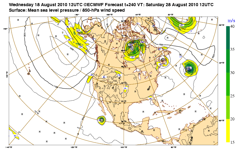
Its like the pattern is just on a constant loop.
0 likes   
Personal Forecast Disclaimer:
The posts in this forum are NOT official forecast and should not be used as such. They are just the opinion of the poster and may or may not be backed by sound meteorological data. They are NOT endorsed by any professional institution or storm2k.org. For official information, please refer to the NHC and NWS products

User avatar
shell70
Tropical Low
Tropical Low
Posts: 34
Joined: Thu Jul 22, 2010 8:34 am
Location: South Alabama

Re: Gulf of Mexico Homebrew early next week?

#18 Postby shell70 » Wed Aug 18, 2010 2:46 pm

This system remind me of a roller coaster that you can not get off of. It goes up and down and around. Will it please go bye-bye!
0 likes   

flwxwatcher
Category 4
Category 4
Posts: 926
Joined: Wed May 16, 2007 3:35 pm
Location: Central Florida

Re: Gulf of Mexico Homebrew early next week?

#19 Postby flwxwatcher » Wed Aug 18, 2010 2:49 pm

The 12Z EURO joins the home brew solutions in the Gulf and has it pretty much sitting off the West Coast of Tampa for several days. It's still in the long range but interesting to see the models starting to sniff this out.
0 likes   

poof121
Category 1
Category 1
Posts: 316
Age: 44
Joined: Tue Sep 11, 2007 11:33 am
Location: Laurel, MD

Re: Gulf of Mexico Homebrew early next week?

#20 Postby poof121 » Wed Aug 18, 2010 3:13 pm

GFS shows it as the same piece of vorticity, so, according to GFS, potentially TD #5 take 3...

http://moe.met.fsu.edu/cgi-bin/gfstc2.cgi?time=2010081812&field=850mb+Vorticity&hour=Animation
0 likes   


Return to “Talkin' Tropics”

Who is online

Users browsing this forum: Ian2401, NotSparta, REDHurricane, Sciencerocks, StormWeather and 37 guests