
ATL: Ex Tropical Storm EARL - Discussion
Moderator: S2k Moderators
-
cycloneye

- Admin

- Posts: 149470
- Age: 69
- Joined: Thu Oct 10, 2002 10:54 am
- Location: San Juan, Puerto Rico
Re: ATL : INVEST 96L - Discussion
Not bad looking at first glance.
0 likes
Visit the Caribbean-Central America Weather Thread where you can find at first post web cams,radars
and observations from Caribbean basin members Click Here
and observations from Caribbean basin members Click Here


Re: ATL : INVEST 96L - Discussion
looks like a player....I have seen systems splash down like this and go to TD before....probably already is one...
0 likes
-
cycloneye
- Admin
- Posts: 149470
- Age: 69
- Joined: Thu Oct 10, 2002 10:54 am
- Location: San Juan, Puerto Rico
Re: ATL : INVEST 96L - Discussion
Up to 40%
TROPICAL WEATHER OUTLOOK
NWS TPC/NATIONAL HURRICANE CENTER MIAMI FL
200 PM EDT MON AUG 23 2010
FOR THE NORTH ATLANTIC...CARIBBEAN SEA AND THE GULF OF MEXICO...
THE NATIONAL HURRICANE CENTER IS ISSUING ADVISORIES ON TROPICAL
STORM DANIELLE...LOCATED ABOUT 1025 MILES WEST OF THE CAPE VERDE
ISLANDS.
A BROAD AREA OF LOW PRESSURE ASSOCIATED WITH A TROPICAL WAVE OFF THE
AFRICAN COAST IS SHOWING SIGNS OF ORGANIZATION. ADDITIONAL
DEVELOPMENT OF THIS SYSTEM IS POSSIBLE...AND IT COULD BECOME A
TROPICAL DEPRESSION OVER THE NEXT COUPLE OF DAYS AS IT MOVES
WESTWARD NEAR 15 MPH. THERE IS A MEDIUM CHANCE...40 PERCENT...OF
THIS SYSTEM BECOMING A TROPICAL CYCLONE DURING THE NEXT 48 HOURS.
ELSEWHERE...TROPICAL CYCLONE FORMATION IS NOT EXPECTED DURING THE
NEXT 48 HOURS.
$$
FORECASTER BERG
0 likes
Visit the Caribbean-Central America Weather Thread where you can find at first post web cams,radars
and observations from Caribbean basin members Click Here
and observations from Caribbean basin members Click Here


Re: ATL : INVEST 96L - Discussion
I'd eat my right shoe if this doesn't become Earl. Amazing how good it looks after only being out over the water for a very short time.
0 likes
-
breaking wind
- Tropical Low

- Posts: 30
- Joined: Sun Aug 15, 2010 7:53 pm
- Location: Lakeland FL
-
micktooth

- S2K Supporter

- Posts: 391
- Joined: Mon Jul 11, 2005 3:47 pm
- Location: PreK:New Orleans,PostK:Colorado
Re:
Vortex wrote:I'll be watching Earl BUT its the wave that moves off late this week/next week that im concerned about...
Do you have a link that shows these other waves over Africa. The ones I had don't work any more. Thanks!
0 likes
-
cycloneye
- Admin
- Posts: 149470
- Age: 69
- Joined: Thu Oct 10, 2002 10:54 am
- Location: San Juan, Puerto Rico
Re: Re:
micktooth wrote:Vortex wrote:I'll be watching Earl BUT its the wave that moves off late this week/next week that im concerned about...
Do you have a link that shows these other waves over Africa. The ones I had don't work any more. Thanks!
Well,this is off-topic but here is the link that you have to go to see many images from Africa that update every 15 minutes.
http://www.sat24.com
0 likes
Visit the Caribbean-Central America Weather Thread where you can find at first post web cams,radars
and observations from Caribbean basin members Click Here
and observations from Caribbean basin members Click Here
-
Aric Dunn
- Category 5

- Posts: 21238
- Age: 43
- Joined: Sun Sep 19, 2004 9:58 pm
- Location: Ready for the Chase.
- Contact:
Re: ATL : INVEST 96L - Discussion
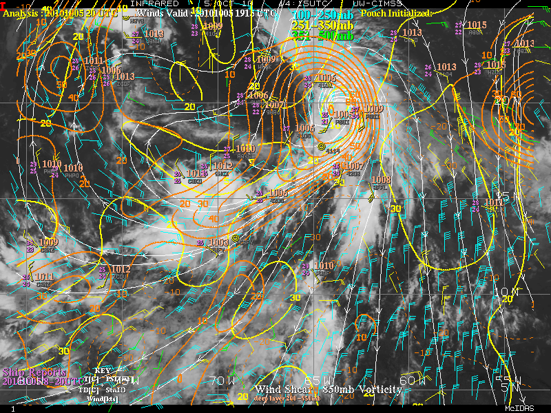
Exellent Microwave pass... clearly showing some weak banding developing and plenty of curvature in the low levels.. and a little older ASCAT image showing broad circulation... from that ASCAT image till now things seem to have organized a little more.


0 likes
-
tolakram
- Admin
- Posts: 20185
- Age: 62
- Joined: Sun Aug 27, 2006 8:23 pm
- Location: Florence, KY (name is Mark)
Re: ATL : INVEST 96L - Discussion
Satellite loop: http://oiswww.eumetsat.org/IPPS/html/MS ... /index.htm
Shift drag to zoom. Right now 9 frame loop looks good but night is falling fast. On this loop looks like Danielle is forming an eye on the last frame.
Shift drag to zoom. Right now 9 frame loop looks good but night is falling fast. On this loop looks like Danielle is forming an eye on the last frame.
0 likes
M a r k
- - - - -
Join us in chat: Storm2K Chatroom Invite. Android and IOS apps also available.
The posts in this forum are NOT official forecasts and should not be used as such. Posts are NOT endorsed by any professional institution or STORM2K.org. For official information and forecasts, please refer to NHC and NWS products.
-
thetruesms

- Professional-Met

- Posts: 844
- Age: 42
- Joined: Thu Aug 16, 2007 1:14 pm
- Location: Tallahasee, FL
- Contact:
-
cycloneye
- Admin
- Posts: 149470
- Age: 69
- Joined: Thu Oct 10, 2002 10:54 am
- Location: San Juan, Puerto Rico
Re: ATL : INVEST 96L - Discussion
18z Best Track
AL, 96, 2010082318, , BEST, 0, 113N, 173W, 25, 1007
ftp://ftp.tpc.ncep.noaa.gov/atcf/tcweb/ ... 010.invest
AL, 96, 2010082318, , BEST, 0, 113N, 173W, 25, 1007
ftp://ftp.tpc.ncep.noaa.gov/atcf/tcweb/ ... 010.invest
0 likes
Visit the Caribbean-Central America Weather Thread where you can find at first post web cams,radars
and observations from Caribbean basin members Click Here
and observations from Caribbean basin members Click Here
-
bob rulz
- Category 5
- Posts: 1711
- Age: 36
- Joined: Sat Jan 28, 2006 7:30 pm
- Location: Salt Lake City, Utah
Re: ATL : INVEST 96L - Discussion
Ivanhater wrote:
WOW, that is very impressive! I can't remember the last time I actually saw a tropical wave burst immediately upon moving off the coast.
0 likes
-
StormClouds63
- Category 2

- Posts: 583
- Age: 62
- Joined: Tue May 13, 2008 11:56 am
- Location: Southwest Louisiana
Re: ATL : INVEST 96L - Discussion
From this perspective, future "my name is Earl" looks quite impressive as well.

0 likes
Who is online
Users browsing this forum: No registered users and 33 guests