ATL: FIONA - Models
Moderator: S2k Moderators
-
flwxwatcher
- Category 4

- Posts: 926
- Joined: Wed May 16, 2007 3:35 pm
- Location: Central Florida
Re: ATL: 97L - Models
It looks like Fiona might be one of those storms that has people pulling their hair out. First the issue of does Fiona survive or will the system get to close to Earl and get absorbed like some models are showing. The EURO has been steadfast on keeping Fiona far enough away from Earl that over time it survives and strengthens. Right now I think it's impossible to say if Fiona survives what the track might be. Anywhere along the SE Coast seems in play. depending on how far North she gets before any bend back to the West might occur. Interesting to see how this unfolds the coming days.
0 likes
-
Ivanhater

- Storm2k Moderator

- Posts: 11221
- Age: 39
- Joined: Fri Jul 01, 2005 8:25 am
- Location: Pensacola
Re: ATL: 97L - Models
BAMD 16.9N 60.9W 19.3N 67.6W 20.2N 72.9W 19.0N 78.6W
Deepening system heading SW , like the Euro is showing.
Deepening system heading SW , like the Euro is showing.
0 likes
Michael
-
Orlando_wx

- Tropical Storm

- Posts: 128
- Age: 53
- Joined: Wed Feb 26, 2003 2:39 pm
- Location: orlando,Florida
Re: ATL: 97L - Models
SouthFLTropics wrote:caneseddy wrote:So the Euro is back to the solution it had this weekend, with landfall into the Southeast
So let's see...we've had the Euro go into SC, Port. St. Lucie, Cuba/Louisiana, fish, Georgia
Also, that is one monster high planted in the SE
If I had to guess the ultimate answer will lie somewhere in between...Which the midpoint between the SC landfall and a Cuba/Lousiana landfall would be somewhere along the FL East Coast...Unfortunately...
SFT
This is what DT was talking about on his main page
0 likes
-
BigB0882
- S2K Supporter

- Posts: 2292
- Joined: Thu Jul 03, 2003 12:08 am
- Location: Baton Rouge, LA
- Contact:
I think this idea of a curve NW and then a band back West and even SW is a good possibility. The question will undoubtedly be "how far N does she get before the turn?" That could be the difference between a East Coast landfall and a FL landfall that gets into the Gulf! Huge difference there.
0 likes

-
ConvergenceZone
.gif)
- Category 5

- Posts: 5241
- Joined: Fri Jul 29, 2005 1:40 am
- Location: Northern California
Yep, We shouldn't see any "recurve for sure" posts when it comes to Fiona, especially since
out of the 3, Fiona would be the LEAST likely to recurve, hence the modelS that haven't even
come to a consensus on it, plus, like others have mentioned, the strength will be a big player in the direction.
out of the 3, Fiona would be the LEAST likely to recurve, hence the modelS that haven't even
come to a consensus on it, plus, like others have mentioned, the strength will be a big player in the direction.
0 likes

I just don't buy a system moving to the West towards South Carolina or Georgia.
It's just counter-intuitive and climatologically illogical.
I know you "climatology-haters" don't accept when one leans on it, but short of actual dynamics, it is a good default.
We do sometimes see the "bump into a ridge" and W or SW track towards South Florida but once a system gets north of Florida, I just don't see it. We have seen a stall or meandering offshore while a system waits for a trough to pick it up, but that too is pretty rare.
Just my opinion and based on many, many years of watching.
0 likes
-
Blown Away

- S2K Supporter
- Posts: 10253
- Joined: Wed May 26, 2004 6:17 am
Re: ATL: 97L - Models
Ivanhater wrote:Make that a Georgia hit continue due west inland.
Well we all know that landfall is a very very low probability, but it seems if Fiona develops she is going to be blocked per the EURO. One thing for sure if the EURO is correct with Fiona becoming an EC or GOM storm, I will become a EURO believer because most of the other models say out to sea. I guess if you can't beat the Texas EURO huggers you might as well join them!
0 likes
Hurricane Eye Experience: David 79, Irene 99, Frances 04, Jeanne 04, Wilma 05… Hurricane Brush Experience: Andrew 92, Erin 95, Floyd 99, Matthew 16, Irma 17, Ian 22, Nicole 22…
-
ConvergenceZone
- Category 5
- Posts: 5241
- Joined: Fri Jul 29, 2005 1:40 am
- Location: Northern California
Re:
fci wrote:I just don't buy a system moving to the West towards South Carolina or Georgia.
It's just counter-intuitive and climatologically illogical.
I know you "climatology-haters" don't accept when one leans on it, but short of actual dynamics, it is a good default.
We do sometimes see the "bump into a ridge" and W or SW track towards South Florida but once a system gets north of Florida, I just don't see it. We have seen a stall or meandering offshore while a system waits for a trough to pick it up, but that too is pretty rare.
Just my opinion and based on many, many years of watching.
I can understand where you are coming from. I don't think that anyone thinks
that 97L has high odds of affecting the US. I think the odds in fact are pretty slim,
based upon climatalogy. But I do believe that the odds are greater than Earl and Danielle.
Keep in mind that it's not even a name system yet. What if the system were take slower to develop into a
tropical storm? You have to keep that in mind to when looking at the track.
0 likes
-
CourierPR

- Category 5
- Posts: 1336
- Age: 72
- Joined: Tue Aug 31, 2004 7:53 pm
- Location: Pompano Beach, Florida
Re:
Your post brings to mind Hurricane Betsy in 1965 which was poised to affect Georgia and the Carolinas but got trapped by high pressure and came back southwest over Key Largo and into the Gulf. It certainly made for an exciting Labor Day weekend around these parts.fci wrote:I just don't buy a system moving to the West towards South Carolina or Georgia.
It's just counter-intuitive and climatologically illogical.
I know you "climatology-haters" don't accept when one leans on it, but short of actual dynamics, it is a good default.
We do sometimes see the "bump into a ridge" and W or SW track towards South Florida but once a system gets north of Florida, I just don't see it. We have seen a stall or meandering offshore while a system waits for a trough to pick it up, but that too is pretty rare.
Just my opinion and based on many, many years of watching.
0 likes
-
BigB0882
- S2K Supporter
- Posts: 2292
- Joined: Thu Jul 03, 2003 12:08 am
- Location: Baton Rouge, LA
- Contact:
Re:
fci wrote:I just don't buy a system moving to the West towards South Carolina or Georgia.
It's just counter-intuitive and climatologically illogical.
I know you "climatology-haters" don't accept when one leans on it, but short of actual dynamics, it is a good default.
We do sometimes see the "bump into a ridge" and W or SW track towards South Florida but once a system gets north of Florida, I just don't see it. We have seen a stall or meandering offshore while a system waits for a trough to pick it up, but that too is pretty rare.
Just my opinion and based on many, many years of watching.
Well I think at this point it is much better to focus on the trends that on the actual landfalls, especially of a system that hasn't even formed yet. The trend that the EURO sees is a strong ridge that will be able to push this back west or even southwest. When, where and to what degree all remain to be seen but the EURO has been sniffing out this idea for quite a few runs now but each time it has played out differently.
0 likes
-
x-y-no

- Category 5
- Posts: 8359
- Age: 65
- Joined: Wed Aug 11, 2004 12:14 pm
- Location: Fort Lauderdale, FL
Re: Re:
CourierPR wrote:Your post brings to mind Hurricane Betsy in 1965 which was poised to affect Georgia and the Carolinas but got trapped by high pressure and came back southwest over Key Largo and into the Gulf. It certainly made for an exciting Labor Day weekend around these parts.
I immediately thought of Betsy too:
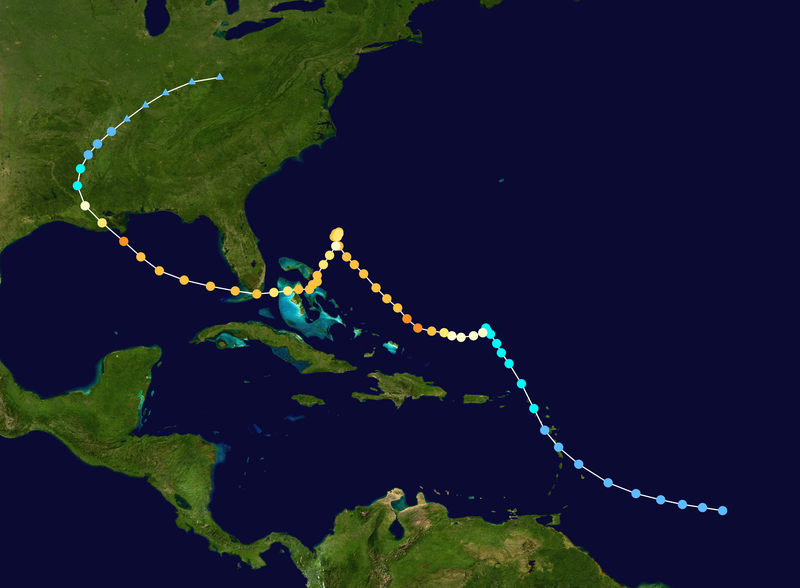
One of my favorite crazy tracks.
Mind you, I'm not suggesting anything that extreme will happen with "Fiona"
0 likes
Re: Re:
x-y-no wrote:CourierPR wrote:Your post brings to mind Hurricane Betsy in 1965 which was poised to affect Georgia and the Carolinas but got trapped by high pressure and came back southwest over Key Largo and into the Gulf. It certainly made for an exciting Labor Day weekend around these parts.
I immediately thought of Betsy too:
One of my favorite crazy tracks.
Mind you, I'm not suggesting anything that extreme will happen with "Fiona"
Betsy was the storm that really turned me into a hurricane nut. I was a little kid listening to every advisory, every 2 hours when my parents told me nothing would change in just 2 hours and to calm down.
Then in like an intermediate advisory at 2 PM, they realized she was going to loop and turn around.
It was amazing.
We were under a hurricane warning for an exceedingly long time as she decided exactly where to come ashore.
The Northern Bahamas were under hurricane conditions for about 2 days (or so it seemed). Not unlike Cancun with Wilma.
Can you even imagine what S2K would be like if a "Betsy" happened, here in the Internet age?
Thousands of users and really bad server issues I suspect
And, I presume a bunch of suspensions and bannings with Mods begging for a break!!
0 likes
-
HURRICANELONNY
- Category 5
- Posts: 1392
- Joined: Wed May 07, 2003 6:48 am
- Location: HOLLYWOOD.FL
Re: ATL: FIONA - Models
Right now the NHC has almost the same track for FIONA as EARL. No discussion yet.
Last edited by HURRICANELONNY on Mon Aug 30, 2010 3:48 pm, edited 1 time in total.
0 likes
hurricanelonny
Re:
ConvergenceZone wrote:Yep, We shouldn't see any "recurve for sure" posts when it comes to Fiona, especially since
out of the 3, Fiona would be the LEAST likely to recurve, hence the modelS that haven't even
come to a consensus on it, plus, like others have mentioned, the strength will be a big player in the direction.
No, unfortunately we'll be getting the "no really all the data says it's coming MY way" posts
0 likes
-
gatorcane

- S2K Supporter
- Posts: 23708
- Age: 48
- Joined: Sun Mar 13, 2005 3:54 pm
- Location: Boca Raton, FL
Re: ATL: 97L - Models
Ivanhater wrote:Yall gotta stop being so quick to think recurve when trying to guess what the run is showing
Euro still building a strong high and pushes it back west toward South Carolina...
Yep I stand corrected.
0 likes

Re: ATL: 97L - Models
Blown Away wrote:Ivanhater wrote:Make that a Georgia hit continue due west inland.
Well we all know that landfall is a very very low probability, but it seems if Fiona develops she is going to be blocked per the EURO. One thing for sure if the EURO is correct with Fiona becoming an EC or GOM storm, I will become a EURO believer because most of the other models say out to sea. I guess if you can't beat the Texas EURO huggers you might as well join them!
got you a EURO seat right next to me, WX warrior and soon to be Ivan...
0 likes
Re: ATL: FIONA - Models
at 144hr Fiona is in the Bahamas...not really strong....fork in the road here...

0 likes
Who is online
Users browsing this forum: No registered users and 52 guests