yep...trouble for NGOM.
That was my gut feeling exhibit A scenario.
Caribbean development? (Is invest 92L)
Moderator: S2k Moderators
Forum rules

The posts in this forum are NOT official forecasts and should not be used as such. They are just the opinion of the poster and may or may not be backed by sound meteorological data. They are NOT endorsed by any professional institution or STORM2K. For official information, please refer to products from the National Hurricane Center and National Weather Service.
-
Wx_Warrior
- Category 5

- Posts: 2718
- Joined: Thu Aug 03, 2006 3:58 pm
- Location: Beaumont, TX

Re:
Weatherfreak000 wrote:That would means if this develops at this point everywhere in the GOM is in play
true...
later fellas....WX Warrior I give you command of the EURO...
Ivan if Warrior bails then you have the com....
0 likes
-
cycloneye

- Admin

- Posts: 149585
- Age: 69
- Joined: Thu Oct 10, 2002 10:54 am
- Location: San Juan, Puerto Rico
Re: Caribbean development?-Code Yellow
2 AM TWO
AN AREA OF SHOWERS AND THUNDERSTORMS IN THE VICINITY OF THE WINDWARD
ISLANDS ARE ASSOCIATED WITH A WEAK LOW PRESSURE SYSTEM.
ENVIRONMENTAL CONDITIONS APPEAR TO BE CONDUCIVE FOR SOME SLOW
DEVELOPMENT AS THE LOW MOVES SLOWLY WESTWARD. THERE IS A LOW
CHANCE...20 PERCENT...OF THIS SYSTEM BECOMING A TROPICAL CYCLONE
DURING THE NEXT 48 HOURS.
0 likes
Visit the Caribbean-Central America Weather Thread where you can find at first post web cams,radars
and observations from Caribbean basin members Click Here
and observations from Caribbean basin members Click Here

-
Wx_Warrior
- Category 5
- Posts: 2718
- Joined: Thu Aug 03, 2006 3:58 pm
- Location: Beaumont, TX

-
Wx_Warrior
- Category 5
- Posts: 2718
- Joined: Thu Aug 03, 2006 3:58 pm
- Location: Beaumont, TX

-
Wx_Warrior
- Category 5
- Posts: 2718
- Joined: Thu Aug 03, 2006 3:58 pm
- Location: Beaumont, TX

-
Wx_Warrior
- Category 5
- Posts: 2718
- Joined: Thu Aug 03, 2006 3:58 pm
- Location: Beaumont, TX

-
Wx_Warrior
- Category 5
- Posts: 2718
- Joined: Thu Aug 03, 2006 3:58 pm
- Location: Beaumont, TX

-
Wx_Warrior
- Category 5
- Posts: 2718
- Joined: Thu Aug 03, 2006 3:58 pm
- Location: Beaumont, TX

-
Wx_Warrior
- Category 5
- Posts: 2718
- Joined: Thu Aug 03, 2006 3:58 pm
- Location: Beaumont, TX
-
Wx_Warrior
- Category 5
- Posts: 2718
- Joined: Thu Aug 03, 2006 3:58 pm
- Location: Beaumont, TX


Re: Caribbean development?-Code Yellow
What's the time frame on this one according to early models? I thought the NGOM was supposed to have a heft ridge over it for at least 5 days out. Did this change?
0 likes

-
cycloneye
- Admin
- Posts: 149585
- Age: 69
- Joined: Thu Oct 10, 2002 10:54 am
- Location: San Juan, Puerto Rico
Re: Caribbean development?-Code Yellow
From this mornings San Juan discussion.
FEATURE OF INTEREST IS NOW A WEAK AREA OF LOW PRES EAST OF
TRINIDAD WHICH MODELS HAVE INDICATED SOME SORT OF WEAK TC
DEVELOPMENT OVR THE PAST COUPLE OF DAYS. THE RELIABLE MODELS ECMWF
AND GFS KEEP THIS SYSTEM JUST SOUTH OF THE AREA WITH THE ECMWF A
BIT FURTHER NORTH THAN THE GFS. PRIMARY THREAT FROM THIS SYSTEM
LOOKS TO BE HEAVY RAINFALL DUE TO ITS EXPECTED SLOW MOVEMENT.
TIMING UNCERTAINTIES NOTED BETWEEN THE MODELS WITH THE ECWMF
FASTER THAN THE GFS. HAVE SIDED WITH THE ECWMF BRINGING SOME GOOD
RAINS SAT AND SAT NIGHT AS THIS MODEL HAS OUTPERFORMED THE REST OF
THE OTHER GLOBAL MODELS THIS HURRICANE SEASON. MODELS HAVE ALSO
LAG BEHIND WITH OTHER TROPICAL CYCLONES AS WAS THE CASE WITH FAST
MOVING STORMS LIKE GASTON...COLIN AND FIONA. PEOPLE ARE ENCOURAGED
TO MONITOR LATEST FORECASTS OVR THE NEXT 48 HRS AS WE ARE VERY NEAR
THE CLIMATOLOGICAL PEAK OF THE HURRICANE SEASON AND TC DEVELOPMENT
CAN TAKE PLACE ABOUT ANYWHERE AND VERY QUICKLY. OF NOTE IS THE
UNRELIABLE MODELS CANADIAN GLOBAL AND NAM INDICATE THIS SYSTEM
ACTUALLY MOVING ACROSS PR ON SUN. GIVEN THAT THE H25 HIGH IS
EXPECTED TO WEAKEN AND UPPER LVL TROUGH XPCD TO CONTINUE TO DIG
SOUTH IS NOT OUT THE REALM OF POSSIBILITIES THAT THIS SYSTEM COULD
END UP FURTHER NORTH THAT WHAT IS SUGGESTED BY THE GFS/ECMWF
MODELS.
0 likes
Visit the Caribbean-Central America Weather Thread where you can find at first post web cams,radars
and observations from Caribbean basin members Click Here
and observations from Caribbean basin members Click Here

GFS looks way too slow with the motion, I doubt its still hanging back near the Yucatan in 10 days time...the ECM is probably too far south but is I suspect more realistic in terms of speed which means something inbetween the GFS/ECM solution is most likely and that would mean Yucatan followed by a threat to the W.Gulf and Mexico...
CMC is interesting and shouldn't be discounted simply because we haven't got a system yet...but IMO its the least likely solution.
Don't expect this one to spin up anytime soon, its got a long way to go, probably 3-4 days till it gets going...
CMC is interesting and shouldn't be discounted simply because we haven't got a system yet...but IMO its the least likely solution.
Don't expect this one to spin up anytime soon, its got a long way to go, probably 3-4 days till it gets going...
0 likes
Personal Forecast Disclaimer:
The posts in this forum are NOT official forecast and should not be used as such. They are just the opinion of the poster and may or may not be backed by sound meteorological data. They are NOT endorsed by any professional institution or storm2k.org. For official information, please refer to the NHC and NWS products
The posts in this forum are NOT official forecast and should not be used as such. They are just the opinion of the poster and may or may not be backed by sound meteorological data. They are NOT endorsed by any professional institution or storm2k.org. For official information, please refer to the NHC and NWS products
-
ColinDelia

- S2K Supporter

- Posts: 918
- Joined: Mon Aug 29, 2005 5:52 am
- Location: The Beach, FL


Looks to me like the GFS takes a long time to lift away from the ITCZ, its been a little slow with quite a few storms recently but it still develops a system.
Pattern aloft will probably very good for strengthening looking at the modelsw in the W.Caribbean and in the BoC/W.Gulf...until then don't expect anything to develop too quickly though I'd expect we will have something by Sunday.
Pattern aloft will probably very good for strengthening looking at the modelsw in the W.Caribbean and in the BoC/W.Gulf...until then don't expect anything to develop too quickly though I'd expect we will have something by Sunday.
0 likes
Personal Forecast Disclaimer:
The posts in this forum are NOT official forecast and should not be used as such. They are just the opinion of the poster and may or may not be backed by sound meteorological data. They are NOT endorsed by any professional institution or storm2k.org. For official information, please refer to the NHC and NWS products
The posts in this forum are NOT official forecast and should not be used as such. They are just the opinion of the poster and may or may not be backed by sound meteorological data. They are NOT endorsed by any professional institution or storm2k.org. For official information, please refer to the NHC and NWS products
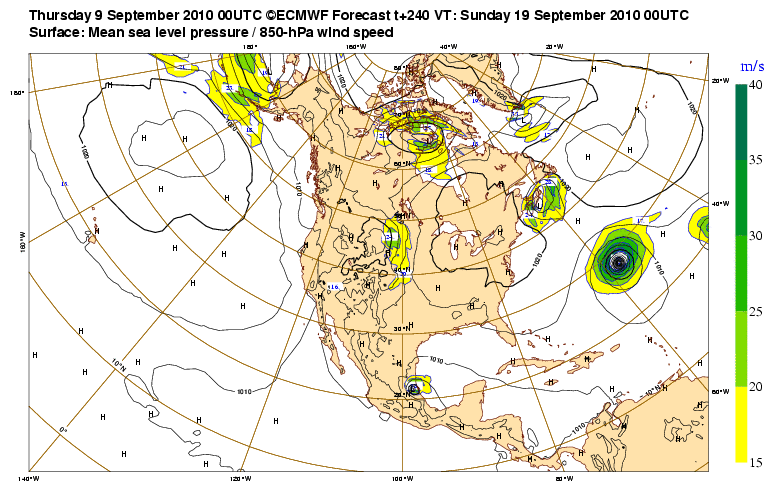
GFS flips back to the Mexico solution and looks very close to the 00z ECM indeed:
http://raleighwx.easternuswx.com/models ... cal240.gif
Thats the most likely solution IMO esp from as far south as it starts and given the strong Southern ridging there has been thus far this season.
http://raleighwx.easternuswx.com/models ... cal240.gif
Thats the most likely solution IMO esp from as far south as it starts and given the strong Southern ridging there has been thus far this season.
0 likes
Personal Forecast Disclaimer:
The posts in this forum are NOT official forecast and should not be used as such. They are just the opinion of the poster and may or may not be backed by sound meteorological data. They are NOT endorsed by any professional institution or storm2k.org. For official information, please refer to the NHC and NWS products
The posts in this forum are NOT official forecast and should not be used as such. They are just the opinion of the poster and may or may not be backed by sound meteorological data. They are NOT endorsed by any professional institution or storm2k.org. For official information, please refer to the NHC and NWS products
-
Gustywind

- Category 5
- Posts: 12334
- Joined: Mon Sep 03, 2007 7:29 am
- Location: Baie-Mahault, GUADELOUPE
Re: Caribbean development?-Code Yellow
cycloneye wrote:From this mornings San Juan discussion.
FEATURE OF INTEREST IS NOW A WEAK AREA OF LOW PRES EAST OF
TRINIDAD WHICH MODELS HAVE INDICATED SOME SORT OF WEAK TC
DEVELOPMENT OVR THE PAST COUPLE OF DAYS. THE RELIABLE MODELS ECMWF
AND GFS KEEP THIS SYSTEM JUST SOUTH OF THE AREA WITH THE ECMWF A
BIT FURTHER NORTH THAN THE GFS. PRIMARY THREAT FROM THIS SYSTEM
LOOKS TO BE HEAVY RAINFALL DUE TO ITS EXPECTED SLOW MOVEMENT.
TIMING UNCERTAINTIES NOTED BETWEEN THE MODELS WITH THE ECWMF
FASTER THAN THE GFS. HAVE SIDED WITH THE ECWMF BRINGING SOME GOOD
RAINS SAT AND SAT NIGHT AS THIS MODEL HAS OUTPERFORMED THE REST OF
THE OTHER GLOBAL MODELS THIS HURRICANE SEASON. MODELS HAVE ALSO
LAG BEHIND WITH OTHER TROPICAL CYCLONES AS WAS THE CASE WITH FAST
MOVING STORMS LIKE GASTON...COLIN AND FIONA. PEOPLE ARE ENCOURAGED
TO MONITOR LATEST FORECASTS OVR THE NEXT 48 HRS AS WE ARE VERY NEAR
THE CLIMATOLOGICAL PEAK OF THE HURRICANE SEASON AND TC DEVELOPMENT
CAN TAKE PLACE ABOUT ANYWHERE AND VERY QUICKLY. OF NOTE IS THE
UNRELIABLE MODELS CANADIAN GLOBAL AND NAM INDICATE THIS SYSTEM
ACTUALLY MOVING ACROSS PR ON SUN. GIVEN THAT THE H25 HIGH IS
EXPECTED TO WEAKEN AND UPPER LVL TROUGH XPCD TO CONTINUE TO DIG
SOUTH IS NOT OUT THE REALM OF POSSIBILITIES THAT THIS SYSTEM COULD
END UP FURTHER NORTH THAT WHAT IS SUGGESTED BY THE GFS/ECMWF
MODELS.
0 likes
Who is online
Users browsing this forum: WaveBreaking and 231 guests