ENSO Updates (2007 thru 2023)
Moderator: S2k Moderators
Forum rules
The posts in this forum are NOT official forecasts and should not be used as such. They are just the opinion of the poster and may or may not be backed by sound meteorological data. They are NOT endorsed by any professional institution or STORM2K. For official information, please refer to products from the National Hurricane Center and National Weather Service.
- cycloneye
- Admin

- Posts: 149550
- Age: 69
- Joined: Thu Oct 10, 2002 10:54 am
- Location: San Juan, Puerto Rico
Re: ENSO Updates
Climate Prediction Center September update
http://www.cpc.ncep.noaa.gov/products/a ... odisc.html
Synopsis: La Niña is expected to last at least through the Northern Hemisphere winter 2010-11.
La Niña strengthened during August 2010, as negative sea surface temperature (SST) anomalies reached at least -1oC across most of the equatorial Pacific Ocean by the end of the month (Fig. 1). All of the Niño indices cooled to between –1.3oC and –1.8oC by the end of August (Fig. 2). Consistent with this evolution, the subsurface heat content (average temperatures in the upper 300m of the ocean, Fig. 3) decreased further, reflecting the additional cooling of sub-surface waters east of the Date Line (Fig. 4). Also convection was enhanced over Indonesia, while remaining suppressed over the western and central equatorial Pacific (Fig. 5). The pattern was associated with the continuation of enhanced low-level easterly trade winds and anomalous upper-level westerly winds over the western and central equatorial Pacific. Collectively, these oceanic and atmospheric anomalies reflect the strengthening of La Niña.
Nearly all models predict La Niña to continue at least through early 2011 (Fig. 6). However, the models continue to disagree on the eventual strength of La Niña. Based on current observations and model guidance, we expect the SST anomalies in the Niño-3.4 region to either persist near the present strength, or to strengthen into the winter as is consistent with the historical evolution of La Niña. Thus, it is likely that the peak strength of this event will be at least moderate (3-month average between –1oC to –1.4oC in Niño-3.4) to strong (3-month average of –1.5oC or less in Niño-3.4).
Expected La Niña impacts during September-November 2010 include suppressed convection over the central tropical Pacific Ocean, and enhanced convection over Indonesia. The transition into the Northern Hemisphere Fall means that La Niña will begin to exert an increasing influence on the weather and climate of the United States. These impacts include an enhanced chance of above-average precipitation in the Pacific Northwest, and below-average precipitation in the Southwest and in portions of the middle and lower Mississippi Valley and Tennessee Valley. Also, La Niña can contribute to increased Atlantic hurricane activity by decreasing the vertical wind shear over the Caribbean Sea and tropical Atlantic Ocean (see the August 5th update of the NOAA Atlantic Seasonal Hurricane Outlook), and to suppressed hurricane activity across the central and eastern tropical North Pacific.
0 likes
Visit the Caribbean-Central America Weather Thread where you can find at first post web cams,radars
and observations from Caribbean basin members Click Here
and observations from Caribbean basin members Click Here
-
HURRICANELONNY
- Category 5

- Posts: 1392
- Joined: Wed May 07, 2003 6:48 am
- Location: HOLLYWOOD.FL
Re: ENSO Updates=CPC September update=La Nina thru winter
They say moderate. To me it looks like a strong La Nina already. 
0 likes
hurricanelonny
- AussieMark
- Category 5

- Posts: 5857
- Joined: Tue Sep 02, 2003 6:36 pm
- Location: near Sydney, Australia
Re: ENSO Updates=CPC September update=La Nina thru winter
HURRICANELONNY wrote:They say moderate. To me it looks like a strong La Nina already.
its based on 3 month averages
Weak: (with a -0.5 to -0.9 SST anomaly),
Moderate: (-1.0 to -1.4)
Strong (≥ -1.5)
June-August had a anomality of -0.6
to officially be in a La Nina every 3 month average between now and Dec has to have a anomality of -0.5C
i.e
July-Sep
Aug-Oct
Sep-Nov
Oct-Dec
from Climate Prediction Center they say
For historical purposes cold and warm episodes (blue and red colored numbers) are defined when the threshold is met for a minimum of 5 consecutive over-lapping seasons.
0 likes
- AussieMark
- Category 5

- Posts: 5857
- Joined: Tue Sep 02, 2003 6:36 pm
- Location: near Sydney, Australia
Re: ENSO Updates
La Niña intensifies in the Pacific
Issued on Wednesday 15 September 2010 | Product Code IDCKGEWWOO
The La Niña event in the Pacific Ocean has strengthened further over the past two weeks. All computer models surveyed by the Bureau predict the La Niña will last through the southern hemisphere spring, with the majority indicating the event will persist into at least early 2011.
La Niña indicators have consolidated in the Pacific. The central and eastern Pacific Ocean is now more than a degree cooler than the long-term mean, the Southern Oscillation Index (SOI) has continued to rise, trade winds are at their strongest since 1998 and cloudiness over the central tropical Pacific remains suppressed.
La Niña periods are usually, but not always, associated with above normal rainfall during the second half of the year across large parts of Australia, most notably eastern and northern regions. Night time temperatures are historically warmer than average and Tropical Cyclone occurrence for northern Australia is typically higher than normal during the cyclone season (November-April).
Recent values of the Indian Ocean Dipole (IOD) index, combined with forecasts from the Bureau’s POAMA model, suggest that a negative IOD event has commenced in the Indian Ocean. Negative IOD events are often, but not always, associated with above average rainfall over large areas of southern Australia during spring, and are known to often coincide with La Niña events. IOD events generally decay in the months of November and December with the onset of the Australian monsoon.
Source
0 likes
- AussieMark
- Category 5

- Posts: 5857
- Joined: Tue Sep 02, 2003 6:36 pm
- Location: near Sydney, Australia
Re: ENSO Updates
Southern Oscillation Index:
The SOI has risen steadily through the first half of September. The latest (13 September) 30-day SOI value is +25; the monthly value for August was +19. The SOI has been consistently positive since early April.
Sustained positive values of the SOI above +8 may indicate a La Niña event, while sustained negative values below −8 may indicate an El Niño event. Values of between about +8 and −8 generally indicate neutral conditions.
----------------------------------------------------------------------------------------------------------------
Weekly sea surface temperatures:
All three key NINO indices in the central Pacific have remained similar in value over the past two weeks. The weekly SST anomaly map shows cooler than usual surface extending along the equator, east of 160°E. The area of SSTs more than 1°C cooler than usual in the equatorial Pacific has increased compared with two weeks ago. Warm anomalies remain evident in the Maritime Continent region.


--------------------------------------------------------------------------------------------------------------------
Weekly sub-surface:
The water below the surface of the tropical Pacific has cooled during the past two weeks. The map for the 5 days ending 13 September shows a large volume of cooler than normal water below the surface of the tropical Pacific Ocean. In the central Pacific, the sub-surface of the ocean is more than 6°C cooler than normal for this time of the year, on a weekly scale.

--------------------------------------------------------------------------------------------------------------------
Trade winds:
Trade winds have strengthened over the past two weeks, and are now stronger than normal across almost the entire equatorial Pacific. The latest wind anomaly map for the 5 days ending 13 September is shown below.
During La Niña events, there is a sustained strengthening of the trade winds across much of the tropical Pacific, while during El Niño events there is a sustained weakening of the trade winds.

The SOI has risen steadily through the first half of September. The latest (13 September) 30-day SOI value is +25; the monthly value for August was +19. The SOI has been consistently positive since early April.
Sustained positive values of the SOI above +8 may indicate a La Niña event, while sustained negative values below −8 may indicate an El Niño event. Values of between about +8 and −8 generally indicate neutral conditions.
----------------------------------------------------------------------------------------------------------------
Weekly sea surface temperatures:
All three key NINO indices in the central Pacific have remained similar in value over the past two weeks. The weekly SST anomaly map shows cooler than usual surface extending along the equator, east of 160°E. The area of SSTs more than 1°C cooler than usual in the equatorial Pacific has increased compared with two weeks ago. Warm anomalies remain evident in the Maritime Continent region.


--------------------------------------------------------------------------------------------------------------------
Weekly sub-surface:
The water below the surface of the tropical Pacific has cooled during the past two weeks. The map for the 5 days ending 13 September shows a large volume of cooler than normal water below the surface of the tropical Pacific Ocean. In the central Pacific, the sub-surface of the ocean is more than 6°C cooler than normal for this time of the year, on a weekly scale.

--------------------------------------------------------------------------------------------------------------------
Trade winds:
Trade winds have strengthened over the past two weeks, and are now stronger than normal across almost the entire equatorial Pacific. The latest wind anomaly map for the 5 days ending 13 September is shown below.
During La Niña events, there is a sustained strengthening of the trade winds across much of the tropical Pacific, while during El Niño events there is a sustained weakening of the trade winds.

0 likes
- cycloneye
- Admin

- Posts: 149550
- Age: 69
- Joined: Thu Oct 10, 2002 10:54 am
- Location: San Juan, Puerto Rico
Re: ENSO Updates
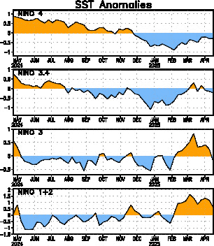
To keep pace on what is going on in the Pacific about how La Nina is doing, here is the weekly update by Climate Prediction Center. La Nina is at -1.5C at area 3.4.
Niño 4= -1.4ºC
Niño 3.4= -1.5ºC
Niño =-1.5ºC
Niño1+2= -1.9ºC
http://www.cpc.ncep.noaa.gov/products/a ... ts-web.pdf
Niño 4= -1.4ºC
Niño 3.4= -1.5ºC
Niño =-1.5ºC
Niño1+2= -1.9ºC
http://www.cpc.ncep.noaa.gov/products/a ... ts-web.pdf

0 likes
Visit the Caribbean-Central America Weather Thread where you can find at first post web cams,radars
and observations from Caribbean basin members Click Here
and observations from Caribbean basin members Click Here
- cycloneye
- Admin

- Posts: 149550
- Age: 69
- Joined: Thu Oct 10, 2002 10:54 am
- Location: San Juan, Puerto Rico
Re: ENSO Updates
Australian 9/29/10 Update
http://www.bom.gov.au/climate/enso/
http://www.bom.gov.au/climate/enso/
La Niña event expected to continue through 2010
Issued on Wednesday 29 September 2010 | Product Code IDCKGEWWOO
A La Niña remains well-established in the Pacific. Given the current strength of the event and the outlook from long-range models surveyed by the Bureau, this La Niña is expected to persist into at least early 2011.
All indicators remain firmly at La Niña levels. The central Pacific Ocean is cooler than the long-term mean both at and below the surface, the Southern Oscillation Index (SOI) remains strongly positive, trade winds are stronger than normal and cloudiness over the central tropical Pacific continues to be suppressed. Such consistent signals indicate the tropical atmosphere and ocean are now clearly reinforcing each other.
La Niña periods are generally associated with above normal rainfall during the second half of the year across large parts of Australia, most notably eastern and northern regions. Night time temperatures are historically warmer than average and Tropical Cyclone occurrence for northern Australia is typically higher than normal during the cyclone season (November-April).
A negative IOD event is also underway in the Indian Ocean. Negative IOD events often coincide with La Niña events, and are often, but not always, associated with above average rainfall over large areas of southern Australia during spring. IOD events generally decay in the months of November and December with the onset of the Australian monsoon.
0 likes
Visit the Caribbean-Central America Weather Thread where you can find at first post web cams,radars
and observations from Caribbean basin members Click Here
and observations from Caribbean basin members Click Here
- AussieMark
- Category 5

- Posts: 5857
- Joined: Tue Sep 02, 2003 6:36 pm
- Location: near Sydney, Australia
Re: ENSO Updates
Southern Oscillation Index:
The SOI has remained firmly positive and fairly steady in value for the past two weeks. The latest (27 September) 30-day SOI value was +25; the monthly value for August was +19. The SOI has been consistently positive since early April.
----------------------------------------------------------------------------------------------------------------
Weekly sea surface temperatures:
The weekly SST anomaly map for the week ending 26 September shows cooler than usual surface temperatures extending along the equator, east of 160°E. When compared with two weeks ago, NINO3.4 and NINO4 have remained similar in value, while NINO3 has warmed slightly. There has been a general slight warming of the tropical Ocean in the eastern Pacific over the past two weeks. Warm anomalies remain evident in the Maritime Continent region, with waters close to Australia warmer than they were two weeks ago.


--------------------------------------------------------------------------------------------------------------------
Weekly sub-surface:
The four-month sequence of sub-surface Pacific Ocean equatorial temperature anomalies, ending 27 September, shows that a large volume of cooler than normal water has been evident below the surface of the tropical Pacific for many months. The sub-surface of the equatorial Pacific has been steadily cooling since November 2009, the peak of the 2009-10 El Niño event. Along most of the equator, the sub-surface water is now more than 4°C cooler than average for this time of the year. The sequence also shows that weak warm anomalies have been developing slowly below the surface in the far western equatorial Pacific.

The map for the 5 days ending 27 September shows a large volume of cooler than normal water below the surface of the tropical Pacific Ocean. In the central Pacific, the sub-surface of the ocean is more than 5°C cooler than normal for this time of the year, on a weekly scale. When compared with two weeks ago, the water below the surface of the tropical Pacific has warmed.

--------------------------------------------------------------------------------------------------------------------
Trade winds:
Trade winds have remained stronger than normal over most of the equatorial Pacific during the past two weeks, with the exception of a small area in the far eastern Pacific where trade winds have been slightly weaker than normal. The latest wind anomaly map for the 5 days ending 27 September is shown below.

Source
The SOI has remained firmly positive and fairly steady in value for the past two weeks. The latest (27 September) 30-day SOI value was +25; the monthly value for August was +19. The SOI has been consistently positive since early April.
----------------------------------------------------------------------------------------------------------------
Weekly sea surface temperatures:
The weekly SST anomaly map for the week ending 26 September shows cooler than usual surface temperatures extending along the equator, east of 160°E. When compared with two weeks ago, NINO3.4 and NINO4 have remained similar in value, while NINO3 has warmed slightly. There has been a general slight warming of the tropical Ocean in the eastern Pacific over the past two weeks. Warm anomalies remain evident in the Maritime Continent region, with waters close to Australia warmer than they were two weeks ago.


--------------------------------------------------------------------------------------------------------------------
Weekly sub-surface:
The four-month sequence of sub-surface Pacific Ocean equatorial temperature anomalies, ending 27 September, shows that a large volume of cooler than normal water has been evident below the surface of the tropical Pacific for many months. The sub-surface of the equatorial Pacific has been steadily cooling since November 2009, the peak of the 2009-10 El Niño event. Along most of the equator, the sub-surface water is now more than 4°C cooler than average for this time of the year. The sequence also shows that weak warm anomalies have been developing slowly below the surface in the far western equatorial Pacific.

The map for the 5 days ending 27 September shows a large volume of cooler than normal water below the surface of the tropical Pacific Ocean. In the central Pacific, the sub-surface of the ocean is more than 5°C cooler than normal for this time of the year, on a weekly scale. When compared with two weeks ago, the water below the surface of the tropical Pacific has warmed.

--------------------------------------------------------------------------------------------------------------------
Trade winds:
Trade winds have remained stronger than normal over most of the equatorial Pacific during the past two weeks, with the exception of a small area in the far eastern Pacific where trade winds have been slightly weaker than normal. The latest wind anomaly map for the 5 days ending 27 September is shown below.

Source
0 likes
- cycloneye
- Admin

- Posts: 149550
- Age: 69
- Joined: Thu Oct 10, 2002 10:54 am
- Location: San Juan, Puerto Rico
Re: ENSO Updates
Climate Prediction Center 10/4/10 Update
September 20
Niño 4= -1.4ºC
Niño 3.4= -1.5ºC
Niño 3 =-1.5ºC
Niño 1+2= -1.9ºC
This Week
Niño 4= -1.4ºC
Niño 3.4= -1.8ºC
Niño 3= -1.3ºC
Niño 1+2= -1.5ºC
[b][size=150]
http://www.cpc.ncep.noaa.gov/products/a ... ts-web.pdf
[/size][/b]

September 20
Niño 4= -1.4ºC
Niño 3.4= -1.5ºC
Niño 3 =-1.5ºC
Niño 1+2= -1.9ºC
This Week
Niño 4= -1.4ºC
Niño 3.4= -1.8ºC
Niño 3= -1.3ºC
Niño 1+2= -1.5ºC
[b][size=150]
http://www.cpc.ncep.noaa.gov/products/a ... ts-web.pdf
[/size][/b]

0 likes
Visit the Caribbean-Central America Weather Thread where you can find at first post web cams,radars
and observations from Caribbean basin members Click Here
and observations from Caribbean basin members Click Here
- cycloneye
- Admin

- Posts: 149550
- Age: 69
- Joined: Thu Oct 10, 2002 10:54 am
- Location: San Juan, Puerto Rico
Re: ENSO Updates
Climate Prediction Center Monthly Update
La Nina is forecast to last until the spring of 2011.
http://www.cpc.ncep.noaa.gov/products/a ... odisc.html
La Nina is forecast to last until the spring of 2011.
http://www.cpc.ncep.noaa.gov/products/a ... odisc.html
Synopsis: La Niña is expected to last at least into the Northern Hemisphere spring 2011.
La Niña continued during September 2010 as reflected by the large expanse of below-average sea surface temperatures (SSTs) across most of the equatorial Pacific Ocean (Fig. 1). All weekly Niño SST index values were between –1.3oC and –1.8oC at the end of the month (Fig. 2). In addition, the subsurface heat content (average temperatures in the upper 300m of the ocean, Fig. 3) remained below-average, reflecting a shallower-than-average thermocline in the central and eastern Pacific (Fig. 4). Convection remained enhanced over Indonesia and suppressed over the western and central equatorial Pacific (Fig. 5). This pattern was linked to a continuation of enhanced low-level easterly trade winds and anomalous upper-level westerly winds over the western and central equatorial Pacific. Collectively, these oceanic and atmospheric anomalies reflect the ongoing La Niña.
Consistent with nearly all of the forecast models (Fig. 6), La Niña is expected to last at least into the Northern Hemisphere spring 2011. Just over half of the models, as well as the dynamical and statistical averages, predict La Niña to become a strong episode (defined by a 3-month average Niño-3.4 index of –1.5oC or colder) by the November-January season before beginning to weaken. Even though the rate of anomalous cooling temporarily abated during September, this model outcome is favored due to the historical tendency for La Niña to strengthen as winter approaches.
Likely La Niña impacts during October-December 2010 include suppressed convection over the central tropical Pacific Ocean, and enhanced convection over Indonesia. The transition into the Northern Hemisphere fall means that La Niña will begin to exert an increasing influence on the weather and climate of the United States. Expected U.S. impacts include an enhanced chance of above-average precipitation in the Pacific Northwest, and below-average precipitation across the southern tier of the country. Also, La Niña can contribute to increased Atlantic hurricane activity by decreasing the vertical wind shear over the Caribbean Sea and tropical Atlantic Ocean (see the August 5th update of the NOAA Atlantic Seasonal Hurricane Outlook). Conversely, La Niña is associated with suppressed hurricane activity across the central and eastern tropical North Pacific.
0 likes
Visit the Caribbean-Central America Weather Thread where you can find at first post web cams,radars
and observations from Caribbean basin members Click Here
and observations from Caribbean basin members Click Here
I've got few doubts this peaks as a strong La Nina, probably reaches it in SON from the looks of things and I'd imagine we will still have some sort of La Nina present in the summer of 2011 as well which will no doubt lead to a risk of an above normal season next year as well...
0 likes
Personal Forecast Disclaimer:
The posts in this forum are NOT official forecast and should not be used as such. They are just the opinion of the poster and may or may not be backed by sound meteorological data. They are NOT endorsed by any professional institution or storm2k.org. For official information, please refer to the NHC and NWS products
The posts in this forum are NOT official forecast and should not be used as such. They are just the opinion of the poster and may or may not be backed by sound meteorological data. They are NOT endorsed by any professional institution or storm2k.org. For official information, please refer to the NHC and NWS products
-
dexterlabio
- Category 5

- Posts: 3511
- Joined: Sat Oct 24, 2009 11:50 pm
Re: ENSO Updates=CPC 10/7/10=La Nina to last thru Spring 2011
I just want to ask how this La Niña phenomenon can affect the weather pattern in the Western Pacific, particularly in southeast Asia? Could this mean a more active season and much enhanced rainfall in the coming months?
0 likes
Personal Forecast Disclaimer:
The posts in this forum are NOT official forecast and should not be used as such. They are just the opinion of the poster and may or may not be backed by sound meteorological data. They are NOT endorsed by any professional institution or storm2k.org. For official information, please refer to the NHC and NWS products.
The posts in this forum are NOT official forecast and should not be used as such. They are just the opinion of the poster and may or may not be backed by sound meteorological data. They are NOT endorsed by any professional institution or storm2k.org. For official information, please refer to the NHC and NWS products.
- AussieMark
- Category 5

- Posts: 5857
- Joined: Tue Sep 02, 2003 6:36 pm
- Location: near Sydney, Australia
Re: ENSO Updates
The La Niña has strengthened
Issued on Wednesday 13 October | Product Code IDCKGEWWOO
The La Niña in the Pacific remains a moderate to strong event. The Southern Oscillation Index (SOI) value of +25 for September was its highest monthly value since 1973, while central Pacific Ocean temperatures are comparable to those observed during previous moderate events, such as 2007 and 1998. Long-range models surveyed by the Bureau suggest that this La Niña will persist into at least early 2011.
ENSO indicators remain firmly at La Niña levels. The central Pacific Ocean is more than 1°C cooler than the long-term mean at the surface, while temperatures below the surface are up to 5°C cooler than normal. The SOI remains above +20, which places it in the top 5% of observed values. Although trade winds are stronger than normal over the western Pacific and cloudiness over the central and western Pacific continues to be suppressed, a strong Madden Julian Oscillation (MJO) may weaken some of these indicators over the coming fortnight.
La Niña periods are generally associated with above normal rainfall during the second half of the year across large parts of Australia, most notably eastern and northern regions. Night time temperatures are historically warmer than average and Tropical Cyclone occurrence for northern Australia is typically higher than normal during the cyclone season (November-April).
A negative IOD event is also underway in the Indian Ocean. Negative IOD events are typically associated with above average rainfall over large areas of southern Australia during spring. IOD events usually decay in the months of November and December with the onset of the Australian monsoon.
Source
0 likes
- Hurricaneman
- Category 5

- Posts: 7404
- Age: 45
- Joined: Tue Aug 31, 2004 3:24 pm
- Location: central florida
- cycloneye
- Admin

- Posts: 149550
- Age: 69
- Joined: Thu Oct 10, 2002 10:54 am
- Location: San Juan, Puerto Rico
Re: ENSO Updates
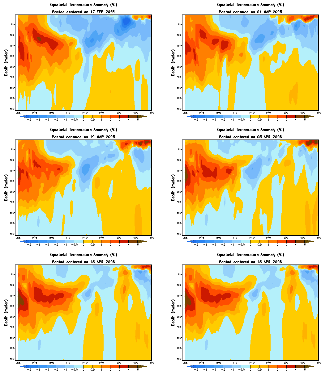
Impressive cooling in the Pacific with this strong La Nina.By the looks of things,it should hang on thru next Spring or Summer,causing another active Atlantic hurricane season in 2011.

0 likes
Visit the Caribbean-Central America Weather Thread where you can find at first post web cams,radars
and observations from Caribbean basin members Click Here
and observations from Caribbean basin members Click Here
- cycloneye
- Admin

- Posts: 149550
- Age: 69
- Joined: Thu Oct 10, 2002 10:54 am
- Location: San Juan, Puerto Rico
Re: ENSO Updates
Another signal that La Nina is strong is how positive the 30 day SOI index has been in the past few months.As long it stays positive and well positive,La Nina will be in no hurry to go away.
http://www.longpaddock.qld.gov.au/seaso ... soivalues/

http://www.longpaddock.qld.gov.au/seaso ... soivalues/

0 likes
Visit the Caribbean-Central America Weather Thread where you can find at first post web cams,radars
and observations from Caribbean basin members Click Here
and observations from Caribbean basin members Click Here
- cycloneye
- Admin

- Posts: 149550
- Age: 69
- Joined: Thu Oct 10, 2002 10:54 am
- Location: San Juan, Puerto Rico
Re: ENSO Updates
Climate Prediction Center 11/4/10 Monthly update=La Nina to last at least thru Spring 2011
http://www.cpc.ncep.noaa.gov/products/a ... odisc.html
http://www.cpc.ncep.noaa.gov/products/a ... odisc.html
Synopsis: La Niña is expected to last at least into the Northern Hemisphere spring 2011.
La NiÑa continued during October 2010, as indicated by below-average sea surface temperatures (SSTs) across most of the equatorial Pacific Ocean (Fig. 1). The weekly Niño SST index values remained nearly unchanged, and were all –1.4oC at the end of the month (Fig. 2). The subsurface heat content (average temperatures in the upper 300m of the ocean, Fig. 3) also changed little during October, and remained well below-average in association with a shallower-than-average thermocline across the central and eastern Pacific (Fig. 4). Convection remained enhanced over Indonesia and suppressed over the western and central equatorial Pacific (Fig. 5). This pattern was linked to a continuation of enhanced low-level easterly trade winds and anomalous upper-level westerly winds over the western and central equatorial Pacific. Collectively, these oceanic and atmospheric anomalies reflect the ongoing La Niña.
Consistent with nearly all ENSO forecast models (Fig. 6), La Niña is expected to last at least into the Northern Hemisphere spring 2011. A large majority of models also predict La Niña to become a strong episode (defined by a 3-month average Niño-3.4 index of –1.5oC or colder) by the November-January season before gradually weakening. A few of the models, including the NCEP Climate Forecast System (CFS), suggest that La Niña could persist into the Northern Hemisphere summer 2011. However, no particular outcome is favored beyond the Northern Hemisphere spring due to large model disagreement and lower model skill during the period.
Likely La Niña impacts during November 2010-January 2011 include suppressed convection over the central tropical Pacific Ocean, and enhanced convection over Indonesia. Expected impacts in the United States include an enhanced chance of above-average precipitation in the Pacific Northwest, Northern Rockies (along with a concomitant increase in snowfall), and Ohio Valley, while below-average precipitation is most likely across the south-central and southeastern states. An increased chance of below-average temperatures is predicted for coastal and near-coastal regions of the northern West Coast, and a higher possibility of above-average temperatures is expected for much of the southern and central U.S. (see 3-month seasonal outlook released on October 21st, 2010).
0 likes
Visit the Caribbean-Central America Weather Thread where you can find at first post web cams,radars
and observations from Caribbean basin members Click Here
and observations from Caribbean basin members Click Here
- cycloneye
- Admin

- Posts: 149550
- Age: 69
- Joined: Thu Oct 10, 2002 10:54 am
- Location: San Juan, Puerto Rico
Re: ENSO Updates
Here is the November update of all the ENSO models and the vast majority of them keep La Nina until the spring or early summer. It's probable that Neutral ENSO will be in the Pacific by the time the peak of the 2011 Atlantic season arrives.
http://iri.columbia.edu/climate/ENSO/cu ... pdate.html


http://iri.columbia.edu/climate/ENSO/cu ... pdate.html


0 likes
Visit the Caribbean-Central America Weather Thread where you can find at first post web cams,radars
and observations from Caribbean basin members Click Here
and observations from Caribbean basin members Click Here
- cycloneye
- Admin

- Posts: 149550
- Age: 69
- Joined: Thu Oct 10, 2002 10:54 am
- Location: San Juan, Puerto Rico
Re: ENSO Updates
Climate Prediction Center Weekly update
La Nina mantains in a moderate stage.
The latest weekly SST departures are:
Niño 4= -1.2ºC
Niño 3.4= -1.5ºC
Niño 3= -1.5ºC
Niño1+2= -1.5ºC
http://www.cpc.ncep.noaa.gov/products/a ... ts-web.pdf
La Nina mantains in a moderate stage.
The latest weekly SST departures are:
Niño 4= -1.2ºC
Niño 3.4= -1.5ºC
Niño 3= -1.5ºC
Niño1+2= -1.5ºC
http://www.cpc.ncep.noaa.gov/products/a ... ts-web.pdf
0 likes
Visit the Caribbean-Central America Weather Thread where you can find at first post web cams,radars
and observations from Caribbean basin members Click Here
and observations from Caribbean basin members Click Here
- cycloneye
- Admin

- Posts: 149550
- Age: 69
- Joined: Thu Oct 10, 2002 10:54 am
- Location: San Juan, Puerto Rico
Re: ENSO Updates=CPC 11/29/10 Weekly Update=Nino 3.4 at -1.6C
Climate Prediction Center 11/29/10 Weekly update
La Nina mantains between moderate and strong in this update and the signs continue to point towards La Nina lasting thru late Spring or early Summer.
Last Week Update
Niño 4= -1.2ºC
Niño 3.4= -1.5ºC
Niño 3= -1.5ºC
Niño1+2= -1.5ºC
This Week Update
Niño 4= -1.4ºC
Niño 3.4= -1.6ºC
Niño 3= -1.7ºC
Niño1+2= -1.4ºC
http://www.cpc.ncep.noaa.gov/products/a ... ts-web.pdf

0 likes
Visit the Caribbean-Central America Weather Thread where you can find at first post web cams,radars
and observations from Caribbean basin members Click Here
and observations from Caribbean basin members Click Here
Who is online
Users browsing this forum: JaviT and 84 guests
