

Nice pic
Moderator: S2k Moderators


ROCK wrote:Ivanhater wrote:BigA wrote:Does the Canadian ensembles run at just 00z or 12z as well?
Both, but it takes a couple hours after the operational run for the ensemble mean to update.
you should be in class!! slacker....
ROCK wrote:those are some impressive pics as it looks like slow organization....I wonder why the wave off Africa gets 10% and this gets nothing....I havent been watching much more than the models of late....EURO is coming out in a few minutes...should be telling...


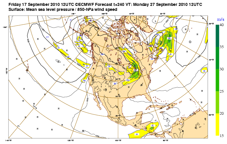
otowntiger wrote::uarrow:It looks like that model (ECMWF?) is showing NOTHING on day 10, LOL!


Dean4Storms wrote:Looks to me on that 500mb EURO EM run that there is a good bit of ridging over all of eastern MX so I would expect a stall in the western Carib and an eventual NW motion around the SW periphery of the SE CONUS ridge. Much will depend on how deep the system gets in the western Carib, a deeper system the more northward. If a trough advances into the picture from the NW there is no way this doesn't get turned northward or/and eastward IMO!
Users browsing this forum: NotSparta, South Texas Storms and 63 guests


