ATL: MATTHEW - Models

Moderator: S2k Moderators

Message
Author
User avatar
artist
Category 5
Category 5
Posts: 9792
Joined: Mon Jun 06, 2005 3:26 pm
Location: West Palm

Re: ATL: INVEST 95L - Models

#901 Postby artist » Thu Sep 23, 2010 1:42 pm

Saints wrote:This system is NOT even a TD, yet most people on here think a doomsday event, catastrophic Hurricane is going to Florida!

Good grief people, take a deep breath.

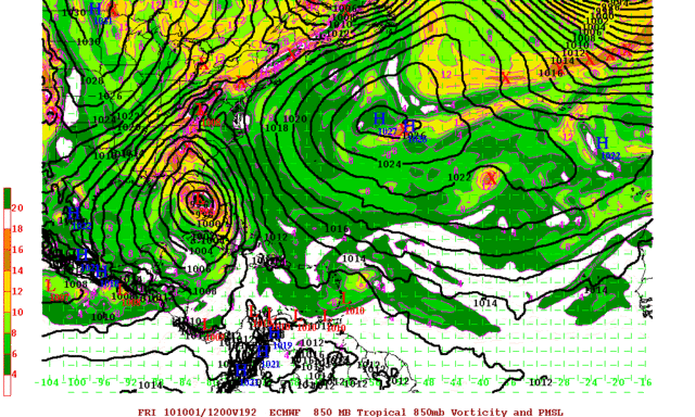
What are so many catastrophic predictions being based on? Models?

Everyone knows models are dynamic, meaning change. It is WAAAAAY too far out to predict so much OMG, and it's over for X scenarios.

While it's interesting to read predictions of where the system will end up and the strength, there is no reason to promote such dire predictions, over and over again, in multiple posts, by the same posters again and again, but with different words. It's as if you are looking for sympathy, or congratulatory accolades....”You forecasted a cataclysmic event and you win the prize for doomsayer champion”, type of recognition? Sheesh...

On to another area. Everyone better watch the BOC, as things appear to be popping there and OMG….another super hurricane is heading somewhere! J/K


actually it was a TD at the time of your post. :wink:

ABNT20 KNHC 231729
TWOAT
FOR THE NORTH ATLANTIC...CARIBBEAN SEA AND THE GULF OF MEXICO...

DATA FROM AN AIR FORCE RECONNAISSANCE PLANE INVESTIGATING THE AREA
OF LOW PRESSURE IN THE SOUTHWESTERN CARIBBEAN SEA INDICATE THAT A
TROPICAL DEPRESSION HAS FORMED. THE NATIONAL HURRICANE CENTER WILL
ISSUE A SPECIAL ADVISORY AT 2 PM EDT TODAY. THERE IS A HIGH
CHANCE...100 PERCENT...OF THIS SYSTEM BECOMING A TROPICAL CYCLONE
DURING THE NEXT 48 HOURS.
0 likes   

User avatar
Vortex
S2K Supporter
S2K Supporter
Posts: 4644
Age: 53
Joined: Fri Aug 01, 2003 9:34 pm
Location: Hilton Head, SC

#902 Postby Vortex » Thu Sep 23, 2010 1:43 pm

when referencing FL that includes the panhandle
0 likes   

User avatar
SouthFLTropics
Category 5
Category 5
Posts: 4236
Age: 50
Joined: Thu Aug 14, 2003 8:04 am
Location: Port St. Lucie, Florida

Re: ATL: TD FIFTEEN - Models

#903 Postby SouthFLTropics » Thu Sep 23, 2010 1:43 pm

Depending on the motion of that 168 hour plot it will mean a big difference between a SW Florida strike that would also affect the Metro Dade, Broward, and Palm Beach areas or will it slide further north and affect Tampa and/or the Big Bend. The alignment of the trough is going to be key to the eventual track this takes through Florida...

SFT
0 likes   
Fourth Generation Florida Native

Personal Storm History: David 79, Andrew 92, Erin 95, Floyd 99, Irene 99, Frances 04, Jeanne 04, Wilma 05, Matthew 16, Irma 17, Ian 22, Nicole 22, Milton 24

User avatar
Bocadude85
Category 5
Category 5
Posts: 2991
Age: 38
Joined: Mon Apr 18, 2005 2:20 pm
Location: Honolulu,Hi

Re: ATL: TD FIFTEEN - Models

#904 Postby Bocadude85 » Thu Sep 23, 2010 1:46 pm

SouthFLTropics wrote:Depending on the motion of that 168 hour plot it will mean a big difference between a SW Florida strike that would also affect the Metro Dade, Broward, and Palm Beach areas or will it slide further north and affect Tampa and/or the Big Bend. The alignment of the trough is going to be key to the eventual track this takes through Florida...

SFT


Very true... Personally I think this will be a panhandle problem more so then a S Fl problem though
0 likes   

User avatar
Ivanhater
Storm2k Moderator
Storm2k Moderator
Posts: 11161
Age: 38
Joined: Fri Jul 01, 2005 8:25 am
Location: Pensacola

Re: ATL: TD FIFTEEN - Models

#905 Postby Ivanhater » Thu Sep 23, 2010 1:46 pm

The Euro is developing a second storm similar to the GFS...this could be "Nicole"
0 likes   
Michael

User avatar
Vortex
S2K Supporter
S2K Supporter
Posts: 4644
Age: 53
Joined: Fri Aug 01, 2003 9:34 pm
Location: Hilton Head, SC

#906 Postby Vortex » Thu Sep 23, 2010 1:47 pm

12Z Euro..H192 Landfall South Florida...


http://raleighwx.easternuswx.com/models ... SLP192.gif
0 likes   

User avatar
southerngale
Retired Staff
Retired Staff
Posts: 27418
Joined: Thu Oct 10, 2002 1:27 am
Location: Southeast Texas (Beaumont area)

Re:

#907 Postby southerngale » Thu Sep 23, 2010 1:47 pm

ConvergenceZone wrote:
This system is NOT even a TD, yet most people on here think a doomsday event, catastrophic Hurricane is going to Florida!


Saint, I think you are off base here. I haven't heard anyone mention
that a horrible cat 4 or 5 hurricane is heading to Florida. Yes, there have
been some(including me) that have said that if a couple of the models runs verified,
that it would be horrible for the Tampa area, but that's about it.

What you are seeing is people who are concerned due to the general direction forecasted.
If it does hit Florida, we don't know if it will be a TD, TS, or weak or strong hurricane.
All is possible.... You are seeing lots of concern, which is justifiable.


I concur. Saints, don't confuse analyzing a particular model run with a forecast. This is the models thread and some of the model runs have predicted doomsday scenarios. Others have predicted something minor. All will likely be mentioned and commented on.
0 likes   
Please support Storm2k by making a donation today. It is greatly appreciated! Click here: Image

Image my Cowboys Image my RocketsImage my Astros

User avatar
Ivanhater
Storm2k Moderator
Storm2k Moderator
Posts: 11161
Age: 38
Joined: Fri Jul 01, 2005 8:25 am
Location: Pensacola

Re: ATL: TD FIFTEEN - Models

#908 Postby Ivanhater » Thu Sep 23, 2010 1:48 pm

Euro runs the west coast of Florida into Tampa
0 likes   
Michael

User avatar
SouthFLTropics
Category 5
Category 5
Posts: 4236
Age: 50
Joined: Thu Aug 14, 2003 8:04 am
Location: Port St. Lucie, Florida

Re:

#909 Postby SouthFLTropics » Thu Sep 23, 2010 1:49 pm

Vortex wrote:12Z Euro..H192 Landfall South Florida...


http://raleighwx.easternuswx.com/models ... SLP192.gif


Looks like Charley Part II, albeit more of an attack from straight south versus the swerve to the right that Charley took...

SFT
0 likes   
Fourth Generation Florida Native

Personal Storm History: David 79, Andrew 92, Erin 95, Floyd 99, Irene 99, Frances 04, Jeanne 04, Wilma 05, Matthew 16, Irma 17, Ian 22, Nicole 22, Milton 24

User avatar
ColinDelia
S2K Supporter
S2K Supporter
Posts: 918
Joined: Mon Aug 29, 2005 5:52 am
Location: The Beach, FL

Re: ATL: TD FIFTEEN - Models

#910 Postby ColinDelia » Thu Sep 23, 2010 1:51 pm

18z SHIPS. 78 knots in 72 hours
LGEM reaches 91 knots in 72 hours
0 likes   

User avatar
Vortex
S2K Supporter
S2K Supporter
Posts: 4644
Age: 53
Joined: Fri Aug 01, 2003 9:34 pm
Location: Hilton Head, SC

#911 Postby Vortex » Thu Sep 23, 2010 1:52 pm

Euro and GFS continue to suggest significant threat of a hurricane across portions of southern or central florida late next week....
0 likes   

jlauderdal
S2K Supporter
S2K Supporter
Posts: 7182
Joined: Wed May 19, 2004 5:46 am
Location: NE Fort Lauderdale
Contact:

Re:

#912 Postby jlauderdal » Thu Sep 23, 2010 1:53 pm

Vortex wrote:Euro and GFS continue to suggest significant threat of a hurricane across portions of southern or central florida late next week....


LBTS pier alert if that holds
0 likes   

User avatar
Aquawind
Category 5
Category 5
Posts: 6714
Age: 62
Joined: Mon Jun 16, 2003 10:41 pm
Location: Salisbury, NC
Contact:

#913 Postby Aquawind » Thu Sep 23, 2010 1:54 pm

Granted things can change but....Bummer news on this page..
0 likes   

User avatar
cycloneye
Admin
Admin
Posts: 145303
Age: 68
Joined: Thu Oct 10, 2002 10:54 am
Location: San Juan, Puerto Rico

Re: ATL: TD FIFTEEN - Models

#914 Postby cycloneye » Thu Sep 23, 2010 2:03 pm

Image
0 likes   
Visit the Caribbean-Central America Weather Thread where you can find at first post web cams,radars
and observations from Caribbean basin members Click Here

Vortmax1
Category 1
Category 1
Posts: 360
Joined: Wed Jul 07, 2010 11:35 pm
Location: Port Salerno, FL
Contact:

#915 Postby Vortmax1 » Thu Sep 23, 2010 2:06 pm

Next Friday:


Image
0 likes   

User avatar
Ivanhater
Storm2k Moderator
Storm2k Moderator
Posts: 11161
Age: 38
Joined: Fri Jul 01, 2005 8:25 am
Location: Pensacola

Re: ATL: TD FIFTEEN - Models

#916 Postby Ivanhater » Thu Sep 23, 2010 2:07 pm

Euro seems sheared.
0 likes   
Michael

Vortmax1
Category 1
Category 1
Posts: 360
Joined: Wed Jul 07, 2010 11:35 pm
Location: Port Salerno, FL
Contact:

#917 Postby Vortmax1 » Thu Sep 23, 2010 2:10 pm

Probably so. It's only at 995mb over a week out.
0 likes   

OuterBanker
S2K Supporter
S2K Supporter
Posts: 1731
Joined: Wed Feb 26, 2003 10:53 am
Location: Nags Head, NC
Contact:

Re: ATL: TD FIFTEEN - Models

#918 Postby OuterBanker » Thu Sep 23, 2010 2:11 pm

Now that Matthew to be has initialized we will get a clearer picture. It will be interesting to see what happens to the models now that TPC has established a position.

i.e. The tpc position is hitting the Yucatan peninsula and then heading north while the latest GFS has it heading north well before the Yucatan.

It seems all have been trending west lately, a good thing for east coasters. Not so good for GOMers.
0 likes   

User avatar
jdray
Category 3
Category 3
Posts: 853
Joined: Tue Aug 31, 2004 10:07 pm
Location: NE Florida

Re: Re:

#919 Postby jdray » Thu Sep 23, 2010 2:13 pm

SouthFLTropics wrote:
Vortex wrote:12Z Euro..H192 Landfall South Florida...


http://raleighwx.easternuswx.com/models ... SLP192.gif


Looks like Charley Part II, albeit more of an attack from straight south versus the swerve to the right that Charley took...

SFT


Yup, a run up the spine of the state or up the west coast. Would affect more than a Charley type track.
0 likes   

User avatar
PTrackerLA
Category 5
Category 5
Posts: 5277
Age: 41
Joined: Thu Oct 10, 2002 8:40 pm
Location: Lafayette, LA

#920 Postby PTrackerLA » Thu Sep 23, 2010 2:23 pm

Correct me if I'm wrong but the Euro is not indicating necessarily a strong hurricane (pressure 990's) and like Ivan said it appears to be sheared. Definitely not the outputs we were seeing two days ago of a major getting into the gulf. Don't panic just yet Floridians.
0 likes   


Return to “2010”

Who is online

Users browsing this forum: No registered users and 5 guests