ATL: MATTHEW - Ex-Tropical Storm - Discussion

Moderator: S2k Moderators

Message
Author
User avatar
fci
S2K Supporter
S2K Supporter
Posts: 3324
Joined: Tue Sep 14, 2004 10:29 am
Location: Lake Worth, FL

Re: ATL: Tropical Depression FIFTEEN - Discussion

#701 Postby fci » Thu Sep 23, 2010 3:49 pm

sfwx wrote:From Florida Division of Emergency Management:

At 2pm EDT Thursday, Tropical Depression Fifteen formed in the south-central Caribbean Sea. It is currently around 270 miles south of Jamaica and near 475 miles west of the eastern coast of Nicaragua, which is about 850 miles southeast of Miami, Florida.
TD #15 is currently moving to the west at 15mph. This general motion is expected to continue over the next 48 hours.
On the forecast track, the center of the storm is expected to be near the Nicaragua/Honduras border late Friday or early Saturday. It is then expected to move along the coast of northeast Honduras on Saturday. This system is then forecast to move through the Gulf of Honduras and then turn towards the north-northeast on Sunday and Monday and move along the coast of Belize and the Yucatan Peninsula Monday and Tuesday.
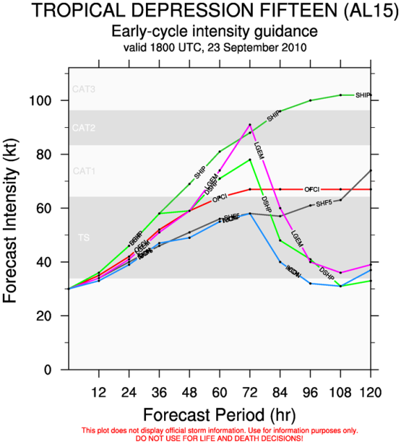
Maximum sustained winds are around 35mph, but environmental conditions could promote strengthening. Tropical Depression 15 is expected to become Tropical Storm Matthew later tonight or Friday. There is around a 60% chance that this system will reach tropical storm intensity by 8pm tonight.
The official forecast keeps the storm at tropical storm strength through Saturday morning. After that, the storm is expected to intensify to hurricane strength.
A complete briefing packet will be sent out after the 5pm advisories are issued.


This seems to be a very early release from the Florida Division of Emergency Managmet.
I think it quells the thoughts that people in Florida are being alarmists.
There is still a whole lot that can happen to TD15/Matthew, however; people in Florida, and the upper GOM I might add; are going to be paying very close attention to this developing storm.
0 likes   

User avatar
ConvergenceZone
Category 5
Category 5
Posts: 5194
Joined: Fri Jul 29, 2005 1:40 am
Location: Northern California

#702 Postby ConvergenceZone » Thu Sep 23, 2010 3:51 pm

But if you look at the forecast, they aren't ramping the strength of this up very quickly.
Do they know something we don't?
0 likes   

User avatar
Typhoon_Willie
Category 5
Category 5
Posts: 1042
Joined: Mon Jun 09, 2003 3:19 pm
Location: Greenacres City, Florida

Re: ATL: Tropical Storm MATTHEW - Discussion

#703 Postby Typhoon_Willie » Thu Sep 23, 2010 3:51 pm

I almost hate to think what kind of ramp up that would be.
0 likes   

User avatar
HURAKAN
Professional-Met
Professional-Met
Posts: 46086
Age: 38
Joined: Thu May 20, 2004 4:34 pm
Location: Key West, FL
Contact:

#704 Postby HURAKAN » Thu Sep 23, 2010 3:52 pm

This system has the potential to be the storm of 2010
0 likes   

User avatar
ConvergenceZone
Category 5
Category 5
Posts: 5194
Joined: Fri Jul 29, 2005 1:40 am
Location: Northern California

Re:

#705 Postby ConvergenceZone » Thu Sep 23, 2010 3:53 pm

HURAKAN wrote:This system has the potential to be the storm of 2010

Any reason why the NHC is being so conservative on the strength??
Sometimes they aren't conservative, but they are with Matt
0 likes   

otowntiger
Category 5
Category 5
Posts: 1921
Joined: Tue Aug 31, 2004 7:06 pm

Re:

#706 Postby otowntiger » Thu Sep 23, 2010 3:54 pm

ConvergenceZone wrote:But if you look at the forecast, they aren't ramping the strength of this up very quickly.
Do they know something we don't?
But keep in mind, intensity forecasting is something no one has a grasp on yet. :wink:
0 likes   

User avatar
HURAKAN
Professional-Met
Professional-Met
Posts: 46086
Age: 38
Joined: Thu May 20, 2004 4:34 pm
Location: Key West, FL
Contact:

Re: Re:

#707 Postby HURAKAN » Thu Sep 23, 2010 3:55 pm

ConvergenceZone wrote:
HURAKAN wrote:This system has the potential to be the storm of 2010

Any reason why the NHC is being so conservative on the strength??
Sometimes they aren't conservative, but they are with Matt


It's a compromise of the track. If it stays north, it will be a lot stronger. If it goes further south, then it will be a lot weaker.
0 likes   

User avatar
ConvergenceZone
Category 5
Category 5
Posts: 5194
Joined: Fri Jul 29, 2005 1:40 am
Location: Northern California

Re: Re:

#708 Postby ConvergenceZone » Thu Sep 23, 2010 3:55 pm

But keep in mind, intensity forecasting is something no one has a grasp on yet. :wink:


There's a big differce between the models 10 days out and the intensity forecasts 2 or 3 days out.
0 likes   

User avatar
SouthFLTropics
Category 5
Category 5
Posts: 4236
Age: 50
Joined: Thu Aug 14, 2003 8:04 am
Location: Port St. Lucie, Florida

#709 Postby SouthFLTropics » Thu Sep 23, 2010 3:57 pm

Lets remember here folks that this could be the Storm of 2010 even if it never makes it to Hurricane strength. There are many people in Central America that are going to impacted in a bad way by this in just a couple of days. When Mitch hit there in 1998 thousands of people lost their homes and loved ones. I remember images on TV of massive mudslides and the reports of the casualties were staggering...This has the potential to drop a boatload of rain in that area and cause the same destruction. I'm taking early bets that the name Matthew will not be used ever again even if it doesn't make it to Hurricane strength.

SFT
0 likes   
Fourth Generation Florida Native

Personal Storm History: David 79, Andrew 92, Erin 95, Floyd 99, Irene 99, Frances 04, Jeanne 04, Wilma 05, Matthew 16, Irma 17, Ian 22, Nicole 22, Milton 24

invest man
Tropical Storm
Tropical Storm
Posts: 206
Joined: Sun Aug 17, 2008 8:12 pm

#710 Postby invest man » Thu Sep 23, 2010 4:01 pm

The discussion said assuming it goes inland, so they still may not be sure that it will make it as far west as they have on their own forcast track. It would only make since that it might would be stronger if it stays of shore, especially with limited shear forcasted in the area. IM
0 likes   

User avatar
ConvergenceZone
Category 5
Category 5
Posts: 5194
Joined: Fri Jul 29, 2005 1:40 am
Location: Northern California

#711 Postby ConvergenceZone » Thu Sep 23, 2010 4:13 pm

I'm just wondering why they aren't ramping up the intensity BEFORE it gets inland(if it does). I can
understand them not ramping up the intensity forecasts once it gets to the point of possibly going inland, but
for the next 24 hours or so, I don't know why the intensity isn't forecasted to increase quicker.
0 likes   

Sanibel
Category 5
Category 5
Posts: 10375
Joined: Mon Aug 30, 2004 11:06 pm
Location: Offshore SW Florida

Re: ATL: Tropical Storm MATTHEW - Discussion

#712 Postby Sanibel » Thu Sep 23, 2010 4:15 pm

I guess the prudent poster would wait until it becomes more clear on what kind of a turn it will take. It could make a big difference as far as final destination. NAM is keeping it offshore Yucatan - which is the worst possible thing because we could see a Wilma track that doesn't waste time over Cozumel and heads straight to the Gulf. But we could also still see a system that heads over Yucatan and limits strength. My attitude is to be aware of this but wait until the turn becomes better understood.

One thing I don't like is this one has a more "muscular" look to the early bands than other Caribbean systems this year.
0 likes   

User avatar
TreasureIslandFLGal
S2K Supporter
S2K Supporter
Posts: 1581
Age: 57
Joined: Sun Aug 15, 2004 6:16 pm
Location: Clearwater, Florida ~3 miles from the coast now. We finally moved safely off the barrier island!

Re:

#713 Postby TreasureIslandFLGal » Thu Sep 23, 2010 4:17 pm

ConvergenceZone wrote:I'm just wondering why they aren't ramping up the intensity BEFORE it gets inland(if it does). I can
understand them not ramping up the intensity forecasts once it gets to the point of possibly going inland, but
for the next 24 hours or so, I don't know why the intensity isn't forecasted to increase quicker.


I'm with you there. I think we are witnessing now how quickly this could ramp up. Maybe they feel the interaction with land, or even the proximity, will cut off matthew's inflow and not allow it to ramp up at all.

I suppose that is plausible. however, as warm as those waters are, I wonder which will win out. maybe it is a draw, and the storm simply maintains its strength. hmmmmm I think that is what they call for. ;)
0 likes   
Chrissy & Ligeia
:flag:

hurricaneCW
Category 5
Category 5
Posts: 1794
Joined: Wed Mar 03, 2010 6:20 am
Location: Toms River, NJ

Re: ATL: MATTHEW - Tropical Storm - Discussion

#714 Postby hurricaneCW » Thu Sep 23, 2010 4:18 pm

There's no need to ramp up the intensity especially due to all that land interaction. It's still a storm that's trying to get its act together so it won't ramp up rapidly. What I'm looking for now is to see if there's a huge blow up of very cold cloud tops (-80C) right over the center. If we see that happen tonight, then Matthew could really ramp up quite rapidly.
0 likes   

User avatar
TreasureIslandFLGal
S2K Supporter
S2K Supporter
Posts: 1581
Age: 57
Joined: Sun Aug 15, 2004 6:16 pm
Location: Clearwater, Florida ~3 miles from the coast now. We finally moved safely off the barrier island!

#715 Postby TreasureIslandFLGal » Thu Sep 23, 2010 4:19 pm

this will be a nailbiter for sure. so many different scenarios. -and none of them are that pleasant. someone will suffer no matter how it pans out.
0 likes   
Chrissy & Ligeia
:flag:

SunnyThoughts
Category 5
Category 5
Posts: 2263
Joined: Wed Jul 09, 2003 12:42 pm
Location: Pensacola, Florida

Re: ATL: MATTHEW - Tropical Storm - Discussion

#716 Postby SunnyThoughts » Thu Sep 23, 2010 4:19 pm

Image
0 likes   

Vortmax1
Category 1
Category 1
Posts: 360
Joined: Wed Jul 07, 2010 11:35 pm
Location: Port Salerno, FL
Contact:

#717 Postby Vortmax1 » Thu Sep 23, 2010 4:19 pm

Finally there is something of substance for the models to initialize and work from.
This has the potential to impact a lot of lives and since I'm way down the line regarding that impact I have no comments about what might happen in the CONUS at this time.


Image
0 likes   

User avatar
Blown Away
S2K Supporter
S2K Supporter
Posts: 10146
Joined: Wed May 26, 2004 6:17 am

Re: ATL: MATTHEW - Tropical Storm - Discussion

#718 Postby Blown Away » Thu Sep 23, 2010 4:21 pm

Image
HPC still placing Matt's low in the Yucatan Channel in about 7 days, this position is a little farther north and east than the previous position!
0 likes   
Hurricane Eye Experience: David 79, Irene 99, Frances 04, Jeanne 04, Wilma 05... EYE COMING MY WAY IN 2024…
Hurricane Brush Experience: Andrew 92, Erin 95, Floyd 99, Matthew 16, Irma 17, Ian 22, Nicole 22…

User avatar
SoupBone
Category 5
Category 5
Posts: 3111
Joined: Tue Sep 20, 2005 5:24 pm

Re: ATL: MATTHEW - Tropical Storm - Discussion

#719 Postby SoupBone » Thu Sep 23, 2010 4:29 pm

If the cold front dips down as far as it's forecasted to do LA would have less to worry about then the states further east. The big question is does it dip that far down?

I did have a question that's related to Matthew. Has Walt Disney World/Universal/Busch Gardens ever been affected by a nasty hurricane? If so how did they fare? I was just wondering with how many times you guys in Florida get hit it would be an easy assumption that it's gotten hit at least once.
0 likes   

User avatar
cycloneye
Admin
Admin
Posts: 145329
Age: 68
Joined: Thu Oct 10, 2002 10:54 am
Location: San Juan, Puerto Rico

Re: ATL: MATTHEW - Tropical Storm - Discussion

#720 Postby cycloneye » Thu Sep 23, 2010 4:33 pm

SoupBone wrote:If the cold front dips down as far as it's forecasted to do LA would have less to worry about then the states further east. The big question is does it dip that far down?

I did have a question that's related to Matthew. Has Walt Disney World/Universal/Busch Gardens ever been affected by a nasty hurricane? If so how did they fare? I was just wondering with how many times you guys in Florida get hit it would be an easy assumption that it's gotten hit at least once.


I remember that Disneyworld was closed when Charley moved thru.
0 likes   
Visit the Caribbean-Central America Weather Thread where you can find at first post web cams,radars
and observations from Caribbean basin members Click Here


Return to “2010”

Who is online

Users browsing this forum: No registered users and 6 guests