ATL: MATTHEW - Ex-Tropical Storm - Discussion
Moderator: S2k Moderators

Yeah and that makes sense given the shear aloft, still the next few hours will confirm whether thats the case with the Vis imagery.
0 likes
Personal Forecast Disclaimer:
The posts in this forum are NOT official forecast and should not be used as such. They are just the opinion of the poster and may or may not be backed by sound meteorological data. They are NOT endorsed by any professional institution or storm2k.org. For official information, please refer to the NHC and NWS products
The posts in this forum are NOT official forecast and should not be used as such. They are just the opinion of the poster and may or may not be backed by sound meteorological data. They are NOT endorsed by any professional institution or storm2k.org. For official information, please refer to the NHC and NWS products
-
wxman57

- Moderator-Pro Met

- Posts: 23175
- Age: 68
- Joined: Sat Jun 21, 2003 8:06 pm
- Location: Houston, TX (southwest)
Re:
KWT wrote:Quite a decent convective ball there Hurakan, wonder where the LLC is in relation to that convective mass...either way the weather is heading close to land now thats for sure, going to be a rough day.
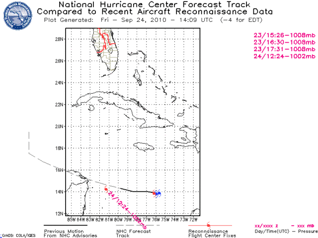
Here's where NHC has it relative to the ball of convection at 12Z:

0 likes
-
hurricaneCW
- Category 5

- Posts: 1799
- Joined: Wed Mar 03, 2010 6:20 am
- Location: Toms River, NJ
Re: ATL: MATTHEW - Tropical Storm - Discussion
Matthew looks like he was on his way to exploding, so thank god for the landmasses to stop him. He's definitely plowing into CA, but his energy will remain and become entrained with a new low forming. A very complex but interesting setup nonetheless.
0 likes

It looks to me possibly like the center is now close to the convective mass, or just to the NE of it but close enough to strengthening either way.
0 likes
Personal Forecast Disclaimer:
The posts in this forum are NOT official forecast and should not be used as such. They are just the opinion of the poster and may or may not be backed by sound meteorological data. They are NOT endorsed by any professional institution or storm2k.org. For official information, please refer to the NHC and NWS products
The posts in this forum are NOT official forecast and should not be used as such. They are just the opinion of the poster and may or may not be backed by sound meteorological data. They are NOT endorsed by any professional institution or storm2k.org. For official information, please refer to the NHC and NWS products


Re:
KWT wrote:It looks to me possibly like the center is now close to the convective mass, or just to the NE of it but close enough to strengthening either way.
Convection does look like it took a sharp jog to more over the center in the last frame.
http://rammb.cira.colostate.edu/product ... 240545.jpg

0 likes
-
tolakram
- Admin

- Posts: 20186
- Age: 62
- Joined: Sun Aug 27, 2006 8:23 pm
- Location: Florence, KY (name is Mark)
Re: ATL: MATTHEW - Tropical Storm - Discussion

0 likes
M a r k
- - - - -
Join us in chat: Storm2K Chatroom Invite. Android and IOS apps also available.
The posts in this forum are NOT official forecasts and should not be used as such. Posts are NOT endorsed by any professional institution or STORM2K.org. For official information and forecasts, please refer to NHC and NWS products.
Re: ATL: MATTHEW - Tropical Storm - Discussion
I was wrong about track. Obvious CA crasher. Good thing too...
0 likes
-
HURAKAN

- Professional-Met

- Posts: 46084
- Age: 39
- Joined: Thu May 20, 2004 4:34 pm
- Location: Key West, FL
- Contact:
Re: ATL: MATTHEW - Tropical Storm - Discussion
Sanibel wrote:I was wrong about track. Obvious CA crasher. Good thing too...
Except if you're in NE Nicaragua and northern Honduras
0 likes
-
AussieMark

- Category 5
- Posts: 5857
- Joined: Tue Sep 02, 2003 6:36 pm
- Location: near Sydney, Australia
Re: ATL: MATTHEW - Tropical Storm - Discussion
Sanibel wrote:I was wrong about track. Obvious CA crasher. Good thing too...
Not really a good thing, a storm this size and with track being projected could quite easily cause a lot of bad flooding across the region.
0 likes
Re: ATL: MATTHEW - Tropical Storm - Discussion
good - this thing is going to run smack dab into CA like I thought all along - no way its intensifying into anything crazy while being over land for probably 3 days straight
(especially since I really need hurricane shutters at my new place and havent bought them yet)
(especially since I really need hurricane shutters at my new place and havent bought them yet)
0 likes
-
lester

- S2K Supporter

- Posts: 1305
- Age: 37
- Joined: Sat Aug 27, 2005 5:21 pm
- Location: Washington, DC
- Contact:
Re: ATL: MATTHEW - Tropical Storm - Discussion
tshizzle wrote:good - this thing is going to run smack dab into CA like I thought all along - no way its intensifying into anything crazy while being over land for probably 3 days straight
(especially since I really need hurricane shutters at my new place and havent bought them yet)
Not good. This could be disastrous for central america
0 likes

Re: ATL: MATTHEW - Tropical Storm - Discussion
tshizzle wrote:good - this thing is going to run smack dab into CA like I thought all along - no way its intensifying into anything crazy while being over land for probably 3 days straight
(especially since I really need hurricane shutters at my new place and havent bought them yet)
Don't be fooled by the convective ball and easterly shear that's displaced the convection far west of the center. The actual center according to NHC, is at 14.3N-80.7W which is displaced NE of the convective ball you see slaming into CA. You'll notice on the SAT that convection is now increasing SW of JAM immediately north of the LLC. The storm is forecast to slow and turn more W-NW over the next 48 hours - the center may still only glaze the NE coast.
http://www.ssd.noaa.gov/goes/flt/t1/loop-vis.html
0 likes
-
Eyeofdtiger75
- Tropical Wave

- Posts: 4
- Joined: Sun Sep 12, 2004 1:50 pm
Re: ATL: MATTHEW - Tropical Storm - Discussion
PLEASE....stay away from Florida. We have a honeymood in 2 weeks in Orlando and WDW. Fingers Crossed.
0 likes
-
alanstover
- Tropical Low

- Posts: 46
- Joined: Mon Jun 28, 2010 8:40 pm
- Location: Quetzaltenango, Guatemala, CA
Seems like some folks here forget that people actually live down here in CA.
And the proximity of water on both sides of us as well as the steep mountains in the interior can turn even a moderate storm into a disastrous rain event.
Though honestly, I´m not sure which would be worse, a direct hit and the mountains tearing up the storm, or having the storm sit along-side pulling moisture up across the mountains from the Pacific. Either way it will be bad.
Thanks to those who have expressed their concern for CA and to all those who post relevant info which helps us in the area be better prepared.
alan
0 likes
-
Bocadude85

- Category 5
- Posts: 2991
- Age: 39
- Joined: Mon Apr 18, 2005 2:20 pm
- Location: Honolulu,Hi
Re: ATL: MATTHEW - Tropical Storm - Discussion
ronjon wrote:tshizzle wrote:good - this thing is going to run smack dab into CA like I thought all along - no way its intensifying into anything crazy while being over land for probably 3 days straight
(especially since I really need hurricane shutters at my new place and havent bought them yet)
Don't be fooled by the convective ball and easterly shear that's displaced the convection far west of the center. The actual center according to NHC, is at 14.3N-80.7W which is displaced NE of the convective ball you see slaming into CA. You'll notice on the SAT that convection is now increasing SW of JAM immediately north of the LLC. The storm is forecast to slow and turn more W-NW over the next 48 hours - the center may still only glaze the NE coast.
http://www.ssd.noaa.gov/goes/flt/t1/loop-vis.html
I do not see anyway that Matthew will just graze the NE coast of Honduras... to me he looks to make landfall in northern Nicuargua.
0 likes
-
Comanche

- Category 1

- Posts: 381
- Age: 54
- Joined: Wed Jul 06, 2005 9:33 am
- Location: Clear Lake City Texas
Re: ATL: MATTHEW - Tropical Storm - Discussion
Bocadude85 wrote:ronjon wrote:tshizzle wrote:good - this thing is going to run smack dab into CA like I thought all along - no way its intensifying into anything crazy while being over land for probably 3 days straight
(especially since I really need hurricane shutters at my new place and havent bought them yet)
Don't be fooled by the convective ball and easterly shear that's displaced the convection far west of the center. The actual center according to NHC, is at 14.3N-80.7W which is displaced NE of the convective ball you see slaming into CA. You'll notice on the SAT that convection is now increasing SW of JAM immediately north of the LLC. The storm is forecast to slow and turn more W-NW over the next 48 hours - the center may still only glaze the NE coast.
http://www.ssd.noaa.gov/goes/flt/t1/loop-vis.html
I do not see anyway that Matthew will just graze the NE coast of Honduras... to me he looks to make landfall in northern Nicuargua.
Completely agree, in fact, based on the few vis shots, it looks to be more like 14.1/81.9, we'll see soon in the next update.
0 likes
Who is online
Users browsing this forum: No registered users and 39 guests