ATL: NICOLE - Ex Tropical Storm - Discussion
Moderator: S2k Moderators
-
gatorcane

- S2K Supporter

- Posts: 23708
- Age: 48
- Joined: Sun Mar 13, 2005 3:54 pm
- Location: Boca Raton, FL
Re:
Vortex wrote:Not going to much for the next 24 or so..then off to the NNE....also should pass over the very skiny part of cuba just east of Havana and head into the FL straits and right up over SE florida...
I know but with 40k of westerly shear screaming over southern fl, we may very well see a lot of this pass to the east with dry air pushing in on the west side.....
Last edited by gatorcane on Mon Sep 27, 2010 9:42 pm, edited 1 time in total.
0 likes
-
kevin
Re: ATL : INVEST 96L - Discussion
When are they sending recon so we'll have a better handle on where the low is?
0 likes
-
otowntiger
- Category 5

- Posts: 1932
- Joined: Tue Aug 31, 2004 7:06 pm
Re: ATL : INVEST 96L - Discussion
You know what's ridiculous? We've been watching this thing supposedly going to develop for well over a week and it went from going to really pack a wallop to being just a torrential rain event to maybe just a few passing clouds to our east.  The NWS really blew the forecast for the Orlando area today as well. We were supposed to have an 80% chance of rain today, (eight-zero!), as in just 20% less than guaranteed rain and I got not one freaking drop here at my house, not even a trace!
  I turned off my irrigation system this weekend expecting big rains and my lawn is down right crispy. I know long range models are for the birds, but apparently short range models can prove to be completely wrong too. Sorry for the rant, now back to our regularly scheduled disorganized blob gazing.
Last edited by otowntiger on Mon Sep 27, 2010 9:47 pm, edited 1 time in total.
0 likes
-
Aric Dunn
- Category 5
- Posts: 21238
- Age: 43
- Joined: Sun Sep 19, 2004 9:58 pm
- Location: Ready for the Chase.
- Contact:
Re: Re:
gatorcane wrote:Vortex wrote:Not going to much for the next 24 or so..then off to the NNE....also should pass over the very skiny part of cuba just east of Havana and head into the FL straits and right up over SE florida...
I know but with 40k of westerly shear screaming over southern fl, we may very well see a lot of thus pass to the east with dry air outing in on the west side.....
well the easterly progressing of the front and the dry is is slowing and should stop as the upper Low ocer the SE screams northward. the shear should relax Some across the southern gulf as this happens.
0 likes
Note: If I make a post that is brief. Please refer back to previous posts for the analysis or reasoning. I do not re-write/qoute what my initial post said each time.
If there is nothing before... then just ask
Space & Atmospheric Physicist, Embry-Riddle Aeronautical University,
I believe the sky is falling...
If there is nothing before... then just ask
Space & Atmospheric Physicist, Embry-Riddle Aeronautical University,
I believe the sky is falling...
-
Aric Dunn
- Category 5
- Posts: 21238
- Age: 43
- Joined: Sun Sep 19, 2004 9:58 pm
- Location: Ready for the Chase.
- Contact:
Re:
gatorcane wrote:Aric perhaps. Anybody else see the low forming now south of the western tip of Cuba? I see cyclonic turning and convection developing.
yeah ... mentioned that up above..
0 likes
Note: If I make a post that is brief. Please refer back to previous posts for the analysis or reasoning. I do not re-write/qoute what my initial post said each time.
If there is nothing before... then just ask
Space & Atmospheric Physicist, Embry-Riddle Aeronautical University,
I believe the sky is falling...
If there is nothing before... then just ask
Space & Atmospheric Physicist, Embry-Riddle Aeronautical University,
I believe the sky is falling...
-
Florida1118
Re: ATL : INVEST 96L - Discussion
otowntiger wrote:You know what's ridiculous? We've been watching this thing supposedly going to develop for well over a week and it went from going to really pack a wallop to being just a torrential rain event to maybe just a few passing clouds to our east.
1) What does a rain chance have to do with 96L
2) You could have been the 20% that didnt get rain maybe?
3) The NWS isnt perfect, none of us are
4) Models dont have that much info to go on right now
5) 96L is looking better...sort of. 50% on TWO.
Last edited by Florida1118 on Mon Sep 27, 2010 9:49 pm, edited 1 time in total.
0 likes


-
cycloneye

- Admin

- Posts: 149586
- Age: 69
- Joined: Thu Oct 10, 2002 10:54 am
- Location: San Juan, Puerto Rico
Re: ATL : INVEST 96L - Discussion
kevin wrote:When are they sending recon so we'll have a better handle on where the low is?
Tommorow afternoon will be the first Air force mission if necessary.
SUSPECT SYSTEM (NORTHWEST CARIBBEAN)
FLIGHT ONE -- TEAL 70
A. 28/1800Z
B. AFXXX 01GGA INVEST
C. 28/1530Z
D. 20.0N 85.0W
E. 28/1700Z TO 28/2300Z
F. SFC TO 10,000 FT
0 likes
Visit the Caribbean-Central America Weather Thread where you can find at first post web cams,radars
and observations from Caribbean basin members Click Here
and observations from Caribbean basin members Click Here
Re: Re:
gatorcane wrote:Vortex wrote:Not going to much for the next 24 or so..then off to the NNE....also should pass over the very skiny part of cuba just east of Havana and head into the FL straits and right up over SE florida...
I know but with 40k of westerly shear screaming over southern fl, we may very well see a lot of this pass to the east with dry air pushing in on the west side.....
Gator the trajectory of the shear will be out of the ssw/sw and the storm will be moving nne..its not until the storm gets to 27N or so that the shear turns out of the sw/wsw...looking at he 200mb charts..this was similar to Irene..
0 likes
-
Aquawind

- Category 5
- Posts: 6714
- Age: 62
- Joined: Mon Jun 16, 2003 10:41 pm
- Location: Salisbury, NC
- Contact:
Re: Re:
gatorcane wrote:Vortex wrote:Not going to much for the next 24 or so..then off to the NNE....also should pass over the very skiny part of cuba just east of Havana and head into the FL straits and right up over SE florida...
I know but with 40k of westerly shear screaming over southern fl, we may very well see a lot of this pass to the east with dry air pushing in on the west side.....
Agreed between both dry air and sheer I don't expect much from this in SW Florida at least..
0 likes
-
Evil Jeremy

- S2K Supporter
- Posts: 5463
- Age: 32
- Joined: Mon Apr 10, 2006 2:10 pm
- Location: Los Angeles, CA
Convection popping up, and rotation becoming evident. The picture Hurakan posted shows the circular formation of the storm. Large circulation with banding. Tomorrow I am going to begin preparations for a strong TS with tons of rain. 50% at the next TWO IMO.
0 likes
Frances 04 / Jeanne 04 / Katrina 05 / Wilma 05 / Fay 08 / Debby 12 / Andrea 13 / Colin 16 / Hermine 16 / Matthew 16 / Irma 17
cuban radar...should be interesting in the hours to come
http://www.insmet.cu/asp/genesis.asp?TB ... AXw01a.gif
http://www.insmet.cu/asp/genesis.asp?TB ... AXw01a.gif
0 likes
-
otowntiger
- Category 5
- Posts: 1932
- Joined: Tue Aug 31, 2004 7:06 pm
Re:
But VERY disorganized. This thing hasn't changed one iota all day.HURAKAN wrote:
very unstable
0 likes

Re: ATL : INVEST 96L - Discussion
I expect to wake up in the morning to find that predictions have changed for S Fl and that the rain,etc., will pass on by that area. This is not a forecast of any kind. 
0 likes


Re: ATL : INVEST 96L - Discussion
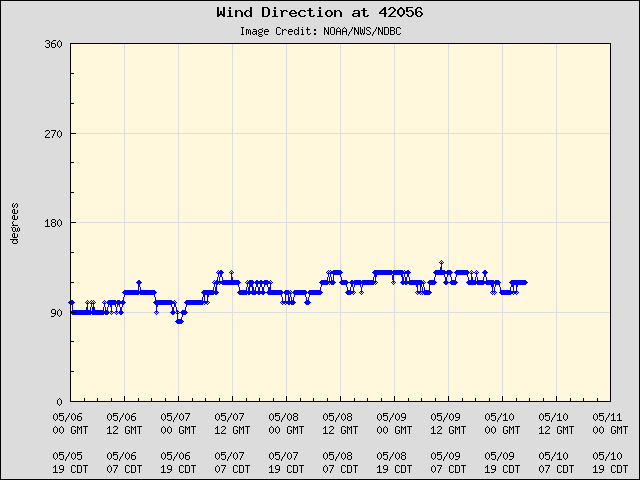
Winds on buoy 42056 are spinning around to out of the north.
0 likes
Who is online
Users browsing this forum: No registered users and 61 guests