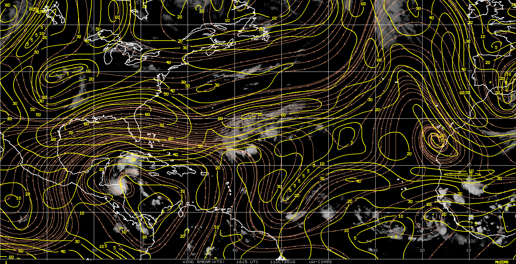
Disturbance in the western Caribbean (Is invest 98L)
Moderator: S2k Moderators
Forum rules
The posts in this forum are NOT official forecasts and should not be used as such. They are just the opinion of the poster and may or may not be backed by sound meteorological data. They are NOT endorsed by any professional institution or STORM2K. For official information, please refer to products from the National Hurricane Center and National Weather Service.
H252 nearing western cuba...a very slow mover and classic October track...
http://raleighwx.easternuswx.com/models ... cal252.gif
http://raleighwx.easternuswx.com/models ... cal252.gif
0 likes
- gatorcane
- S2K Supporter

- Posts: 23708
- Age: 48
- Joined: Sun Mar 13, 2005 3:54 pm
- Location: Boca Raton, FL
Re:
Consensus is growing. What is amazing is that the models are still showing strong upper-level westeries across the southern gom and Florida all the way through mid to late October causing this to move into Cuba and off into the Bahamas south of Florida. However we are talking long-range so could change.
0 likes
Re: ATL: Disturbed Weather in the southwest Caribbean
This could be stationary thru the weekend.


0 likes
Re: ATL: Disturbed Weather in the southwest Caribbean
Heavy convection, south of Hispaniola, continues to fire and move slowly west just south iof the TUTT centered north of the Mona Passage.
http://rammb.cira.colostate.edu/product ... 050245.jpg
http://www.goes.noaa.gov/HURRLOOPS/huwvloop.html
Anticyclone continues to work its way slowly south nearer to the convection.
Cloud tops are running 55 to 60K-ft.
The persistant heavy convection and solar heating of the cirrus will continue diabatic heating of the upper troposphere.
This will continue to develop the negative moist potential vorticity (NMPV) in the mid Carib's upper troposphere.
The improvement in the UL's should be indicated by the anti-cyclone moving over the convection.

0 likes
All the globals on board with development...ECM/GFS/NOGAPS/UKMET all indicate a cyclone forming over the SW carribean over the next 4-7 days...The cyclone will likely remain quasi-stationary over the SW carribean through much of the upcoming weekend..Later next week a cold front is expected to charge across the midwest and this will draw the cyclone NNW/N then NE to a position near western cuba late in the week..At the same time a cold front is expected to possibly pass through all Florida and exit the SE coast...How far North the cyclone gets will determine weather this crosses SFL or remains just to the east and heads into the bahamas...Climatology would suggest a very close call or hit on south fl....stay tuned...
0 likes
I'm guessing the system that has split off from 97L is going to be the region that sparks off any development in the W.Caribbean?
A little too early to call with regards to track though...
A little too early to call with regards to track though...
0 likes
Personal Forecast Disclaimer:
The posts in this forum are NOT official forecast and should not be used as such. They are just the opinion of the poster and may or may not be backed by sound meteorological data. They are NOT endorsed by any professional institution or storm2k.org. For official information, please refer to the NHC and NWS products
The posts in this forum are NOT official forecast and should not be used as such. They are just the opinion of the poster and may or may not be backed by sound meteorological data. They are NOT endorsed by any professional institution or storm2k.org. For official information, please refer to the NHC and NWS products
- latitude_20
- Tropical Storm

- Posts: 196
- Joined: Wed Jun 30, 2010 6:46 am
- Location: Tulum, Mexico
- Contact:
Re: ATL: Disturbed Weather in the southwest Caribbean
Increasing area of vorticity just north of Panama.
0 likes
- wzrgirl1
- S2K Supporter

- Posts: 1360
- Joined: Sat Sep 04, 2004 6:44 am
- Location: Pembroke Pines, Florida
Re: ATL: Disturbed Weather in the southwest Caribbean
Should be another wait and see situation. Being that all the models have latched on becomes a matter of patience. Here's to hoping that this is nothing but a minor rain event for anyone.
0 likes
- Blown Away
- S2K Supporter

- Posts: 10253
- Joined: Wed May 26, 2004 6:17 am
Re: ATL: Disturbed Weather in the southwest Caribbean
IMO, this area should be a "Code Yellow" very soon.
http://www.ssd.noaa.gov/goes/east/tatl/loop-avn.html
http://www.ssd.noaa.gov/goes/east/tatl/loop-avn.html
0 likes
Hurricane Eye Experience: David 79, Irene 99, Frances 04, Jeanne 04, Wilma 05… Hurricane Brush Experience: Andrew 92, Erin 95, Floyd 99, Matthew 16, Irma 17, Ian 22, Nicole 22…
Who is online
Users browsing this forum: Ulf and 278 guests


