Caribbean - Central America Weather

U.S. & Caribbean Weather Discussions and Severe Weather Events

Moderator: S2k Moderators

Forum rules

The posts in this forum are NOT official forecast and should not be used as such. They are just the opinion of the poster and may or may not be backed by sound meteorological data. They are NOT endorsed by any professional institution or STORM2K.

Help Support Storm2K
Message
Author
User avatar
msbee
S2K Supporter
S2K Supporter
Posts: 3027
Joined: Wed Jun 11, 2003 10:11 am
Location: St. Maarten

Re: Caribbean - Central America Weather Thread

#7061 Postby msbee » Sat Oct 09, 2010 11:02 am

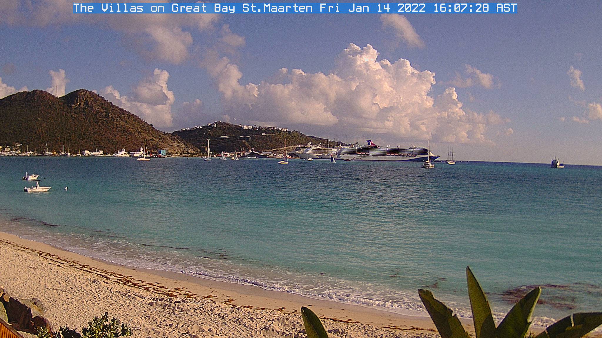
cycloneye wrote:Nice change from cloudy rainy days to this,right Barbara? :) All the cams posted at the first post of thread show sunny conditions in the Caribbean.

Image


Hi Luis
That's a beautiful sight right? LOL
I'm lovin' the sunshine!
and the water is clearing up too. This is what it looked like a few days ago.

Image

and the salt pond overflowed and the tarpon in the salt pond were just flopping around in the streets. The kids were having fun catching them.

Image

Image


I'm glad things are clearing up in PR too.
and VERY glad there were no fatalities.
As bad as this was, it could have been worse.
0 likes   
Too many hurricanes to remember

User avatar
Gustywind
Category 5
Category 5
Posts: 12334
Joined: Mon Sep 03, 2007 7:29 am
Location: Baie-Mahault, GUADELOUPE

Re: Caribbean - Central America Weather Thread

#7062 Postby Gustywind » Sat Oct 09, 2010 11:18 am

msbee wrote:
cycloneye wrote:Nice change from cloudy rainy days to this,right Barbara? :) All the cams posted at the first post of thread show sunny conditions in the Caribbean.

Image


Hi Luis
That's a beautiful sight right? LOL
I'm lovin' the sunshine!
and the water is clearing up too. This is what it looked like a few days ago.

Image

and the salt pond overflowed and the tarpon in the salt pond were just flopping around in the streets. The kids were having fun catching them.

Image

Image


I'm glad things are clearing up in PR too.
and VERY glad there were no fatalities.
As bad as this was, it could have been worse.

Very nice pics Barbara but awfully amazing :double: :eek: boys fishing a big fish?!in all these these water, just saying waouw. I will be glad to have more pics from our island in our daily newspaper... i will try to post it soon.
0 likes   

User avatar
Gustywind
Category 5
Category 5
Posts: 12334
Joined: Mon Sep 03, 2007 7:29 am
Location: Baie-Mahault, GUADELOUPE

#7063 Postby Gustywind » Sat Oct 09, 2010 11:39 am

Regional service of Guadeloupe BP 451 - 97183 ABYMES
On Thursday, October 7th, 2010 at 4:30 pm
:rarrow: http://www.meteo.fr/temps/domtom/antill ... gd_loc.pdf
Exceptional rains.

The tropical storm OTTO centred enough far from to us, in the North of Dominican Republic, generated on Lesser Antilles an exceptional pluvio-stormy episode accompanied with intense electromagnetic effects causing numerous strikings by lightning. The whole Guadelupian archipelago and islands of the North underwent the effects of this vast particularly unstable cloudy block. The exceptional movement from west to east of this disturbance made hillsides West of the relief more exposed than to the common and the supply hasten streams provoked a fast rise in the water level. Causing numerous damages.
During the last four days, the rainy heights of meditative rain turn out locally important susceptible to occur every 20 years:
- 248 mm in Basse-Terre
- 222 mm to Bellevue at Pointe-Noire
- 308 mm in Grand-Case, Sint Marteen
- 360 mm to Sint Barth

The activation which occurred last night between 8 pm and 02 am in the morning on Guadeloupe (that is in 6 hours of time) intervenes while grounds are saturated by important rains of the last days. The heights of rain collected on this episode are remarkable for October and for a not cyclonic phenomenon:
- 99 mm in Basse-Terre
- 125 mm to Bellevue Pointe-Noire
- 118 mm in Grand-Case, Sint Marteen


We stay nevertheless far from the 392 mm of the cyclone JOSE on November 18th, 1999 in Sint Marteen and
362 mm of the cyclone MARILYN on September 14th, 1995 at Pointe-Noire.
At the time of the publication of this press relasead, important rains still occur on the Northern Leewards.
Meteorological Office of Guadeloupe
0 likes   

User avatar
Gustywind
Category 5
Category 5
Posts: 12334
Joined: Mon Sep 03, 2007 7:29 am
Location: Baie-Mahault, GUADELOUPE

#7064 Postby Gustywind » Sat Oct 09, 2010 12:06 pm

Troubles in the water of Guadeloupe. Hope that the others island should not deal with this type of dangerous fish :eek: . Be aware islanders... :double:
Here is the link :rarrow: http://www.microsofttranslator.com/bv.a ... -96934.php
0 likes   

User avatar
Macrocane
Category 5
Category 5
Posts: 4218
Age: 36
Joined: Sun May 24, 2009 5:35 pm
Location: El Salvador

Re: Caribbean - Central America Weather Thread

#7065 Postby Macrocane » Sat Oct 09, 2010 2:27 pm

Hi guys! I'm glad that some of the isalnds have seen the sun today, in El Salvador the winds diminished a lot today but the morning was still cool, I have posted some observations of this event in the "Central America Cold Surges" thread, if you want to see them they're here under the title of "First Cold Surge of the 2010-2011 season": http://www.storm2k.org/phpbb2/viewtopic.php?f=22&t=106879&p=2082536#p2082536
0 likes   

User avatar
Gustywind
Category 5
Category 5
Posts: 12334
Joined: Mon Sep 03, 2007 7:29 am
Location: Baie-Mahault, GUADELOUPE

Re: Caribbean - Central America Weather Thread

#7066 Postby Gustywind » Sat Oct 09, 2010 2:45 pm

Macrocane wrote:Hi guys! I'm glad that some of the isalnds have seen the sun today, in El Salvador the winds diminished a lot today but the morning was still cool, I have posted some observations of this event in the "Central America Cold Surges" thread, if you want to see them they're here under the title of "First Cold Surge of the 2010-2011 season": http://www.storm2k.org/phpbb2/viewtopic.php?f=22&t=106879&p=2082536#p2082536

Thanks to keep us informed Macrocane :)
0 likes   

User avatar
cycloneye
Admin
Admin
Posts: 145307
Age: 68
Joined: Thu Oct 10, 2002 10:54 am
Location: San Juan, Puerto Rico

Re: Caribbean - Central America Weather Thread

#7067 Postby cycloneye » Sat Oct 09, 2010 3:00 pm

AREA FORECAST DISCUSSION
NATIONAL WEATHER SERVICE SAN JUAN PR
257 PM AST SAT OCT 9 2010

.SYNOPSIS...MID UPPER LEVEL HIGH PRES WILL REMAIN IN CONTROL OF
THE REGION THROUGH MUCH OF NEXT WEEK. TROPICAL WAVE ACROSS THE
WINDWARDS EXPECTED TO REACH 65W BY SUN MORNING AND NEAR 70W BY
MON.

&&

.DISCUSSION...WATER VAPOR IMAGERY ALONG WITH SATELLITE DERIVED
WINDS AND ACARS DATA SHOWS THAT MID-UPPER LVL RIDGE HAS BUILT IN
WITH CENTER OF THE HIGH NOW OVR THE LEEWARD ISLANDS. THIS FEATURE
WILL BE THE MAIN DOMINANT WX FEATURE OVR THE NEXT SEVEN DAYS. AT
LOW LEVELS...TROPICAL WAVE HAS ENTERED THE SOUTHEAST CARIBBEAN AND
IS EXPECTED TO MOVE NW NEXT COUPLE OF DAYS REACHING 70W BY MON
MORNING. GUIDANCE SHOWS STRONG SUBSIDENCE/DRYING WILL TAKE PLACE
TONIGHT AHEAD OF TROPICAL WAVE. SO EXPECTING SHOWERS TO DISSIPATE
QUICKLY WITH SUNSET. NICE DAY SUN WITH PLENTY OF SUN AND VERY
LIMITED IF ANY SHRA ACTIVITY. A MODEST INCREASE IN MOISTURE IS
EXPECTED BEGINNING SUN NIGHT FOR THE USVI SPREADING WEST ACROSS PR
AND LOCAL CARIBBEAN WATERS MON AND TUE WITH SCT-NMRS TSRA ACROSS
WRN/NWRN PR.

THINGS QUIET DOWN FOR MIDDLE OF NEXT WEEK AS MODELS SHOW A
DECLINE IN MOISTURE VALUES WITH MID-UPPER LVL RIDGE IN CONTROL.
TRADES WILL DOMINATE FOR NEXT WEEK WITH ISOLD/SCT AFTERNOON
CONVECTION ACROSS WRN PR. A LARGE AREA OF SAHARAN DUST CAN ALSO BE
SEEN ACROSS THE CNTRL ATLC ON ANIMATION OF SEAWIFS IMAGERY.
HOWEVER...NAAPS GUIDANCE SHOWS THIS AREA SAHARAN DUST DISSIPATING
BEFORE REACHING PR AND USVI.

MJO ANALYSIS AND PROGNOSIS INDICATE AN ACTIVE PHASE ONGOING OVR
THE MARITIME CONTINENT WITH A PROPAGATING EASTWARD SIGNAL EXPECTED ACROSS
THE WRN PACIFIC OVR THE NEXT TWO WEEKS. THIS TYPICAL RESULTS IN
SUPPRESED CONVECTION ACROSS THE WRN ATLC. SO LOOKS LIKE WE ARE IN
FOR A PROLONGED PERIOD OF MUCH DRIER THAN NORMAL WX PATTERN WITH
NO SIG WX FEATURES TO SPEAK ABOUT.

&&

.AVIATION...SOME LIGHT VOLCANIC ASH BEING DETECTED OFF MONSERRAT
BUT IS EXPECTED TO DISSIPATE THIS EVENING. VFR TOMORROW WITH AN
INCREASE IN SHRA/TSRA ACTIVITY FOR MON-TUE WITH POSSIBLE MVFR CIGS.

&&

.MARINE...4-6 FT SEAS WILL DIMINISH TO 2-4 FT OVR THE NEXT FIVE
DAYS. CG LIGHTNING WITH TSRA THE ONLY HAZARD.

&&

.CLIMATE...AT THE SJU LMM INTL ARPT A TOTAL OF 69.95 INCHES OF RAIN
HAVE ALREADY FALLEN SO FAR THIS YEAR MAKING 2010 THE SIXTH WETTEST
YEAR ON RECORD. THE WETTEST YEAR ON RECORD WAS 2005 WHEN 77.28
INCHES WERE RECORDED.

AT ST. THOMAS...AN IMPRESSIVE 15.25 INCHES OF RAIN HAVE ALREADY
FALLEN SO FAR THIS MONTH MAKING OCTOBER 2010 THE WETTEST OCTOBER ON
RECORD. THIS BROKE THE PREVIOUS RECORD OF 2005 WHEN 12.49 INCHES
WERE MEASURED. THESE 15.25 INCHES ARE ALSO THE THIRD HIGHEST
TOTAL EVER RECORDED FOR ANY MONTH SINCE RECORD KEEPING BEGAN THERE
ON 1953. THE HIGHEST TOTAL FOR ANY MONTH WAS IN NOVEMBER 1960 WHEN
18.39 INCHES FELL. 2010 IS ALSO THE THIRD WETTEST YEAR ON RECORD AT
STT WITH A TOTAL OF 53.53 INCHES. THE WETTEST YEAR ON RECORD WAS
1960 WHEN 67.59 INCHES FELL.

AT ST. CROIX...OCTOBER 2010 IS THE TENTH WETTEST OCTOBER ON RECORD
WITH A TOTAL 8.07 INCHES. THE WETTEST OCTOBER ON RECORD WAS 1977
WHEN 16.20 INCHES FELL.

0 likes   
Visit the Caribbean-Central America Weather Thread where you can find at first post web cams,radars
and observations from Caribbean basin members Click Here

User avatar
Macrocane
Category 5
Category 5
Posts: 4218
Age: 36
Joined: Sun May 24, 2009 5:35 pm
Location: El Salvador

Re: Caribbean - Central America Weather Thread

#7068 Postby Macrocane » Sat Oct 09, 2010 3:46 pm

2010 is already the wettest year since reliable records bagan in El Salvador. Here's what the SNET said on september 28 (translated with miscrosoft translator and edited a little by me):

Matthew increases the rainfall to 30.7% above the historical average
Tuesday 28 September 2010.

Since January 1 until September 27, 2353 mm (92.6 inches) of rain have been accumulated throughout the country. This is 30.7% above the annual average registered in previous years.. The accumulated rainfall this year exceeds the normal value of annual rain that corresponds to 1800 mm (70.9 inches). The accumulated rainfall this year is already higher than the previous record of 2181 mm (85.9 inches) in 2005.

According to the records of the national network of meteorological stations, the rains from Matthew in El Salvador exceeded 200 mm. The maximum amount was recorded in Santiago de María, Department of Usulután with an amount of 253.4 millimetres (mm), followed by the Los Andes station in Santa Ana, with 226 mm (mm). Other two places where water quantities exceeded the 100 millimetres of precipitation were Chiltiupán in La Libertad with 112.4 mm and 112.1 in Acajutla.

The influence of Tropical storm Matthew began in the country Friday 24th and lasted through Sunday 26 when it was downgraded to tropical depression in the Mexican territory. Furthermore, the Intertropical Convergence zone approached the Central American region producing moderate and occasionally very strong rains. Tropical storm Matthew is the 13th named cyclone in the Atlantic Ocean according to the National Hurricane Center. This same entity predicted a very active hurricane season for the Atlantic, foreseeing 18 cyclones named when the historical average is 10.

The original link in Spanish: http://www.marn.gob.sv/index.php?option=com_content&view=article&id=481%25matthew-incrementa-al-307-de-lluvias-sobre-el-promedio-historico&catid=1%25noticias-ciudadano&Itemid=77
0 likes   

User avatar
msbee
S2K Supporter
S2K Supporter
Posts: 3027
Joined: Wed Jun 11, 2003 10:11 am
Location: St. Maarten

Re:

#7069 Postby msbee » Sat Oct 09, 2010 3:58 pm

Gustywind wrote:Troubles in the water of Guadeloupe. Hope that the others island should not deal with this type of dangerous fish :eek: . Be aware islanders... :double:
Here is the link :rarrow: http://www.microsofttranslator.com/bv.a ... -96934.php


Hi Gusty
the translator didnt quite work but I see the picture.
Lionfish!
and we are seeing them in our waters too. More and more reports every day

http://www.smn-news.com/component/conte ... forts.html

They are really going to be a problem for the Caribbean.


and as far as the children fishing, I found out they actually were helping out local Nature Foundation in rescuing trapped fish and returning them to the salt pond.
0 likes   
Too many hurricanes to remember

User avatar
Gustywind
Category 5
Category 5
Posts: 12334
Joined: Mon Sep 03, 2007 7:29 am
Location: Baie-Mahault, GUADELOUPE

Re: Re:

#7070 Postby Gustywind » Sat Oct 09, 2010 5:18 pm

msbee wrote:
Gustywind wrote:Troubles in the water of Guadeloupe. Hope that the others island should not deal with this type of dangerous fish :eek: . Be aware islanders... :double:
Here is the link :rarrow: http://www.microsofttranslator.com/bv.a ... -96934.php


Hi Gusty
the translator didnt quite work but I see the picture.
Lionfish!
and we are seeing them in our waters too. More and more reports every day

http://www.smn-news.com/component/conte ... forts.html

They are really going to be a problem for the Caribbean.


and as far as the children fishing, I found out they actually were helping out local Nature Foundation in rescuing trapped fish and returning them to the salt pond.

Oh tkanks for you post Barbara :) Really sorry for the translator maybe he's fighting against the LionFish :lol: and has lost :cheesy: :oops: Yeah very worrying for the island and especially as i'm a swimmer that's not a good news for much of my friends doing some stroke every Saturday and Sunday morning... Good point for the children :) i appreciate. As usual very nice pics Barbara, excellent job by posting them :wink:
0 likes   

User avatar
Gustywind
Category 5
Category 5
Posts: 12334
Joined: Mon Sep 03, 2007 7:29 am
Location: Baie-Mahault, GUADELOUPE

#7071 Postby Gustywind » Sat Oct 09, 2010 5:23 pm

Hey Luis are you concerned by these type of fish (Lionfish) in PR? I will be glad to have your answer...
Thanks :)
0 likes   

User avatar
Gustywind
Category 5
Category 5
Posts: 12334
Joined: Mon Sep 03, 2007 7:29 am
Location: Baie-Mahault, GUADELOUPE

#7072 Postby Gustywind » Sat Oct 09, 2010 5:28 pm

0 likes   

User avatar
Gustywind
Category 5
Category 5
Posts: 12334
Joined: Mon Sep 03, 2007 7:29 am
Location: Baie-Mahault, GUADELOUPE

#7073 Postby Gustywind » Sat Oct 09, 2010 5:44 pm

Image
0 likes   

User avatar
cycloneye
Admin
Admin
Posts: 145307
Age: 68
Joined: Thu Oct 10, 2002 10:54 am
Location: San Juan, Puerto Rico

Re:

#7074 Postby cycloneye » Sat Oct 09, 2010 6:09 pm

Gustywind wrote:Hey Luis are you concerned by these type of fish (Lionfish) in PR? I will be glad to have your answer...
Thanks :)


I have heard news about this in recent weeks, but so far, no close encounter by beachgoers with those lionfish.
0 likes   
Visit the Caribbean-Central America Weather Thread where you can find at first post web cams,radars
and observations from Caribbean basin members Click Here

User avatar
Gustywind
Category 5
Category 5
Posts: 12334
Joined: Mon Sep 03, 2007 7:29 am
Location: Baie-Mahault, GUADELOUPE

Re: Re:

#7075 Postby Gustywind » Sat Oct 09, 2010 7:48 pm

cycloneye wrote:
Gustywind wrote:Hey Luis are you concerned by these type of fish (Lionfish) in PR? I will be glad to have your answer...
Thanks :)


I have heard news about this in recent weeks, but so far, no close encounter by beachgoers with those lionfish.

:) Thanks for this info.
0 likes   

User avatar
cycloneye
Admin
Admin
Posts: 145307
Age: 68
Joined: Thu Oct 10, 2002 10:54 am
Location: San Juan, Puerto Rico

Re: Caribbean - Central America Weather Thread

#7076 Postby cycloneye » Sun Oct 10, 2010 6:01 am

Good morning.


AREA FORECAST DISCUSSION
NATIONAL WEATHER SERVICE SAN JUAN PR
615 AM AST SUN OCT 10 2010

.SYNOPSIS...MID TO UPPER LEVEL HIGH PRESSURE CENTERED OVER THE AREA
WILL REMAIN IN CONTROL OF THE REGION THROUGH MUCH OF NEXT WEEK. TROPICAL
WAVE NOW ACROSS THE EASTERN CARIBBEAN IS EXPECTED TO MOVE ACROSS
THE REGIONAL WATERS LATE TONIGHT THROUGH MONDAY NIGHT.

&&

.DISCUSSION...RELATIVELY STABLE CONDITIONS CONTINUE TO PERSIST
ACROSS THE LOCAL AREA THROUGH MUCH OF THE DAY...DUE TO THE
SUBSIDENCE AHEAD OF THE TROPICAL WAVE. LATEST SATELLITE IMAGERY
AND RADAR OBSERVATIONS INDICATES NEARLY CLOUD FREE CONDITIONS
ACROSS PUERTO RICO AND THE VIRGIN ISLANDS. THE GPS SOUNDER SHOWS A
DECREASING TREND IN PWAT VALUES IN THE LAST 6 HOURS...WITH VALUES
AROUND 1.7 INCHES. THIS TREND IS EXPECTED TO CONTINUE...ACCORDING WITH
THE GFS AND NAM FORECAST SOUNDINGS THAT INDICATE PWAT VALUES
DECREASING UNTIL LATE MORNING HOURS BEFORE INCREASE AGAIN AS THE
TROPICAL WAVE APPROACH TO THE LOCAL AREA LATER TODAY. CURRENTLY THE
WAVE IS LOCATED ACROSS THE EASTERN CARIBBEAN. THIS PERTURBATION IS
MOVING TOWARD THE WEST NORTHWEST AND IS EXPECTED TO CROSS THROUGH
SAINT THOMAS AROUND 11/00Z AND SAN JUAN AROUND 11/15Z. DESPITE THE
TROPICAL WAVE SHOWS NO SIGNIFICANT CONVECTION IN THE LATEST IR
IMAGERY...THIS WAVE AND ITS ASSOCIATED MOISTURE WILL INTERACT
WITH LOCAL EFFECTS...TO PRODUCE SHOWERS AND THUNDERSTORMS...PERIODS
OF HEAVY RAINFALL...LIGHTNING AND LOCALLY GUSTY WINDS ACROSS THE
LOCAL ISLANDS...BEGINNING LATE TONIGHT/EARLY MONDAY AND THEN
LIKELY CONTINUING THROUGH MONDAY NIGHT.

LOOKING AHEAD...MOISTURE WILL PROBABLY LINGER THROUGH TUESDAY...
RESULTING IN ADDITIONAL DAY OF ACTIVE WEATHER. AN OVERALL "DRIER"
AND MORE STABLE WEATHER PATTERN IS CURRENTLY INDICATED BY THE
GLOBAL GUIDANCE...BEGINNING TUESDAY NIGHT AND POSSIBLY CONTINUING
THROUGH FRIDAY.

&&

.AVIATION...VFR CONDITIONS ARE EXPECTED THROUGH 10/17Z ACROSS ALL
TAF SITES. AFT 10/17Z...BRIEF MVFR CONDS POSSIBLE IN AND AROUND TJSJ
AND TJBQ IN SHRA/TSRA. MTN OBSCURATIONS ARE EXPECTED AFT 10/16Z IN
WESTERN INTERIOR PUERTO RICO.

&&

.MARINE...MARINERS CAN EXPECT WINDS OF 16 KNOTS OR LESS AND SEAS
FROM 3 TO 6 FEET THROUGH TONIGHT. SMALL CRAFT OPERATORS SHOULD
EXERCISE CAUTION ACROSS THE OFFSHORE ATLANTIC WATERS.

&&

.PRELIMINARY POINT TEMPS/POPS...
SJU 89 77 88 77 / 30 20 30 10
STT 87 77 88 80 / 20 50 40 20
0 likes   
Visit the Caribbean-Central America Weather Thread where you can find at first post web cams,radars
and observations from Caribbean basin members Click Here

User avatar
Gustywind
Category 5
Category 5
Posts: 12334
Joined: Mon Sep 03, 2007 7:29 am
Location: Baie-Mahault, GUADELOUPE

#7077 Postby Gustywind » Sun Oct 10, 2010 6:39 am

Image
0 likes   

User avatar
cycloneye
Admin
Admin
Posts: 145307
Age: 68
Joined: Thu Oct 10, 2002 10:54 am
Location: San Juan, Puerto Rico

Re: Caribbean - Central America Weather Thread

#7078 Postby cycloneye » Sun Oct 10, 2010 11:39 am

AREA FORECAST DISCUSSION...UPDATED
NATIONAL WEATHER SERVICE SAN JUAN PR
1104 AM AST SUN OCT 10 2010

.UPDATE...SUBSIDENCE AND DRYING IN PLACE ACROSS THE AREA AS SEEN
ON 12Z RAOB/ACARS AND BLENDED TPW IMAGERY BUT MOISTURE ADVECTION
ALREADY UNDERWAY ACROSS THE USVI. LATEST SHORT TERM GUIDANCE SHOWS
THAT BULK OF THE MOISTURE ASSOCIATED WITH TROPICAL WAVE WILL NOT
REACH PR UNTIL AFTER 21Z. SO BELIEVE MOST OF THE DAY WILL BE DRY
SO HAVE REDUCED POPS CONSIDERABLY XCPT FOR NW PR AND USVI WHERE
AN ISOLD SHRA/TSRA MAY STILL DEVELOP. OTHERWISE HOT AND SUNNY WITH
BEST CHANCES OF CONVECTION AFTER SUNSET MAINLY ACROSS SE PR AND
THE USVI.

&&

.AVIATION...VFR CONDITIONS XPCT FOR POSSIBLE MVFR CIGS AT JBQ/ISX
THIS AFTERNOON WITH SCT TSRA. BETTER CHANCES FOR CONVECTION TONIGHT.

0 likes   
Visit the Caribbean-Central America Weather Thread where you can find at first post web cams,radars
and observations from Caribbean basin members Click Here

User avatar
cycloneye
Admin
Admin
Posts: 145307
Age: 68
Joined: Thu Oct 10, 2002 10:54 am
Location: San Juan, Puerto Rico

Re: Caribbean - Central America Weather Thread

#7079 Postby cycloneye » Sun Oct 10, 2010 4:41 pm


AREA FORECAST DISCUSSION
NATIONAL WEATHER SERVICE SAN JUAN PR
242 PM AST SUN OCT 10 2010

.SYNOPSIS...TROPICAL WAVE WILL AFFECT THE LOCAL AREA TONIGHT
THROUGH MONDAY. HIGH PRESSURE WILL DOMINATE THE LOCAL AREA DURING
THE NEXT SEVERAL DAYS.

&&

.DISCUSSION...PLENTY OF SUNSHINE HAS PREVAILED ACROSS PUERTO RICO
AND THE U.S. VIRGIN ISLANDS TODAY...FINALLY. AN AREA OF DRY AIR
HAS MOVED ACROSS THE LOCAL AREA LIMITING SIGNIFICANTLY THE CHANCES
FOR PRECIPITATION ACROSS THE LOCAL AREA. PW VALUES FINALLY WENT
BELOW 2.0 INCHES...WITH RECENT VALUES AROUND 1.6 INCHES. THE
MOISTURE WILL INCREASE SOMEWHAT STARTING LATE TONIGHT AND
MONDAY...AS A TROPICAL WAVE AFFECT THE LOCAL AREA. THIS WAVE IS
NOT IMPRESSIVE...AND WILL ONLY PRODUCE ISOLATED SHOWERS MAINLY
ACROSS THE EASTERN HALF OF PUERTO RICO...AND FEW SHOWERS OVER THE
U.S. VIRGIN ISLANDS. COMPUTER MODELS AGREE THE BEST MOISTURE WILL
AFFECT THE AREA MONDAY...AND BY MONDAY NIGHT...ANOTHER AREA OF
DRIER AIR WILL MOVE ACROSS THE LOCAL AREA BEHIND THE
WAVE...RETURNING TO A MORE DRIER SCENARIO THAN WE HAVE SEEN IN
RECENT DAYS. IN GENERAL...NO SIGNIFICANT WEATHER EVENTS ARE
FORECAST TO AFFECT THE LOCAL AREA IN THE SHORT TERM AT THIS TIME.
A HIGH PRESSURE SYSTEM AT MID TO UPPER LEVEL OF THE ATMOSPHERE IS
EXPECTED TO LINGER ACROSS THE NORTHEAST CARIBBEAN. THE ONLY
CONVECTION EXPECTED IS THE DIURNAL AFTERNOON CONVECTION ACROSS THE
WESTERN INTERIOR SECTION OF PUERTO RICO...AND FEW OVER THE U.S.
VIRGIN ISLANDS. MEANWHILE...IN THE LONG TERM...GFS COMPUTER MODEL
SUGGEST AN UPPER LEVEL LOW WILL APPROACH THE LOCAL AREA FROM THE
EAST AT THE END OF NEXT WEEK. HOWEVER...THE MODEL FORECAST IS THAT
THE UPPER LOW WILL STAY EAST OF THE ISLANDS...WITH SUBSIDENCE AIR
STAYING OVER THE AREA. ALSO...THE MODEL FORECAST A COLD FRONT
WILL APPROACH THE LOCAL AREA FROM THE NORTHWEST BY NEXT WEEKEND.
HOWEVER...IS TOO EARLY TO KNOW EXACTLY IF THIS SCENARIO WILL
OCCUR.

&&

.AVIATION...VFR CONDITIONS WILL PREVAIL ACROSS ALL TAF SITES
TONIGHT THROUGH MONDAY MORNING.

0 likes   
Visit the Caribbean-Central America Weather Thread where you can find at first post web cams,radars
and observations from Caribbean basin members Click Here

User avatar
cycloneye
Admin
Admin
Posts: 145307
Age: 68
Joined: Thu Oct 10, 2002 10:54 am
Location: San Juan, Puerto Rico

Re: Caribbean - Central America Weather Thread

#7080 Postby cycloneye » Mon Oct 11, 2010 6:05 am

Good morning.

AREA FORECAST DISCUSSION
NATIONAL WEATHER SERVICE SAN JUAN PR
457 AM AST MON OCT 11 2010

.SYNOPSIS...AT UPPER LEVELS...HIGH PRESSURE WILL PREVAIL OVER THE
CARIBBEAN SEA WHILE A CUT-OFF LOW SLOWLY APPROACHES THE WINDWARD
ISLANDS FROM THE EAST NORTHEAST DURING THE NEXT EIGHT DAYS.

AT MID LEVELS...HIGH PRESSURE STRETCHES FROM THE SOUTH CENTRAL
ATLANTIC OCEAN TO THE NORTHEAST CARIBBEAN WITH THIS GENERAL
PATTERN CONTINUING THROUGH SUNDAY.

AT LOWER LEVELS...A TROPICAL WAVE IS NOW MOVING THROUGH PUERTO
RICO AND WILL MOVE INTO THE DOMINICAN REPUBLIC LATER THIS
AFTERNOON. HIGH PRESSURE IN THE CENTRAL ATLANTIC JUST NORTH OF 20
DEGREES NORTH LATITUDE WILL MAINTAIN EASTERLY FLOW OVER THE LOCAL
AREA THAT WILL CONTAIN PATCHES OF MOISTURE AND SHOWERS. NEXT WEEK
A COLD FRONT WILL APPROACH 20 DEGREES NORTH TO THE NORTH OF THE
LOCAL AREA AND HIGH PRESSURE WILL BUILD OVER THE WESTERN ATLANTIC.

&&

.DISCUSSION...SCATTERED SHOWERS HAVE MOVED ACROSS SOUTHEAST AND
SOUTH PUERTO RICO CONTINUOUSLY SINCE BEFORE MIDNIGHT AS A TROPICAL
WAVE MOVES THROUGH THE AREA. THESE SHOWERS SHOULD BEGIN TO
DIMINISH THIS MORNING. LINGERING MOISTURE OVER NORTHWEST PUERTO
RICO AND SOUTH SOUTHEAST FLOW BEHIND THE WAVE THIS AFTERNOON WILL
SPAWN SHOWERS AND THUNDERSTORMS OVER THE AREA AND OVER THE
NORTHERN COASTAL PLAINS AND INTERIOR MOUNTAINS BEFORE DRIER AIR
MOVES IN TONIGHT. BOTH THE GFS AND THE ECMWF INDICATE A GENERAL EAST
SOUTHEAST FLOW OUT OF A SURFACE HIGH PRESSURE LOW IN THE SUB-
TROPICAL ATLANTIC THAT WILL CONTINUE FOR THE REST OF THE WEEK.
THIS BRINGS PATCHES OF MOISTURE ACROSS THE AREA THAT WILL BRING
SCATTERED PASSING SHOWERS ACROSS EASTERN PUERTO RICO AND THE U.S.
VIRGIN ISLANDS DURING THE EARLY MORNING HOURS...AND AFTERNOON
THUNDERSTORMS TO THE WESTERN HALF OF PUERTO RICO EACH DAY.
MOISTURE IS NOT EXPECTED TO BE SUFFICIENT TO BRING ANYTHING MORE
THAN OCCASIONAL AND VERY LOCALIZED URBAN AND SMALL STREAM FLOODING
DURING THE AFTERNOONS IN THE HEAVIEST OF SHOWERS. THE FRONT OUT OF
THE UNITED STATES THAT REACHES ITS CLOSEST POINT TO PUERTO RICO
SOMETIME DURING THE MIDDLE OF NEXT WEEK MAY BRING MORE SHOWERS TO
THE AREA AS MOIST FLOW CONVERGES TO THE SOUTH OF THE BOUNDARY OVER
US...BUT THE FRONT APPEARS TO COME NO CLOSER THAN 20 DEGREES NORTH
AND MID LEVELS ARE RELATIVELY DRY JUST AS THEY WILL BE FOR MOST
OF THIS WEEK AND NEXT AFTER THE TROPICAL WAVE PASSES OUT OF OUR
AREA.

&&

.AVIATION...
VFR WILL PREVAIL ACROSS ALL OF THE TAF SITE THROUGH THE FORECAST
PERIOD WITH THE FOLLOWING EXCEPTIONS...BRIEF MVFR CONDS POSSIBLE
ACROSS TJPS AND TISX IN PASSING SHRA THROUGH THE MORNING HOURS.
AFT 11/17Z...SHRAS AND ISOLD TSTMS COULD PRODUCE PERIODS OF
MVFR/IFR CONDS AND MOUNTAIN OBSCURATIONS ACROSS TJBQ...TJMZ...AND
POSSIBLY TJSJ. LLVL WINDS WILL BE MAINLY FROM THE SE AT 10 TO 15
KTS.

&&

.MARINE...SEAS ARE EXPECTED TO REMAIN 3 TO 4 FEET OR LESS
THROUGHOUT THE FORECAST PERIOD IN THE SURROUNDING WATERS. WINDS
WILL ALSO BE GENERALLY ONLY LIGHT TO MODERATE.

&&

.PRELIMINARY POINT TEMPS/POPS...
SJU 90 78 88 77 / 40 10 20 20
STT 88 77 87 79 / 20 20 20 40
0 likes   
Visit the Caribbean-Central America Weather Thread where you can find at first post web cams,radars
and observations from Caribbean basin members Click Here


Return to “USA & Caribbean Weather”

Who is online

Users browsing this forum: No registered users and 14 guests