Disturbed area north of Panama - (Is invest 99L)
Moderator: S2k Moderators
Forum rules

The posts in this forum are NOT official forecasts and should not be used as such. They are just the opinion of the poster and may or may not be backed by sound meteorological data. They are NOT endorsed by any professional institution or STORM2K. For official information, please refer to products from the National Hurricane Center and National Weather Service.
-
SouthDadeFish

- Professional-Met

- Posts: 2835
- Joined: Thu Sep 23, 2010 2:54 pm
- Location: Miami, FL
- Contact:
-
SouthDadeFish
- Professional-Met
- Posts: 2835
- Joined: Thu Sep 23, 2010 2:54 pm
- Location: Miami, FL
- Contact:
-
Dean4Storms
- S2K Supporter

- Posts: 6358
- Age: 63
- Joined: Sun Aug 31, 2003 1:01 pm
- Location: Miramar Bch. FL
12z GFS Tracks it NNW across western Cuba and then turns it NNE tracking across SE FL into the Atlantic.
http://wxweb.meteostar.com/cgi-bin/mode ... es/gfs_slp
http://wxweb.meteostar.com/cgi-bin/mode ... es/gfs_slp
0 likes
-
cycloneye

- Admin

- Posts: 149505
- Age: 69
- Joined: Thu Oct 10, 2002 10:54 am
- Location: San Juan, Puerto Rico
Re: Disturbed area north of Panama
12z CMC joins NOGAPS and GFS in the very bullish camp for this area.
http://moe.met.fsu.edu/cgi-bin/cmctc2.c ... =Animation
http://moe.met.fsu.edu/cgi-bin/cmctc2.c ... =Animation
0 likes
Visit the Caribbean-Central America Weather Thread where you can find at first post web cams,radars
and observations from Caribbean basin members Click Here
and observations from Caribbean basin members Click Here
-
srainhoutx

- S2K Supporter
- Posts: 6919
- Age: 68
- Joined: Sun Jan 14, 2007 11:34 am
- Location: Haywood County, NC
- Contact:
Re: Disturbed area north of Panama
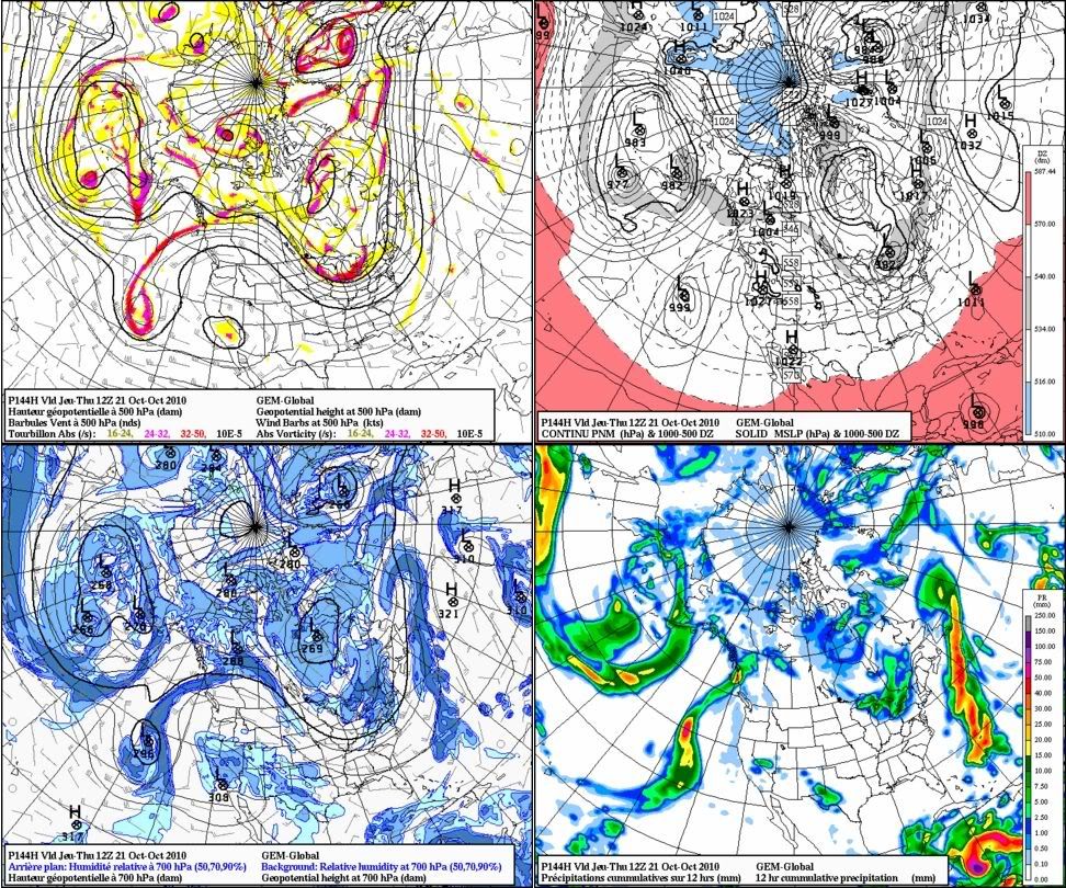
The 12Z CMC @ hour 144...
0 likes
Carla/Alicia/Jerry(In The Eye)/Michelle/Charley/Ivan/Dennis/Katrina/Rita/Wilma/Ike/Harvey
Member: National Weather Association
Wx Infinity Forums
http://wxinfinity.com/index.php
Facebook.com/WeatherInfinity
Twitter @WeatherInfinity
Member: National Weather Association
Wx Infinity Forums
http://wxinfinity.com/index.php
Facebook.com/WeatherInfinity
Twitter @WeatherInfinity


Re: Disturbed area north of Panama
Interesting consistency really makes me believe this is for real y'all. October 25 is just 10 days away.
0 likes
Georges '98, Irene '99, Frances '04, Jeanne '04, Katrina '05, Wilma '05, Gustav '08, Isaac '12, Matthew '16, Florence '18, Michael '18, Ian '22
-
SouthDadeFish
- Professional-Met
- Posts: 2835
- Joined: Thu Sep 23, 2010 2:54 pm
- Location: Miami, FL
- Contact:

Yeah quite a few of the models are getting increasingly agressive now with developing something, given we've already had 3 systems out from the W.CAribbean and the fact we have a strong La Nina I'd certainly bet on another system developing.
Paula showed conditions at least south of 20N right now are very favourable and this one could easily end up being a hurricane down the line IF it develops.
Paula showed conditions at least south of 20N right now are very favourable and this one could easily end up being a hurricane down the line IF it develops.
0 likes
Personal Forecast Disclaimer:
The posts in this forum are NOT official forecast and should not be used as such. They are just the opinion of the poster and may or may not be backed by sound meteorological data. They are NOT endorsed by any professional institution or storm2k.org. For official information, please refer to the NHC and NWS products
The posts in this forum are NOT official forecast and should not be used as such. They are just the opinion of the poster and may or may not be backed by sound meteorological data. They are NOT endorsed by any professional institution or storm2k.org. For official information, please refer to the NHC and NWS products

-
Weatherfreak000
^^^
Not even nearly convinced of this area yet. I hate to say it but the models as much too weak even 96 hours out is such a monster stretch....and the time frame just keeps getting pushed back day after day after day....
I've said it before and i'll say it again, hugging models just isn't worth the time. The NHC removing the TWO is also very telling. I am thinking it's more likely this won't pan out than it will, IMO. We could wake up tomorrow and all the sudden the GFS is showing a ton of shear and everyone will again say its just a faulty run, and then it pans out.
Hugging the models just hasn't panned out well at all this year...I think overall I can't honestly say any one model with perhaps the exception of the CMC has done very well, imo.
0 likes
-
srainhoutx
- S2K Supporter
- Posts: 6919
- Age: 68
- Joined: Sun Jan 14, 2007 11:34 am
- Location: Haywood County, NC
- Contact:
Re: Disturbed area north of Panama
^^^
Yet the 12Z GFS ensemble members suggest cyclogenesis and development. We will continue to discuss the models as this is Talkin’ Tropics and that's what we do, discuss probable storm development.
Yet the 12Z GFS ensemble members suggest cyclogenesis and development. We will continue to discuss the models as this is Talkin’ Tropics and that's what we do, discuss probable storm development.
0 likes
Carla/Alicia/Jerry(In The Eye)/Michelle/Charley/Ivan/Dennis/Katrina/Rita/Wilma/Ike/Harvey
Member: National Weather Association
Wx Infinity Forums
http://wxinfinity.com/index.php
Facebook.com/WeatherInfinity
Twitter @WeatherInfinity
Member: National Weather Association
Wx Infinity Forums
http://wxinfinity.com/index.php
Facebook.com/WeatherInfinity
Twitter @WeatherInfinity
Re: Disturbed area north of Panama
Weatherfreak000 wrote:^^^
Not even nearly convinced of this area yet. I hate to say it but the models as much too weak even 96 hours out is such a monster stretch....and the time frame just keeps getting pushed back day after day after day....
I've said it before and i'll say it again, hugging models just isn't worth the time. The NHC removing the TWO is also very telling. I am thinking it's more likely this won't pan out than it will, IMO.
Actually, the GFS in all its runs has been consistent with genesis and the South Florida landfall; every run that has had Richard impacting South Florida has been between the 23rd and 25th so it has not pushed back
As to the NHC dropping it, read Wxman's comment above on why they dropped it; even he agrees with the models sniffing development
IMO, the fact that they already put a percentage in that area (even though it was dropped) is telling because that means the NHC is already paying attention to the models showing cyclogenesis developing. Just because this 10% was dropped does not mean something won't get going..remember that the models do not indicate development starting until early next week
0 likes
-
srainhoutx
- S2K Supporter
- Posts: 6919
- Age: 68
- Joined: Sun Jan 14, 2007 11:34 am
- Location: Haywood County, NC
- Contact:
Re: Disturbed area north of Panama
One thing to consider is the Rex Blocking pattern that guidance has depicted out West for the past several days. The pattern across the E Gulf and Caribbean may well look a bit different than we have seen in a while IMO.
0 likes
Carla/Alicia/Jerry(In The Eye)/Michelle/Charley/Ivan/Dennis/Katrina/Rita/Wilma/Ike/Harvey
Member: National Weather Association
Wx Infinity Forums
http://wxinfinity.com/index.php
Facebook.com/WeatherInfinity
Twitter @WeatherInfinity
Member: National Weather Association
Wx Infinity Forums
http://wxinfinity.com/index.php
Facebook.com/WeatherInfinity
Twitter @WeatherInfinity
Re: Disturbed area north of Panama
12z Euro is being a prude and has little Richard evidence. Like night and day with the 12Z gfs.
0 likes
Personal Forecast Disclaimer:
The posts in this forum are NOT official forecasts and should not be used as such. They are just the opinion of the poster and may or may not be backed by sound meteorological data. They are NOT endorsed by any professional institution or storm2k.org. For official information, please refer to the NHC and NWS products.
The posts in this forum are NOT official forecasts and should not be used as such. They are just the opinion of the poster and may or may not be backed by sound meteorological data. They are NOT endorsed by any professional institution or storm2k.org. For official information, please refer to the NHC and NWS products.
Re: Disturbed area north of Panama
This area north of Panama portrayed by the models looks like what many of us feared might transpire in mid-late october in a la nina type season ...
GFS H96
http://www.nco.ncep.noaa.gov/pmb/nwprod ... n_096l.gif
GFS H96
http://www.nco.ncep.noaa.gov/pmb/nwprod ... n_096l.gif
0 likes
H168 Hurricane Richard between Jamaica and Honduras
http://www.nco.ncep.noaa.gov/pmb/nwprod ... n_168l.gif
http://www.nco.ncep.noaa.gov/pmb/nwprod ... n_168l.gif
0 likes
H192 really intensifying west of jamaica and S of Central Cuba moving NNW....
http://www.nco.ncep.noaa.gov/pmb/nwprod ... n_192l.gif
http://www.nco.ncep.noaa.gov/pmb/nwprod ... n_192l.gif
0 likes
Who is online
Users browsing this forum: AnnularCane and 167 guests