WPAC: MEGI (1013/15W) - Tropical Depression
Moderator: S2k Moderators
-
P.K.

- Professional-Met

- Posts: 5149
- Joined: Thu Sep 23, 2004 5:57 pm
- Location: Watford, England
- Contact:
Re: WPAC: MEGI - Typhoon
This is very similar in intensity to Tip now. The JMA's BT has 140kts for that and the JTWC's 165kts. This is really not good at all.
0 likes


Re: WPAC: MEGI - Typhoon
dexterlabio wrote:P.K. wrote:I'm speechless having seen that 192kt FL reading. This makes it 150kts at the surface even with a 10 min ave.
Stunning.
Haha...in response to that, James says via Twitter: "I feel faint"
I would, too! I can't imagine being in the path of this. Terrifying!
0 likes
-
dexterlabio
- Category 5

- Posts: 3512
- Joined: Sat Oct 24, 2009 11:50 pm
Re: WPAC: MEGI - Typhoon
Infdidoll wrote:dexterlabio wrote:P.K. wrote:I'm speechless having seen that 192kt FL reading. This makes it 150kts at the surface even with a 10 min ave.
Stunning.
Haha...in response to that, James says via Twitter: "I feel faint"
I would, too! I can't imagine being in the path of this. Terrifying!
I couldn't imagine that kind of wind striking in one area. I know James (TH) is used to his job but this one is no ordinary cyclone.
0 likes
Personal Forecast Disclaimer:
The posts in this forum are NOT official forecast and should not be used as such. They are just the opinion of the poster and may or may not be backed by sound meteorological data. They are NOT endorsed by any professional institution or storm2k.org. For official information, please refer to the NHC and NWS products.
The posts in this forum are NOT official forecast and should not be used as such. They are just the opinion of the poster and may or may not be backed by sound meteorological data. They are NOT endorsed by any professional institution or storm2k.org. For official information, please refer to the NHC and NWS products.
-
P.K.
- Professional-Met
- Posts: 5149
- Joined: Thu Sep 23, 2004 5:57 pm
- Location: Watford, England
- Contact:
Re: WPAC: MEGI - Typhoon
WTPQ20 RJTD 171200
RSMC TROPICAL CYCLONE ADVISORY
NAME TY 1013 MEGI (1013)
ANALYSIS
PSTN 171200UTC 18.1N 125.1E GOOD
MOVE WSW 11KT
PRES 895HPA
MXWD 120KT
GUST 170KT
50KT 110NM
30KT 325NM EAST 220NM WEST
FORECAST
24HF 181200UTC 17.7N 120.7E 75NM 70%
MOVE W 11KT
PRES 940HPA
MXWD 085KT
GUST 120KT
48HF 191200UTC 17.3N 117.8E 110NM 70%
MOVE W 07KT
PRES 940HPA
MXWD 085KT
GUST 120KT
72HF 201200UTC 17.5N 116.1E 160NM 70%
MOVE W SLOWLY
PRES 945HPA
MXWD 085KT
GUST 120KT =
0 likes

Re: WPAC: MEGI - Typhoon
dexterlabio wrote:
I couldn't imagine that kind of wind striking in one area. I know James (TH) is used to his job but this one is no ordinary cyclone.
I know! I wish I was so brave, but a storm that big? I'd be running the other way. He's like a firefighter - running in when everyone else is running out. Praying he stays safe along with everyone else in Northern Luzon, tonight. Last few storms I saw with numbers this impressive were out in the middle of the Pacific, not doing anyone any harm. This is different...though I'm certainly glad it's not hitting metro Manila with its greater population.
0 likes
-
P.K.
- Professional-Met
- Posts: 5149
- Joined: Thu Sep 23, 2004 5:57 pm
- Location: Watford, England
- Contact:
Re: WPAC: MEGI - Typhoon
CMA 140kts.
WTPQ20 BABJ 171200
SUBJECTIVE FORECAST
SuperTY MEGI 1013 (1013) INITIAL TIME 171200 UTC
00HR 18.1N 125.0E 895HPA 72M/S
30KTS 320KM
50KTS 110KM
P12HR W 20KM/H
P+24HR 17.6N 120.5E 950HPA 45M/S
P+48HR 17.3N 117.7E 950HPA 45M/S
P+72HR 17.7N 115.6E 945HPA 48M/S
P+96HR 18.3N 114.0E 930HPA 52M/S
P+120HR 19.0N 112.8E 930HPA 52M/S=
0 likes
-
oaba09
- S2K Supporter

- Posts: 1496
- Age: 39
- Joined: Thu Oct 01, 2009 10:02 am
- Location: Valenzuela, Philippines
- Contact:
The sub tropical ridge is currently holding up...

TY 1013 (Megi)
Issued at 12:50 UTC, 17 October 2010
<Analyses at 17/12 UTC>
Scale Large
Intensity Very Intense
Center position N18°05'(18.1°)
E125°05'(125.1°)
Direction and speed of movement WSW 20km/h(11kt)
Central pressure 895hPa
Maximum wind speed near the center 60m/s(120kt)
Maximum wind gust speed 85m/s(170kt)
Area of 50kt winds or more Wide 200km(110NM)
Area of 30kt winds or more E600km(325NM)
W410km(220NM)
0 likes

Re: WPAC: MEGI - Typhoon
0 likes
-
P.K.
- Professional-Met
- Posts: 5149
- Joined: Thu Sep 23, 2004 5:57 pm
- Location: Watford, England
- Contact:
Re: WPAC: MEGI - Typhoon
I've never seen such high figures from any of these agencies since I've been tracking.
WTKO20 RKSL 171200
KMA TROPICAL CYCLONE ADVISORY NO. 17
NAME TY 1013 MEGI
ANALYSIS
POSITION 171200UTC 18.1N 125.1E
MOVEMENT WSW 11KT
PRES/VMAX 895HPA 117KT
FORECAST
24HR
POSITION 181200UTC 17.6N 120.8E WITHIN 80NM
PRES/VMAX 945HPA 87KT
48HR
POSITION 191200UTC 17.1N 116.9E WITHIN 135NM
PRES/VMAX 945HPA 87KT
72HR
POSITION 201200UTC 17.7N 114.4E WITHIN 215NM
PRES/VMAX 940HPA 89KT
KOREA METEOROLOGICAL ADMINISTRATION.
0 likes

Re: WPAC: MEGI - Typhoon
That is a huge eye-wall. No ERC.
http://cimss.ssec.wisc.edu/tropic/real- ... t24hrs.gif
Directly under a huge anti-cyclone.
This will be very destructive.


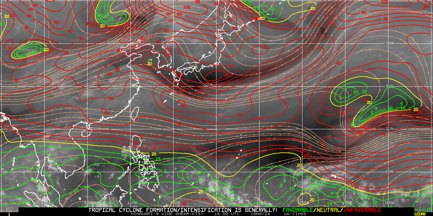
http://cimss.ssec.wisc.edu/tropic/real- ... t24hrs.gif
Directly under a huge anti-cyclone.
This will be very destructive.
0 likes
Re:
oaba09 wrote:Does anyone have the figures for Super Typhoon Angela? I believe that was one of the strongest typhoons to ever hit the country...I wanna compare it w/ "Megi"...
Data on wikipedia: http://en.wikipedia.org/wiki/Typhoon_Angela_(1995)
0 likes
Who is online
Users browsing this forum: No registered users and 22 guests