Storm2k's 2010 Atlantic Invest Database

This is the general tropical discussion area. Anyone can take their shot at predicting a storms path.

Moderator: S2k Moderators

Forum rules

The posts in this forum are NOT official forecasts and should not be used as such. They are just the opinion of the poster and may or may not be backed by sound meteorological data. They are NOT endorsed by any professional institution or STORM2K. For official information, please refer to products from the National Hurricane Center and National Weather Service.

Help Support Storm2K
Message
Author
User avatar
HURAKAN
Professional-Met
Professional-Met
Posts: 46086
Age: 38
Joined: Thu May 20, 2004 4:34 pm
Location: Key West, FL
Contact:

Storm2k's 2010 Atlantic Invest Database

#1 Postby HURAKAN » Sun Jul 04, 2010 11:26 pm

Invests: 7
Depressions: 2
Storms: 1
Hurricanes: 1
Intense Hurricanes: 0
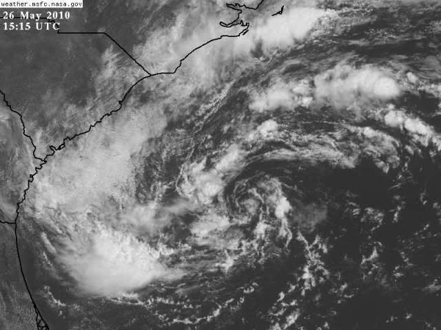

Image
_________________________________________________________________________________________

1. INVEST 90L

Start: 21 May / 1200Z
End: 27 May / 1800Z

Maximum Winds: 40 kt
Minimum Pressure: 1004 hPa

Black : Below 35 knots, Red : at or above 35 knots


Image

Image

________________________________________________________________________________________________

2. INVEST 91L

Start: 31 May / 1800Z
End: 2 June / 0000Z

Maximum Winds: 25 kt
Minimum Pressure: 1011 hPa


Image

Image

________________________________________________________________________________________________

3. INVEST 92L

Start: 11 June / 1800Z
End: 19 June / 1200Z

Maximum Winds: 30 kt
Minimum Pressure: 1010 hPa


Image

Image

________________________________________________________________________________________________

4. INVEST 93L / HURRICANE ALEX

Start: 20 June / 1800Z
End: 02 July / 0300Z

Maximum Winds: 90 kt
Minimum Pressure: 947 hPa


Green: Tropical Depression, Blue: Tropical Storm, Magenta: Hurricane-1, Red: Hurricane-2

Image

Image

________________________________________________________________________________________________

5. INVEST 94L

Start: 24 June / 1800Z
End: 27 June / 0000Z

Maximum Winds: 25 kt
Minimum Pressure: 1012 hPa


Image

Image

________________________________________________________________________________________________

6. INVEST 95L

Start: 1 July / 1800Z
End: 6 July / 1200Z

Maximum Winds: 30 kt
Minimum Pressure: 1008 hPa


Image

Image

________________________________________________________________________________________________

7. INVEST 96L / TROPICAL DEPRESSION TWO

Start: 3 July / 0600Z
End: -

Maximum Winds: 30 kt
Minimum Pressure: 1005 hPa


Image

Image
Last edited by HURAKAN on Thu Jul 08, 2010 4:08 pm, edited 14 times in total.
0 likes   

Cyclone1
Category 5
Category 5
Posts: 2739
Age: 33
Joined: Tue Jun 12, 2007 12:03 pm
Location: Florida

#2 Postby Cyclone1 » Mon Jul 05, 2010 8:37 am

Nice. I was looking through 2009's list yesterday. Awesome thread.
0 likes   

User avatar
HURAKAN
Professional-Met
Professional-Met
Posts: 46086
Age: 38
Joined: Thu May 20, 2004 4:34 pm
Location: Key West, FL
Contact:

#3 Postby HURAKAN » Mon Jul 05, 2010 11:46 am

92L is up!
0 likes   

User avatar
KWT
Category 5
Category 5
Posts: 31415
Joined: Tue Aug 17, 2004 11:02 am
Location: UK!!!

#4 Postby KWT » Mon Jul 05, 2010 12:04 pm

92L really did look like it was going to develop at one point, but it ran out of time and the shear really ramped up.
0 likes   
Personal Forecast Disclaimer:
The posts in this forum are NOT official forecast and should not be used as such. They are just the opinion of the poster and may or may not be backed by sound meteorological data. They are NOT endorsed by any professional institution or storm2k.org. For official information, please refer to the NHC and NWS products

User avatar
HURAKAN
Professional-Met
Professional-Met
Posts: 46086
Age: 38
Joined: Thu May 20, 2004 4:34 pm
Location: Key West, FL
Contact:

#5 Postby HURAKAN » Mon Jul 05, 2010 1:40 pm

93L/Alex is up!
0 likes   

User avatar
HURAKAN
Professional-Met
Professional-Met
Posts: 46086
Age: 38
Joined: Thu May 20, 2004 4:34 pm
Location: Key West, FL
Contact:

#6 Postby HURAKAN » Mon Jul 05, 2010 3:55 pm

94L is up!
0 likes   

User avatar
HURAKAN
Professional-Met
Professional-Met
Posts: 46086
Age: 38
Joined: Thu May 20, 2004 4:34 pm
Location: Key West, FL
Contact:

#7 Postby HURAKAN » Mon Jul 05, 2010 10:56 pm

95L & 96L are up!
0 likes   

User avatar
HURAKAN
Professional-Met
Professional-Met
Posts: 46086
Age: 38
Joined: Thu May 20, 2004 4:34 pm
Location: Key West, FL
Contact:

#8 Postby HURAKAN » Tue Jul 06, 2010 10:03 am

95L is complete!
0 likes   

User avatar
HURAKAN
Professional-Met
Professional-Met
Posts: 46086
Age: 38
Joined: Thu May 20, 2004 4:34 pm
Location: Key West, FL
Contact:

#9 Postby HURAKAN » Tue Jul 06, 2010 9:28 pm

96L updated!
0 likes   

User avatar
HURAKAN
Professional-Met
Professional-Met
Posts: 46086
Age: 38
Joined: Thu May 20, 2004 4:34 pm
Location: Key West, FL
Contact:

#10 Postby HURAKAN » Thu Jul 08, 2010 4:08 pm

96L / TD 2 updated
0 likes   

Florida1118

Re: Storm2k's 2010 Atlantic Invest Database

#11 Postby Florida1118 » Sun Jan 02, 2011 11:00 pm

Are we going to Finish this? I or someone else could take it up if Hurakan isn't up to it.
0 likes   

Florida1118

Re: Storm2k's 2010 Atlantic Invest Database

#12 Postby Florida1118 » Wed Jan 05, 2011 5:22 pm

Anyone? I think It would be nice to have...Im gonna guess Hurakan would wanna finish but if not, Id gladly do it.
0 likes   

User avatar
HURAKAN
Professional-Met
Professional-Met
Posts: 46086
Age: 38
Joined: Thu May 20, 2004 4:34 pm
Location: Key West, FL
Contact:

#13 Postby HURAKAN » Wed Jan 05, 2011 7:17 pm

Go ahead! Don't have time now.
0 likes   

Florida1118

Re: Storm2k's 2010 Atlantic Invest Database

#14 Postby Florida1118 » Wed Jan 05, 2011 11:22 pm

Alright Ill probably start tomorrow
0 likes   

Florida1118

Re: Storm2k's 2010 Atlantic Invest Database

#15 Postby Florida1118 » Thu Jan 06, 2011 6:19 pm

97L/ Bonnie
http://www.storm2k.org/phpbb2/viewtopic.php?f=54&t=108610&st=0&sk=t&sd=a
http://www.nhc.noaa.gov/archive/2010/BONNIE.shtml?

Start: July 19th, 2010
End:July 24th, 2010

Max Winds:40mph
Min. Pressure: 1005mb

Landfall:
1) Ragged Island, Bahamas
2) Andros Island, Bahamas
3) Elliot Key, Florida (Miami-Dade county)


:darrow: (I added a little length before it became TD 3, from when it was being tracked as 97L. The NHC did not do the black squares)
Image

Image

Image
0 likes   

Florida1118

Re: Storm2k's 2010 Atlantic Invest Database

#16 Postby Florida1118 » Thu Jan 06, 2011 7:06 pm

Invest 98L
http://www.storm2k.org/phpbb2/viewtopic.php?f=54&t=108653&st=0&sk=t&sd=a


Start: July 21st, 2010
End: July 22nd, 2010

Max Winds: 25kts
Min. Pressure:1008mb

Highest TWO percentage: 50%

Landfall: Central Mexico (Near Poza Rica, Veracruz)

Image

Image


(Edit to add TWO section)
Last edited by Florida1118 on Sat Jan 08, 2011 8:42 pm, edited 2 times in total.
0 likes   

Florida1118

Re: Storm2k's 2010 Atlantic Invest Database

#17 Postby Florida1118 » Thu Jan 06, 2011 7:25 pm

Invest 99L
http://www.storm2k.org/phpbb2/viewtopic.php?f=54&t=108715&hilit=ATL+%3A+Invest+99L&start=0
Start: July 25th, 2010
End: July 25th, 2010

Max Winds: 20kts
Min pressure: 1009mb

Highest TWO percentage: 0%

Landfall: Never touched water...Stayed Inland in NE Mexico (Near Tuxpan)

Image

(Edit to add TWO section/S2k URL)
Last edited by Florida1118 on Sat Jan 08, 2011 8:48 pm, edited 2 times in total.
0 likes   

Florida1118

Re: Storm2k's 2010 Atlantic Invest Database

#18 Postby Florida1118 » Thu Jan 06, 2011 7:46 pm

Invest 90L (2)
http://www.storm2k.org/phpbb2/viewtopic.php?f=54&t=108759&hilit=atl&start=0

Start: July 29th, 2010
End: July 31st, 2010

Max Winds: 20kts
Min Pressure: 1009mb

Highest TWO percentage: 20%

Landfall:Nicaragua

Image


(Edit to add TWO section/S2k URL)
Last edited by Florida1118 on Sun Jan 09, 2011 4:15 pm, edited 2 times in total.
0 likes   

Florida1118

Re: Storm2k's 2010 Atlantic Invest Database

#19 Postby Florida1118 » Thu Jan 06, 2011 7:57 pm

Invest 91L (2)/Tropical Storm Colin
http://www.storm2k.org/phpbb2/viewtopic.php?f=54&t=108790&start=0
http://www.nhc.noaa.gov/archive/2010/COLIN.shtml?

Start:August 1st, 2010
End:August 8th, 2010

Max Winds: 60mph/50kts
Min Pressure: 1005mb

Landfall:None

Image

Image
0 likes   

Florida1118

Re: Storm2k's 2010 Atlantic Invest Database

#20 Postby Florida1118 » Sat Jan 08, 2011 7:48 pm

Invest 92L (2)
http://www.storm2k.org/phpbb2/viewtopic.php?f=54&t=108852&hilit=invest+atl&start=0

Start: August 3rd, 2010
End: August 8th, 2010

Max winds: 25kts
Min Pressure: 1009mb

Landfall: Belize/Yucatan Peninsula

Highest TWO Percentage: 20%

Image

Image
0 likes   


Return to “Talkin' Tropics”

Who is online

Users browsing this forum: Steve H. and 28 guests