Texas Winter 2010-2011

Winter Weather Discussion

Moderator: S2k Moderators

Forum rules

The posts in this forum are NOT official forecast and should not be used as such. They are just the opinion of the poster and may or may not be backed by sound meteorological data. They are NOT endorsed by any professional institution or STORM2K.

Help Support Storm2K
Message
Author
User avatar
iorange55
Category 5
Category 5
Posts: 2388
Joined: Thu Nov 13, 2008 9:47 pm
Location: Big D

Re: Texas Winter 2010-2011

#2101 Postby iorange55 » Thu Jan 13, 2011 4:16 pm

Portastorm wrote:The Euro, the Canadian, and UKMET all show strong ridging developing off the Pacific Coast about six days out. This coincides well with the existing teleconnections (PNA, MJO, tropical forcing). I wouldn't pay too much attention to the operational GFS right now. Beyond five days, it's hopelessly lost.


The GFS seems to be whacked out lately. Which makes me sad cause I always looked forward to the 18z to keep me sane till we get the 0z.
0 likes   

User avatar
somethingfunny
ChatStaff
ChatStaff
Posts: 3926
Age: 37
Joined: Thu May 31, 2007 10:30 pm
Location: McKinney, Texas

Re: Texas Winter 2010-2011

#2102 Postby somethingfunny » Thu Jan 13, 2011 5:45 pm

People always say that the only thing separating Texas from the North Pole is a few barbed wire fences. So why is it that these Arctic blasts always seem to get shunted off to the East? As cold as it's been this week, I know that it isn't true Arctic air, and now the (hopelessly confused) models keep pushing next week's blast over into the Ohio and Tennessee Valleys and this seems to be the case the majority of the time. What keeps these airmasses from diving due south through our barbed wire barriers?....Coriolis Effect? (Or not exactly Coriolis, but some effect of the Earth's rotation similar to how the Northeast US rarely gets hit by a due-northward moving hurricane)
0 likes   
I am not a meteorologist, and any posts made by me are not official forecasts or to be interpreted as being intelligent. These posts are just my opinions and are probably silly opinions.

User avatar
Ntxw
Storm2k Moderator
Storm2k Moderator
Posts: 22790
Joined: Wed Oct 21, 2009 6:34 pm
Location: DFW, Texas

Re: Texas Winter 2010-2011

#2103 Postby Ntxw » Thu Jan 13, 2011 6:00 pm

somethingfunny wrote:People always say that the only thing separating Texas from the North Pole is a few barbed wire fences. So why is it that these Arctic blasts always seem to get shunted off to the East? As cold as it's been this week, I know that it isn't true Arctic air, and now the (hopelessly confused) models keep pushing next week's blast over into the Ohio and Tennessee Valleys and this seems to be the case the majority of the time. What keeps these airmasses from diving due south through our barbed wire barriers?....Coriolis Effect? (Or not exactly Coriolis, but some effect of the Earth's rotation similar to how the Northeast US rarely gets hit by a due-northward moving hurricane)


It just depends on position of the trough. A lot of it has to do with the polar jet diving down (and the overall pattern west to east), usually not due south but rather something reminiscent of northwesterly flow hence the NE-SE orientation of many cold air masses. There's a lot more to it than that but just broad terms.

I would stray away from looking at surface orientation of the models. Many if not all have been flopping around lately. As Portastorm has stated, look at the overall patter (I like using the 500mb charts) to determine how things will likely play out. As the events get closer the models will naturally adjust!
0 likes   
The above post and any post by Ntxw is NOT an official forecast and should not be used as such. It is just the opinion of the poster and may or may not be backed by sound meteorological data. It is NOT endorsed by any professional institution including Storm2k. For official information, please refer to NWS products.

  Help support Storm2K!
Help Support Storm2K

utweather
Category 1
Category 1
Posts: 252
Joined: Tue Jan 26, 2010 10:51 pm
Location: SE Austin, TX

Re: Texas Winter 2010-2011

#2104 Postby utweather » Thu Jan 13, 2011 6:15 pm

somethingfunny wrote:People always say that the only thing separating Texas from the North Pole is a few barbed wire fences. So why is it that these Arctic blasts always seem to get shunted off to the East? As cold as it's been this week, I know that it isn't true Arctic air, and now the (hopelessly confused) models keep pushing next week's blast over into the Ohio and Tennessee Valleys and this seems to be the case the majority of the time. What keeps these airmasses from diving due south through our barbed wire barriers?....Coriolis Effect? (Or not exactly Coriolis, but some effect of the Earth's rotation similar to how the Northeast US rarely gets hit by a due-northward moving hurricane)


Interesting idea. I'd like to see the angle of the jet stream during the worse arctic outbreaks ever. Usually we get nw to se flow most of the time and then back to the normal west to east to push it out.
This week was a good winter setup for ice week just not enough moisture or strong enough disturbance to come across. Almost half way thru January, need to see something soon or the sun angle is going to start to put a damper on things..
0 likes   

User avatar
Texas Snowman
Storm2k Moderator
Storm2k Moderator
Posts: 6179
Joined: Fri Jan 25, 2008 11:29 am
Location: Denison, Texas

Re: Texas Winter 2010-2011

#2105 Postby Texas Snowman » Thu Jan 13, 2011 6:46 pm

utweather wrote:
somethingfunny wrote:People always say that the only thing separating Texas from the North Pole is a few barbed wire fences. So why is it that these Arctic blasts always seem to get shunted off to the East? As cold as it's been this week, I know that it isn't true Arctic air, and now the (hopelessly confused) models keep pushing next week's blast over into the Ohio and Tennessee Valleys and this seems to be the case the majority of the time. What keeps these airmasses from diving due south through our barbed wire barriers?....Coriolis Effect? (Or not exactly Coriolis, but some effect of the Earth's rotation similar to how the Northeast US rarely gets hit by a due-northward moving hurricane)


Interesting idea. I'd like to see the angle of the jet stream during the worse arctic outbreaks ever. Usually we get nw to se flow most of the time and then back to the normal west to east to push it out.
This week was a good winter setup for ice week just not enough moisture or strong enough disturbance to come across. Almost half way thru January, need to see something soon or the sun angle is going to start to put a damper on things..


Huh?!? :double: We're not even a month into astronomical winter yet.

Some of the worst snow, ice, and cold events in Texas history have been in February. Then there was the big Valentine's Day snow event just a few years ago in Dallas and points northward. Actually resulted in Heavy Snow Warnings being issued.

And in my part of the world, North Texas, we've had several March snow events during the past few years including last year.

And just a few years ago, there was an Easter snow event in portions of western and central Texas.

IMHO, we're not even CLOSE to being done with winter weather possibilities in Texas just yet.
0 likes   
The above post and any post by Texas Snowman is NOT an official forecast and should not be used as such. It is just the opinion of the poster and may or may not be backed by sound meteorological data. It is NOT endorsed by any professional institution including storm2k.org. For official information, please refer to NWS products.

Tejas89
Category 1
Category 1
Posts: 429
Joined: Mon Dec 28, 2009 9:25 pm
Location: DFW, TX

Re: Texas Winter 2010-2011

#2106 Postby Tejas89 » Thu Jan 13, 2011 6:47 pm

In North Texas, we don't seem to get the true "blue norther" fronts anymore - where Mr. Taft would allude to the barbed wire. These were the 70's to 20's (for hi's) in a day type fronts with sleet and ice around. I could be overstating, but these events seemed to occur at least twice a winter before 1990 or so when the switch got turned off.
0 likes   

User avatar
txagwxman
Professional-Met
Professional-Met
Posts: 960
Joined: Thu Dec 24, 2009 3:26 pm
Location: Tomball, TX

#2107 Postby txagwxman » Thu Jan 13, 2011 7:00 pm

Well I stuck a thermometer about 3/4 mile away from my house into a field on a tree ( with radiative shielding) just to see how cold it got...

My official low at my house the night before was 25.5F, but just 3/4 mile away it was 22.8F.

Amazing little sink hole I found of cold air drainage.
0 likes   
“If you thought that science was certain - well, that is just an error on your part.”

User avatar
txagwxman
Professional-Met
Professional-Met
Posts: 960
Joined: Thu Dec 24, 2009 3:26 pm
Location: Tomball, TX

Re: Texas Winter 2010-2011

#2108 Postby txagwxman » Thu Jan 13, 2011 7:01 pm

iorange55 wrote:
Portastorm wrote:The Euro, the Canadian, and UKMET all show strong ridging developing off the Pacific Coast about six days out. This coincides well with the existing teleconnections (PNA, MJO, tropical forcing). I wouldn't pay too much attention to the operational GFS right now. Beyond five days, it's hopelessly lost.


The GFS seems to be whacked out lately. Which makes me sad cause I always looked forward to the 18z to keep me sane till we get the 0z.


Winter ain't over.
0 likes   
“If you thought that science was certain - well, that is just an error on your part.”

utweather
Category 1
Category 1
Posts: 252
Joined: Tue Jan 26, 2010 10:51 pm
Location: SE Austin, TX

Re: Texas Winter 2010-2011

#2109 Postby utweather » Thu Jan 13, 2011 7:22 pm

Texas Snowman wrote:
utweather wrote:
somethingfunny wrote:People always say that the only thing separating Texas from the North Pole is a few barbed wire fences. So why is it that these Arctic blasts always seem to get shunted off to the East? As cold as it's been this week, I know that it isn't true Arctic air, and now the (hopelessly confused) models keep pushing next week's blast over into the Ohio and Tennessee Valleys and this seems to be the case the majority of the time. What keeps these airmasses from diving due south through our barbed wire barriers?....Coriolis Effect? (Or not exactly Coriolis, but some effect of the Earth's rotation similar to how the Northeast US rarely gets hit by a due-northward moving hurricane)


Interesting idea. I'd like to see the angle of the jet stream during the worse arctic outbreaks ever. Usually we get nw to se flow most of the time and then back to the normal west to east to push it out.
This week was a good winter setup for ice week just not enough moisture or strong enough disturbance to come across. Almost half way thru January, need to see something soon or the sun angle is going to start to put a damper on things..


Huh?!? :double: We're not even a month into astronomical winter yet.

Some of the worst snow, ice, and cold events in Texas history have been in February. Then there was the big Valentine's Day snow event just a few years ago in Dallas and points northward. Actually resulted in Heavy Snow Warnings being issued.

And in my part of the world, North Texas, we've had several March snow events during the past few years including last year.

And just a few years ago, there was an Easter snow event in portions of western and central Texas.

IMHO, we're not even CLOSE to being done with winter weather possibilities in Texas just yet.


Your farther north, you have more time than I do down here in Austin. Temps start to recover faster down here.
0 likes   

User avatar
srainhoutx
S2K Supporter
S2K Supporter
Posts: 6919
Age: 67
Joined: Sun Jan 14, 2007 11:34 am
Location: Haywood County, NC
Contact:

Re: Texas Winter 2010-2011

#2110 Postby srainhoutx » Thu Jan 13, 2011 7:33 pm

:uarrow:

February is known for some memorable wintry events across Central/E TX.
0 likes   
Carla/Alicia/Jerry(In The Eye)/Michelle/Charley/Ivan/Dennis/Katrina/Rita/Wilma/Ike/Harvey

Member: National Weather Association
Wx Infinity Forums
http://wxinfinity.com/index.php

Facebook.com/WeatherInfinity
Twitter @WeatherInfinity

User avatar
Portastorm
Storm2k Moderator
Storm2k Moderator
Posts: 9914
Age: 63
Joined: Fri Jul 11, 2003 9:16 am
Location: Round Rock, TX
Contact:

#2111 Postby Portastorm » Thu Jan 13, 2011 7:43 pm

Utweather, I have to chime in here and re-assure you that we have until the end of February before I would say our chances are slim and none.

As srain said, some of our best winter weather events have occurred in February.

We're still in the early innings.
0 likes   

utweather
Category 1
Category 1
Posts: 252
Joined: Tue Jan 26, 2010 10:51 pm
Location: SE Austin, TX

Re:

#2112 Postby utweather » Thu Jan 13, 2011 7:54 pm

Portastorm wrote:Utweather, I have to chime in here and re-assure you that we have until the end of February before I would say our chances are slim and none.

As srain said, some of our best winter weather events have occurred in February.

We're still in the early innings.


Yes, I know there is still a chance of something. But lots of cold air wasted this week. Sustained snow cover is my first preference.
0 likes   

User avatar
srainhoutx
S2K Supporter
S2K Supporter
Posts: 6919
Age: 67
Joined: Sun Jan 14, 2007 11:34 am
Location: Haywood County, NC
Contact:

Re: Texas Winter 2010-2011

#2113 Postby srainhoutx » Thu Jan 13, 2011 9:20 pm

The 00Z NAM suggests some chilly damp weather across TX this weekend...

Image
0 likes   
Carla/Alicia/Jerry(In The Eye)/Michelle/Charley/Ivan/Dennis/Katrina/Rita/Wilma/Ike/Harvey

Member: National Weather Association
Wx Infinity Forums
http://wxinfinity.com/index.php

Facebook.com/WeatherInfinity
Twitter @WeatherInfinity

User avatar
iorange55
Category 5
Category 5
Posts: 2388
Joined: Thu Nov 13, 2008 9:47 pm
Location: Big D

Re: Texas Winter 2010-2011

#2114 Postby iorange55 » Fri Jan 14, 2011 12:15 am

Well not trusting the GFS so not much to comment about on it's last run. Does show a cold front coming next week and then maybe a much bigger one sometime after that. Who knows, though.


I'm more excited for the Euro.
0 likes   

User avatar
Ntxw
Storm2k Moderator
Storm2k Moderator
Posts: 22790
Joined: Wed Oct 21, 2009 6:34 pm
Location: DFW, Texas

#2115 Postby Ntxw » Fri Jan 14, 2011 12:20 am

Man, the signals point one way the models go the other. Just when I thought the models had turned the corner last year finally lol. I guess last year was just too easy for them, chill and wintry weather! La Nada is throwing them for a loop, or should I say teleconnections?
0 likes   
The above post and any post by Ntxw is NOT an official forecast and should not be used as such. It is just the opinion of the poster and may or may not be backed by sound meteorological data. It is NOT endorsed by any professional institution including Storm2k. For official information, please refer to NWS products.


  Help support Storm2K!

Help Support Storm2K


User avatar
iorange55
Category 5
Category 5
Posts: 2388
Joined: Thu Nov 13, 2008 9:47 pm
Location: Big D

Re: Texas Winter 2010-2011

#2116 Postby iorange55 » Fri Jan 14, 2011 2:07 am

Euro for president?
0 likes   

User avatar
somethingfunny
ChatStaff
ChatStaff
Posts: 3926
Age: 37
Joined: Thu May 31, 2007 10:30 pm
Location: McKinney, Texas

Re: Texas Winter 2010-2011

#2117 Postby somethingfunny » Fri Jan 14, 2011 2:31 am

From what I can tell the euro has an arctic blast moving in Wednesday night and a ULL noving through on Thursday.
0 likes   
I am not a meteorologist, and any posts made by me are not official forecasts or to be interpreted as being intelligent. These posts are just my opinions and are probably silly opinions.

BigB0882
S2K Supporter
S2K Supporter
Posts: 2284
Joined: Thu Jul 03, 2003 12:08 am
Location: Baton Rouge, LA
Contact:

#2118 Postby BigB0882 » Fri Jan 14, 2011 2:48 am

I know this is the TX thread but does the blast make it down through to the Gulf?
0 likes   

User avatar
wxman57
Moderator-Pro Met
Moderator-Pro Met
Posts: 22984
Age: 67
Joined: Sat Jun 21, 2003 8:06 pm
Location: Houston, TX (southwest)

Re: Texas Winter 2010-2011

#2119 Postby wxman57 » Fri Jan 14, 2011 8:37 am

somethingfunny wrote:From what I can tell the euro has an arctic blast moving in Wednesday night and a ULL noving through on Thursday.


Euro 2 meter temps are above freezing for lows along the Gulf Coast behind the "blast", which is considerably warmer than the last front. The potential for extreme cold across Texas appears to be diminishing. However, the pattern may support an ice storm across north TX and OK (which may include Dallas). Cold air may be shallower this time, with more freezing rain and less snow. But all that is too far out to have any confidence in.
0 likes   

User avatar
Portastorm
Storm2k Moderator
Storm2k Moderator
Posts: 9914
Age: 63
Joined: Fri Jul 11, 2003 9:16 am
Location: Round Rock, TX
Contact:

Re: Texas Winter 2010-2011

#2120 Postby Portastorm » Fri Jan 14, 2011 9:38 am

Alright gang, let’s put this week in some kind of perspective. We are wrapping up a five-day spread of temperatures consistently 15-20 degrees below normal. In most years, a spread like this would be considered quite a cold snap (at least in Texas). Yeah, only our friends in the northern and northeastern parts of Texas got to enjoy snow while the rest of us had cloudy and cold. A waste of a good cold snap? Agreed!

But I want to point out this morning is that I do not recall either the GFS or the Euro (or even the Canadian) LAST WEEK showing 5 days of 15-20 degree below normal temps for us. Instead we saw a forecast of several days of this kind of cold followed by a warm-up. Well, the warm-up never happened! It just goes to show that computer models are far from 100%, even the best performing ones.

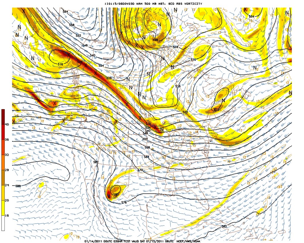
This also leads me to next week. Srainhoutx, Wxman57, Ntxw, and I have all suggested the possibility of another Arctic attack for the middle to latter part of next week. The teleconnections which longer-range forecasters use strongly suggests that significant ridging will develop off the Pacific Coast and create a trajectory more apt to bring down whatever air is up in Northern Canada. Seen the temps there lately? Yes, the operational models are still grappling with the pattern and do not consistently show this … although the UKMet, which I know txagwxman has espoused, has shown this for the last two days. The Euro for several days has shown a cutoff low in the Southwest and now the GFS appears to be coming on board with this. Any of you who have followed Texas winter weather know that when you have an Arctic airmass and a strong upper-level system approaching from the west … someone in this state will have to deal with some serious winter weather. I believe we are in for some surprises next week … surprises in the sense that the computer models TODAY do not show it. I will be surprised if the GFS operational runs verify. I won’t be surprised if we get more Arctic before next week is over and there is a winter storm threat for parts of Texas.

The following post is NOT an official forecast and should not be used as such. It is just the opinion of the poster and may or may not be backed by sound meteorological data. It is NOT endorsed by any professional institution including storm2k.org. For Official Information please refer to the NHC and NWS products.
0 likes   


Return to “Winter Weather”

Who is online

Users browsing this forum: No registered users and 2 guests