
View of Mt. Etna spewing smoke or ash from the orbiting NASA Terra Satellite before the eruption.
Close up view of northeastern Sicily and the Italian boot (top right).
Acquired on January 11, 2011.
NASA Earth Observatory Image of the Day on January 15, 2011.
Credit: NASA Terra Satellite
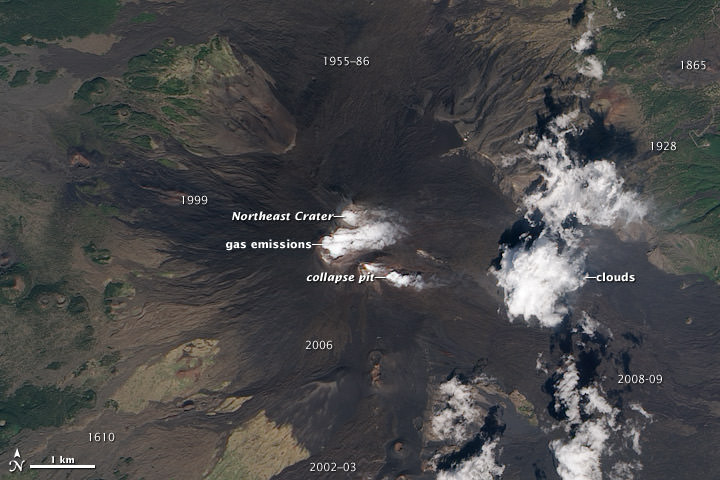
Signs of activity at the summit of Mount Etna, Europe’s most active volcano.
Water vapor and other volcanic gases overflow Etna’s summit craters, spilling out over the volcano’s upper slopes.
A steam plume rises from a collapse pit that formed in late 2009, the newest volcanic feature on Etna.
Dark lava flows from recent eruptions cover the peak, overlaying lighter, weathered flows from hundreds or thousands of years ago.
(Numbers on the image indicate when a flow was erupted.)
The oldest lavas are covered by green vegetation.
Eruptive cones and fissures also dot the landscape.
Frequent explosions deep within the Northeast Crater, which may presage an upcoming eruption, are audible at the summit.
These explosions were occurring sporadically every few minutes, as recorded by nearby seismometers.
This natural-color satellite image was acquired by the Advanced Land Imager (ALI) aboard (EO-1) on September 26, 2010.
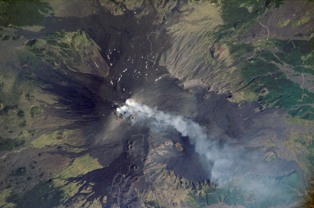
Mt Etna photographed by astronauts aboard the International Space Station on August, 2, 2006.
One of the most consistently active volcanoes in the world, Sicily’s Mount Etna has a historical record of eruptions dating back to 1500 BC.
This astronaut photograph captures plumes of steam and possibly ash originating from summit craters on the mountain:
the Northeast Crater and Central Crater, which includes two secondary craters (Voragine and Bocca Nuova).
Locals heard explosions coming from the rim of the Northeast Crater on July 26, 2006,
and the plumes shown in this image are likely a continuation of that activity.
Credit: NASA.


