

Out of Fort Worth this morning...
SPECIAL WEATHER STATEMENT
NATIONAL WEATHER SERVICE FORT WORTH TX
420 AM CST THU JAN 20 2011
TXZ091>095-100>107-115>123-129>135-141>148-156>162-174-175-201700-
MONTAGUE-COOKE-GRAYSON-FANNIN-LAMAR-YOUNG-JACK-WISE-DENTON-COLLIN-
HUNT-DELTA-HOPKINS-STEPHENS-PALO PINTO-PARKER-TARRANT-DALLAS-
ROCKWALL-KAUFMAN-VAN ZANDT-RAINS-EASTLAND-ERATH-HOOD-SOMERVELL-
JOHNSON-ELLIS-HENDERSON-COMANCHE-MILLS-HAMILTON-BOSQUE-HILL-
NAVARRO-FREESTONE-ANDERSON-LAMPASAS-CORYELL-BELL-MCLENNAN-FALLS-
LIMESTONE-LEON-MILAM-ROBERTSON-
420 AM CST THU JAN 20 2011
...WINTERY PRECIPITATION POSSIBLE ACROSS THE NORTHERN HALF OF NORTH
TEXAS TODAY...
A STRONG COLD FRONT IS MOVING SOUTHEAST ACROSS NORTH TEXAS THIS
MORNING. THIS FRONT WILL MOVE INTO SOUTHEAST TEXAS THIS
AFTERNOON. NORTHERLY WINDS OF 15 TO 25 MPH WITH GUSTS OVER 30 MPH
ARE EXPECTED TODAY BEHIND THE FRONT WHICH WILL USHER IN MUCH
COLDER AIR. THERE IS A CHANCE OF LIGHT RAIN ACROSS MOST OF NORTH
TEXAS THIS MORNING...WITH PRECIPITATION CONTINUING INTO THE
AFTERNOON ALONG AND EAST OF THE I-35 CORRIDOR. AS TEMPERATURES
FALL BELOW FREEZING...THE RAIN WILL CHANGE OVER TO LIGHT FREEZING
RAIN OR FREEZING DRIZZLE ALONG AND NORTH OF THE I-20 CORRIDOR.
THE PRECIPITATION MAY MIX WITH OR CHANGE OVER TO SLEET OR SNOW
ALONG AND EAST OF A BONHAM TO CANTON LINE THIS AFTERNOON. AT THIS
TIME...IT APPEARS THAT THE PRECIPITATION WILL BE LIGHT SO NO
ADVISORIES ARE BEING ISSUED. SOME LIGHT ICING IS
POSSIBLE...ESPECIALLY ON ELEVATED SURFACES. AREAS NORTHEAST OF A
SHERMAN TO EMORY LINE APPEAR TO HAVE THE GREATEST THREAT OF
HAVING SOME TRAVEL IMPACTS...AND A WINTER WEATHER ADVISORY MAY BE
NEEDED THIS AFTERNOON IF THE PRECIPITATION IS A LITTLE HEAVIER
THAN IS CURRENTLY FORECAST.
RESIDENTS ACROSS NORTH TEXAS SHOULD MONITOR THE WEATHER CLOSELY
TODAY FOR THE LATEST UPDATES ON THIS POTENTIAL WINTRY WEATHER EVENT.
STAY INFORMED OF THE LATEST WEATHER INFORMATION AND FORECASTS BY
VISITING OUR WEBSITE AT http://WWW.WEATHER.GOV/FORTWORTH
Texas Winter 2010-2011
Moderator: S2k Moderators
Forum rules
 The posts in this forum are NOT official forecast and should not be used as such. They are just the opinion of the poster and may or may not be backed by sound meteorological data. They are NOT endorsed by any professional institution or STORM2K.

The posts in this forum are NOT official forecast and should not be used as such. They are just the opinion of the poster and may or may not be backed by sound meteorological data. They are NOT endorsed by any professional institution or STORM2K.
-
wxman57

- Moderator-Pro Met

- Posts: 23172
- Age: 68
- Joined: Sat Jun 21, 2003 8:06 pm
- Location: Houston, TX (southwest)
Re:
DentonGal wrote:I'm not sure if the front has hit Denton yet....but it was 45 at 4:30 this morning when I woke up, and it's down to 37 now (6:15)....it's dropped 3 degrees in the last few minutes. Much sooner than what the weather folks said this front was going to hit here.
The front is definitely past Denton now. It's moving through the D-FW metroplex. Winds ahead of it are light from the ESE. Behind it, northerly winds 15-20 mph and sharply dropping temps.
0 likes


Re: Texas Winter 2010-2011
Shreveport NWS
ANOTHER TRICKY SHORT TERM FORECAST THIS MORNING...AS THE PROGS
HAVE TRENDED COLDER WITH THE ARCTIC FRONT SURGING S ACROSS SRN AND
SE OK AND WRN AR. MOSAIC RADAR IMAGERY INDICATES A BROAD AREA OF
LIGHT FZRA/IP/SN ACROSS MUCH OF OK/NW AR THIS MORNING...AHEAD OF
THE UPPER TROUGH DROPPING ESE ACROSS THE LEESIDE OF THE ROCKIES
AND INTO THE CNTRL/SRN PLAINS. MEANWHILE...THE ARCTIC COLD FRONT
CONTINUES TO PLOW QUICKLY S ACROSS WCNTRL TX INTO SE OK/NCNTRL
AR...AND WILL QUICKLY SHIFT SE INTO THE FOUR STATE REGION AND
DEEPEN LATER THIS MORNING/EARLY AFTERNOON. MOS GUIDANCE AND 2M
TEMPS OFF THE 00Z NAM AND GFS HAVE TEMPS FALLING TO/SLIGHTLY BELOW
FREEZING BY EARLY AFTERNOON ACROSS EXTREME NE TX/SE OK/EXTREME SW
AR...AS AREAS OF LIGHT PRECIPITATION ARE ONGOING. AN ANALYSIS OF
PARTIAL THICKNESSES AND FORECAST SOUNDINGS REVEAL A QUICKER
TRANSITION OF THE LIGHT RAIN OVER TO A IP/SN MIX BY LATE MORNING
ACROSS MCCURTAIN/RED RIVER COUNTIES...WITH THIS TRANSITION
ADVANCING E ACROSS EXTREME NE TX/SW AR BY EARLY/MID AFTERNOON.
THUS...MINOR SNOW/ICE ACCUMULATIONS WILL BE POSSIBLE THIS
AFTERNOON...MAINLY NW OF A MOUNT VERNON TEXAS...TO MOUNT
PLEASANT...TO BROKEN BOW OKLAHOMA...AND DEQUEEN/NASHVILLE AR LINE
AS TEMPS NEAR/FALL SLIGHTLY BELOW FREEZING. THUS...HAVE POSTED A
WINTER WX ADVISORY FOR THESE AREAS FROM 18-00Z. NOT EXPECTING A
GREAT DEAL OF SNOW/ICE ACCUMULATIONS...BUT A GLAZING OF ICE WILL
BE POSSIBLE MAINLY ON ELEVATED SURFACES...ESPECIALLY BRIDGES AND
OVERPASSES. ELSEWHERE...AREAS OF LIGHT RAIN WILL SPREAD E ACROSS
THE REMAINDER OF THE REGION TODAY...ALTHOUGH QPF TOTALS WILL
REMAIN GENERALLY AROUND A TENTH OF AN INCH. N WINDS WILL ALSO BE
GUSTY WITH THE FRONTAL PASSAGE AS WELL...AND COULD REACH LAKE WIND
ADVISORY CRITERIA FOR A BRIEF TIME THIS AFTERNOON. BUT GIVEN THE
EXPECTED SHORT DURATION...WILL FOREGO AN ADVISORY ATTM.
THE PRECIPITATION WILL QUICKLY DIMINISH FROM W TO E EARLY THIS
EVENING...AS MUCH DRIER AIR FOLLOWS THE FRONTAL PASSAGE.
POSTFRONTAL STRATOCU WILL LINGER BEHIND THE FRONT THOUGH...AND
WILL BE SLOW TO CLEAR AREAS S OF I-20 ACROSS E TX/N LA UNTIL LATE.
THUS...AS THE SKY CLEARS AND WINDS RELAX...TEMPS WILL QUICKLY
PLUMMET...WITH MCCURTAIN COUNTY AND ADJACENT SECTIONS OF SW AR
POSSIBLY REACHING HARD FREEZE WARNING CRITERIA /MID TEENS/
OVERNIGHT. WILL ALLOW THE DAY SHIFT TO ISSUE AN ADVISORY IF
CRITERIA IS MET.
A NW FLOW ALOFT COMMENCES WITH THE TROUGH PASSAGE LATE
TONIGHT...WITH THE NEXT SHORTWAVE EXPECTED TO DROP SE ACROSS THE
REGION LATE FRIDAY NIGHT. THE NAM IS A LITTLE MORE AGGRESSIVE IN
GENERATING VERY LIGHT FROZEN PRECIPITATION OVER SE OK/SW AR...BUT
THE VERY DRY LOW LEVELS SHOULD KEEP MOST IF NOT ALL PRECIP. FROM
REACHING THE GROUND. THUS...HAVE NOT MENTIONED ANY FROZEN PRECIP.
IN THE FORECAST ATTM. THE GFS HAS REALLY SPED UP THE NEXT UPPER
TROUGH EXPECTED TO DROP S ACROSS THE 4-CORNERS REGION AHEAD OF THE
BUILDING UPPER LEVEL RIDGE JUST OFF THE WRN U.S. COAST THIS
WEEKEND. THIS RUN HAS THE TROUGH TRAVERSING THE SRN PLAINS SUNDAY
AFTERNOON/EVENING...BEFORE QUICKLY EXITING THE AREA SUNDAY NIGHT.
THE ECMWF REMAINS MORE CONSISTENT WITH A SLOWER SOLUTION...NOT
BRINGING IT ACROSS THE REGION UNTIL SUNDAY NIGHT/MONDAY. HAVE
TRENDED TOWARDS A COMPROMISE BETWEEN THE TWO...WHICH WOULD MEAN A
POSSIBILITY OF A WINTRY MIX MAINLY ALONG/N OF THE I-30 CORRIDOR OF
NE TX...AS WELL AS SE OK/SW AR SUNDAY NIGHT/MONDAY MORNING AS
TEMPS NEAR FREEZING. WILL NOT GET FANCY WITH THE WORDING NOW...BUT
HAVE MENTIONED A RA/SN MIX FOR THESE AREAS...BEFORE WARMER TEMPS
OVERRUNNING THE COLD AIR DOME IS ABLE TO MODIFY THE SFC TEMPS
ABOVE FREEZING MONDAY. TIMING WILL BE KEY...BUT THE GFS IS
INDICATING 1-2" OF SNOW ACROSS MCCURTAIN COUNTY AND ADJACENT
SECTIONS OF SW AR DURING THIS TIME PERIOD.
GIVEN THE DEEP TROUGHINESS ACROSS THE ERN 2/3RDS OF THE COUNTRY
FOR MUCH OF NEXT WEEK...LOOK FOR BELOW NORMAL TEMPS TO PERSIST
AREAWIDE.
0 likes

Re: Texas Winter 2010-2011
DFW will get to freezing before noon easily. Already 32F Decatur.
Question is how much precip...most of the returns to the NW remain light. But should see some fz drizzle/sleet later.
Question is how much precip...most of the returns to the NW remain light. But should see some fz drizzle/sleet later.
0 likes
“If you thought that science was certain - well, that is just an error on your part.”
Re:
DentonGal wrote:I'm not sure if the front has hit Denton yet....but it was 45 at 4:30 this morning when I woke up, and it's down to 37 now (6:15)....it's dropped 3 degrees in the last few minutes. Much sooner than what the weather folks said this front was going to hit here.
Arctic fronts typically come in faster than predicted by computer models.
0 likes
“If you thought that science was certain - well, that is just an error on your part.”

Re: Texas Winter 2010-2011
The temperature here at SMU has dropped from 51 to 41 in the past 30 minutes or so according to our campus weather station.
Since it appears that the freezing temps are advancing a little bit faster than expected, do any of you pros out there think that we might get significant icing here in DFW?
Since it appears that the freezing temps are advancing a little bit faster than expected, do any of you pros out there think that we might get significant icing here in DFW?
0 likes


Re: Texas Winter 2010-2011
RUC says what's forming over DFW now will be the heaviest we'll get today. The stuff out between Lubbock and Childress is very light and not showing up well on the models. I don't know if it's reaching the ground probably drizzle or flurries out there (only Abilene is reporting ZR, but it's not under that precip). If it holds together and makes it here, we should drive carefully over bridges and overpasses. That looks to be about it for today.

BTW the light rain right now is coming down sideways with the brisk winds so cover up if you're heading out!
BTW the light rain right now is coming down sideways with the brisk winds so cover up if you're heading out!
Last edited by Ntxw on Thu Jan 20, 2011 7:49 am, edited 2 times in total.
0 likes
The above post and any post by Ntxw is NOT an official forecast and should not be used as such. It is just the opinion of the poster and may or may not be backed by sound meteorological data. It is NOT endorsed by any professional institution including Storm2k. For official information, please refer to NWS products.
Help support Storm2K!
Re: Re:
txagwxman wrote:DentonGal wrote:I'm not sure if the front has hit Denton yet....but it was 45 at 4:30 this morning when I woke up, and it's down to 37 now (6:15)....it's dropped 3 degrees in the last few minutes. Much sooner than what the weather folks said this front was going to hit here.
Arctic fronts typically come in faster than predicted by computer models.
That's what I thought, but the local Mets were sticking to their guns about it arriving later - even at 4:30 this morning!
The radar is showing freezing drizzle in Denton already.....this could make for a fun trip to school(s) this morning!
0 likes
Mom to 8 really is enough!
Re: Texas Winter 2010-2011
brewskymc wrote:The temperature here at SMU has dropped from 51 to 41 in the past 30 minutes or so according to our campus weather station.
Since it appears that the freezing temps are advancing a little bit faster than expected, do any of you pros out there think that we might get significant icing here in DFW?
Right now precip is light to the west.
0 likes
“If you thought that science was certain - well, that is just an error on your part.”
-
Brandon8181
- S2K Supporter

- Posts: 431
- Age: 42
- Joined: Tue Jan 04, 2011 4:52 pm
- Location: Tyler, TX
- Contact:
Re: Texas Winter 2010-2011
Good morning,
Looks like travel impacts could be somewhat greater than earlier expected at some points today across the majority of north central Texas.
Those of you getting ready to go to work today, be careful going, and coming, and take care of yourself.
Have a wonderful day.
Looks like travel impacts could be somewhat greater than earlier expected at some points today across the majority of north central Texas.
Those of you getting ready to go to work today, be careful going, and coming, and take care of yourself.
Have a wonderful day.
0 likes
I am not a meteorologist. Any post from me should be taken as hobby or fun educational information, but not an accurate source for weather information. Please, refer to your local weather station or National Weather Service for the most up to date information. 
-
johnbasham

- Professional-Met

- Posts: 71
- Age: 55
- Joined: Mon Jan 03, 2011 7:14 pm
- Location: Fort Worth, Texas
- Contact:
Re: Texas Winter 2010-2011
Last two RUC runs don't seem to be handling the freezing drizzle and freezing light rain that stretches all the way back to NM.
They both show a rapid dissipation by hour 3, but this has not been the case in the last runs.
They both show a rapid dissipation by hour 3, but this has not been the case in the last runs.
0 likes
-
HockeyTx82
- S2K Supporter
- Posts: 2791
- Joined: Tue Oct 27, 2009 11:17 am
- Location: Ponder, TX
Re: Texas Winter 2010-2011
0 likes
Don't hold me accountable for anything I post on this forum. Leave the real forecasting up to the professionals.
Location: Ponder, TX (all observation posts are this location unless otherwise noted)
Location: Ponder, TX (all observation posts are this location unless otherwise noted)
-
wxman57
- Moderator-Pro Met
- Posts: 23172
- Age: 68
- Joined: Sat Jun 21, 2003 8:06 pm
- Location: Houston, TX (southwest)
Re: Texas Winter 2010-2011
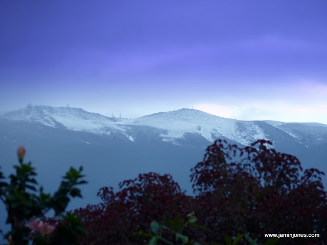
You folks up in Dallas are too far for the snow today. If you want snow, you need to go south - way south. Time to pack a bag and head to Maui (that's in Hawaii for the geographically-challenged  ) Lots of snow there from a storm that passed through on Tuesday. Here's a shot of the island from yesterday morning:
0 likes
-
wxman57
- Moderator-Pro Met
- Posts: 23172
- Age: 68
- Joined: Sat Jun 21, 2003 8:06 pm
- Location: Houston, TX (southwest)
Re: Texas Winter 2010-2011
HockeyTx82 wrote::uarrow: So are you saying we might get a little more precip then forecasted? I live here in Denton so just trying to get tabs on frozen stuff. Thank you for all of you input.
Observations to your west and northwest indicate that the precip is just about over there in the D-FW metroplex. The air dries out fairly quickly as you go just a little west of Ft. Worth into Mineral Wells. Although radar does indicate snow to your NW, observations don't confirm anything reaching the ground.
6Z GFS says no precip there in the D-FW area Sunday-Monday. Euro and Canadian have all frozen precip from Oklahoma northward with that system. Here's a 6z meteogram for DFW:

0 likes

Re: Texas Winter 2010-2011
wxman57 wrote:HockeyTx82 wrote::uarrow: So are you saying we might get a little more precip then forecasted? I live here in Denton so just trying to get tabs on frozen stuff. Thank you for all of you input.
Observations to your west and northwest indicate that the precip is just about over there in the D-FW metroplex. The air dries out fairly quickly as you go just a little west of Ft. Worth into Mineral Wells. Although radar does indicate snow to your NW, observations don't confirm anything reaching the ground.
6Z GFS says no precip there in the D-FW area Sunday-Monday. Euro and Canadian have all frozen precip from Oklahoma northward with that system. Here's a 6z meteogram for DFW:
http://myweb.cableone.net/nolasue/dfwgffs6zjan20.gif
Interesting to note that in your meteogram it only shows a low of 27F in Dallas tonight, while the NWS is forecasting a low of 22. I am reading the metogram correctly?
0 likes
Any forecast I make is based on my opinion only. Please refer to the NWS or NHC for official forecasts.
Re: Texas Winter 2010-2011
GFS will bust tonight, 24F DFW, 20F burbs.
0 likes
“If you thought that science was certain - well, that is just an error on your part.”
-
wxman57
- Moderator-Pro Met
- Posts: 23172
- Age: 68
- Joined: Sat Jun 21, 2003 8:06 pm
- Location: Houston, TX (southwest)
Re: Texas Winter 2010-2011
Snowman67 wrote:wxman57 wrote:HockeyTx82 wrote::uarrow: So are you saying we might get a little more precip then forecasted? I live here in Denton so just trying to get tabs on frozen stuff. Thank you for all of you input.
Observations to your west and northwest indicate that the precip is just about over there in the D-FW metroplex. The air dries out fairly quickly as you go just a little west of Ft. Worth into Mineral Wells. Although radar does indicate snow to your NW, observations don't confirm anything reaching the ground.
6Z GFS says no precip there in the D-FW area Sunday-Monday. Euro and Canadian have all frozen precip from Oklahoma northward with that system. Here's a 6z meteogram for DFW:
http://myweb.cableone.net/nolasue/dfwgffs6zjan20.gif
Interesting to note that in your meteogram it only shows a low of 27F in Dallas tonight, while the NWS is forecasting a low of 22. I am reading the metogram correctly?
You're reading it right. That's the raw GFS 2 meter data plotted. And that "low" is the 6am forecast temp, not necessarily the morning low. Models often don't handle the low temps in Canadian-Arctic air well. GFS MOS forecast is in the 20-22 range there for tomorrow morning.
0 likes
Who is online
Users browsing this forum: No registered users and 92 guests