
Texas Winter 2010-2011
Moderator: S2k Moderators
Forum rules
 The posts in this forum are NOT official forecast and should not be used as such. They are just the opinion of the poster and may or may not be backed by sound meteorological data. They are NOT endorsed by any professional institution or STORM2K.

The posts in this forum are NOT official forecast and should not be used as such. They are just the opinion of the poster and may or may not be backed by sound meteorological data. They are NOT endorsed by any professional institution or STORM2K.
-
cycloneye

- Admin

- Posts: 149505
- Age: 69
- Joined: Thu Oct 10, 2002 10:54 am
- Location: San Juan, Puerto Rico
Re: Texas Winter 2010-2011
txagwxman,right now the NAO is well in positive territory,but is forecast to turn again negative after mid Febuary.
0 likes
Visit the Caribbean-Central America Weather Thread where you can find at first post web cams,radars
and observations from Caribbean basin members Click Here
and observations from Caribbean basin members Click Here

Marshall 7 Day forecast:
Tuesday Night: A chance of rain and snow. Mostly cloudy, with a low around 27. Chance of precipitation is 40%.
Wednesday: A 40 percent chance of snow. Mostly cloudy, with a high near 32.
Wednesday Night: A 20 percent chance of snow. Mostly cloudy, with a low around 16.
Thursday: Mostly sunny, with a high near 35.
Thursday Night: Partly cloudy, with a low around 17.
Friday: Mostly sunny, with a high near 37.
Several days in the 30s again?
0 likes
-
downsouthman1
- Category 2

- Posts: 706
- Age: 46
- Joined: Fri Jan 07, 2011 8:14 pm
- Location: Rowlett, TX
Re: Texas Winter 2010-2011
cycloneye wrote:txagwxman,right now the NAO is well in positive territory,but is forecast to turn again negative after mid Febuary.
Didn't this storm have a positive tilt to it? Or is that something different than the NAO being positive?
0 likes
Not a professional MET! My posts are merely speculation.
-
wxman57

- Moderator-Pro Met

- Posts: 23175
- Age: 68
- Joined: Sat Jun 21, 2003 8:06 pm
- Location: Houston, TX (southwest)
Re:
wxman22 wrote:Euro says we do this all over again next week, Houston looks to be a close call right now.
Got an idea to improve my meteograms. I added in the projected 850mb temperature (dotted red line). Now you can see if the 850mb temp is below freezing during precip. It shows the current forecast 850mb temp is well above freezing next Wednesday morning during the light precip:

And, to give you all a little hope about the future of February, here's the extended part of the 12Z GFS. Keep in mind the temps are valid 6am and 6pm. Actual highs will be greater than the 6pm temps by maybe 4-6 deg.

0 likes
-
southerngale

- Retired Staff

- Posts: 27418
- Joined: Thu Oct 10, 2002 1:27 am
- Location: Southeast Texas (Beaumont area)

Re: Texas Winter 2010-2011
Wow Very neat!
i measured here this morning 6.6 inches and then another 1/2" with the last round
i measured here this morning 6.6 inches and then another 1/2" with the last round
0 likes
just a guess.......take everything i say with a grain of salt.......check your local NWS for forecast information
-
Brandon8181
- S2K Supporter

- Posts: 431
- Age: 42
- Joined: Tue Jan 04, 2011 4:52 pm
- Location: Tyler, TX
- Contact:
Re:
DonWrk wrote:Cannot believe it is still snowing. It's very light now but this little band stuck around a long long time.
I'm still gettting pretty moderate snowfall here in Sherman..This is crazy. Been snowing most of the day.
0 likes
I am not a meteorologist. Any post from me should be taken as hobby or fun educational information, but not an accurate source for weather information. Please, refer to your local weather station or National Weather Service for the most up to date information. 


Re: Texas Winter 2010-2011
Now that the sun is out and the skies are clear. Man it sure does look pretty.
0 likes

-
Brandon8181
- S2K Supporter
- Posts: 431
- Age: 42
- Joined: Tue Jan 04, 2011 4:52 pm
- Location: Tyler, TX
- Contact:
Re: Texas Winter 2010-2011
*Its important to note the below information is not an offical forecast and should not be used as such. The below thoughts are my opinions and may not be fully backed by sound meteorological data. It is not endorsed by any professional instituion or Storm2K. For Official Information please refer to National Weather Service products and your local news office such as KXII and KTEN.*
This is intended for Grayson County and surrounding areas.
All I can say is Wow. I don't think I have ever seen a winter even like this.. Snow on snow, then again potential for multiple snow events next week, some being more significant than others.
Tonight, snow fall will continue due to wrap around snowfall from the upper level low. Additional accumulation seems likely with this event. Reports today over Texoma were anywhere from as little as 1 inch to as high as 8 inches. Last night I was suggesting 1 to 4 inch accumulation, with some areas higher. I did want to point out that instially yesterday the National Weather Service and local media outlets were only forecasting a dusting to an inch. Snow packed over ice continues to make driving conditions hazardous. There will also be a potential for snow flurries early Saturday morning.
As I mentioned yesterday I feel like the excessive snow/snow pack that we got last night and today would help keep temperatures down this weekend, preventing them from getting into the 40's and 50's to create additional snow melt. It appears that low level thermal profile over the weekend and into next week will result in cooler temperatures than had been previously suggested. Therefore, I feel like it is likely that much of the snow and ice we have on the ground will be around for several more days to come. Don't get me wrong, we will get some melting this weekend, just nothing significant before the next wave of snow approaches our area.
Sunday will be fair, but Sunday evening another front will push through the area bringing again another opportunity for snow. At this time I feel like the heaviest area of precip will stay north of the red river; however, its possible that some snow will cross the red river and move down toward central Texas before starting to break up. Light accumulations of 1 to 2 inches are possible Sunday night into Monday morning.
Tuesday thru Thurday will again be the next opportunity for a major winter storm that I'm very concerned about. A very strong artic airmass will approach the area Tuesday Night/Wednesday morning time frame bring the potential again for ice and snow across Texoma. Due to high pressure gradiant, and several inches of snow on the ground, winds will be significant 20 mph with gust up to 35 to 40 mph creating blowing snow and blizzard like conditions on Wednesday. The high temperature should be about 31, falling throughout the day. Significant snowfall accumulation is likely with this event of 3 to 6 inches in addition to the snow we will already have on the ground. Some of the snow will likely linger into Thursday morning as well. Most computer models are in fair agreement of this system Wednesday and I'm pretty confident with my forecast.
Bottam Line:
-Snowfall continuing overnight
-Super Bowl Sunday could bring snow to Jerry's World
-Major snow storm middle of next week creating "blizzard like" conditons
-Light at the end of the tunnel, after next week, long term models suggest a warming trend.
Forecast
Tonight Low near 15, 100% of Light snow
Saturday High near 34, 40% Snow flurries early
Sunday High near 39, 50% of evening Rain changing over to Snow 1 to 2 inch accumulation possible
Monday High near 34, 20% of light snow early little to no accumulation
Tuesday High near 35, Partly Cloud with a 20% of snow late
Wednesday High Near 31, 90% Sleet changing to snow. Blowing snow possible. Low visibilities 3 to 6 inches of accumulation likely
Thursday High around 29, 80% of early morning snow Some additional accumulation possible
Friday High around 34, Mostly Sunny
Enjoy the snow if you can,
Brandon
Here is my blog:
http://www.facebook.com/note.php?saved& ... 1920450574
0 likes
I am not a meteorologist. Any post from me should be taken as hobby or fun educational information, but not an accurate source for weather information. Please, refer to your local weather station or National Weather Service for the most up to date information.
-
southerngale
- Retired Staff
- Posts: 27418
- Joined: Thu Oct 10, 2002 1:27 am
- Location: Southeast Texas (Beaumont area)
Re: Texas Winter 2010-2011
jasons wrote:Wow, my high today was 31F - that's it.
Was that this afternoon? My high was 31° as well, but that was at midnight, before it dropped further. I haven't gotten out of the 20s all day! It's been 27° or 28° all day, with a low of 26° this morning.
Even down at the airport never got above freezing. Wow. Nobody forecast that.
I haven't seen the sun all day and for the past 1 1/2 hours or so, we've been getting snow flurries. They're very light, but I've heard many reports from people seeing them all around here. I guess this is our snow. lol
0 likes
Please support Storm2k by making a donation today. It is greatly appreciated! Click here: 
 my Cowboys my Rockets my Astros
my Cowboys my Rockets my Astros

Re: Texas Winter 2010-2011
Now that the last accumulating snow band has exited the north Texas region (residual light snow far NE Grayson county and NW Fannin), official snow map for North Texas.

DFW airport has mad measuring skills. It has the lowest total of every site around it basically. But of course they do it professionally unlike the rest of us so the total there is usually lower than everyone else. We are officially above average this year in terms of snowfall for a La Nada.
And not to bring Txagwxman on the spotlight but! I just wanted to jinx him a little . One down! 1 more to go!
Last March.
DFW airport has mad measuring skills. It has the lowest total of every site around it basically. But of course they do it professionally unlike the rest of us so the total there is usually lower than everyone else. We are officially above average this year in terms of snowfall for a La Nada.
And not to bring Txagwxman on the spotlight but! I just wanted to jinx him a little
Last March.
txagwxman wrote:Ntxw wrote:Texas Snowman wrote:Also, I haven't glanced too far ahead, but there is often a last gasp cold front around Easter.
Any indications of that in the model pipeline?
Could be a mild and stormy Easter this year. It all depends on the speed of the storm\front progged to move through that weekend.
And I too believe we're moving into a colder period (weather pattern indications have said so). Even though it doesn't seem like it, the 2000s have been generous to us with snow (in Texas). if you include 2010, you average almost 40 inches of snow throughout the decade. The only other that comes close was the 70s. But to see another foot of snow from a single storm (at DFW) is very unlikely, but I can see how active winters can come along in clusters.
I am guaranteeing next winter < 10" snowfall for the season for Dallas, maybe less than 1.5".
0 likes
The above post and any post by Ntxw is NOT an official forecast and should not be used as such. It is just the opinion of the poster and may or may not be backed by sound meteorological data. It is NOT endorsed by any professional institution including Storm2k. For official information, please refer to NWS products.
Help support Storm2K!
Re: Texas Winter 2010-2011
Sounds like a challenge to Mother Nature. Personally I'd be thrilled to see a foot of snow next week. I'M CRAZY RIGHT? NO!
My reasons are
1. Super bowl will be over so no more complaining.
2. Last year when we had the foot of snow driving wasn't near as difficult as it was this week. So accidents will probably be minimal.
and the most important reason
3. It would top off one of the most incredible winters we've ever had and probably the most incredible winters we've ever had back to back.
and plus I do enjoy snow.
Last edited by iorange55 on Fri Feb 04, 2011 7:36 pm, edited 1 time in total.
0 likes
Re: Texas Winter 2010-2011
Seems like my news channel is already hyped for next week's cold/snow.

0 likes
Re: Texas Winter 2010-2011
It would top off one of the most incredible winters we've ever had and probably the most incredible winters we've ever had back to back.
whoaa.. let's tap the brakes on that a bit.
This week's event wasn't necessarily commonplace in the 70's/80's but it happened more often. December 1983 will always be the most freakish winter experience for me. Playing hockey on a frozen pond in Plano, TX.. or attempting to anyway. I remember many more sleet / snow events than we've had the last 20 years. Maybe things are cycling though.
0 likes
Re: Texas Winter 2010-2011
Tejas89 wrote:It would top off one of the most incredible winters we've ever had and probably the most incredible winters we've ever had back to back.
whoaa.. let's tap the brakes on that a bit.
This week's event wasn't necessarily commonplace in the 70's/80's but it happened more often. December 1983 will always be the most freakish winter experience for me. Playing hockey on a frozen pond in Plano, TX.. or attempting to anyway. I remember many more sleet / snow events than we've had the last 20 years. Maybe things are cycling though.
I said one of the! I mean last year was a record so I'm pretty sure we've never had over a foot of snow back to back years from one storm! It'd be pretty neat.
You're right though from what I hear they were tough back then. I wasn't alive back then so in recent memory these winters are definitely something new for me. Growing up in the 90s I don't remember too many times like this.
0 likes
Re: Texas Winter 2010-2011
I know it's early, but just about every weather expert, met I've seen, seems to be convinced we'll (TX) see snow/mix middle of next week. Of course the usual suspects is NTX and Oklahoma (storm would be a little bit more south than the big storm earlier this week). And for Southerngale, potential for something to track yet again!
0 likes
The above post and any post by Ntxw is NOT an official forecast and should not be used as such. It is just the opinion of the poster and may or may not be backed by sound meteorological data. It is NOT endorsed by any professional institution including Storm2k. For official information, please refer to NWS products.
Help support Storm2K!
Help support Storm2K!
-
Rgv20

- S2K Supporter
- Posts: 2466
- Age: 39
- Joined: Wed Jan 05, 2011 5:42 pm
- Location: Edinburg/McAllen Tx
Nice graphic by the NWS in Brownsville...WOW

My Hot Wheel FROZE
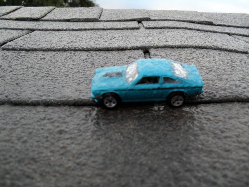
My Hot Wheel FROZE
0 likes
The following post is NOT an official forecast and should not be used as such. It is just the opinion of the poster and may or may not be backed by sound meteorological data. It is NOT endorsed by any professional institution including storm2k.org For Official Information please refer to the NHC and NWS products.
Who is online
Users browsing this forum: No registered users and 186 guests