Seems reasonable. The pressure I think might have been below 920mb though (given its large size and trends once Recon arrived), but without Recon it is hard to tell. I definitely agree that it was not a Category 5, which some were speculating afterward - it didn't seem to look like a T7.0 to me and Igor consistently ran below Dvorak once Recon arrived even if T7.0 was valid.
In the weakening phase, it seems the intensities may have been underestimated though as Newfoundland surface data proved. I would have gone 80 kt for the landfall intensity (pressure 948mb) given the final data and the assumption the strongest winds were occuring over water. Likewise, given the Bermuda data, I think all the intensities ahead of Newfoundland were higher than 65 kt as well and the pressures lower than 960mb (or even lower than 950mb).
2010 Tropical Cyclone Reports
Moderator: S2k Moderators
Forum rules

The posts in this forum are NOT official forecasts and should not be used as such. They are just the opinion of the poster and may or may not be backed by sound meteorological data. They are NOT endorsed by any professional institution or STORM2K. For official information, please refer to products from the National Hurricane Center and National Weather Service.
-
cycloneye

- Admin

- Posts: 149021
- Age: 69
- Joined: Thu Oct 10, 2002 10:54 am
- Location: San Juan, Puerto Rico
Re: 2010 TC Reports=Hurricane Igor is up (Peak Intensity 135kts)
I have been waiting for the one that is left,Tomas,for a long time,to see what was the peak intensity near St Lucia. Let's see if they release it this week.
0 likes
Visit the Caribbean-Central America Weather Thread where you can find at first post web cams,radars
and observations from Caribbean basin members Click Here
and observations from Caribbean basin members Click Here
-
chrisjslucia
- S2K Supporter

- Posts: 236
- Joined: Thu Oct 09, 2008 8:27 pm
- Location: St Lucia
Re: 2010 TC Reports=Hurricane Igor is up (Peak Intensity 135kts)
cycloneye wrote:I have been waiting for the one that is left,Tomas,for a long time,to see what was the peak intensity near St Lucia. Let's see if they release it this week.
Still not out it seems - do reports usually take this long?
0 likes

-
cycloneye
- Admin
- Posts: 149021
- Age: 69
- Joined: Thu Oct 10, 2002 10:54 am
- Location: San Juan, Puerto Rico
Re: 2010 Tropical Cyclone Reports
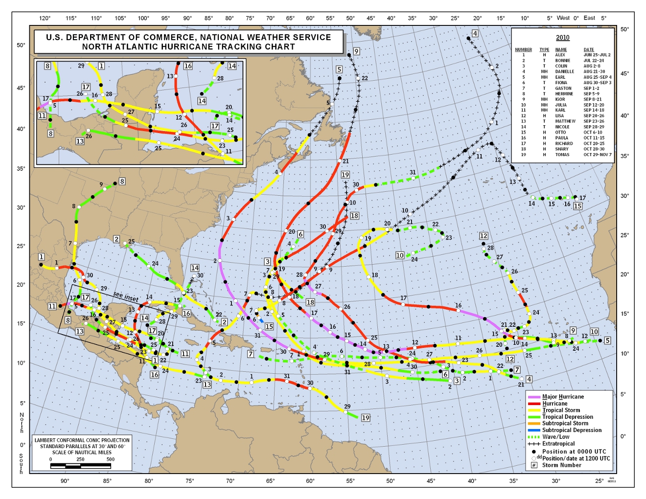
NHC released the chart of the tracks for all 19 systems. Still ,the Tomas report has not been released.
http://www.nhc.noaa.gov/2010atlan.shtml
http://www.nhc.noaa.gov/2010atlan.shtml
0 likes
Visit the Caribbean-Central America Weather Thread where you can find at first post web cams,radars
and observations from Caribbean basin members Click Here
and observations from Caribbean basin members Click Here
-
SouthDadeFish

- Professional-Met

- Posts: 2835
- Joined: Thu Sep 23, 2010 2:54 pm
- Location: Miami, FL
- Contact:
-
wxman57

- Moderator-Pro Met

- Posts: 23169
- Age: 68
- Joined: Sat Jun 21, 2003 8:06 pm
- Location: Houston, TX (southwest)
Re:
SouthDadeFish wrote:Looks like they classified Tomas as a tropical cyclone a little earlier, judging by that map, right?
Should have been about 24-36 hrs earlier, judging by surface obs and its satellite representation.
0 likes
-
SouthDadeFish
- Professional-Met
- Posts: 2835
- Joined: Thu Sep 23, 2010 2:54 pm
- Location: Miami, FL
- Contact:
Re: Re:
wxman57 wrote:SouthDadeFish wrote:Looks like they classified Tomas as a tropical cyclone a little earlier, judging by that map, right?
Should have been about 24-36 hrs earlier, judging by surface obs and its satellite representation.
I agree, which is why I'm glad it seems they're classifying it a bit earlier.
0 likes
-
Metalicwx220
Re: 2010 Tropical Cyclone Reports=Hurricane Igor is up
cycloneye wrote:Hurricane Igor report is up at the first post of thread. The peak intensity was 135 kts. Crazy,do you agree?
I don't know how to convert knots to mph. lol what is 135kts in mph???
0 likes
-
SouthDadeFish
- Professional-Met
- Posts: 2835
- Joined: Thu Sep 23, 2010 2:54 pm
- Location: Miami, FL
- Contact:
Re: 2010 Tropical Cyclone Reports=Hurricane Igor is up
Metalicwx220 wrote:cycloneye wrote:Hurricane Igor report is up at the first post of thread. The peak intensity was 135 kts. Crazy,do you agree?
I don't know how to convert knots to mph. lol what is 135kts in mph???
Multiply knots by 1.15, so you get 155 mph
0 likes
-
Metalicwx220
Re: 2010 Tropical Cyclone Reports=Hurricane Igor is up
SouthDadeFish wrote:Metalicwx220 wrote:cycloneye wrote:Hurricane Igor report is up at the first post of thread. The peak intensity was 135 kts. Crazy,do you agree?
I don't know how to convert knots to mph. lol what is 135kts in mph???
Multiply knots by 1.15, so you get 155 mph
I believe it was a Category 5.
0 likes
-
SouthDadeFish
- Professional-Met
- Posts: 2835
- Joined: Thu Sep 23, 2010 2:54 pm
- Location: Miami, FL
- Contact:
-
cycloneye
- Admin
- Posts: 149021
- Age: 69
- Joined: Thu Oct 10, 2002 10:54 am
- Location: San Juan, Puerto Rico
Re: 2010 Tropical Cyclone Reports
Crazy,they put comming soon,but how soon that would be is the question,as we are still waiting and waiting for that Tomas report. 
0 likes
Visit the Caribbean-Central America Weather Thread where you can find at first post web cams,radars
and observations from Caribbean basin members Click Here
and observations from Caribbean basin members Click Here
-
CrazyC83
- Professional-Met
- Posts: 34311
- Joined: Tue Mar 07, 2006 11:57 pm
- Location: Deep South, for the first time!
Re: 2010 Tropical Cyclone Reports
cycloneye wrote:Crazy,they put comming soon,but how soon that would be is the question,as we are still waiting and waiting for that Tomas report.
Yeah I am wondering, maybe they went back for new data.
Barbados released their report to the WMO on the meeting site, and confirmed wind gusts to 105 mph (sustained about 53 mph) and a pressure of 983mb at the time it crossed the island at 0900Z on October 30 (operationally it was 990mb at the time!).
http://www.wmo.int/pages/prog/www/tcp/d ... rbados.doc (MS Word document)
I would make some dramatic changes to the intensities around the islands based on those data:
29/1800 - 45 kt / 998mb (as supported by Recon)
30/0000 - 55 kt / 996mb (as supported by Recon)
30/0600 - 70 kt / 988mb (higher than Recon based on later trends and Barbados reports)
30/1200 - 80 kt / 982mb (pressure from Barbados at 0900Z, wind a crude guess using P-W relationships)
30/1800 - 85 kt / 981mb (estimate on land data)
31/0000 - 90 kt / 979mb (estimate on land data and assumption that it weakened at the next Recon flight, peak intensity)
31/0600 - 85 kt / 982mb (as supported by Recon)
31/1200 - 75 kt / 987mb (extrapolation of Recon data)
31/1800 - 65 kt / 994mb (as supported by Recon)
The operational intensities at those points are 35, 50, 60, 65, 65, 80, 85, 80 and 70 respectively. A big change indeed!
0 likes
-
christchurchguy
- Tropical Low

- Posts: 43
- Joined: Sat Sep 19, 2009 10:31 am
-
CrazyC83
- Professional-Met
- Posts: 34311
- Joined: Tue Mar 07, 2006 11:57 pm
- Location: Deep South, for the first time!
http://www.wmo.int/pages/prog/www/tcp/d ... oc.5.1.doc
Barbados is requesting Recon farther east, saying they were caught off guard by Tomas (they were hit with hurricane conditions only 14 hours after first advisory and couldn't get adequate warning).
IMO it is a fair request, but they should pay the US for base use and operations for those flights when they request them until the US can take over from St. Croix. Stationed at Barbados, they could reach as far as 45W.
Also, the need for secondary backups were mentioned. IMO, the NWS (United States) should be everyone's (except possibly Cuba) secondary backup, since they have many offices that could implement warnings.
0 likes
-
HurricaneBill
- Category 5

- Posts: 3420
- Joined: Sun Apr 11, 2004 5:51 pm
- Location: East Longmeadow, MA, USA
Re:
CrazyC83 wrote:http://www.wmo.int/pages/prog/www/tcp/documents/Doc.5.1.doc
Barbados is requesting Recon farther east, saying they were caught off guard by Tomas (they were hit with hurricane conditions only 14 hours after first advisory and couldn't get adequate warning).
IMO it is a fair request, but they should pay the US for base use and operations for those flights when they request them until the US can take over from St. Croix. Stationed at Barbados, they could reach as far as 45W.
Also, the need for secondary backups were mentioned. IMO, the NWS (United States) should be everyone's (except possibly Cuba) secondary backup, since they have many offices that could implement warnings.
I remember somebody saying St. Lucia was also caught off guard by Tomas.
0 likes
-
cycloneye
- Admin
- Posts: 149021
- Age: 69
- Joined: Thu Oct 10, 2002 10:54 am
- Location: San Juan, Puerto Rico
Re: 2010 Tropical Cyclone Reports=Hurricane Tomas is up
85 kts was the maximun intensity.  Excerpt from the report.
The estimated maximum intensity of this hurricane, 85 kt, is based on a maximum 10-
min wind observation of 77 kt from Hewanorra Airport in St. Lucia at 1926 UTC 30 October,
adjusted by applying a gust factor of 1.11 to convert from a 10-min average to a maximum 1-min
average (Harper et al. 2009). In addition, there was an SFMR-based surface wind measurement
of 85 kt at 0537 UTC 31 October from the 53WRS.
0 likes
Visit the Caribbean-Central America Weather Thread where you can find at first post web cams,radars
and observations from Caribbean basin members Click Here
and observations from Caribbean basin members Click Here
Who is online
Users browsing this forum: JetFuel_SE and 125 guests