Gulf Disturbance Week of June 27th (Is invest 95L)

This is the general tropical discussion area. Anyone can take their shot at predicting a storms path.

Moderator: S2k Moderators

Forum rules

The posts in this forum are NOT official forecasts and should not be used as such. They are just the opinion of the poster and may or may not be backed by sound meteorological data. They are NOT endorsed by any professional institution or STORM2K. For official information, please refer to products from the National Hurricane Center and National Weather Service.

Help Support Storm2K
Message
Author
User avatar
Ivanhater
Storm2k Moderator
Storm2k Moderator
Posts: 11162
Age: 38
Joined: Fri Jul 01, 2005 8:25 am
Location: Pensacola

Gulf Disturbance Week of June 27th (Is invest 95L)

#1 Postby Ivanhater » Thu Jun 16, 2011 12:16 pm

Well the Climate prediction center put out the extended outlook and talks about the gulf disturbance bringing much needed rain to the Gulf coast. A disturbance looks very credible, but will it be a classified system? We will see.


TODAYS WEEK 2 BLEND CHART INDICATES NEAR TO ABOVE NORMAL HEIGHTS OVER ALASKA
AND MOST OF THE EASTERN TWO-THIRDS OF THE CONUS, AND NEAR TO BELOW NORMAL
HEIGHTS OVER MOST OF THE WESTERN THIRD OF THE CONUS. THE MAGNITUDE OF THE
HEIGHT ANOMALIES FORECAST OVER THE CONUS ARE QUITE SMALL. THE EXPECTED
TEMPERATURE AND PRECIPITATION ANOMALY PATTERNS FOR WEEK 2 ARE LITTLE CHANGED
FROM THOSE FORECAST DURING THE 6-10 DAY PERIOD, ALTHOUGH WARMER CONDITIONS ARE
EXPECTED OVER THE CENTRAL PLAINS AND MIDDLE MISSISSIPPI VALLEY DURING WEEK 2.
IN ADDITION, FOR WEEK 2 THERE ARE ENHANCED PROBABILITIES FOR ABOVE MEDIAN
PRECIPITATION ALONG THE GULF COAST AND PARTS OF THE SOUTHEAST DUE TO
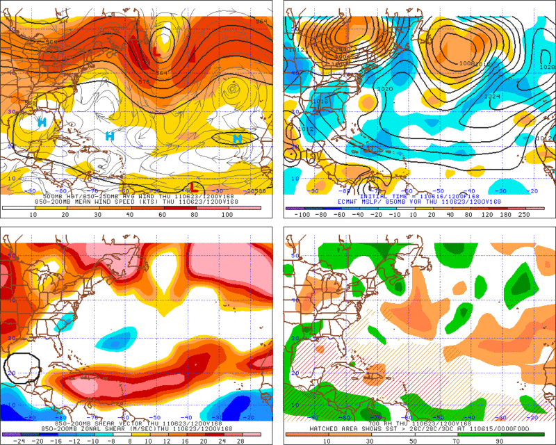
INDICATIONS FROM THE GFS OPERATIONAL SOLUTIONS OF TROPICAL DISTURBANCE ACTIVITY
IN THE GULF OF MEXICO DURING THE PERIOD. THERE IS LOW CONFIDENCE IN THIS ASPECT
OF THE FORECAST DUE TO THE LONG LEAD TIME FOR A RELATIVELY SMALL SCALE FEATURE.


[img]Image

Uploaded with ImageShack.us[/img]

[img]Image

Uploaded with ImageShack.us[/img]
0 likes   
Michael

Dean4Storms
S2K Supporter
S2K Supporter
Posts: 6358
Age: 62
Joined: Sun Aug 31, 2003 1:01 pm
Location: Miramar Bch. FL

#2 Postby Dean4Storms » Thu Jun 16, 2011 12:29 pm

GFS has not given up on it for at least 6 days of runs so far. I sure hope it comes to fruition, we need the rain really bad. Don't want anything more than a good TS to just soak us all good!
0 likes   

User avatar
micktooth
S2K Supporter
S2K Supporter
Posts: 391
Joined: Mon Jul 11, 2005 3:47 pm
Location: PreK:New Orleans,PostK:Colorado

Re: Possible Gulf Disturbance (Drought buster?)

#3 Postby micktooth » Thu Jun 16, 2011 12:49 pm

When and where is this possible disturbance supposed to originate from?
0 likes   

User avatar
srainhoutx
S2K Supporter
S2K Supporter
Posts: 6919
Age: 67
Joined: Sun Jan 14, 2007 11:34 am
Location: Haywood County, NC
Contact:

Re: Possible Gulf Disturbance (Drought buster?)

#4 Postby srainhoutx » Thu Jun 16, 2011 12:59 pm

It appears to be a combination of a Kelvin wave, EPAC moisture (possible Hurricane Beatriz), deep tropical moisture currently in the Western Caribbean surging N and NW and an approaching frontal boundary/trough.
0 likes   
Carla/Alicia/Jerry(In The Eye)/Michelle/Charley/Ivan/Dennis/Katrina/Rita/Wilma/Ike/Harvey

Member: National Weather Association
Wx Infinity Forums
http://wxinfinity.com/index.php

Facebook.com/WeatherInfinity
Twitter @WeatherInfinity

User avatar
Ivanhater
Storm2k Moderator
Storm2k Moderator
Posts: 11162
Age: 38
Joined: Fri Jul 01, 2005 8:25 am
Location: Pensacola

Re: Possible Gulf Disturbance (Drought buster?)

#5 Postby Ivanhater » Thu Jun 16, 2011 1:04 pm

srainhoutx wrote:It appears to be a combination of a Kelvin wave, EPAC moisture (possible Hurricane Beatriz), deep tropical moisture currently in the Western Caribbean surging N and NW and an approaching frontal boundary/trough.


I just took a look back and it does seem to come from lowering pressure over Mexico left over from the EPAC. Here is a look at the 500mb chart from the GFS showing the approaching trough as the ridge breaks down and the disturbance lifts north.

Image
0 likes   
Michael

User avatar
srainhoutx
S2K Supporter
S2K Supporter
Posts: 6919
Age: 67
Joined: Sun Jan 14, 2007 11:34 am
Location: Haywood County, NC
Contact:

Re: Possible Gulf Disturbance (Drought buster?)

#6 Postby srainhoutx » Thu Jun 16, 2011 2:17 pm

HPC:

MID LEVEL BREAK IN THE EPAC AND WEST ATLC/GULFMEX RIDGING SEEN IN
GUIDANCE AND ENS MEAN LATE PERIOD INTO NEXT WEEKEND WITH A NWD
SHIFT IN VORTICITY MAXIMA COMING NWD ALONG THE ERN MEXICAN COAST
INTO TX/LA. THIS HAS BEEN A RECURRING MODEL FEATURE FOR MORE THAN
SEVERAL DAYS AND WOULD PROVIDE THE POTENTIAL OF SOME MUCH NEEDED
RAINFALL BUT REMAINS SUSPECT AT THIS TIME RANGE.
ROTH/ROSENSTEIN

0 likes   
Carla/Alicia/Jerry(In The Eye)/Michelle/Charley/Ivan/Dennis/Katrina/Rita/Wilma/Ike/Harvey

Member: National Weather Association
Wx Infinity Forums
http://wxinfinity.com/index.php

Facebook.com/WeatherInfinity
Twitter @WeatherInfinity

User avatar
vbhoutex
Storm2k Executive
Storm2k Executive
Posts: 29113
Age: 73
Joined: Wed Oct 09, 2002 11:31 pm
Location: Cypress, TX
Contact:

Re: Possible Gulf Disturbance (Drought buster?)

#7 Postby vbhoutex » Thu Jun 16, 2011 3:08 pm

My problem with this is that it continues to appear to move in over LA and leaves TX high and dry. I will be happy for my LA and Gulf coast friends to our East, but right now I don't see anything that makes me believe we will get any type of drought relief from this in TX. Am I missing something?
0 likes   
Skywarn, C.E.R.T.
Please click below to donate to STORM2K to help with the expenses of keeping the site going:
Image

CYCLONE MIKE
Category 5
Category 5
Posts: 2183
Joined: Tue Aug 31, 2004 6:04 pm
Location: Gonzales, LA

Re: Possible Gulf Disturbance (Drought buster?)

#8 Postby CYCLONE MIKE » Thu Jun 16, 2011 3:20 pm

I still feel we could all end up missing out on this. Just becasue the GFS has been showing this for run after run, I continue to think back to all the times it has spun all these phantom storms up in the past. Getting to the point where I pretty much have to see some sort of evidence of a disturbance before I will start giving models credit.
0 likes   

User avatar
srainhoutx
S2K Supporter
S2K Supporter
Posts: 6919
Age: 67
Joined: Sun Jan 14, 2007 11:34 am
Location: Haywood County, NC
Contact:

Re: Possible Gulf Disturbance (Drought buster?)

#9 Postby srainhoutx » Thu Jun 16, 2011 3:29 pm

The problem is none and I mean none of the models have been spot on regarding rain chances over the past several months. Brownsville NWS had a great one line comment in regards to forecasting rain in a severe drought situation, "when in doubt, leave it out". HGX gives some explanation that all Gulf Coast residents should be aware of...

AFTER THE HOT AND RAIN FREE WEEKEND...COULD RAIN BE ON THE
HORIZON? A STRONG TROUGH WILL APPROACH THE CENTER OF THE COUNTRY
AND THIS SHUNTS THE PERSISTENT RIDGE OFF TO THE EAST. A PLUME OF
DEEP MOISTURE WILL BE PULLED NORTHWARD ON THE BACK SIDE OF THE
RIDGE AND THIS MOISTURE WILL BE LIFTED BY THE APPROACHING TROUGH.
HEIGHTS LOOK LOW ENOUGH ON TUESDAY TO GENERATE SOME ISOLATED
SHOWERS ON THE SEA BREEZE. MOISTURE DEEPENS AND LIFT INCREASES
WED/THU FOR A GOOD CHANCE OF SHOWERS AND THUNDERSTORMS EACH DAY.
PW VALUES ARE FORECAST TO EXCEED 2 INCHES AND FCST SOUNDINGS SHOW
WEAK CAPPING THAT WILL BE EASILY OVERCOME WITH MODEST DAYTIME
HEATING. HAVE BUMPED POPS TO CHANCE ON WED/THU AND POPS WILL
LIKELY NEED TO BE RAISED IF MODEL CONSENSUS CONTINUES TO GROW.

THE GFS IS STRONGER WITH AN UPPER LEVEL WEAKNESS OVER THE GULF
LATE IN THE WEEK. NEITHER THE CANADIAN OR ECMWF SHOW THIS UPPER
FEATURE. THE ECMWF IS STRONGER WITH THE EAST COAST RIDGE AND THE
EC BUILDS THE RIDGE WESTWARD ON FRI THUS PUSHING THE MOISTURE WEST
AND AWAY FROM SOUTHEAST TEXAS.
STILL SOME UNCERTAINTY FOR NEXT
WEEKEND BUT AM CURRENTLY LEANING TOWARD THE DRIER ECMWF SOLUTION.

0 likes   
Carla/Alicia/Jerry(In The Eye)/Michelle/Charley/Ivan/Dennis/Katrina/Rita/Wilma/Ike/Harvey

Member: National Weather Association
Wx Infinity Forums
http://wxinfinity.com/index.php

Facebook.com/WeatherInfinity
Twitter @WeatherInfinity

User avatar
MGC
S2K Supporter
S2K Supporter
Posts: 5899
Joined: Sun Mar 23, 2003 9:05 pm
Location: Pass Christian MS, or what is left.

Re: Possible Gulf Disturbance (Drought buster?)

#10 Postby MGC » Thu Jun 16, 2011 4:17 pm

It would be nice to get a weak system along the GOM coast....I am getting sick of draging the sprinkler around the yard......MGC
0 likes   

User avatar
Ivanhater
Storm2k Moderator
Storm2k Moderator
Posts: 11162
Age: 38
Joined: Fri Jul 01, 2005 8:25 am
Location: Pensacola

Re: Possible Gulf Disturbance (Drought buster?)

#11 Postby Ivanhater » Thu Jun 16, 2011 5:41 pm

Check another run off the list...

[img]Image

Uploaded with ImageShack.us[/img]


[img]Image

Uploaded with ImageShack.us[/img]
0 likes   
Michael

User avatar
vbhoutex
Storm2k Executive
Storm2k Executive
Posts: 29113
Age: 73
Joined: Wed Oct 09, 2002 11:31 pm
Location: Cypress, TX
Contact:

Re: Possible Gulf Disturbance (Drought buster?)

#12 Postby vbhoutex » Thu Jun 16, 2011 5:49 pm

MGC wrote:It would be nice to get a weak system along the GOM coast....I am getting sick of draging the sprinkler around the yard......MGC

You got that right on all aspects!! :cheesy:
0 likes   
Skywarn, C.E.R.T.
Please click below to donate to STORM2K to help with the expenses of keeping the site going:
Image

CYCLONE MIKE
Category 5
Category 5
Posts: 2183
Joined: Tue Aug 31, 2004 6:04 pm
Location: Gonzales, LA

Re: Possible Gulf Disturbance (Drought buster?)

#13 Postby CYCLONE MIKE » Thu Jun 16, 2011 5:52 pm

The problem is none and I mean none of the models have been spot on regarding rain chances over the past several months. Brownsville NWS had a great one line comment in regards to forecasting rain in a severe drought situation, "when in doubt, leave it out". HGX gives some explanation that all Gulf Coast residents should be aware of...


Couldn't have said it better myself. That is absolutely 110% correct! We had some severe storms: lightning, hail, and wind damage just hardly any rain to go with them the past two weeks. And by everyones surprise the first two rounds happened when there was only a 10% chance or less. Then of course after a few days of it the NWS decided to increase the chances everyday. But as usual as soon as they did, we got nothing. :roll:

Not to say I don't think there is a chance some sort of disturbance could start to develop in the gulf. Just don't see it moving north then NE. If anything due west into Mexico.
Last edited by CYCLONE MIKE on Thu Jun 16, 2011 5:54 pm, edited 1 time in total.
0 likes   

User avatar
Ivanhater
Storm2k Moderator
Storm2k Moderator
Posts: 11162
Age: 38
Joined: Fri Jul 01, 2005 8:25 am
Location: Pensacola

Re: Possible Gulf Disturbance (Drought buster?)

#14 Postby Ivanhater » Thu Jun 16, 2011 5:53 pm

Wow..the 18z GFS hangs the low around the Gulf coast a very long time...over 14 inches for areas of the Gulf coast :double:

[img]Image

Uploaded with ImageShack.us[/img]

[img]Image

Uploaded with ImageShack.us[/img]
0 likes   
Michael

Dean4Storms
S2K Supporter
S2K Supporter
Posts: 6358
Age: 62
Joined: Sun Aug 31, 2003 1:01 pm
Location: Miramar Bch. FL

#15 Postby Dean4Storms » Thu Jun 16, 2011 6:34 pm

From what I can tell the GFS digs the west coast trough much deeper and as it swings eastward it flattens and pushes the ridging over MX and into the Gulf Eastward thus energy down in the BOC begins to get drawn northward by the trough but gets left behind as the trough lifts out making whatever we have in the way of a Low slowly moving eastbound.

The ECMWF is also digging the trough much like the GFS although the low it develops down in the BOC is pretty much stuck there and gets shunted westward into MX.

Some of this energy appears to be whatever is leftover from the EPAC disturbance and both the GFS and ECM do not develop it much beyond TS strength and send it northward toward MX.
0 likes   

User avatar
Rgv20
S2K Supporter
S2K Supporter
Posts: 2466
Age: 39
Joined: Wed Jan 05, 2011 5:42 pm
Location: Edinburg/McAllen Tx

#16 Postby Rgv20 » Thu Jun 16, 2011 7:51 pm

The 18zNOGAPS trying to show something in the BOC by next Thursday morning.

Image

I know the NOGAPS is a pretty bad model for the Tropical Atlantic but its the only model right now backing the GFS on the possible Gulf disturbance.
0 likes   
The following post is NOT an official forecast and should not be used as such. It is just the opinion of the poster and may or may not be backed by sound meteorological data. It is NOT endorsed by any professional institution including storm2k.org For Official Information please refer to the NHC and NWS products.

User avatar
PTrackerLA
Category 5
Category 5
Posts: 5277
Age: 41
Joined: Thu Oct 10, 2002 8:40 pm
Location: Lafayette, LA

Re: Possible Gulf Disturbance (Drought buster?)

#17 Postby PTrackerLA » Thu Jun 16, 2011 10:14 pm

The rainfall amounts the GFS has been showing for next weekend have been staggering and it has continued to show this run after run. It's amazing that such a large area looks to pick up 5"-10"+ of rain and the 'low' continues to linger around for days! This would most definitely cause a few flooding problems but we'll just have to accept that as this is the perfect drought buster if it comes to fruition.
0 likes   

lonelymike
S2K Supporter
S2K Supporter
Posts: 634
Joined: Sat Jul 26, 2008 10:12 am
Location: walton county fla

Re:

#18 Postby lonelymike » Thu Jun 16, 2011 10:22 pm

Rgv20 wrote:The 18zNOGAPS trying to show something in the BOC by next Thursday morning.

http://i61.photobucket.com/albums/h62/c ... 162hrs.png

I know the NOGAPS is a pretty bad model for the Tropical Atlantic but its the only model right now backing the GFS on the possible Gulf disturbance.


I wish some other models would pick up on the rain for the Gulf Coast but this ridge overhead is one tough bugger :sun:
0 likes   


GO SEMINOLES

User avatar
Rgv20
S2K Supporter
S2K Supporter
Posts: 2466
Age: 39
Joined: Wed Jan 05, 2011 5:42 pm
Location: Edinburg/McAllen Tx

#19 Postby Rgv20 » Thu Jun 16, 2011 11:08 pm

12zECMWF has no shear whatsoever in the BOC by Thursday morning when at the same time the GFS has a Low in that same general area.

Image
0 likes   
The following post is NOT an official forecast and should not be used as such. It is just the opinion of the poster and may or may not be backed by sound meteorological data. It is NOT endorsed by any professional institution including storm2k.org For Official Information please refer to the NHC and NWS products.

User avatar
Rgv20
S2K Supporter
S2K Supporter
Posts: 2466
Age: 39
Joined: Wed Jan 05, 2011 5:42 pm
Location: Edinburg/McAllen Tx

#20 Postby Rgv20 » Fri Jun 17, 2011 12:20 am

I hate to post the Nogaps but it looks like it has join the GFS on developing a disturbance in the BOC.

This is the forecast for Thursday 7pm.
Image
0 likes   
The following post is NOT an official forecast and should not be used as such. It is just the opinion of the poster and may or may not be backed by sound meteorological data. It is NOT endorsed by any professional institution including storm2k.org For Official Information please refer to the NHC and NWS products.


Return to “Talkin' Tropics”

Who is online

Users browsing this forum: Google Adsense [Bot], kevin and 33 guests