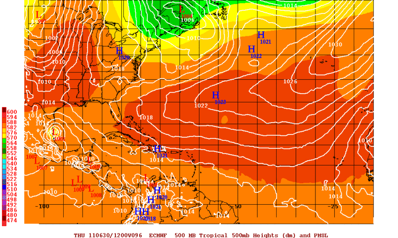
12zECMWF with a 1001mb low.
Moderator: S2k Moderators


Rgv20 wrote:The past few runs the ECMWF has been trending more northerly with the BOC feature.
12zECMWF with a 1001mb low.


Rgv20 wrote:Rain chances for my area are looking better and better with each new model run. 12z runs have the rain ever so close to deep south texas.
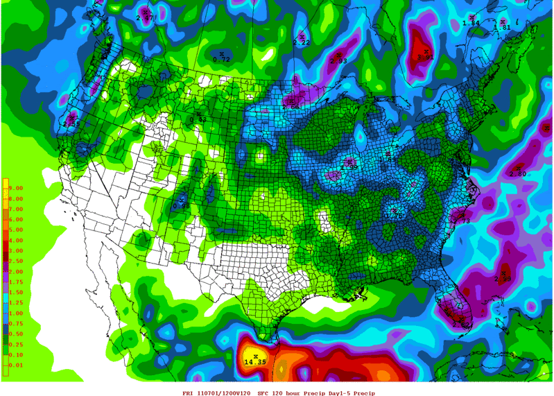
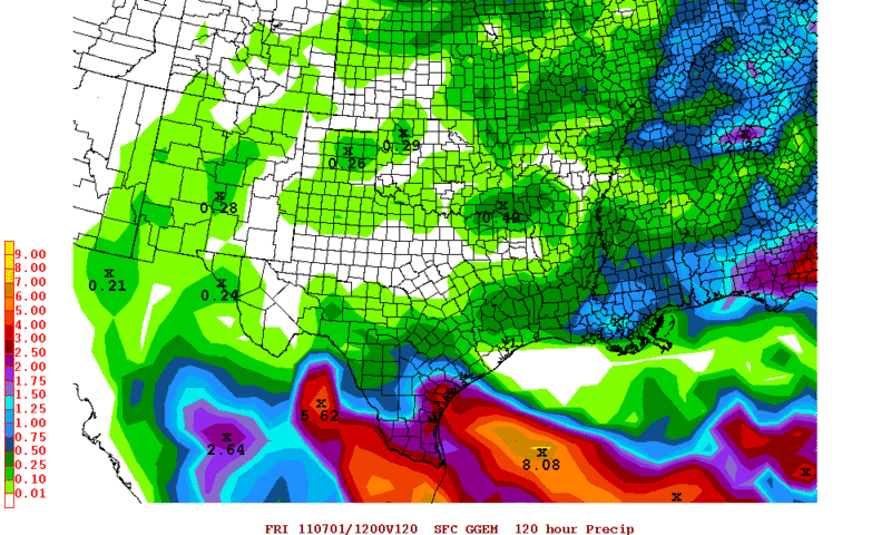
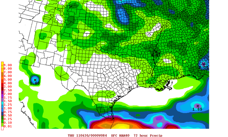
The following are rainfall totals for the next 5 days.
12zGFS
http://i61.photobucket.com/albums/h62/c ... 120hrs.gif
12zCMC
http://i61.photobucket.com/albums/h62/c ... 120hrs.gif
12zNAM
http://i61.photobucket.com/albums/h62/c ... 084hrs.gif
And the 12zECMWF has rainfall ranging from 1.50 to 3 inches for my area
Ptarmigan wrote:
Lucky you.Where did you get those maps from?

Ptarmigan wrote:Lucky you.


Sorry I am busy all week LOL.South Texas Storms wrote:So you guys are saying that the potential track of this system could continue to shift more north on the models because of a possible center reformation? Also, is there any chance that San Antonio could get a few rainbands from this?
South Texas Storms wrote:So you guys are saying that the potential track of this system could continue to shift more north on the models because of a possible center reformation? Also, is there any chance that San Antonio could get a few rainbands from this?
South Texas Storms wrote:So you guys are saying that the potential track of this system could continue to shift more north on the models because of a possible center reformation? Also, is there any chance that San Antonio could get a few rainbands from this?
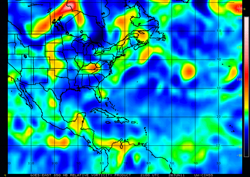
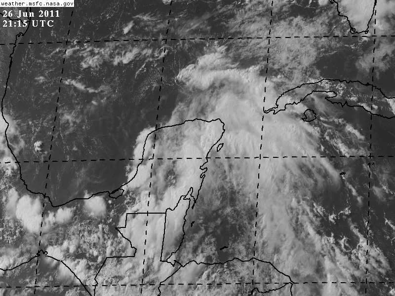
Dean4Storms wrote:I'm hearing that best vorticity is further north near Cozumel, this could make the eventual landfall further north being that the models are initiating the vorticity down near Belize.
Users browsing this forum: No registered users and 40 guests


