Development on either side of Central A? (Is invest 97L)

This is the general tropical discussion area. Anyone can take their shot at predicting a storms path.

Moderator: S2k Moderators

Forum rules

The posts in this forum are NOT official forecasts and should not be used as such. They are just the opinion of the poster and may or may not be backed by sound meteorological data. They are NOT endorsed by any professional institution or STORM2K. For official information, please refer to products from the National Hurricane Center and National Weather Service.

Help Support Storm2K
Message
Author
User avatar
cycloneye
Admin
Admin
Posts: 145452
Age: 68
Joined: Thu Oct 10, 2002 10:54 am
Location: San Juan, Puerto Rico

Development on either side of Central A? (Is invest 97L)

#1 Postby cycloneye » Sun Jul 10, 2011 6:49 am

I think is time to have a thread apart from the global models discussion thread for the members to discuss all about what the models are latching on on the EPAC side or the Caribbean side or both and to post the future model runs here. Since there is no clarity on them on when or where any development may take place if it occurs at all,we will have to continue to watch how the next runs do to see if a consensus is reached or not on track and location and also where the point of origin will take place.What is clear is any development if it occurs will be of monsoon type. As our friend in Central America Macrocane has said,regardless of development,copious amounts of rain would dump in Central America,and that would be a disaster for them.So the best thing to do in the next few days is to watch how things progress in the EPAC and in the SW Caribbean,and of course,watch the model runs.

This pic updates.

Image
0 likes   
Visit the Caribbean-Central America Weather Thread where you can find at first post web cams,radars
and observations from Caribbean basin members Click Here

User avatar
gatorcane
S2K Supporter
S2K Supporter
Posts: 23691
Age: 47
Joined: Sun Mar 13, 2005 3:54 pm
Location: Boca Raton, FL

#2 Postby gatorcane » Sun Jul 10, 2011 7:09 am

NOGAPS moves it NW into the NW Caribbean:

Image

CMC develops it in the EPAC:
Image

GFS splits the difference:
Image
0 likes   

User avatar
cycloneye
Admin
Admin
Posts: 145452
Age: 68
Joined: Thu Oct 10, 2002 10:54 am
Location: San Juan, Puerto Rico

Re: Posible development on either side of Centralamerica

#3 Postby cycloneye » Sun Jul 10, 2011 7:39 am

NHC did a paragrafh in the discussion about this theme.

2 AM EDT:

LOOKING AHEAD...A TROPICAL WAVE...CURRENTLY IN THE E CARIBBEAN
WILL MOVE INTO THE W CARIBBEAN EARLY NEXT WEEK...THEN INTO THE
GULF OF MEXICO BY MIDWEEK. IN RESPONSE TO THIS...THE MONSOON
TROUGH IS EXPECTED TO SHIFT NORTHWARD WHERE IT IS FORECAST TO
EXTEND FROM SOUTHERN MEXICO ACROSS CENTRAL AMERICA BY MIDWEEK.
IN ADDITION...THE MONSOON TROUGH WILL BECOME CONSIDERABLY
STRONGER BY THE BEGINNING OF NEXT WEEK...WITH WESTERLY FLOW
REACHING UP TO 700 MB. ASSOCIATED WITH THIS INCREASE IN
INTENSITY...A SURGE OF FRESH 20 KT SW MONSOONAL FLOW WILL
COMMENCE BY MONDAY MORNING FROM 02N TO 08N BETWEEN 80W AND 100W
WITH FRESH TO STRONG WINDS EXPECTED OVER THAT SAME GENERAL AREA
BY MONDAY AFTERNOON. THE STRONG WINDS WILL FOLLOW THE MONSOON
TROUGH NORTHWARD AS THE MONSOON TROUGH SHIFTS NORTHWARD THROUGH
MIDWEEK. WITH PERSISTENT FRESH TO STRONG SW MONSOONAL
FLOW...SEAS WILL BUILD TO 10-12 FT BY WED OVER THE E PART OF THE
AREA. MODEL GUIDANCE IS ALSO SUGGESTING THAT THE STRONG SW
MONSOONAL FLOW WILL PERSIST...ADVECTING ABUNDANT TROPICAL
MOISTURE WITH IT INTO CENTRAL AMERICA. IT MUST BE MENTIONED THAT
THERE IS ALWAYS A LOT OF UNCERTAINTY IN THE MEDIUM RANGE
FORECAST GUIDANCE...HOWEVER...IF THE MODELS ARE CORRECT AND THIS
SCENARIO PLAYS OUT...HEAVY RAINFALL WILL BE POSSIBLE OVER
PORTIONS OF CENTRAL AMERICA OR SOUTHERN MEXICO...ESPECIALLY FOR
THE SECOND HALF OF THE WEEK.


8 AM EDT:

SOMETHING TO KEEP IN MIND...THE MONSOON TROUGH IS EXPECTED TO
SHIFT NORTHWARD WHERE IT IS FORECAST TO EXTEND ACROSS SOUTHERN
MEXICO AND CENTRAL AMERICA BY WEDNESDAY...BECOMING CONSIDERABLY
STRONGER BY THE BEGINNING OF NEXT WEEK. IN RESPONSE TO
THIS...ABUNDANT TROPICAL MOISTURE WILL ADVECT INTO CENTRAL
AMERICA GENERATING AREAS OF HEAVY RAINFALL AND POSSIBLE
MUDSLIDES OVER PORTIONS OF CENTRAL AMERICA AND SOUTHERN
MEXICO...ESPECIALLY FOR THE SECOND HALF OF THE WEEK. FOR
NOW...WE WILL CONTINUE MONITORING MEDIUM RANGE FORECAST MODELS
FOR CONSISTENCY ON THIS POSSIBLE SCENARIO.

0 likes   
Visit the Caribbean-Central America Weather Thread where you can find at first post web cams,radars
and observations from Caribbean basin members Click Here

User avatar
gatorcane
S2K Supporter
S2K Supporter
Posts: 23691
Age: 47
Joined: Sun Mar 13, 2005 3:54 pm
Location: Boca Raton, FL

#4 Postby gatorcane » Sun Jul 10, 2011 7:51 am

This graphic shows how there will be rising air (green areas) across Central America and adjacent waters of the SW Caribbean and Eastern Pacific by end of this coming week:

Image
0 likes   

User avatar
ROCK
Category 5
Category 5
Posts: 9484
Age: 54
Joined: Tue Aug 17, 2004 7:30 am
Location: Kemah, Texas

Re: Posible development on either side of Centralamerica?

#5 Postby ROCK » Sun Jul 10, 2011 8:17 am

Loius do we post model runs for this system here?
0 likes   

User avatar
cycloneye
Admin
Admin
Posts: 145452
Age: 68
Joined: Thu Oct 10, 2002 10:54 am
Location: San Juan, Puerto Rico

Re: Posible development on either side of Centralamerica?

#6 Postby cycloneye » Sun Jul 10, 2011 8:19 am

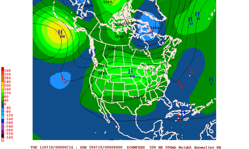
ROCK wrote:Loius do we post model runs for this system here?


Yes,models runs for this here :)
0 likes   
Visit the Caribbean-Central America Weather Thread where you can find at first post web cams,radars
and observations from Caribbean basin members Click Here

User avatar
ROCK
Category 5
Category 5
Posts: 9484
Age: 54
Joined: Tue Aug 17, 2004 7:30 am
Location: Kemah, Texas

Re: Posible development on either side of Centralamerica?

#7 Postby ROCK » Sun Jul 10, 2011 10:31 am

http://www.nco.ncep.noaa.gov/pmb/nwprod ... n_312l.gif


06Z GFS (long range) seems to think a little further up the MX coast than Arlene but weaker than some prior runs and on this side of CA.....

http://www.nco.ncep.noaa.gov/pmb/nwprod ... n_312l.gif
0 likes   

User avatar
cycloneye
Admin
Admin
Posts: 145452
Age: 68
Joined: Thu Oct 10, 2002 10:54 am
Location: San Juan, Puerto Rico

Re: Posible development on either side of Centralamerica?

#8 Postby cycloneye » Sun Jul 10, 2011 10:48 am

Discussion at 16:05 UTC for EPAC.

Marcocane,it looks very omminous for you over there in terms of the rainfall if all pans out as the models paint in the runs.

LOOKING AHEAD...A TROPICAL WAVE IN THE CENTRAL CARIBBEAN WILL
MOVE INTO THE W CARIBBEAN THROUGH TUE. THE MONSOON TROUGH IS
EXPECTED TO SHIFT NORTHWARD IN RESPONSE TO THE TROPICAL WAVE AND
EXTEND FROM SOUTHERN MEXICO ACROSS CENTRAL AMERICA BY MIDWEEK.
THE MONSOON TROUGH WILL BECOME CONSIDERABLY STRONGER MON THROUGH
WED. A SURGE OF SW MONSOONAL FLOW WILL COMMENCE BY MONDAY
MORNING FROM 03N TO 07N BETWEEN 85W AND 100W WITH FRESH TO
STRONG WINDS EXPECTED. THE PERSISTENT FRESH TO STRONG SW
MONSOONAL FLOW WILL ALLOW SEAS TO BUILD TO 10-12 FT BY MON NIGHT
AND UP TO 13 FT BY TUE NIGHT OVER THE E PART OF THE AREA. MARINE
GUIDANCE SUGGESTS INCREASING WINDS TO 30 KT SOUTH OF COSTA RICA
AND PANAMA BY THU. PERSISTENT STRONG SW MONSOONAL FLOW WILL
BRING ABUNDANT TROPICAL MOISTURE INTO CENTRAL AMERICA. THIS
WEATHER PATTERN MAY ENHANCE HEAVY RAINFALL OVER PORTIONS OF
CENTRAL AMERICA AND SOUTHERN MEXICO THE LATTER HALF OF THE WEEK.

http://www.nhc.noaa.gov/text/refresh/MI ... 1527.shtml?
0 likes   
Visit the Caribbean-Central America Weather Thread where you can find at first post web cams,radars
and observations from Caribbean basin members Click Here

User avatar
Rgv20
S2K Supporter
S2K Supporter
Posts: 2466
Age: 39
Joined: Wed Jan 05, 2011 5:42 pm
Location: Edinburg/McAllen Tx

#9 Postby Rgv20 » Sun Jul 10, 2011 11:43 am

The first threat out of this is going to be very heavy rainfall for our friend Marcocane in El Salvador but especially more for Southern Mexico.

Forecast rainfall thru 5 days by the 6zGFS.
Image

Forecast 500mb anomalies by the 0zGFS Ensembles. Those negative numbers in southern Mexico represent the lowering of heights which implies a release of heat in the form of very heavy rain.
Image
0 likes   
The following post is NOT an official forecast and should not be used as such. It is just the opinion of the poster and may or may not be backed by sound meteorological data. It is NOT endorsed by any professional institution including storm2k.org For Official Information please refer to the NHC and NWS products.

User avatar
South Texas Storms
Professional-Met
Professional-Met
Posts: 4227
Joined: Thu Jun 24, 2010 12:28 am
Location: Houston, TX

Re: Posible development on either side of Centralamerica?

#10 Postby South Texas Storms » Sun Jul 10, 2011 11:44 am

6z GFS is back at it again! I really hope this run verifies as the GFS shows maybe a tropical depression hitting just south of Brownsville but spreads copious amounts of moisture/rainfall to all of south Texas. Widespread 1-4 would be awesome here and I hope you don't get too much rain down there in Central America Macrocane! Please spread some of the wealth up here with your drought stricken Texas friends! :D
0 likes   

User avatar
South Texas Storms
Professional-Met
Professional-Met
Posts: 4227
Joined: Thu Jun 24, 2010 12:28 am
Location: Houston, TX

Re: Posible development on either side of Centralamerica?

#11 Postby South Texas Storms » Sun Jul 10, 2011 11:46 am

Rgv do you think some of this tropical moisture will spread northward and give us some very beneficial rain in the next few weeks? Or is it still too far out to tell? I really hope the 6z GFS run verifies for us!
0 likes   

User avatar
Ivanhater
Storm2k Moderator
Storm2k Moderator
Posts: 11162
Age: 38
Joined: Fri Jul 01, 2005 8:25 am
Location: Pensacola

Re: Posible development on either side of Centralamerica?

#12 Postby Ivanhater » Sun Jul 10, 2011 11:48 am

12z GFS

Image
0 likes   
Michael

User avatar
cycloneye
Admin
Admin
Posts: 145452
Age: 68
Joined: Thu Oct 10, 2002 10:54 am
Location: San Juan, Puerto Rico

Re: Posible development on either side of Centralamerica?

#13 Postby cycloneye » Sun Jul 10, 2011 11:51 am

Michael,before that timeframe,at 192 hours,it shows two different cyclones,one in the EPAC and the other just east of Nicaragua.

Image
0 likes   
Visit the Caribbean-Central America Weather Thread where you can find at first post web cams,radars
and observations from Caribbean basin members Click Here

User avatar
South Texas Storms
Professional-Met
Professional-Met
Posts: 4227
Joined: Thu Jun 24, 2010 12:28 am
Location: Houston, TX

Re: Posible development on either side of Centralamerica?

#14 Postby South Texas Storms » Sun Jul 10, 2011 11:52 am

:uarrow:

Wow is that even possible? Can 2 cyclones be that close to each other?
0 likes   

User avatar
Ivanhater
Storm2k Moderator
Storm2k Moderator
Posts: 11162
Age: 38
Joined: Fri Jul 01, 2005 8:25 am
Location: Pensacola

Re: Posible development on either side of Centralamerica?

#15 Postby Ivanhater » Sun Jul 10, 2011 11:53 am

Yeah Luis...a very messy situation...looks like next week we may have a hard time locating where something might try to spin up over this large area. Flooding looks to be a major concern...
0 likes   
Michael

User avatar
Rgv20
S2K Supporter
S2K Supporter
Posts: 2466
Age: 39
Joined: Wed Jan 05, 2011 5:42 pm
Location: Edinburg/McAllen Tx

Re: Posible development on either side of Centralamerica?

#16 Postby Rgv20 » Sun Jul 10, 2011 12:00 pm

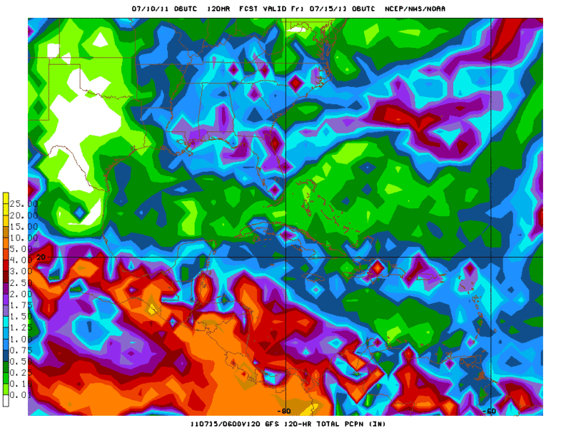
South Texas Storms wrote:Rgv do you think some of this tropical moisture will spread northward and give us some very beneficial rain in the next few weeks? Or is it still too far out to tell? I really hope the 6z GFS run verifies for us!


It is way way to early to tell but the 6z GFS was alone on that idea.

At 216hrs 6zGFS showed a weakness over Florida and that would help what ever it may form in the Caribbean to gain some latitude.
Image

At the same time 6zGFS Ensembles shows no such weakness.
Image

And finally neither does the 0zECMWF Ensembles.
Image

Hopefully their is enough of a weakness so some of the tropical moisture can go northward and give us some rain :lol:
0 likes   
The following post is NOT an official forecast and should not be used as such. It is just the opinion of the poster and may or may not be backed by sound meteorological data. It is NOT endorsed by any professional institution including storm2k.org For Official Information please refer to the NHC and NWS products.

User avatar
cycloneye
Admin
Admin
Posts: 145452
Age: 68
Joined: Thu Oct 10, 2002 10:54 am
Location: San Juan, Puerto Rico

Re: Posible development on either side of Centralamerica?

#17 Postby cycloneye » Sun Jul 10, 2011 12:35 pm

12z NOGAPS on day 7.

Image

12z CMC at 138 hours.

Image

Will the ECMWF join the other models soon?
0 likes   
Visit the Caribbean-Central America Weather Thread where you can find at first post web cams,radars
and observations from Caribbean basin members Click Here

User avatar
Macrocane
Category 5
Category 5
Posts: 4218
Age: 36
Joined: Sun May 24, 2009 5:35 pm
Location: El Salvador

Re: Posible development on either side of Centralamerica?

#18 Postby Macrocane » Sun Jul 10, 2011 1:33 pm

Thanks for the good wishes guys, I don't remember having so much rain for so long, usually tropical cyclones produce heavy rains in Central America for 3 to 5 days but according to the models we could have very heavy rains for almost 10 days! :eek: As you've said it would be better less rain for us and more for Texas. I will keep you updated.
0 likes   

User avatar
Macrocane
Category 5
Category 5
Posts: 4218
Age: 36
Joined: Sun May 24, 2009 5:35 pm
Location: El Salvador

Re: Posible development on either side of Centralamerica?

#19 Postby Macrocane » Sun Jul 10, 2011 1:46 pm

From the latest Atlantic TWD:

SOMETHING TO KEEP IN MIND...THE MONSOON TROUGH IN THE NORTHEAST
PACIFIC IS EXPECTED TO SHIFT NORTHWARD WHERE IT IS FORECAST TO
EXTEND ACROSS SOUTHERN MEXICO AND CENTRAL AMERICA BY
WEDNESDAY...BECOMING CONSIDERABLY STRONGER BY THE END OF THIS
WEEK. IN RESPONSE TO THIS...ABUNDANT TROPICAL MOISTURE FROM THE
SOUTHWEST WINDS WILL ADVECT INTO CENTRAL AMERICA...POTENTIALLY
GENERATING AREAS OF HEAVY RAINFALL AND POSSIBLE MUDSLIDES OVER
PORTIONS OF CENTRAL AMERICA AND SOUTHERN MEXICO...ESPECIALLY FOR
THE SECOND HALF OF THIS WEEK.
FOR NOW...WE WILL CONTINUE
MONITORING MEDIUM RANGE FORECAST MODELS FOR CONSISTENCY ON THIS
POSSIBLE SCENARIO.
0 likes   

User avatar
Rgv20
S2K Supporter
S2K Supporter
Posts: 2466
Age: 39
Joined: Wed Jan 05, 2011 5:42 pm
Location: Edinburg/McAllen Tx

#20 Postby Rgv20 » Sun Jul 10, 2011 2:12 pm

The GFS Ensembles forecast for the MJO to at least hang around for the next two weeks.

Image
0 likes   
The following post is NOT an official forecast and should not be used as such. It is just the opinion of the poster and may or may not be backed by sound meteorological data. It is NOT endorsed by any professional institution including storm2k.org For Official Information please refer to the NHC and NWS products.


Return to “Talkin' Tropics”

Who is online

Users browsing this forum: Google Adsense [Bot], REDHurricane and 30 guests