ATL: EMILY - Remnants
Moderator: S2k Moderators

Re: ATL: EMILY - Tropical Storm - Discussion
I'm voting for poof. This has never gotten its act together. Of course, this is only my opinion. See the products of the NHC for accurate info. 
0 likes
-
Blown Away

- S2K Supporter

- Posts: 10253
- Joined: Wed May 26, 2004 6:17 am
Re: ATL: EMILY - Tropical Storm - Discussion
wxman57 wrote:Wind shear may be decreasing now. I think it'll clip western Haiti then go across more of eastern Cuba. May track a little west of Andros. Don't see anything to suggest eastern Gulf.
W of Andros VERY hard to miss Florida during recurve! Assuming anything is left.
0 likes
Hurricane Eye Experience: David 79, Irene 99, Frances 04, Jeanne 04, Wilma 05… Hurricane Brush Experience: Andrew 92, Erin 95, Floyd 99, Matthew 16, Irma 17, Ian 22, Nicole 22…
-
cycloneye

- Admin

- Posts: 149508
- Age: 69
- Joined: Thu Oct 10, 2002 10:54 am
- Location: San Juan, Puerto Rico
Re: ATL: EMILY - Recon Discussion
Lowest pressure was 1003.7 mbs.
0 likes
Visit the Caribbean-Central America Weather Thread where you can find at first post web cams,radars
and observations from Caribbean basin members Click Here
and observations from Caribbean basin members Click Here

Re: ATL: EMILY - Tropical Storm - Discussion
ronjon wrote:LLC is covered again by convection - some spiral banding starting to occur too. My eyes might be fooling me but the LLC seemed to jog W-NW the last hour or so.
http://rammb.cira.colostate.edu/ramsdis/online/loop_640.asp?product=tropical_ge_1km_center_relative_vis_floater
I thought I saw the same thing, could just be an optical illusion though.
Also could be because the circulation has opened up...we shall see what recon shows!
0 likes
Personal Forecast Disclaimer:
The posts in this forum are NOT official forecast and should not be used as such. They are just the opinion of the poster and may or may not be backed by sound meteorological data. They are NOT endorsed by any professional institution or storm2k.org. For official information, please refer to the NHC and NWS products
The posts in this forum are NOT official forecast and should not be used as such. They are just the opinion of the poster and may or may not be backed by sound meteorological data. They are NOT endorsed by any professional institution or storm2k.org. For official information, please refer to the NHC and NWS products

Re: ATL: EMILY - Tropical Storm - Discussion
I tend to go with history, if the majority of historical tracks say one way, I watch the models that are seeing the same thing. Yes synoptics are different with each storm, but patterns mean a lot as well.
UKMet (has been, now flip flopping) and CMC are seeing the same setup as the historical pattern.
UKMet (has been, now flip flopping) and CMC are seeing the same setup as the historical pattern.
Last edited by jdray on Wed Aug 03, 2011 1:37 pm, edited 1 time in total.
0 likes


0 likes
I am just an amateur and a "noob" at that so any speculations that I have made are just that, uneducated speculations. Please refer to the NHC for accurate information.
Thank you all for your thoughts, I've loved reading through this community since '06 and finally decided to post more actively.
-JJ
Thank you all for your thoughts, I've loved reading through this community since '06 and finally decided to post more actively.
-JJ
-
Canelaw99

- S2K Supporter
- Posts: 2128
- Age: 49
- Joined: Tue Aug 31, 2004 8:27 am
- Location: Homestead, FL
Re: ATL: EMILY - Tropical Storm - Discussion
Clint_TX wrote:Gotta keep an eye on all of them....a little history of Andrew:
Satellite images suggest that Andrew produced deep convection only sporadically for several days, mainly in several bursts of about 12 hours duration. Also, the deep convection did not persist. Instead, it was stripped away from the low-level circulation by the strong southwesterly flow at upper levels. Air Force Reserve unit reconnaissance aircraft investigated Andrew and, on the 20th, found that the cyclone had degenerated to the extent that only a diffuse low-level circulation center remained. Andrew's central pressure rose considerably (Fig. 2 [87K GIF]). Nevertheless, the flight-level data indicated that Andrew retained a vigorous circulation aloft. Wind speeds near 70 kt were measured at an altitude of 1500 ft near a convective band lying to the northeast of the low-level center. Hence, Andrew is estimated on 20 August to have been a tropical storm with 40 kt surface winds and an astonishingly high central pressure of 1015 mb (Figs. 2 and 3 [87K GIF]).
From TPC
Wow....amazing how that situation changed, and definitely hoping this one doesn't LOL Thanks for that....
0 likes
-
cycloneye
- Admin
- Posts: 149508
- Age: 69
- Joined: Thu Oct 10, 2002 10:54 am
- Location: San Juan, Puerto Rico
Re: ATL: EMILY - Tropical Storm - Discussion
Lowest pressure was 1003.7 mbs.
0 likes
Visit the Caribbean-Central America Weather Thread where you can find at first post web cams,radars
and observations from Caribbean basin members Click Here
and observations from Caribbean basin members Click Here
Re: ATL: EMILY - Tropical Storm - Discussion
I am still having a hard time seeing this go NW?
1) it's moving at a good clip 14mph and is shallow ATTM
2)the digging trof and Emily are seperated by 600miles and the trof looks to be slowing on the dig.
3)one can see the upper levels feeling the trof @68W 23N behind Emily on this WV loop set for 24hrs
http://mapcenter.hamweather.com/satelli ... ?s=800x600
0 likes
Looks like the center is about 16.75N at the moment.
0 likes
Personal Forecast Disclaimer:
The posts in this forum are NOT official forecast and should not be used as such. They are just the opinion of the poster and may or may not be backed by sound meteorological data. They are NOT endorsed by any professional institution or storm2k.org. For official information, please refer to the NHC and NWS products
The posts in this forum are NOT official forecast and should not be used as such. They are just the opinion of the poster and may or may not be backed by sound meteorological data. They are NOT endorsed by any professional institution or storm2k.org. For official information, please refer to the NHC and NWS products
-
Weatherboy1

- Category 5

- Posts: 1190
- Age: 50
- Joined: Mon Jul 05, 2004 1:50 pm
- Location: Jupiter/Sarasota, FL
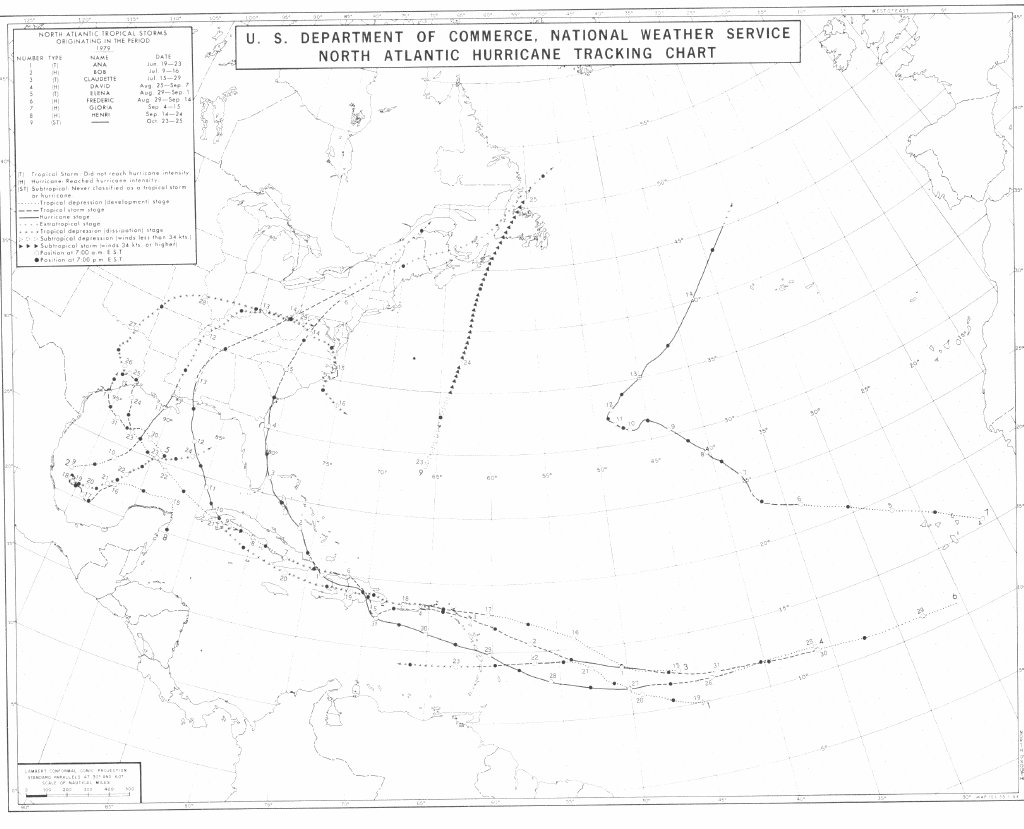
Again, the best thing Emily has going for her is the fact she won't be doing battle with the mountains of the DR/Haiti. That's a big difference from what we all expected 24-36 hours ago. Wonder if she's not due for a "1979 David" type track after she clears the island. Looks pretty close.
http://www.nhc.noaa.gov/tracks/1979atl.gif
http://www.nhc.noaa.gov/tracks/1979atl.gif
0 likes
-
Hurricaneman

- Category 5
- Posts: 7404
- Age: 45
- Joined: Tue Aug 31, 2004 3:24 pm
- Location: central florida
Re: ATL: EMILY - Tropical Storm - Discussion
is it me or does it look like the midlevel center look like its catching the surface center at the moment
The posts in this forum are NOT official forecast and should not be used as such. They are just the opinion of the poster and may or may not be backed by sound meteorological data. They are NOT endorsed by any professional institution or storm2k.org. For official information, please refer to the NHC and NWS products.
The posts in this forum are NOT official forecast and should not be used as such. They are just the opinion of the poster and may or may not be backed by sound meteorological data. They are NOT endorsed by any professional institution or storm2k.org. For official information, please refer to the NHC and NWS products.
0 likes
-
Blown Away
- S2K Supporter
- Posts: 10253
- Joined: Wed May 26, 2004 6:17 am
Re: ATL: EMILY - Models
0 likes
Hurricane Eye Experience: David 79, Irene 99, Frances 04, Jeanne 04, Wilma 05… Hurricane Brush Experience: Andrew 92, Erin 95, Floyd 99, Matthew 16, Irma 17, Ian 22, Nicole 22…
-
SouthDadeFish

- Professional-Met

- Posts: 2835
- Joined: Thu Sep 23, 2010 2:54 pm
- Location: Miami, FL
- Contact:
Re: ATL: EMILY - Tropical Storm - Discussion
KWT wrote:ronjon wrote:LLC is covered again by convection - some spiral banding starting to occur too. My eyes might be fooling me but the LLC seemed to jog W-NW the last hour or so.
http://rammb.cira.colostate.edu/ramsdis/online/loop_640.asp?product=tropical_ge_1km_center_relative_vis_floater
I thought I saw the same thing, could just be an optical illusion though.
Also could be because the circulation has opened up...we shall see what recon shows!
the circulation has not opened up. In fact recon data has shown that is as defined as it has ever been. Perfect wind shifts. You may have gotten confused because they did a loop in in the center, in which they found a minimum pressure of 1003.2mb
0 likes
Re: Re:
Blown Away wrote:gatorcane wrote:Looking at the models graphic above, what looks to be happening is that you have models splitting into two camps. In the one camp, they send a remnant circulation or very weak, shallow system through Cuba and through the FL Straits into the GOM.
In the other camp, the models keep the system vertically stacked enough so that it feels the weakness, turns north and then eventually northeast through the Bahamas east of Florida.
Emily remains shallow and continues more W, but the more W she goes before vertically stacking will cause the recurve bend down the road to shift more W, just like we are seeing. If Emily ends up going W of Andros going to be hard not to scrape WPB on her way N.
Yup, she will recurve if she stays a storm, but where does she recurve at? She keeps trudging west, so the recurve is going to be more west as well.
0 likes

Re: ATL: EMILY - Tropical Storm - Discussion
Should start to see afternoon convection fire up over Haiti anytime now.
That will help to moisten the mid-level dry air to the NW of Emily.
That will help to moisten the mid-level dry air to the NW of Emily.
0 likes

Re: ATL: EMILY - Models
12z GFDL and HWRF out - same track for GFDL and slightly further east on HWRF off the FL east coast then the 06z run. Here's the 06z NOAA HWRF 3 kn run.
http://moe.met.fsu.edu/cgi-bin/hwrf-noaahfiptc2.cgi?time=2011080306-emily05l&field=Sea+Level+Pressure&hour=Animation
http://moe.met.fsu.edu/cgi-bin/hwrf-noaahfiptc2.cgi?time=2011080306-emily05l&field=Sea+Level+Pressure&hour=Animation
0 likes
Yep just an illusion of the convection developing again SDF.
Recon does show a good wind shift, it was abit south of where I was thinking, indeed still on a solid 275 track from the looks of things...
Looks like she keeps on trucking westwards, going to be end up outside the NHC cone for say 24hrs ago at this rate!
Recon does show a good wind shift, it was abit south of where I was thinking, indeed still on a solid 275 track from the looks of things...
Looks like she keeps on trucking westwards, going to be end up outside the NHC cone for say 24hrs ago at this rate!
0 likes
Personal Forecast Disclaimer:
The posts in this forum are NOT official forecast and should not be used as such. They are just the opinion of the poster and may or may not be backed by sound meteorological data. They are NOT endorsed by any professional institution or storm2k.org. For official information, please refer to the NHC and NWS products
The posts in this forum are NOT official forecast and should not be used as such. They are just the opinion of the poster and may or may not be backed by sound meteorological data. They are NOT endorsed by any professional institution or storm2k.org. For official information, please refer to the NHC and NWS products
000
URNT15 KNHC 031840
AF306 0805A EMILY HDOB 14 20110803
183030 1623N 07001W 8437 01537 0068 +180 +100 216021 022 032 000 00
183100 1622N 07000W 8437 01540 0069 +179 +099 215020 021 032 001 00
183130 1621N 06959W 8434 01543 0068 +182 +097 213021 021 028 000 00
183200 1619N 06958W 8436 01541 0067 +183 +096 217018 019 030 000 00
183230 1618N 06957W 8436 01542 0068 +182 +096 220018 018 029 000 00
183300 1617N 06955W 8436 01544 0072 +180 +098 217018 019 029 000 00
183330 1616N 06954W 8436 01543 0072 +180 +099 216019 020 029 000 00
183400 1615N 06953W 8436 01544 0072 +180 +099 212022 023 031 000 00
183430 1614N 06952W 8436 01545 0074 +175 +100 206023 024 030 000 00
183500 1613N 06950W 8437 01542 0075 +175 +099 209025 026 029 000 00
183530 1612N 06949W 8436 01545 0075 +175 +099 212025 025 028 000 00
183600 1610N 06948W 8434 01546 0075 +176 +099 212024 025 028 000 00
183630 1609N 06947W 8435 01547 0077 +176 +100 207025 025 027 000 03
183700 1608N 06946W 8436 01547 0077 +177 +099 204026 027 027 000 00
183730 1607N 06945W 8436 01548 0077 +178 +099 206027 028 027 001 00
183800 1606N 06943W 8438 01545 0081 +175 +099 206028 028 030 003 00
183830 1605N 06942W 8436 01550 0083 +174 +099 202028 029 034 003 00
183900 1604N 06941W 8437 01549 0084 +171 +098 196028 028 036 005 00
183930 1603N 06940W 8432 01557 0093 +159 +098 202028 029 036 016 00
184000 1602N 06939W 8437 01548 0090 +164 +095 202026 027 040 014 00
$$
;
0 likes
I am just an amateur and a "noob" at that so any speculations that I have made are just that, uneducated speculations. Please refer to the NHC for accurate information.
Thank you all for your thoughts, I've loved reading through this community since '06 and finally decided to post more actively.
-JJ
Thank you all for your thoughts, I've loved reading through this community since '06 and finally decided to post more actively.
-JJ
-
UpTheCreek

- Category 1

- Posts: 397
- Age: 62
- Joined: Tue Aug 31, 2004 5:28 pm
- Location: Vassalboro, Maine
Re: ATL: EMILY - Models
ronjon wrote:12z GFDL and HWRF out - same track for GFDL and slightly further east on HWRF off the FL east coast then the 06z run. Here's the 06z NOAA HWRF 3 kn run.
http://moe.met.fsu.edu/cgi-bin/hwrf-noaahfiptc2.cgi?time=2011080306-emily05l&field=Sea+Level+Pressure&hour=Animation
Yikes, that'd be a messy one for the whole southeast coast, including eastern NC!!!
0 likes
Who is online
Users browsing this forum: No registered users and 69 guests