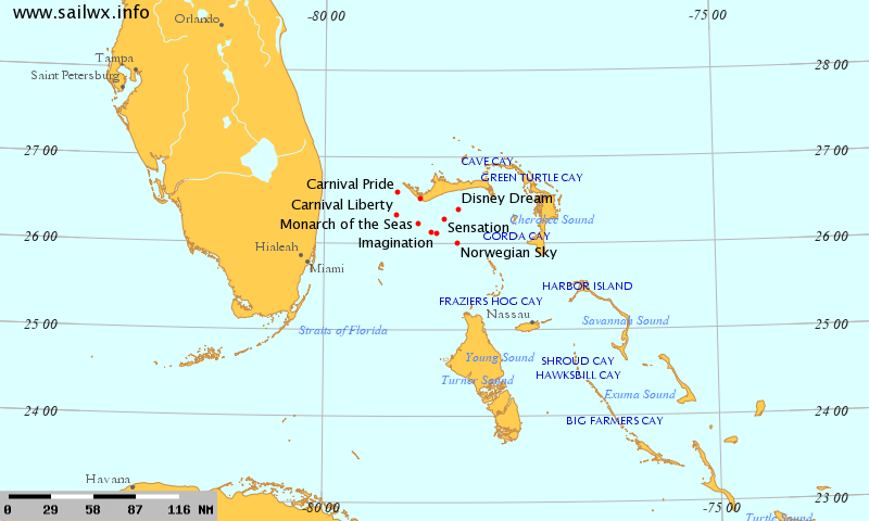
wxman57 wrote:I can see a weak low center about 90 miles due east of Miami
Good news. Keeps the interest going a bit longer. Thanks for the info.
Moderator: S2k Moderators
wxman57 wrote:I can see a weak low center about 90 miles due east of Miami


Code: Select all
WHXX01 KWBC 061229
CHGHUR
TROPICAL CYCLONE GUIDANCE MESSAGE
NWS NATIONAL HURRICANE CENTER MIAMI FL
1229 UTC SAT AUG 6 2011

DISCLAIMER...NUMERICAL MODELS ARE SUBJECT TO LARGE ERRORS.
PLEASE REFER TO NHC OFFICIAL FORECASTS FOR TROPICAL CYCLONE
AND SUBTROPICAL CYCLONE INFORMATION.

ATLANTIC OBJECTIVE AIDS FOR

DISTURBANCE EMILY (AL052011) 20110806 1200 UTC

        ...00 HRS...   ...12 HRS...   ...24 HRS. ..   ...36 HRS...
        110806  1200   110807  0000   110807  1200   110808  0000

         LAT    LON     LAT    LON     LAT    LON     LAT    LON
BAMS    25.6N  78.0W   27.6N  78.4W   29.1N  77.9W   30.4N  75.5W
BAMD    25.6N  78.0W   26.8N  79.0W   27.9N  79.4W   28.7N  79.0W
BAMM    25.6N  78.0W   27.1N  78.8W   28.4N  78.9W   29.4N  77.5W
LBAR    25.6N  78.0W   27.1N  78.8W   28.5N  79.0W   29.5N  78.5W
SHIP        30KTS          31KTS          34KTS          38KTS
DSHP        30KTS          31KTS          34KTS          38KTS

        ...48 HRS...   ...72 HRS...   ...96 HRS. ..   ..120 HRS...
        110808  1200   110809  1200   110810  1200   110811  1200

         LAT    LON     LAT    LON     LAT    LON     LAT    LON
BAMS    31.1N  71.8W   31.2N  60.7W   30.3N  51.7W   31.6N  46.2W
BAMD    29.2N  78.0W   30.4N  74.2W   32.5N  67.8W   35.1N  59.6W
BAMM    29.9N  75.2W   30.5N  67.8W   30.3N  60.5W   29.0N  57.2W
LBAR    30.5N  76.6W   31.8N  70.4W   33.4N  63.6W   36.3N  56.7W
SHIP        42KTS          49KTS          55KTS          52KTS
DSHP        42KTS          49KTS          55KTS          52KTS

         ...INITIAL CONDITIONS...
LATCUR =  25.6N LONCUR =  78.0W DIRCUR = 340DEG SPDCUR =  10KT
LATM12 =  23.7N LONM12 =  77.5W DIRM12 = 336DEG SPDM12 =  10KT
LATM24 =  21.9N LONM24 =  76.1W
WNDCUR =   30KT RMAXWD =   60NM WNDM12 =   30KT
CENPRS = 1011MB OUTPRS = 1013MB OUTRAD =  100NM SDEPTH =   M
RD34NE =    0NM RD34SE =    0NM RD34SW =    0NM RD34NW =   0NM
wxman57 wrote:I can see a weak low center about 90 miles due east of Miami near 25.5N/78.2W, which is about 30 miles NW of Andros Island. Very, very weak rotation evident in surface obs, less than 10 kts. It's moving northward just as forecast. Most squalls should pass east of Florida today. It will turn out to sea to the NE tomorrow.
cycloneye wrote:12z Best Track
AL, 05, 2011080612, , BEST, 0, 256N, 780W, 30, 1011, LO
ftp://ftp.tpc.ncep.noaa.gov/atcf/tcweb/ ... 011.invest
robbielyn wrote:wnw motion 79w and 23.9n way actually looks west now if this cont. it could get into the gulf its nt headed towards miami not yet but if steering currents change then it could still go east i guess.
Ok well i guess i was talking about the mlc vs the llc. man sometimes i get them confused when looking at them. how does one tell by looking at vis what is mlc vs llc? please educate me. thank you


boca wrote:We wont even get a rainshower out of this storm here in S Florida,its amazing how close it is and we wont get affected by her.
KWT wrote:You can see Wxman57's position of the low very neatly on the hugh resolution, its very easy to spot, on the northern part of the convection.


cpdaman wrote:cycloneye wrote:12z Best Track
AL, 05, 2011080612, , BEST, 0, 256N, 780W, 30, 1011, LO
ftp://ftp.tpc.ncep.noaa.gov/atcf/tcweb/ ... 011.invest
and look at the previous co-ordinates. this thing just turned DUE North and is following the wx forecast


NDG wrote:Zoomed radar loop, 130 miles E of Miami.
http://vortex.plymouth.edu/gifs/AMX.N0Z ... .35_an.gif

tailgater wrote:cpdaman wrote:cycloneye wrote:12z Best Track
AL, 05, 2011080612, , BEST, 0, 256N, 780W, 30, 1011, LO
ftp://ftp.tpc.ncep.noaa.gov/atcf/tcweb/ ... 011.invest
and look at the previous co-ordinates. this thing just turned DUE North and is following the wx forecast
I personally don't think they had found a definite low center, this one looks like it might dominate but there are still a few other swirls out there.
The one east of Maimi I've been watching most of the morning and it's motion has been SSW abiet very slowly, watch the loop of about 4 or 5 hours.
http://weather.rap.ucar.edu/radar/displ ... duration=5
Users browsing this forum: No registered users and 13 guests