C/S TX Weather: Seasonal with some rains
Moderator: S2k Moderators
Forum rules

The posts in this forum are NOT official forecast and should not be used as such. They are just the opinion of the poster and may or may not be backed by sound meteorological data. They are NOT endorsed by any professional institution or STORM2K.

Re:
somethingfunny wrote:I've had enough.

We all have. I've lived in Texas all my life, but this is ridiculous. If this really is going to become the norm for summer as some are predicting, I think I'll look to relocate after I graduate.
0 likes
-
Portastorm

- Storm2k Moderator

- Posts: 9954
- Age: 63
- Joined: Fri Jul 11, 2003 9:16 am
- Location: Round Rock, TX
- Contact:
Re: C/SC TX Weather: Frying Pan Summer
I don't believe it! I just don't believe it!! 
Excerpts from:
AREA FORECAST DISCUSSION
NATIONAL WEATHER SERVICE AUSTIN/SAN ANTONIO TX
334 PM CDT WED AUG 10 2011
.DISCUSSION...
THE BETTER RAIN CHANCES SHOULD KICK IN WHEN A WEAK MID-LEVEL
DISTURBANCE DROPS SOUTH FROM THE TX/OK BORDER INTO WEST CENTRAL TX
THURSDAY AFTERNOON. THE CONTINUED PRESENCE OF DEEP MOISTURE OVER
THE SOUTHERN EDWARDS PLATEAU AND THE CONTINUED NEAR TRIPLE DIGIT
HEAT SHOULD PROMOTE AGRESSIVE THUNDERSTORM GROWTH WITH ACTIVITY
EXPECTED TO PERSIST THROUGH THE NIGHT.
WHILE MODEL QPF AND WIND FIELDS ONLY SUGGEST A SMALL
COMPLEX OF STORMS DEVELOPING...THE LOW LEVEL CONVERGENCE AND PWAT
VALUES OVER 2 INCHES SHOULD SUPPORT A FEW STORM CLUSTERS PRODUCING
SPOTTY 2-4 INCH RAINFALL TOTALS...MAINLY WEST OF A LLANO TO EAGLE
PASS LINE. THE NEWLY ARRIVED 18Z NAM SHOWS AN EVER GROWING
POTENTIAL FOR HEAVY RAINFALL WITH A SLIGHT EASTWARD TREND WITH
EACH RUN. THUS THERE IS SOME HOPE THAT THIS RAIN EVENT WILL AFFECT
PORTIONS OF THE METRO CITIES.
AS TO BE EXPECTED...HIGH TEMPS
SHOULD BE EXPECTED TO MODERATE BACK TO MORE SEASONAL VALUES...
ESPECIALLY FOR THE HILL COUNTRY. MORE INTRIGUING IS THAT THE 18Z
NAM CONTINUES LINGERING EFFECTS OF THE MID LEVEL DISTURBANCE INTO
THE DAYTIME FRIDAY. THUS THE EVENING SHIFT WILL BE BRIEFED TO
CONSIDER FURTHER RAIN CHANCE INCREASES FOR THURSDAY NIGHT AND
FRIDAY.
BEYOND FRIDAY...THE MODEL CONSENSUS ROTATES THE MID LEVEL
DISTURBANCE SOUTHWARD TO MEXICO AND RETURNS THE POTENTIAL FOR
MORE TRIPLE DIGIT HEAT. LOW TO NIL POPS AND HOT TEMPERATURES ROUND
OUT THE EXTENDED PERIODS...BUT THE MODEL DATA CONTINUES TO SHOW
HINTS OF WEAKNESSES IN THE UPPER RIDGE AFTER IT ATTEMPTS TO
MAINTAIN CONTROL OVER THE AREA OVER THE WEEKEND.
LOST IN THE EXCITEMENT OVER A REAL CHANCE OF RAIN IS THE ONGOING
HEAT ADVY WHICH CONTINUES THROUGH THURSDAY EVENING. THE HOT AND
MUGGY CONDITIONS WILL CONTINUE EAST OF I-35...AND SO LATER SHIFTS
MAY NEED TO CONSIDER EXTENDING THE HEAT ADVISORY INTO THE
WEEKEND...ESPECIALLY OF THE CLOUD DEBRIS FROM THE CONVECTION TO
THE WEST DOES NOT EXPAND EAST.
0 likes
Any forecasts under my name are to be taken with a grain of salt. Get your best forecasts from the National Weather Service and National Hurricane Center.
-
South Texas Storms

- Professional-Met

- Posts: 4256
- Joined: Thu Jun 24, 2010 12:28 am
- Location: Houston, TX
Re: C/SC TX Weather: Frying Pan Summer
Porta, you beat me to it! We finally have some hope for rain! I'm cautiously optimistic/excited!
0 likes
-
Portastorm
- Storm2k Moderator
- Posts: 9954
- Age: 63
- Joined: Fri Jul 11, 2003 9:16 am
- Location: Round Rock, TX
- Contact:
Re: C/SC TX Weather: Frying Pan Summer
South Texas Storms wrote:Porta, you beat me to it! We finally have some hope for rain! I'm cautiously optimistic/excited!
Can you believe it, man?! I want to ... but this death ridge has been unbeatable.
How cool would it be to have a large mesoscale system out west roll east-southeast and rain itself out over the Austin-San Antonio corridor?!
0 likes
Any forecasts under my name are to be taken with a grain of salt. Get your best forecasts from the National Weather Service and National Hurricane Center.
-
South Texas Storms
- Professional-Met
- Posts: 4256
- Joined: Thu Jun 24, 2010 12:28 am
- Location: Houston, TX
Re: C/SC TX Weather: Frying Pan Summer
Yeah, that would be perfect! I'm even more excited now as our local met here in SA just said he thinks that there is a good chance of that happening tomorrow night!
I'm really hopeful!
I'm really hopeful!
0 likes
-
Kory
- Tropical Storm

- Posts: 200
- Age: 30
- Joined: Tue Aug 02, 2011 11:32 am
- Location: New Orleans, Louisiana
I wouldn't get to excited...the QPF is less than a tenth of an inch. The SREF model, used for mesoscale type systems, shows a weakening mesoscale system moving into South Central Texas.
Last edited by Kory on Wed Aug 10, 2011 6:28 pm, edited 1 time in total.
0 likes

-
vbhoutex

- Storm2k Executive

- Posts: 29143
- Age: 74
- Joined: Wed Oct 09, 2002 11:31 pm
- Location: Cypress, TX
- Contact:
Re: C/SC TX Weather: Frying Pan Summer
Portastorm wrote:South Texas Storms wrote:Porta, you beat me to it! We finally have some hope for rain! I'm cautiously optimistic/excited!
Can you believe it, man?! I want to ... but this death ridge has been unbeatable.
How cool would it be to have a large mesoscale system out west roll east-southeast and rain itself out over the Austin-San Antonio corridor?!
Gee, thanks for caring about your friends in SE TX!
0 likes
Skywarn, C.E.R.T.
Please click below to donate to STORM2K to help with the expenses of keeping the site going:

Please click below to donate to STORM2K to help with the expenses of keeping the site going:
-
Portastorm
- Storm2k Moderator
- Posts: 9954
- Age: 63
- Joined: Fri Jul 11, 2003 9:16 am
- Location: Round Rock, TX
- Contact:
Re: C/SC TX Weather: Frying Pan Summer
vbhoutex wrote:Portastorm wrote:South Texas Storms wrote:Porta, you beat me to it! We finally have some hope for rain! I'm cautiously optimistic/excited!
Can you believe it, man?! I want to ... but this death ridge has been unbeatable.
How cool would it be to have a large mesoscale system out west roll east-southeast and rain itself out over the Austin-San Antonio corridor?!
Gee, thanks for caring about your friends in SE TX!
Darn it ... somehow the sentence "But then it would re-generate east of us and pour on our friends in SE Texas" was deleted from my post. Not sure how that happened!
0 likes
Any forecasts under my name are to be taken with a grain of salt. Get your best forecasts from the National Weather Service and National Hurricane Center.
-
somethingfunny

- ChatStaff

- Posts: 3926
- Age: 37
- Joined: Thu May 31, 2007 10:30 pm
- Location: McKinney, Texas
Re: C/SC TX Weather: Frying Pan Summer
omgomgomgomgomgomgomgomgomgomgomgomgomgomgomgomgomgomgomgomgomgomgomgomgomg

OMGOMGOMGOMGOMGOMGOMGOMGOMGOMGOMGOMGOMGOMGOMGOMGOMGOMGOMGOMGOMG
Oklahoma City, Will Rogers World Airport
Lat: 35.41 Lon: -97.6 Elev: 1280
Last Update on Aug 11, 10:52 am CDT
Thunderstorm Light Rain
69 °F
(21 °C)
Humidity: 87 %
Wind Speed: NE 14 G 18 MPH
Barometer: 29.98" (1013.9 mb)
Dewpoint: 65 °F (18 °C)
Visibility: 7.00 mi.
OMGOMGOMGOMGOMGOMGOMGOMGOMGOMGOMGOMGOMGOMGOMGOMGOMGOMGOMGOMGOMG
0 likes
I am not a meteorologist, and any posts made by me are not official forecasts or to be interpreted as being intelligent. These posts are just my opinions and are probably silly opinions.

Dallas' heat streak could be in jeopardy today! That outflow boundary is nice lookin 1 day shy of the record! If not today tomorrow is a close call too! Holy!
0 likes
The above post and any post by Ntxw is NOT an official forecast and should not be used as such. It is just the opinion of the poster and may or may not be backed by sound meteorological data. It is NOT endorsed by any professional institution including Storm2k. For official information, please refer to NWS products.
Help support Storm2K!
-
Tireman4

- S2K Supporter

- Posts: 5903
- Age: 60
- Joined: Fri Jun 30, 2006 1:08 pm
- Location: Humble, Texas
- Contact:
Re:
Ntxw wrote:Dallas' heat streak could be in jeopardy today! That outflow boundary is nice lookin
It is time to get the Grey Goose chilling Ntxw...you all need a break. A serious break. We, on the other hand, are cursed. I am thinking we will be the record of 14 straight 100 degree days set back in July 1980 ( and I remember that. That was a rough year. I was mowing the two acres we had...still have, with a push mower and it got up to 104. My mother comes out screaming, "get yourself inside, do you want to die. I was 15 and was in my own world. The heat did not even phase me. Now, I die getting into the car. LOL)
0 likes
-
somethingfunny
- ChatStaff
- Posts: 3926
- Age: 37
- Joined: Thu May 31, 2007 10:30 pm
- Location: McKinney, Texas
Re: C/SC TX Weather: Frying Pan Summer
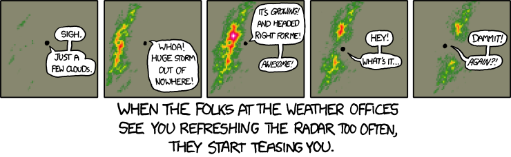
This is me right now:
That streak is going to cut it really close. Gust front looks to be about 2 hours away from KDFW, which just hit 95 at 12:53.
That streak is going to cut it really close. Gust front looks to be about 2 hours away from KDFW, which just hit 95 at 12:53.
0 likes
I am not a meteorologist, and any posts made by me are not official forecasts or to be interpreted as being intelligent. These posts are just my opinions and are probably silly opinions.
-
somethingfunny
- ChatStaff
- Posts: 3926
- Age: 37
- Joined: Thu May 31, 2007 10:30 pm
- Location: McKinney, Texas
Re: C/SC TX Weather: Frying Pan Summer
The streak is TOAST!!!!! 


And not a moment too soon:
And not a moment too soon:
Greatest Consecutive
Rank # of Days Dates
1 42 Jun 23 - Aug 3, 1980
2 40 Jul 2 - Aug 10, 2011 *
3 29 Jul 6 - Aug 3, 1998
0 likes
I am not a meteorologist, and any posts made by me are not official forecasts or to be interpreted as being intelligent. These posts are just my opinions and are probably silly opinions.
Return to “USA & Caribbean Weather”
Who is online
Users browsing this forum: No registered users and 137 guests