


under jam as a TW....nothing special about this run.....but we have had the GFS miss development all season so take it with a grain of salt....
Moderator: S2k Moderators
ROCK wrote:
under jam as a TW....nothing special about this run.....but we have had the GFS miss development all season so take it with a grain of salt....


rnmm wrote:Does anyone know what the 00Z CMC showed?
South Texas Storms wrote:Dang ROCK, you sure have been staying up late for the Euro with this system. That must mean you smell some trouble (or in our case, very welcomed drought relief) for Texas from 93L.
ROCK wrote:South Texas Storms wrote:Dang ROCK, you sure have been staying up late for the Euro with this system. That must mean you smell some trouble (or in our case, very welcomed drought relief) for Texas from 93L.
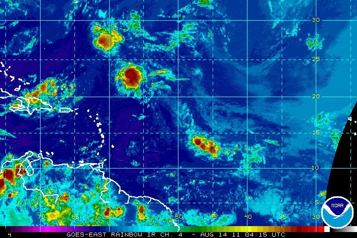
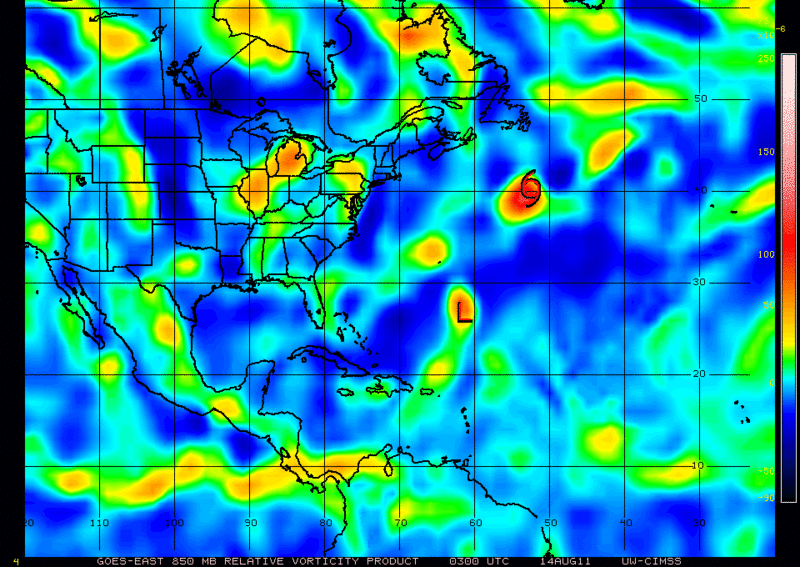
I have seen too many globals running a similar long range solution.....93L is passing 45W and entering a better environment, vort is increasing with convection. Our first few storms none of the globals latched on in the long range. Just being vigilant.....
South Texas Storms wrote:rnmm wrote:Does anyone know what the 00Z CMC showed?
I don't think it showed much tonight. I'm not 100% sure though.
South Texas Storms wrote:ROCK wrote:South Texas Storms wrote:Dang ROCK, you sure have been staying up late for the Euro with this system. That must mean you smell some trouble (or in our case, very welcomed drought relief) for Texas from 93L.
I have seen too many globals running a similar long range solution.....93L is passing 45W and entering a better environment, vort is increasing with convection. Our first few storms none of the globals latched on in the long range. Just being vigilant.....
Oh I agree completely. This is reminding me a lot of Don a few weeks ago. I think it has a good chance of suprising a lot of people when all is said and done.
rnmm wrote:South Texas Storms wrote:rnmm wrote:Does anyone know what the 00Z CMC showed?
I don't think it showed much tonight. I'm not 100% sure though.
Thank you!!
Users browsing this forum: No registered users and 30 guests
