NDG, it has been quite an interesting season thus far in the ATL basin. It seems that we are having several systems form either at or above 25 degrees laditude, while our deep tropical waves at the lower latitudes have struggled to maintain themselves. Plus, we still have not yet officially had our first hurricane in the ATL basin. Very fascinating to this point.
NDG, the small swirl/vort north of PR may find a small window of opportunity to perculate as maybe the shear may let up as it approaches the Bahamas region the next 36 hours or so. However, if it tries to get going, the trough forecast to reach the East Coast should pull this small feature poleward eventually.
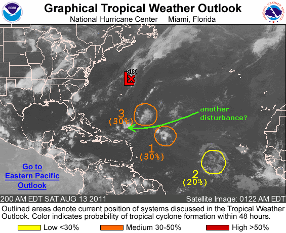
Another Disturbance?
Moderator: S2k Moderators
Forum rules

The posts in this forum are NOT official forecasts and should not be used as such. They are just the opinion of the poster and may or may not be backed by sound meteorological data. They are NOT endorsed by any professional institution or STORM2K. For official information, please refer to products from the National Hurricane Center and National Weather Service.
-
northjaxpro

- S2K Supporter

- Posts: 8900
- Joined: Mon Sep 27, 2010 11:21 am
- Location: Jacksonville, FL

Re:
northjaxpro wrote:NDG, it has been quite an intersting season thus far in the ATL basin. It seems that we are having several systems form either at or above 25 degrees laditude, while our deep tropical waves at the lower latitudes have struggled to maintain themselves. Plus, we still have not yet officially had our first hurricane in the ATL basin. Very fascinating to this point.
NDG, You are right. The small swirl/vort north of PR may find a small window of opportunity to perculate as maybe the shear may let up as it approaches the Bahamas region the next 36 hours or so. However, if it tries to get going, the trough forecast to reach the East Coast should pull this small feature poleward eventually.
But quite the contrary in the GOM, where north of 25N has been a dead zone.
This La Nina pattern has been relentless. Will we see a pattern change in September? There's the possibility, but IMO is getting slimmer and slimmer, especially that now we are seeing ENSO cooling down faster than forecasted a couple of months ago by models.
0 likes
-
Aric Dunn
- Category 5

- Posts: 21238
- Age: 43
- Joined: Sun Sep 19, 2004 9:58 pm
- Location: Ready for the Chase.
- Contact:
Re:
NDG wrote:Vis sat loop this morning still shows the weak vorticity north of P.R.
Very limited convection with it this morning.
Forecasted to track slowly WNW to NW over the next few days, convection may increase as the trough of low pressure digs down the eastern US over the next couple of days, helping to create some UL divergence on this surface feature.
This sucks having to watch a naked swirl this morning, the only thing interesting over the next 7 days or so that would be closest to the US which may not even affect FL afterall, lol.

Yep. it should begin to move into a more favorable environment in the next 12 to 24 hrs which should allow convection to form.
0 likes
Note: If I make a post that is brief. Please refer back to previous posts for the analysis or reasoning. I do not re-write/qoute what my initial post said each time.
If there is nothing before... then just ask
Space & Atmospheric Physicist, Embry-Riddle Aeronautical University,
I believe the sky is falling...
If there is nothing before... then just ask
Space & Atmospheric Physicist, Embry-Riddle Aeronautical University,
I believe the sky is falling...
-
Aric Dunn
- Category 5
- Posts: 21238
- Age: 43
- Joined: Sun Sep 19, 2004 9:58 pm
- Location: Ready for the Chase.
- Contact:
0 likes
Note: If I make a post that is brief. Please refer back to previous posts for the analysis or reasoning. I do not re-write/qoute what my initial post said each time.
If there is nothing before... then just ask
Space & Atmospheric Physicist, Embry-Riddle Aeronautical University,
I believe the sky is falling...
If there is nothing before... then just ask
Space & Atmospheric Physicist, Embry-Riddle Aeronautical University,
I believe the sky is falling...
-
HurricaneBelle

- S2K Supporter
- Posts: 1203
- Joined: Sun Aug 27, 2006 6:12 pm
- Location: Clearwater, FL
Re: Another Disturbance?
Bastardi thinks this is going to affect FL later in the week, per his twitter feed:
Note.. FLA weather will get disturbed late week from yet to be seen system near Hispaniola now.
0 likes
-
northjaxpro
- S2K Supporter
- Posts: 8900
- Joined: Mon Sep 27, 2010 11:21 am
- Location: Jacksonville, FL
This is an excerpt from the 2:00 p.m. Tropical Weather Discussion from NHC regarding the surface trough currently located just north of Puerto Rico and Hispaniola. At this time, NHC is forecasting a west to west/northwest track for this system:
THE SURFACE TROUGH N OF THE GREATER ANTILLES
WILL TRACK W REACHING THE FAR SE BAHAMAS TONIGHT THEN MOVE
THROUGH THE REMAINDER ISLANDS THROUGH TUE BEFORE REACHING THE NW
BAHAMAS AND FLORIDA WED INTO THU.
THE SURFACE TROUGH N OF THE GREATER ANTILLES
WILL TRACK W REACHING THE FAR SE BAHAMAS TONIGHT THEN MOVE
THROUGH THE REMAINDER ISLANDS THROUGH TUE BEFORE REACHING THE NW
BAHAMAS AND FLORIDA WED INTO THU.
0 likes
NEVER, EVER SAY NEVER in the tropics and weather in general, and most importantly, with life itself!!
________________________________________________________________________________________
Fay 2008 Beryl 2012 Debby 2012 Colin 2016 Hermine 2016 Julia 2016 Matthew 2016 Irma 2017 Dorian 2019
________________________________________________________________________________________
Fay 2008 Beryl 2012 Debby 2012 Colin 2016 Hermine 2016 Julia 2016 Matthew 2016 Irma 2017 Dorian 2019
-
SouthDadeFish

- Professional-Met

- Posts: 2835
- Joined: Thu Sep 23, 2010 2:54 pm
- Location: Miami, FL
- Contact:
-
northjaxpro
- S2K Supporter
- Posts: 8900
- Joined: Mon Sep 27, 2010 11:21 am
- Location: Jacksonville, FL
Re:
SouthDadeFish wrote:Looks like convection is trying to increase in the area. Perhaps this will be tagged invest 97L soon.
During the past few hours SouthDadeFish convection is now beginning to get started around the area where the small vort/swirl is located, which is now approximately at 22.0 N 68.5 W. The area continues moving west.
If the convection can continue to build and sustain though the evening, then we shall see what NHC will do with maybe declaring this an invest. I have followed this area with considerable interest since it broke off away Thursday from the entity 94L, which is now T.S. Gert.
0 likes
NEVER, EVER SAY NEVER in the tropics and weather in general, and most importantly, with life itself!!
________________________________________________________________________________________
Fay 2008 Beryl 2012 Debby 2012 Colin 2016 Hermine 2016 Julia 2016 Matthew 2016 Irma 2017 Dorian 2019
________________________________________________________________________________________
Fay 2008 Beryl 2012 Debby 2012 Colin 2016 Hermine 2016 Julia 2016 Matthew 2016 Irma 2017 Dorian 2019
-
SouthDadeFish
- Professional-Met
- Posts: 2835
- Joined: Thu Sep 23, 2010 2:54 pm
- Location: Miami, FL
- Contact:

Re: Another Disturbance?
UL winds are relaxing, so could have a chance to fire some deep convection overnight and at DMAX.

0 likes
-
sittingduck

- S2K Supporter
- Posts: 112
- Joined: Mon Aug 13, 2007 3:16 pm
- Location: venice florida
Re: Another Disturbance?
Is this the same area that is now over the southeastern part of cuba? I am maybe seeing a bit of a turning there.
0 likes
-
Stormcenter
- S2K Supporter
- Posts: 6685
- Joined: Wed Sep 03, 2003 11:27 am
- Location: Houston, TX
Re: Another Disturbance?
I don't think this is anything llike 2005. In 2005 we started with a bang and there
was never a lull. As we all know it was quite active throughout to say the least.
was never a lull. As we all know it was quite active throughout to say the least.
ozonepete wrote:Wow. There really seems to be an explosion of activity. Is that another disturbance popping up southwest of 94L? It certainly seems to have developed into a completely separate area.
This sudden activity spike is reminding me of 2005.

0 likes
-
Aric Dunn
- Category 5
- Posts: 21238
- Age: 43
- Joined: Sun Sep 19, 2004 9:58 pm
- Location: Ready for the Chase.
- Contact:
Although this is a part of the same boundary its farther south... the area just south of cuba is actually looking more interesting this afternoon. See a decent mid level circ and some low level cu clouds flowing in from the south and NW off cuba. may have to watch that as well..
0 likes
Note: If I make a post that is brief. Please refer back to previous posts for the analysis or reasoning. I do not re-write/qoute what my initial post said each time.
If there is nothing before... then just ask
Space & Atmospheric Physicist, Embry-Riddle Aeronautical University,
I believe the sky is falling...
If there is nothing before... then just ask
Space & Atmospheric Physicist, Embry-Riddle Aeronautical University,
I believe the sky is falling...
-
northjaxpro
- S2K Supporter
- Posts: 8900
- Joined: Mon Sep 27, 2010 11:21 am
- Location: Jacksonville, FL
Aric, that is the southern extension of the same surface trough that broke away from then 94L last Thursday. NHC stated earlier this afternoon that a weak upper level Low southwest of Eastern Cuba was interacting with the trough. The northern extension of the trough is moving through the SE Bahamas.
2:00 p.m. TWD excerpt from NHC:
THE CARIBBEAN SEA...
A SURFACE TROUGH EXTENDS ACROSS THE MONA PASSAGE ALONG 23N70W TO
18N76W SUPPORTING SCATTERED SHOWERS/ISOLATED THUNDERSTORMS
WITHIN 200 NM NW OF THE AXIS ACROSS ERN CUBA. A WEAK UPPER LEVEL
LOW IS TO THE SW OF THE TROUGH WHICH MAY BE HELPING TO ENHANCE
SOME OF THE ACTIVITY.
0 likes
NEVER, EVER SAY NEVER in the tropics and weather in general, and most importantly, with life itself!!
________________________________________________________________________________________
Fay 2008 Beryl 2012 Debby 2012 Colin 2016 Hermine 2016 Julia 2016 Matthew 2016 Irma 2017 Dorian 2019
________________________________________________________________________________________
Fay 2008 Beryl 2012 Debby 2012 Colin 2016 Hermine 2016 Julia 2016 Matthew 2016 Irma 2017 Dorian 2019
-
northjaxpro
- S2K Supporter
- Posts: 8900
- Joined: Mon Sep 27, 2010 11:21 am
- Location: Jacksonville, FL
8 p.m. TWD excerpts. The surface trough still moving west/northwest.
ATLANTIC OCEAN.....
A SURFACE TROUGH IS
MOVING ACROSS THE SE BAHAMAS AND EASTERN CUBA FROM 23N72W TO
19N77W GENERATING SCATTERED HEAVY SHOWERS AND THUNDERSTORMS
WITHIN 60 NM ON EITHER SIDE OF THE AXIS. EXPECT MORE CONVECTION
TO DEVELOP ACROSS THE WATERS NEAR CENTRAL CUBA AND CENTRAL
BAHAMAS AS THE SURFACE TROUGH DRIFTS WNW.
CARIBBEAN SEA.....
SIMILAR CONVECTION IS OVER THE COASTAL
WATERS OF EASTERN CUBA AND NRN JAMAICA N OF 18N BETWEEN
75W-80W...ASSOCIATED TO A SURFACE TROUGH ANALYZED FROM 23N72W TO
19N77W.
EXPECT MORE
CONVECTION TO DEVELOP ACROSS THE WATERS NEAR CENTRAL CUBA AND
NRN OF JAMAICA AS THE SURFACE TROUGH DRIFTS WNW.
0 likes
NEVER, EVER SAY NEVER in the tropics and weather in general, and most importantly, with life itself!!
________________________________________________________________________________________
Fay 2008 Beryl 2012 Debby 2012 Colin 2016 Hermine 2016 Julia 2016 Matthew 2016 Irma 2017 Dorian 2019
________________________________________________________________________________________
Fay 2008 Beryl 2012 Debby 2012 Colin 2016 Hermine 2016 Julia 2016 Matthew 2016 Irma 2017 Dorian 2019
-
Aric Dunn
- Category 5
- Posts: 21238
- Age: 43
- Joined: Sun Sep 19, 2004 9:58 pm
- Location: Ready for the Chase.
- Contact:
clear rotation.. small system.. but something to watch for sure..
http://www.insmet.cu/asp/genesis.asp?TB ... B1=RADARES
http://www.insmet.cu/asp/genesis.asp?TB ... B1=RADARES
0 likes
Note: If I make a post that is brief. Please refer back to previous posts for the analysis or reasoning. I do not re-write/qoute what my initial post said each time.
If there is nothing before... then just ask
Space & Atmospheric Physicist, Embry-Riddle Aeronautical University,
I believe the sky is falling...
If there is nothing before... then just ask
Space & Atmospheric Physicist, Embry-Riddle Aeronautical University,
I believe the sky is falling...
Re:
Aric Dunn wrote:clear rotation.. small system.. but something to watch for sure..
http://www.insmet.cu/asp/genesis.asp?TB ... B1=RADARES
Yeah, nice vorticity, but it appears to be in the mid levels. Will be interesting to see vis sat pics in the morning to see if it tries to develope a surface reflection.
0 likes


Re: Another Disturbance?
thats looks more like mid level than a ULL south of Cuba....some nice convection down there....
0 likes
-
Aric Dunn
- Category 5
- Posts: 21238
- Age: 43
- Joined: Sun Sep 19, 2004 9:58 pm
- Location: Ready for the Chase.
- Contact:
Re: Another Disturbance?
ROCK wrote:thats looks more like mid level than a ULL south of Cuba....some nice convection down there....
Yeah I mentioned its in the mid levels but at the surface there is a trough with a wind shift that is lagging behind the mid level a little. none the less convection died again anyway. lol
0 likes
Note: If I make a post that is brief. Please refer back to previous posts for the analysis or reasoning. I do not re-write/qoute what my initial post said each time.
If there is nothing before... then just ask
Space & Atmospheric Physicist, Embry-Riddle Aeronautical University,
I believe the sky is falling...
If there is nothing before... then just ask
Space & Atmospheric Physicist, Embry-Riddle Aeronautical University,
I believe the sky is falling...
Who is online
Users browsing this forum: Google [Bot] and 88 guests