Gulf Homebrew? (Is invest 93L)
Moderator: S2k Moderators
Forum rules

The posts in this forum are NOT official forecasts and should not be used as such. They are just the opinion of the poster and may or may not be backed by sound meteorological data. They are NOT endorsed by any professional institution or STORM2K. For official information, please refer to products from the National Hurricane Center and National Weather Service.
-
Pearl River

- S2K Supporter

- Posts: 825
- Age: 67
- Joined: Fri Dec 09, 2005 6:07 pm
- Location: SELa
Re: Gulf Homebrew? - 10%
We could use some rain here too. Marsh fire in New Orleans East don't smell too good. Hopefully our friends in Texas and all along the coast get beneficial rains from this.
0 likes
-
Dean4Storms
- S2K Supporter
- Posts: 6358
- Age: 63
- Joined: Sun Aug 31, 2003 1:01 pm
- Location: Miramar Bch. FL
HPC Day 6 come Monday. Why this system would not begin moving Northward or NE in advance of the front is questionable to me!
http://www.hpc.ncep.noaa.gov/medr/nav_c ... fcolor=wbg
http://www.hpc.ncep.noaa.gov/medr/nav_c ... fcolor=wbg
0 likes
-
Aric Dunn
- Category 5

- Posts: 21238
- Age: 43
- Joined: Sun Sep 19, 2004 9:58 pm
- Location: Ready for the Chase.
- Contact:
Really think they need to move they their little circle farther north into the southern and GUlf..
0 likes
Note: If I make a post that is brief. Please refer back to previous posts for the analysis or reasoning. I do not re-write/qoute what my initial post said each time.
If there is nothing before... then just ask
Space & Atmospheric Physicist, Embry-Riddle Aeronautical University,
I believe the sky is falling...
If there is nothing before... then just ask
Space & Atmospheric Physicist, Embry-Riddle Aeronautical University,
I believe the sky is falling...
Re: Gulf Homebrew? - 10%
Aric...when do you foresee an invest being assigned for this system....while it is still in the carrib.?....or the gulf?...or if at all......?
The posts in this forum are NOT official forecast and should not be used as such. They are just the opinion of the poster and may or may not be backed by sound meteorological data. They are NOT endorsed by any professional institution or storm2k.org. For official information, please refer to the NHC and NWS products.
The posts in this forum are NOT official forecast and should not be used as such. They are just the opinion of the poster and may or may not be backed by sound meteorological data. They are NOT endorsed by any professional institution or storm2k.org. For official information, please refer to the NHC and NWS products.
0 likes
-
Aric Dunn
- Category 5
- Posts: 21238
- Age: 43
- Joined: Sun Sep 19, 2004 9:58 pm
- Location: Ready for the Chase.
- Contact:
Re: Gulf Homebrew? - 10%
underthwx wrote:Aric...when do you foresee an invest being assigned for this system....while it is still in the carrib.?....or the gulf?...or if at all......?
The posts in this forum are NOT official forecast and should not be used as such. They are just the opinion of the poster and may or may not be backed by sound meteorological data. They are NOT endorsed by any professional institution or storm2k.org. For official information, please refer to the NHC and NWS products.
the invest should come by tomorrow. right now it seems a little too broad.
0 likes
Note: If I make a post that is brief. Please refer back to previous posts for the analysis or reasoning. I do not re-write/qoute what my initial post said each time.
If there is nothing before... then just ask
Space & Atmospheric Physicist, Embry-Riddle Aeronautical University,
I believe the sky is falling...
If there is nothing before... then just ask
Space & Atmospheric Physicist, Embry-Riddle Aeronautical University,
I believe the sky is falling...
-
Tireman4

- S2K Supporter
- Posts: 5903
- Age: 60
- Joined: Fri Jun 30, 2006 1:08 pm
- Location: Humble, Texas
- Contact:
Re: Gulf Homebrew? - 10%
Cannot we all just love weather? LOL. I love the variance of the models and how they can be apart then finally converge. Just the interesting dynamics of weather. I am not sure humankind will ever really be able to figure all weather out. Just my three cents from a weather watcher. Back OT.
edited by tolakram: quote cleanup
edited by tolakram: quote cleanup
0 likes
-
PauleinHouston
- Tropical Storm

- Posts: 102
- Joined: Mon Aug 13, 2007 10:23 am
- Location: League City, TX
- Contact:
Re:
Dave C wrote:the long range radar loop out of Tampa seems to show some rotation in the convection. Is that the area you think should be highlighted Aric?
Personally, I'm watching the last few rgb frames on the GOM loop, just at/off the NE tip of Yucatan peninsula. 87W/22N or thereabouts
0 likes
The posts in this forum are NOT official forecasts and should not be used as such. They are just the opinion of this amateur poster and may or may not be backed by sound meteorological data. They are NOT endorsed by any professional institution or storm2k.org. For official information, please refer to NWS products.
-
Aric Dunn
- Category 5
- Posts: 21238
- Age: 43
- Joined: Sun Sep 19, 2004 9:58 pm
- Location: Ready for the Chase.
- Contact:
Re:
Dave C wrote:the long range radar loop out of Tampa seems to show some rotation in the convection. Is that the area you think should be highlighted Aric?
very much so basically from the Yucatan channel northward. The winds are pretty strong out of the South across western cuba and the keys.. even a report of SSW winds from a ship off the western tip pf Cuba.. the winds up around just offshore tampa keel over the the east. This whole area should drift to the NW and depending on where any concentrated convection develops will probably determine where and circ develops.. right now the southern portion seems more likely just north of the Yucatan Channel

0 likes
Note: If I make a post that is brief. Please refer back to previous posts for the analysis or reasoning. I do not re-write/qoute what my initial post said each time.
If there is nothing before... then just ask
Space & Atmospheric Physicist, Embry-Riddle Aeronautical University,
I believe the sky is falling...
If there is nothing before... then just ask
Space & Atmospheric Physicist, Embry-Riddle Aeronautical University,
I believe the sky is falling...
Re: Gulf Homebrew? - 10%
I would imagine Aric.....that the first invest spaghetti model runs will look pretty wild...do you agree?....does there have to be a surface low for a invest to be designated?...im sorry if this question is silly....
The posts in this forum are NOT official forecast and should not be used as such. They are just the opinion of the poster and may or may not be backed by sound meteorological data. They are NOT endorsed by any professional institution or storm2k.org. For official information, please refer to the NHC and NWS products.
The posts in this forum are NOT official forecast and should not be used as such. They are just the opinion of the poster and may or may not be backed by sound meteorological data. They are NOT endorsed by any professional institution or storm2k.org. For official information, please refer to the NHC and NWS products.
Last edited by underthwx on Wed Aug 31, 2011 8:32 am, edited 1 time in total.
0 likes
-
southerngale

- Retired Staff

- Posts: 27418
- Joined: Thu Oct 10, 2002 1:27 am
- Location: Southeast Texas (Beaumont area)
Well, the Euro and GFS are undoubtedly the two models that are relied upon the most. Who cares if someone likes one better than the other? If you don't want to see posts by someone, ignore them. (Friends & Foes in your User Control Panel)
I don't understand any emotion regarding models, including someone else's like or dislike of one. Who cares?
Anyway, let's keep this discussion on the potential system in the GOM.
I don't understand any emotion regarding models, including someone else's like or dislike of one. Who cares?
Anyway, let's keep this discussion on the potential system in the GOM.
0 likes
Please support Storm2k by making a donation today. It is greatly appreciated! Click here: 
 my Cowboys my Rockets my Astros
my Cowboys my Rockets my Astros-
Aric Dunn
- Category 5
- Posts: 21238
- Age: 43
- Joined: Sun Sep 19, 2004 9:58 pm
- Location: Ready for the Chase.
- Contact:
Re: Gulf Homebrew? - 10%
underthwx wrote:I would imagine Aric..from a novice point of view...that the first invest model runs will look pretty wild...do you agree?....does there have to be a surface low for a invest to be designated?...im sorry if this question is silly....
The posts in this forum are NOT official forecast and should not be used as such. They are just the opinion of the poster and may or may not be backed by sound meteorological data. They are NOT endorsed by any professional institution or storm2k.org. For official information, please refer to the NHC and NWS products.
No there does not have to be a surface low and yes the models are going to be all over the place especially because at first wince there is no center the models dont ever get initialized in the same location so each model will be off. but it will still give a general idea of what each thinks the environment will be like.
0 likes
Note: If I make a post that is brief. Please refer back to previous posts for the analysis or reasoning. I do not re-write/qoute what my initial post said each time.
If there is nothing before... then just ask
Space & Atmospheric Physicist, Embry-Riddle Aeronautical University,
I believe the sky is falling...
If there is nothing before... then just ask
Space & Atmospheric Physicist, Embry-Riddle Aeronautical University,
I believe the sky is falling...
-
Wx_Warrior
- Category 5
- Posts: 2718
- Joined: Thu Aug 03, 2006 3:58 pm
- Location: Beaumont, TX
Re: Gulf Homebrew? - 10%
The models are actually all over the place & have no clue. Haven't seen it like this for a GOM disturbance in a while. Weird set up all away around.
0 likes
-
Tireman4
- S2K Supporter
- Posts: 5903
- Age: 60
- Joined: Fri Jun 30, 2006 1:08 pm
- Location: Humble, Texas
- Contact:
From Jeff ( I hope he does not mind me posting)
Morning e-mail from Jeff:
Weekend:
Now for the fun part! Uncertainty abounds with this system still this morning!
All models still develop some kind of tropical system in the NW/W/N Gulf this weekend and linger it around for a few to several days. Still do not think any one of the models has a better solution than the other. CMC dump the system altogether yesterday and now brings a hurricane to the upper TX coast. ECMWF develops a low off of KBRO and drifts it ENE and then SW and then around the middle of next week sends it back NW as a hurricane into the upper TX/SW LA coast. GFS develops a system off of S LA and moves it eastward toward NW FL. NAM continues to be aggressive in the short term and brings a strong TS toward Galveston Bay and then moves it slightly inland only to send it back offshore. Will not follow any of the guidance solutions, even though the ECMWF and NAM do have support from the GFS ensembles.
Will instead go with the general idea of a broad surface low forming somewhere in the central or NW Gulf late Friday and moving very slowly NW toward the middle/upper TX coast. System will likely slow/stall/meander near or offshore through much of the weekend before either moving WSW toward the lower/middle coast or turning NE toward the upper coast/SW LA. Would give slightly more credit to the WSW motion, but it may not be enough to get it inland as suggested by the 00Z ECMWF in which the system is left over the Gulf into the middle of next week getting stronger and stronger. System looks very large (broad) over the weekend and will likely be fairly disorganized at first. Point must continue to be made that the forecast is of little confidence and just about anything is possible, ,this is going to be a slow moving system that will have a prolonged impact for some areas. It is not going anywhere fast!
Impacts:
Will keep impacts general as there is so much uncertainty with the formation, track, and intensity that these aspects will certainly change over the next few days.
Will go with increasing rain chances Thursday-Monday if nothing else just for the increase in moisture. Should a surface low develop south or SW of the upper TX coast onshore flow on the east and north sides of the system would bring frequent squalls and rain bands, while a system developing S of LA would draw dry air southward cutting off rain chances. I am leaning toward the wetter side of things, but keeping those rain chances close to the coast (south of I-10) for now.
Another potential will be tides. Models are forecasting a decent pressure gradient to develop over the northern Gulf as pressures lower in the western Gulf. Long fetch ESE to SE wind on the east side of the possible tropical system will support both an increase in seas and tides. Seas will build into the 3-5 foot range by Saturday and 5-8 feet over the weekend (possibly higher). Favorable wind direction will support water movement toward the coast and expect the response to be increasing tides over the weekend. Tides could run 1-2 feet above normal over the weekend due to increasing swells and the favorable wind direction. Should the tropical system develop to our south these numbers will need to be bumped up some. There is the potential for a prolonged coastal flooding event given the very slow nature of this system, but how high both the seas and tides will go are uncertain until it can be determined where the surface low will likely form. Pattern is very similar to TS Frances 1998 which brought a prolonged storm surge of 6-8 feet to the upper TX coast over several days.
I would encourage residents to continue to monitor the weather forecasts for this weekend and early next week closely as rapid changes may be required depending on the evolution of the Gulf system.
http://forums.khou.com/viewtopic.php?f= ... 8&start=80
0 likes
Re: Gulf Homebrew? - 10%
thanks for your replies Aric...a pattern called a Rex Block Low was mentioned in a NWS discussion earlier yesterday in this topic...does this apply to this system?...i believe it means that with a Rex Block pattern..that a given area under the influence of it..experiences the same type of weather for an extended period of time....thanks..you may delete if this does not apply...
The posts in this forum are NOT official forecast and should not be used as such. They are just the opinion of the poster and may or may not be backed by sound meteorological data. They are NOT endorsed by any professional institution or storm2k.org. For official information, please refer to the NHC and NWS products.
The posts in this forum are NOT official forecast and should not be used as such. They are just the opinion of the poster and may or may not be backed by sound meteorological data. They are NOT endorsed by any professional institution or storm2k.org. For official information, please refer to the NHC and NWS products.
Last edited by underthwx on Wed Aug 31, 2011 8:51 am, edited 3 times in total.
0 likes

Re:
Dean4Storms wrote:HPC Day 6 come Monday. Why this system would not begin moving Northward or NE in advance of the front is questionable to me!
http://www.hpc.ncep.noaa.gov/medr/nav_c ... fcolor=wbg
I agree Dean! If the same setup, a front sweeping towards the eastern seaboard, ALWAYS deflects an approaching storm in the Atlantic off of it's westward track and turns it NW, NNW, N, NNE, NE, etc...then how would this continue to move west into Texas? Granted, IF the front isn't positioned as depicted in that chart then of course it could move otherwise, but if it is, it's not going west.
0 likes
-
Aric Dunn
- Category 5
- Posts: 21238
- Age: 43
- Joined: Sun Sep 19, 2004 9:58 pm
- Location: Ready for the Chase.
- Contact:
Re: Gulf Homebrew? - 10%
12z NAM still favoring the area in the eastern and central gulf....
12hrs from now ..

12hrs from now ..
0 likes
Note: If I make a post that is brief. Please refer back to previous posts for the analysis or reasoning. I do not re-write/qoute what my initial post said each time.
If there is nothing before... then just ask
Space & Atmospheric Physicist, Embry-Riddle Aeronautical University,
I believe the sky is falling...
If there is nothing before... then just ask
Space & Atmospheric Physicist, Embry-Riddle Aeronautical University,
I believe the sky is falling...
-
vbhoutex

- Storm2k Executive

- Posts: 29147
- Age: 74
- Joined: Wed Oct 09, 2002 11:31 pm
- Location: Cypress, TX
- Contact:
Re: Gulf Homebrew? - 10%
Wx_Warrior wrote:The models are actually all over the place & have no clue. Haven't seen it like this for a GOM disturbance in a while. Weird set up all away around.
And I haven't seen them this clueless this close in either. I presume some of it is because there is not LLC to latch on to. It also indicates that the steering currents are expected to be very weak for a while. This will be very interesting to watch.
0 likes
Skywarn, C.E.R.T.
Please click below to donate to STORM2K to help with the expenses of keeping the site going:
Please click below to donate to STORM2K to help with the expenses of keeping the site going:


Re: Gulf Homebrew? - 10%
Just looking at the satellite of the gulf today, it just seems like we in the Houston area would have some moisture flow in from the gulf.
0 likes
Re: Gulf Homebrew? - 10%
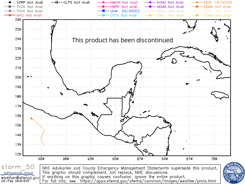
https://my.sfwmd.gov/sfwmd/common/image ... orm_50.gif
what is this?..overlap from katia models?
The posts in this forum are NOT official forecast and should not be used as such. They are just the opinion of the poster and may or may not be backed by sound meteorological data. They are NOT endorsed by any professional institution or storm2k.org. For official information, please refer to the NHC and NWS products
Last edited by underthwx on Wed Aug 31, 2011 9:12 am, edited 1 time in total.
0 likes
Who is online
Users browsing this forum: Google Adsense [Bot] and 114 guests