
ATL: LEE - Remnants - Discussion
Moderator: S2k Moderators
Re: ATL: THIRTEEN - Tropical Depression - Discussion
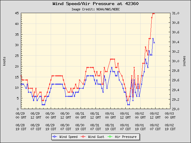
Just about TS winds at this buoy in mid GOM
0 likes

Re: Re:
wxman57 wrote:tigergirl wrote:Has anyone ever seen a forecast like this? 6 days of Tropical storm conditions..:
http://forecast.weather.gov/MapClick.ph ... n=-90.3745
Well, 4 days anyway - Fri-Mon. Enjoy your Labor Day weekend rain. How about sharing some with us, or are you planning on keeping it all for yourself?
Actually, I'm heading your way this afternoon, then to Dallas for the big game! I'll put buckets out now and collect what I can to bring to ya!
0 likes

33kts GCANE, its pretty close thats for sure...
Nice line heading into MS Gulf coastline right now...
Nice line heading into MS Gulf coastline right now...
0 likes
Personal Forecast Disclaimer:
The posts in this forum are NOT official forecast and should not be used as such. They are just the opinion of the poster and may or may not be backed by sound meteorological data. They are NOT endorsed by any professional institution or storm2k.org. For official information, please refer to the NHC and NWS products
The posts in this forum are NOT official forecast and should not be used as such. They are just the opinion of the poster and may or may not be backed by sound meteorological data. They are NOT endorsed by any professional institution or storm2k.org. For official information, please refer to the NHC and NWS products

Re: ATL: THIRTEEN - Tropical Depression - Discussion
It looks like that pacific moisture is trying to cut off the dry air?
You can almost see the storm reaching out in that direction on the IR loop.
You can almost see the storm reaching out in that direction on the IR loop.
0 likes
-
cycloneye

- Admin

- Posts: 149438
- Age: 69
- Joined: Thu Oct 10, 2002 10:54 am
- Location: San Juan, Puerto Rico
Re: ATL: THIRTEEN - Recon
AF plane is flying towards the center.
URNT15 KNHC 021214
AF306 0213A CYCLONE HDOB 05 20110902
120500 2852N 09030W 8405 01594 0094 +179 +087 110028 029 031 000 03
120530 2850N 09031W 8437 01561 0092 +179 +088 109027 028 031 000 00
120600 2849N 09032W 8438 01556 0091 +178 +088 112027 028 031 000 00
120630 2847N 09034W 8428 01568 0090 +178 +087 110026 026 031 000 00
120700 2846N 09035W 8431 01561 0091 +176 +088 112025 025 032 000 00
120730 2845N 09036W 8430 01561 0090 +174 +089 109028 030 038 006 00
120800 2843N 09037W 8437 01555 0102 +154 +090 113034 036 038 011 00
120830 2842N 09038W 8421 01568 0098 +157 +087 117033 034 038 005 00
120900 2840N 09039W 8431 01559 0092 +166 +084 113032 032 037 004 00
120930 2839N 09040W 8428 01564 0088 +175 +083 115033 034 033 001 00
121000 2838N 09041W 8433 01556 0085 +178 +083 120033 034 033 000 00
121030 2838N 09041W 8433 01556 0084 +178 +082 118033 033 031 001 00
121100 2835N 09044W 8429 01559 0082 +180 +082 115032 033 032 000 00
121130 2834N 09045W 8433 01556 0083 +180 +082 115031 032 031 001 00
121200 2833N 09047W 8431 01556 0084 +176 +081 112031 033 031 002 00
121230 2832N 09048W 8427 01560 0083 +176 +080 113029 030 032 002 00
121300 2830N 09050W 8430 01555 0081 +176 +078 108026 026 032 000 00
121330 2829N 09051W 8432 01552 0081 +175 +078 107026 026 033 000 00
121400 2828N 09052W 8429 01557 0085 +175 +078 108026 027 031 001 03
121430 2826N 09052W 8436 01547 0078 +179 +079 109029 031 032 001 00
$$
0 likes
Visit the Caribbean-Central America Weather Thread where you can find at first post web cams,radars
and observations from Caribbean basin members Click Here
and observations from Caribbean basin members Click Here
-
gboudx

- S2K Supporter

- Posts: 4090
- Joined: Thu Sep 04, 2003 1:39 pm
- Location: Rockwall, Tx but from Harvey, La
Re: Re:
tigergirl wrote:wxman57 wrote:tigergirl wrote:Has anyone ever seen a forecast like this? 6 days of Tropical storm conditions..:
http://forecast.weather.gov/MapClick.ph ... n=-90.3745
Well, 4 days anyway - Fri-Mon. Enjoy your Labor Day weekend rain. How about sharing some with us, or are you planning on keeping it all for yourself?
Actually, I'm heading your way this afternoon, then to Dallas for the big game! I'll put buckets out now and collect what I can to bring to ya!
Bring an effective Jarrett Lee instead please.
Drive safe and Geaux Tigers!
I was really hoping just a tad of the moisture would make it's way up here for some 40-50% shot at rain, but alas the desert creation process remains in tact.
0 likes
-
wxman57

- Moderator-Pro Met

- Posts: 23174
- Age: 68
- Joined: Sat Jun 21, 2003 8:06 pm
- Location: Houston, TX (southwest)
Re:
KWT wrote:33kts GCANE, its pretty close thats for sure...
Nice line heading into MS Gulf coastline right now...
Recon is finding TS winds, that's for sure. The only thing missing is a well-defined LLC. That upper low to its west is preventing the very weak LLC from getting any better organized.
0 likes
Looks like rain should move into more southern parts of LA in the next couple of hours.
Slowly but surely rain totals will be increasing. Flooding is gonna be a big problem come the end of the weekend in some parts...
Slowly but surely rain totals will be increasing. Flooding is gonna be a big problem come the end of the weekend in some parts...
0 likes
Personal Forecast Disclaimer:
The posts in this forum are NOT official forecast and should not be used as such. They are just the opinion of the poster and may or may not be backed by sound meteorological data. They are NOT endorsed by any professional institution or storm2k.org. For official information, please refer to the NHC and NWS products
The posts in this forum are NOT official forecast and should not be used as such. They are just the opinion of the poster and may or may not be backed by sound meteorological data. They are NOT endorsed by any professional institution or storm2k.org. For official information, please refer to the NHC and NWS products
-
cycloneye
- Admin
- Posts: 149438
- Age: 69
- Joined: Thu Oct 10, 2002 10:54 am
- Location: San Juan, Puerto Rico
Re: ATL: THIRTEEN - Recon
URNT15 KNHC 021224
AF306 0213A CYCLONE HDOB 06 20110902
121500 2825N 09052W 8434 01547 0079 +176 +078 108034 034 031 001 00
121530 2823N 09052W 8426 01556 0077 +177 +078 106033 033 033 001 00
121600 2822N 09052W 8425 01555 0077 +177 +078 104030 032 033 001 00
121630 2820N 09052W 8426 01555 0076 +175 +077 104029 030 035 001 00
121700 2818N 09052W 8434 01544 0074 +178 +078 107026 027 035 000 00
121730 2817N 09052W 8432 01550 0073 +180 +079 105028 028 036 001 00
121800 2815N 09052W 8425 01553 0069 +185 +079 105030 031 037 000 00
121830 2814N 09052W 8429 01548 0066 +188 +080 103029 030 036 000 03
121900 2812N 09052W 8436 01542 0069 +181 +080 101027 027 035 001 00
121930 2811N 09052W 8429 01548 0072 +176 +080 110023 024 034 000 00
122000 2809N 09051W 8428 01549 0072 +175 +080 116021 021 033 002 00
122030 2807N 09051W 8432 01543 0068 +180 +078 112021 023 034 000 00
122100 2806N 09051W 8429 01546 0069 +179 +078 121019 021 035 001 00
122130 2804N 09051W 8430 01543 0068 +179 +079 123017 019 037 001 00
122200 2803N 09051W 8431 01542 0068 +179 +079 115022 022 038 001 00
122230 2801N 09051W 8431 01542 0067 +179 +079 120024 024 037 001 00
122300 2800N 09051W 8433 01540 0068 +178 +080 124024 026 039 001 00
122330 2758N 09050W 8428 01547 0067 +176 +078 119019 020 040 002 00
122400 2757N 09050W 8423 01550 0067 +177 +078 121018 022 041 005 00
122430 2755N 09050W 8428 01546 0070 +172 +077 113021 024 040 003 00
0 likes
Visit the Caribbean-Central America Weather Thread where you can find at first post web cams,radars
and observations from Caribbean basin members Click Here
and observations from Caribbean basin members Click Here
Re: ATL: THIRTEEN - Tropical Depression - Discussion
7:00 AM CDT Fri Sep 2
Location: 27.0°N 91.6°W
Max sustained: 35 mph
Moving: N at 1 mph
Min pressure: 1005 mb
latest.........
Personal Forecast Disclaimer:
The posts in this forum are NOT official forecast and should not be used as such. They are just the opinion of the poster and may or may not be backed by sound meteorological data. They are NOT endorsed by any professional institution or storm2k.org. For official information, please refer to the NHC and NWS products.
0 likes
-
gboudx
- S2K Supporter
- Posts: 4090
- Joined: Thu Sep 04, 2003 1:39 pm
- Location: Rockwall, Tx but from Harvey, La
From jeff.
Tropical Depression remains poorly organized over the northern Gulf of Mexico
Tropical Storm Warnings remain in effect from Pascagoula, MS to Sabine Pass, TX including metro New Orleans and Lake Pontchartain.
Serious flooding threat developing over SE LA and MS
Discussion:
IR satellite images and water vapor loops show a weak and disorganized tropical cyclone on the eastern side of an upper level trough which extends from SW LA into the NW Gulf of Mexico (a complex weather interaction between these two systems is occurring). The upper level trough is producing 15-20kts of westerly shear over the elongate surface center which has stripped it of all the deep convection. The tropical system is located with a very weak steering flow and has been drifting at a very uncertain NW at 2mph for most of the night. Based on the current information, it is possible that a new surface center may form at some point today closer to the deeper convection, or off to the E/NE of the current center.
Track:
While global and hurricane forecasting models have come into better agreement on the overall track forecast and reasoning there remains a large amount of spread. Slow moving and disorganized tropical systems can be extremely hard to forecast as there is nothing to push them along so they sit and meander around. The general synoptic pattern shows a weakening mid level ridge over the northern Gulf coast which should gradually allow the system to begin to move toward the NW and N slowly. This is in agreement with nearly all of the 00Z guidance which shows a clustering toward the central LA coast with a landfall in about 72 hours. The HWRF, GFDL, and CMC are toward the western side of the guidance showing a track toward SW LA with the GFS and ECMWF more toward the central LA coast. Will probably not have a real good track forecast until a well defined center is able to develop, but the general agreement and NHC forecast track is toward southern LA.
Intensity:
Noting is going to happen fast given the ongoing shear over the system this morning. The upper low over SW LA is forecast to weak and shift west allowing more favorable upper level outflow to develop over the low level center, but this is not expected to happen until Saturday evening. Until that time, convection will continue to remain displaced to the east of the center. In addition to the shear, the water vapor images show a slug a dry air has moved off the TX coast and is wrapping into the system from the west which is also limiting convection new the center and to the west of it. The large circulation will take time to organize and with the slow motion and warm waters, once the shear weakens the system should begin to deepen. Will follow the weaker solutions in the near term and bring the depression to a tropical storm this afternoon or tonight and then a 60mph TS by landfall on Monday. This is in good agreement with the intensity forecast models.
Impacts:
Adverse weather is already impacting the LA, MS, AL coasts with numerous squalls and gusty winds. Winds have already exceeded 40mph in squalls over SE LA overnight and offshore oil rigs have been gusting to 45mph in squalls. Prolonged extreme rainfall amounts, coastal flooding, and tropical storm force winds are likely over coastal LA and MS for the entire Labor Day weekend.
Rainfall:
Some potentially extraordinary amounts will be possible over SE LA and MS where the eastern flank of this system moves ashore. HPC progs 5-day totals of 20-25 inches and this seems reasonable given the very slow motion of the system. Rule of thumb for rainfall forecasting with tropical cyclones is to divide the forward motion into 100 and that gives a good estimate of the expected rainfall. For a system moving around 5mph like this one that would equate to around 20 inches of rainfall. Extensive to extreme fresh water flooding will be possible.
Over SE and E TX rainfall amounts will be limiting due to being on the western flank of the circulation (dry side) and dry air to our N and NE that will be brought SW. Expect rainfall amounts of .5-1 inch from US 59 toward the coast and possibly no rainfall NW of US 59. A sickening reality given the incredible drought conditions in place.
Tides/Seas/Storm Surge:
Strong E winds along the northern Gulf coast will bring seas across the northern Gulf into the 10-15 foot range over the weekend. Onshore winds will gradually pile water onto the coast especially in the concave shoreline around SE LA and MS including Lake Pontchartrain. Storm surge flooding of 2-5 feet above ground level will be possible over SE LA and coastal MS especially across the lower Mississippi River delta region and the east facing shores of SE LA.
Over the upper TX coast long period swells generated over the northern Gulf will bring higher water levels onto the coast. NE winds on the west side of the circulation will also push water toward the coast through Ekman transport or the process of water moving to the right of the wind direction (in this case NW). Tides will run 1-2 feet above normal with seas running 5-8 feet near the coast over the weekend. Seas offshore will be 10-12 feet and conditions in our eastern coastal waters will be dangerous over the weekend. The forecasted tides do not appear like they will cause any problems, but some minor beach erosion at times of high tide will be possible into Monday.
Winds:
Tropical storm force winds will be possibly mainly from central LA east into coastal MS with sustained winds of 50-60mph near and to the east of where the center crosses the coast.
Locally ENE winds will back to the NE and NNE over the weekend and increase into the 15-25mph range including the beaches. Our outer eastern coastal waters may reach sustained winds near 40mph Sunday and a Gale Warning may be required for parts of the offshore waters west of the TS warning area.
0 likes
-
gone2beach

- S2K Supporter
- Posts: 70
- Joined: Wed Aug 27, 2008 1:20 pm
- Location: Long Beach, MS
Re: ATL: THIRTEEN - Tropical Depression - Discussion
Just checked the rain bucket... 1.05". About 0.20" was from late yesterday, the rest from that last band that came across. Temp is a comforatable 76*!!
0 likes
Re: ATL: THIRTEEN - Tropical Depression - Discussion
person on the local radio here said we are getting a break here in Texas from the system in the Gulf..
Personal Forecast Disclaimer:
The posts in this forum are NOT official forecast and should not be used as such. They are just the opinion of the poster and may or may not be backed by sound meteorological data. They are NOT endorsed by any professional institution or storm2k.org. For official information, please refer to the NHC and NWS products.
Last edited by underthwx on Fri Sep 02, 2011 7:43 am, edited 1 time in total.
0 likes
-
Dave

- Retired Staff

- Posts: 13442
- Age: 75
- Joined: Tue Aug 01, 2006 3:57 pm
- Location: Milan Indiana
- Contact:
477
URNT15 KNHC 021234
AF306 0213A CYCLONE HDOB 07 20110902
122500 2753N 09050W 8436 01536 0074 +165 +077 118016 019 036 006 00
122530 2752N 09050W 8426 01545 0070 +170 +076 129018 022 035 004 00
122600 2750N 09050W 8418 01554 0075 +162 +075 118019 022 035 006 00
122630 2749N 09050W 8442 01530 0070 +168 +075 117014 016 031 002 03
122700 2747N 09050W 8434 01537 0069 +173 +074 110011 013 027 003 03
122730 2746N 09051W 8428 01541 0065 +177 +075 111011 012 029 000 03
122800 2745N 09053W 8425 01546 0066 +175 +076 119011 012 027 000 00
122830 2744N 09054W 8433 01540 0064 +180 +076 119008 009 025 001 00
122900 2742N 09055W 8432 01538 0061 +182 +076 098005 007 023 000 00
122930 2741N 09057W 8426 01546 0061 +185 +076 065004 005 022 001 03
123000 2740N 09057W 8429 01543 0059 +185 +078 337003 003 023 000 03
123030 2738N 09057W 8427 01543 0056 +188 +077 342003 004 023 001 00
123100 2736N 09057W 8435 01535 0054 +190 +078 306003 003 022 000 00
123130 2735N 09057W 8425 01544 0055 +190 +078 270004 005 020 001 03
123200 2733N 09056W 8427 01543 0059 +188 +076 261005 006 /// /// 03
123230 2733N 09054W 8429 01541 0057 +192 +076 233004 005 /// /// 03
123300 2735N 09054W 8428 01539 0057 +186 +079 235003 004 017 003 03
123330 2736N 09055W 8429 01540 0057 +185 +082 263001 002 022 000 00
123400 2738N 09056W 8430 01539 0055 +189 +084 021003 003 024 001 00
123430 2739N 09058W 8432 01543 0058 +188 +086 034004 005 022 001 03
$$
;
0 likes
This post is NOT AN OFFICIAL FORECAST and should not be used as such. It is just the opinion of the poster and may or may not be backed by sound meteorological data. It is NOT endorsed by any professional institution including storm2k.org. For Official Information please refer to the NHC and NWS products.
-
wxman57
- Moderator-Pro Met
- Posts: 23174
- Age: 68
- Joined: Sat Jun 21, 2003 8:06 pm
- Location: Houston, TX (southwest)
Re: ATL: THIRTEEN - Tropical Depression - Discussion
Model guidance now says Tropical Cyclone Thirteen with an intensity of 35kts. Big question now is Lee or Maria?
0 likes
-
cycloneye
- Admin
- Posts: 149438
- Age: 69
- Joined: Thu Oct 10, 2002 10:54 am
- Location: San Juan, Puerto Rico
Re: ATL: THIRTEEN - Tropical Depression - Discussion
wxman57 wrote:Model guidance now says Tropical Cyclone Thirteen with an intensity of 35kts. Big question now is Lee or Maria?
12z Best Track
AL, 13, 2011090212, , BEST, 0, 270N, 916W, 35, 1005, TS
0 likes
Visit the Caribbean-Central America Weather Thread where you can find at first post web cams,radars
and observations from Caribbean basin members Click Here
and observations from Caribbean basin members Click Here
-
PTrackerLA

- Category 5

- Posts: 5281
- Age: 42
- Joined: Thu Oct 10, 2002 8:40 pm
- Location: Lafayette, LA
Re: ATL: THIRTEEN - Tropical Depression - Discussion
Very deep convection continues to fire just to the east of TD 13, if this rotates into LA this afternoon it won't be long before flooding problems begin  . We could very well take 5" of rain given drought conditions but obviously not 15". I'm just hoping the center doesn't reform well to the east and we end up getting nothing!
0 likes


Re: ATL: THIRTEEN - Tropical Depression - Discussion
Same here ... red/pink skies as the sun was coming up. Then at 7:40 cst ... just had a quick 5 min squall like line come thru going from east to west ... hard rain for 5 min and gusty wind .... the type where the rain sheets and flows off the roof lines ......
Lightning detector app is going off too. And my 2 cats got caught out in the squall and just came inside soaking wet ..... they "aint" too happy right now !
Lightning detector app is going off too. And my 2 cats got caught out in the squall and just came inside soaking wet ..... they "aint" too happy right now !
Last edited by Bluefrog on Fri Sep 02, 2011 7:46 am, edited 1 time in total.
0 likes


Re: ATL: THIRTEEN - Tropical Depression - Discussion
Recon may have just found a center relocation to the northeast at about 27.6, 90.9. ENE to WSW wind shift at that point This would put the new center more under the heavy convection.
Might just be an eddy, but I believe it is the new center.
Might just be an eddy, but I believe it is the new center.
0 likes
Re: ATL: THIRTEEN - Tropical Depression - Discussion
BigA wrote:Recon may have just found a center relocation to the northeast at about 27.6, 90.9. ENE to WSW wind shift at that point This would put the new center more under the heavy convection.
Might just be an eddy, but I believe it is the new center.
can you illustrate?....
0 likes
Who is online
Users browsing this forum: No registered users and 37 guests