
WPAC: ROKE - Post-Tropical (18W)
Moderator: S2k Moderators
-
StormingB81

- S2K Supporter

- Posts: 5676
- Age: 44
- Joined: Thu Aug 27, 2009 1:45 am
- Location: Rockledge, Florida


Re: WPAC: ROKE - Tropical Storm (18W)
The posts in this forum are NOT official forecast and should not be used as such. They are just the opinion of the poster and may or may not be backed by sound meteorological data. They are NOT endorsed by any professional institution or storm2k.org.
The agencies are so underestimating the intensity of Sonca and Roke IMO, they have been typhoons for several hours and have been intensifying for several hours as well, just look at their structures, tropical storm are not that well organized.
0 likes
-
StormingB81
- S2K Supporter
- Posts: 5676
- Age: 44
- Joined: Thu Aug 27, 2009 1:45 am
- Location: Rockledge, Florida
Re: WPAC: ROKE - Tropical Storm (18W)
Macrocane wrote:The posts in this forum are NOT official forecast and should not be used as such. They are just the opinion of the poster and may or may not be backed by sound meteorological data. They are NOT endorsed by any professional institution or storm2k.org.
The agencies are so underestimating the intensity of Sonca and Roke IMO, they have been typhoons for several hours and have been intensifying for several hours as well, just look at their structures, tropical storm are not that well organized.
If it moves and hits okinawa it may take alot by suprise!
0 likes
-
Extratropical94

- Professional-Met

- Posts: 3545
- Age: 31
- Joined: Wed Oct 20, 2010 6:36 am
- Location: Hamburg, Germany
- Contact:
JTWC at 60 knots:
WTPN31 PGTW 171500
MSGID/GENADMIN/NAVMARFCSTCEN PEARL HARBOR HI/JTWC//
SUBJ/TROPICAL CYCLONE WARNING//
RMKS/
1. TROPICAL STORM 18W (ROKE) WARNING NR 025
02 ACTIVE TROPICAL CYCLONES IN NORTHWESTPAC
MAX SUSTAINED WINDS BASED ON ONE-MINUTE AVERAGE
WIND RADII VALID OVER OPEN WATER ONLY
---
WARNING POSITION:
171200Z --- NEAR 24.8N 130.3E
MOVEMENT PAST SIX HOURS - 120 DEGREES AT 04 KTS
POSITION ACCURATE TO WITHIN 030 NM
POSITION BASED ON CENTER LOCATED BY A COMBINATION OF
SATELLITE AND RADAR
PRESENT WIND DISTRIBUTION:
MAX SUSTAINED WINDS - 060 KT, GUSTS 075 KT
WIND RADII VALID OVER OPEN WATER ONLY
RADIUS OF 050 KT WINDS - 025 NM NORTHEAST QUADRANT
025 NM SOUTHEAST QUADRANT
025 NM SOUTHWEST QUADRANT
025 NM NORTHWEST QUADRANT
RADIUS OF 034 KT WINDS - 115 NM NORTHEAST QUADRANT
120 NM SOUTHEAST QUADRANT
110 NM SOUTHWEST QUADRANT
100 NM NORTHWEST QUADRANT
REPEAT POSIT: 24.8N 130.3E
---
FORECASTS:
12 HRS, VALID AT:
180000Z --- 25.3N 130.5E
MAX SUSTAINED WINDS - 065 KT, GUSTS 080 KT
WIND RADII VALID OVER OPEN WATER ONLY
RADIUS OF 050 KT WINDS - 030 NM NORTHEAST QUADRANT
030 NM SOUTHEAST QUADRANT
030 NM SOUTHWEST QUADRANT
030 NM NORTHWEST QUADRANT
RADIUS OF 034 KT WINDS - 120 NM NORTHEAST QUADRANT
120 NM SOUTHEAST QUADRANT
115 NM SOUTHWEST QUADRANT
110 NM NORTHWEST QUADRANT
VECTOR TO 24 HR POSIT: 355 DEG/ 04 KTS
---
24 HRS, VALID AT:
181200Z --- 26.0N 130.4E
MAX SUSTAINED WINDS - 070 KT, GUSTS 085 KT
WIND RADII VALID OVER OPEN WATER ONLY
RADIUS OF 050 KT WINDS - 040 NM NORTHEAST QUADRANT
040 NM SOUTHEAST QUADRANT
035 NM SOUTHWEST QUADRANT
040 NM NORTHWEST QUADRANT
RADIUS OF 034 KT WINDS - 130 NM NORTHEAST QUADRANT
125 NM SOUTHEAST QUADRANT
120 NM SOUTHWEST QUADRANT
120 NM NORTHWEST QUADRANT
VECTOR TO 36 HR POSIT: 010 DEG/ 03 KTS
---
36 HRS, VALID AT:
190000Z --- 26.6N 130.5E
MAX SUSTAINED WINDS - 070 KT, GUSTS 085 KT
WIND RADII VALID OVER OPEN WATER ONLY
RADIUS OF 064 KT WINDS - 025 NM NORTHEAST QUADRANT
025 NM SOUTHEAST QUADRANT
025 NM SOUTHWEST QUADRANT
025 NM NORTHWEST QUADRANT
RADIUS OF 050 KT WINDS - 045 NM NORTHEAST QUADRANT
045 NM SOUTHEAST QUADRANT
045 NM SOUTHWEST QUADRANT
045 NM NORTHWEST QUADRANT
RADIUS OF 034 KT WINDS - 135 NM NORTHEAST QUADRANT
130 NM SOUTHEAST QUADRANT
130 NM SOUTHWEST QUADRANT
125 NM NORTHWEST QUADRANT
VECTOR TO 48 HR POSIT: 035 DEG/ 03 KTS
---
EXTENDED OUTLOOK:
48 HRS, VALID AT:
191200Z --- 27.1N 130.9E
MAX SUSTAINED WINDS - 070 KT, GUSTS 085 KT
WIND RADII VALID OVER OPEN WATER ONLY
RADIUS OF 064 KT WINDS - 025 NM NORTHEAST QUADRANT
025 NM SOUTHEAST QUADRANT
025 NM SOUTHWEST QUADRANT
025 NM NORTHWEST QUADRANT
RADIUS OF 050 KT WINDS - 045 NM NORTHEAST QUADRANT
045 NM SOUTHEAST QUADRANT
045 NM SOUTHWEST QUADRANT
045 NM NORTHWEST QUADRANT
RADIUS OF 034 KT WINDS - 130 NM NORTHEAST QUADRANT
135 NM SOUTHEAST QUADRANT
130 NM SOUTHWEST QUADRANT
125 NM NORTHWEST QUADRANT
VECTOR TO 72 HR POSIT: 050 DEG/ 06 KTS
---
72 HRS, VALID AT:
201200Z --- 28.6N 132.9E
MAX SUSTAINED WINDS - 065 KT, GUSTS 080 KT
WIND RADII VALID OVER OPEN WATER ONLY
RADIUS OF 050 KT WINDS - 040 NM NORTHEAST QUADRANT
040 NM SOUTHEAST QUADRANT
040 NM SOUTHWEST QUADRANT
040 NM NORTHWEST QUADRANT
RADIUS OF 034 KT WINDS - 125 NM NORTHEAST QUADRANT
125 NM SOUTHEAST QUADRANT
120 NM SOUTHWEST QUADRANT
115 NM NORTHWEST QUADRANT
VECTOR TO 96 HR POSIT: 040 DEG/ 11 KTS
---
LONG RANGE OUTLOOK:
---
96 HRS, VALID AT:
211200Z --- 31.9N 136.2E
MAX SUSTAINED WINDS - 060 KT, GUSTS 075 KT
WIND RADII VALID OVER OPEN WATER ONLY
BECOMING EXTRATROPICAL
VECTOR TO 120 HR POSIT: 035 DEG/ 21 KTS
---
120 HRS, VALID AT:
221200Z --- 38.6N 142.8E
MAX SUSTAINED WINDS - 050 KT, GUSTS 065 KT
WIND RADII VALID OVER OPEN WATER ONLY
BECOMING EXTRATROPICAL
---
REMARKS:
171500Z POSITION NEAR 24.9N 130.3E.
TROPICAL STORM 18W (ROKE), LOCATED APPROXIMATELY 170 NM SOUTHEAST
OF KADENA AB, JAPAN, HAS TRACKED EAST-SOUTHEASTWARD AT 04 KNOTS
OVER THE PAST SIX HOURS. MAXIMUM SIGNIFICANT WAVE HEIGHT AT 171200Z
IS 18 FEET. NEXT WARNINGS AT 172100Z, 180300Z, 180900Z AND 181500Z.
REFER TO TYPHOON 19W (SONCA) WARNINGS (WTPN32 PGTW) FOR SIX-HOURLY
UPDATES.//
NNNN
0 likes
54° 11' 59'' N, 9° 9' 20'' E
Boomer Sooner!
Go Broncos! Go Cards!
Clinching counties, one at a time: https://mob-rule.com/user-gifs/USA/xtrp94.gif
- Daniel
Boomer Sooner!
Go Broncos! Go Cards!
Clinching counties, one at a time: https://mob-rule.com/user-gifs/USA/xtrp94.gif
- Daniel


Re: WPAC: ROKE - Severe Tropical Storm (18W)
What's wrong with the JTWC? I don't like to criticize the job of any agency but this time their underestimation is so obvious that even they are kind of contradicting themselves, I mean, they say it has a pinhole eye but they call it a tropical storm 

0 likes
-
StormingB81
- S2K Supporter
- Posts: 5676
- Age: 44
- Joined: Thu Aug 27, 2009 1:45 am
- Location: Rockledge, Florida
With alot of people not taking this serious because JTWC said this one would stay weak..I wonder what people would say right now if they saw it..and would anyone be nervous of it hitting us..I mean I know what the track says...but I also know what the track said and what this drunken storm does....I wonder if this hits Okinawa because the last several days that said either weak or missing us..if it does hit I wonder if there would ne any backlash
0 likes
-
Extratropical94
- Professional-Met
- Posts: 3545
- Age: 31
- Joined: Wed Oct 20, 2010 6:36 am
- Location: Hamburg, Germany
- Contact:
JMA 18Z: 55 knots, not expected to strengthen any further.
Center position N24°50'(24.8°)
E130°30'(130.5°)
Direction and speed of movement Almost stationary
Central pressure 975hPa
Maximum wind speed near the center 30m/s(55kt)
Maximum wind gust speed 40m/s(80kt)
Area of 50kt winds or more ALL70km(40NM)
Area of 30kt winds or more ALL370km(200NM)
JTWC 18/21Z: 60 knots - 70 knots expected
WARNING POSITION:
171800Z --- NEAR 24.9N 130.5E
MOVEMENT PAST SIX HOURS - 060 DEGREES AT 02 KTS
POSITION ACCURATE TO WITHIN 040 NM
POSITION BASED ON CENTER LOCATED BY SATELLITE
PRESENT WIND DISTRIBUTION:
MAX SUSTAINED WINDS - 060 KT, GUSTS 075 KT
WIND RADII VALID OVER OPEN WATER ONLY
RADIUS OF 050 KT WINDS - 025 NM NORTHEAST QUADRANT
025 NM SOUTHEAST QUADRANT
025 NM SOUTHWEST QUADRANT
025 NM NORTHWEST QUADRANT
RADIUS OF 034 KT WINDS - 090 NM NORTHEAST QUADRANT
090 NM SOUTHEAST QUADRANT
100 NM SOUTHWEST QUADRANT
100 NM NORTHWEST QUADRANT
REPEAT POSIT: 24.9N 130.5E
0 likes
54° 11' 59'' N, 9° 9' 20'' E
Boomer Sooner!
Go Broncos! Go Cards!
Clinching counties, one at a time: https://mob-rule.com/user-gifs/USA/xtrp94.gif
- Daniel
Boomer Sooner!
Go Broncos! Go Cards!
Clinching counties, one at a time: https://mob-rule.com/user-gifs/USA/xtrp94.gif
- Daniel
-
StormingB81
- S2K Supporter
- Posts: 5676
- Age: 44
- Joined: Thu Aug 27, 2009 1:45 am
- Location: Rockledge, Florida
-
RobWESTPACWX
- WestPACMet

- Posts: 1616
- Joined: Fri Sep 17, 2010 2:26 am
- Location: Tokyo, Japan
- Contact:
Also want to note the rainfall towards Shikoku continues top fall, latest out of one station 180mm.
As reported from MIYAZAKI
(31.93N 131.41E 15m)
JAPAN
Heavy Rain/Snow
(Rainfall/Snowfall was 179.5 mm in the past 24 hours ending at 18 UTC 17 Sep 2011)
As reported from MIYAZAKI
(31.93N 131.41E 15m)
JAPAN
Heavy Rain/Snow
(Rainfall/Snowfall was 179.5 mm in the past 24 hours ending at 18 UTC 17 Sep 2011)
0 likes
Satellites, Charts and Forecasting tools for East Asia at WESTERNPACIFICWEATHER.COM
-
StormingB81
- S2K Supporter
- Posts: 5676
- Age: 44
- Joined: Thu Aug 27, 2009 1:45 am
- Location: Rockledge, Florida
-
phwxenthusiast
- Category 2

- Posts: 637
- Joined: Wed Mar 24, 2010 3:10 am
- Location: Holbrook, NY (Long Island)
-
StormingB81
- S2K Supporter
- Posts: 5676
- Age: 44
- Joined: Thu Aug 27, 2009 1:45 am
- Location: Rockledge, Florida
Re: WPAC: ROKE - Tropical Storm (18W)
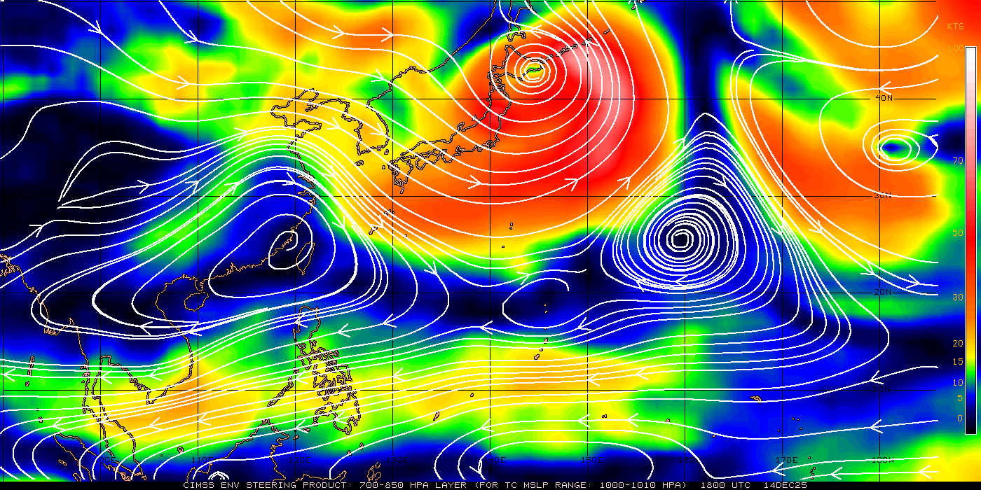
RobWESTPACWX wrote:rdhdstpchld wrote: Can anyone post the wind pattern graphic? thanks -
I think this is what your loooking for, not sure.
http://tropic.ssec.wisc.edu/real-time/w ... msdlm1.GIF
anyone got the updated one....see if it wants to move and where today
0 likes
-
RobWESTPACWX
- WestPACMet
- Posts: 1616
- Joined: Fri Sep 17, 2010 2:26 am
- Location: Tokyo, Japan
- Contact:
Re: WPAC: ROKE - Severe Tropical Storm (18W)
To find those in the future storming, either use cmiss or wpw but the one above actually auto updates on here so that is the newest one.
http://tropic.ssec.wisc.edu/
http://www.westernpacificweather.com/Stream_Lines.html
http://tropic.ssec.wisc.edu/
http://www.westernpacificweather.com/Stream_Lines.html
Last edited by RobWESTPACWX on Sat Sep 17, 2011 7:26 pm, edited 1 time in total.
0 likes
Satellites, Charts and Forecasting tools for East Asia at WESTERNPACIFICWEATHER.COM
-
euro6208
-
euro6208
Re: WPAC: ROKE - Severe Tropical Storm (18W)
in my opinion, at roke's peak intensity with a pinhole eye, i would estimate the intensity at 85 knots 1 minute winds...
i agree, roke and sonca have been typhoons for so long and have been intensifying but god why does jtwc and jma take so long to upgrade when there is an eye and both are truly underestimated...
i agree, roke and sonca have been typhoons for so long and have been intensifying but god why does jtwc and jma take so long to upgrade when there is an eye and both are truly underestimated...
Last edited by euro6208 on Sat Sep 17, 2011 7:29 pm, edited 1 time in total.
0 likes
-
StormingB81
- S2K Supporter
- Posts: 5676
- Age: 44
- Joined: Thu Aug 27, 2009 1:45 am
- Location: Rockledge, Florida
-
RobWESTPACWX
- WestPACMet
- Posts: 1616
- Joined: Fri Sep 17, 2010 2:26 am
- Location: Tokyo, Japan
- Contact:
Well I wouldnt go that far, but this storm has been a real tough one, for example warning #1 had the storm making landfall in Okinawa on the 14th! To bad that wasn't the case this would be all over with.
I think big case is Radar does not really show an eye. Yes Microwave imagery though shows something and maybe that is why they are showing a slow intensification. But the imagery below dosent really indicate a Typhoon to be honest, at least that is what I'm seeing here. On that note though there is still the intensification and I wouldnt be suprised if this does get upgraded here in the near future.

I think big case is Radar does not really show an eye. Yes Microwave imagery though shows something and maybe that is why they are showing a slow intensification. But the imagery below dosent really indicate a Typhoon to be honest, at least that is what I'm seeing here. On that note though there is still the intensification and I wouldnt be suprised if this does get upgraded here in the near future.
Last edited by RobWESTPACWX on Sat Sep 17, 2011 7:37 pm, edited 1 time in total.
0 likes
Satellites, Charts and Forecasting tools for East Asia at WESTERNPACIFICWEATHER.COM
-
StormingB81
- S2K Supporter
- Posts: 5676
- Age: 44
- Joined: Thu Aug 27, 2009 1:45 am
- Location: Rockledge, Florida
Who is online
Users browsing this forum: No registered users and 10 guests