The NWS has put in a slight chance for snow late Wednesday night behind the system for Midland and mentioned it in the AFD for Abilene and San Angelo.
Wow what a year for snow in Midland. They have had almost 20 inches!!!!!
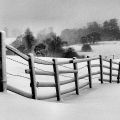
Texas Winter 2011-2012...
Moderator: S2k Moderators
Forum rules
 The posts in this forum are NOT official forecast and should not be used as such. They are just the opinion of the poster and may or may not be backed by sound meteorological data. They are NOT endorsed by any professional institution or STORM2K.

The posts in this forum are NOT official forecast and should not be used as such. They are just the opinion of the poster and may or may not be backed by sound meteorological data. They are NOT endorsed by any professional institution or STORM2K.
Re: Texas Winter 2011-2012...
0 likes
-
Texas Snowman

- Storm2k Moderator

- Posts: 6197
- Joined: Fri Jan 25, 2008 11:29 am
- Location: Denison, Texas
Interesting read about the winter - or lack thereof - in North Dakota.
No wonder I need to mow my yard already.
Sure hope winter appears in February!
http://m.bismarcktribune.com/lifestyles ... 3ce6c.html
No wonder I need to mow my yard already.
Sure hope winter appears in February!
http://m.bismarcktribune.com/lifestyles ... 3ce6c.html
0 likes
The above post and any post by Texas Snowman is NOT an official forecast and should not be used as such. It is just the opinion of the poster and may or may not be backed by sound meteorological data. It is NOT endorsed by any professional institution including storm2k.org. For official information, please refer to NWS products.
-
Rgv20

- S2K Supporter

- Posts: 2466
- Age: 39
- Joined: Wed Jan 05, 2011 5:42 pm
- Location: Edinburg/McAllen Tx
The NWS in Corpus regarding the Severe Weather threat..
SPECIAL WEATHER STATEMENT
NATIONAL WEATHER SERVICE CORPUS CHRISTI TX
325 PM CST MON JAN 23 2012
TXZ229>234-239>247-240700-
LA SALLE-MCMULLEN-LIVE OAK-BEE-GOLIAD-VICTORIA-WEBB-DUVAL-
JIM WELLS-KLEBERG-NUECES-SAN PATRICIO-ARANSAS-REFUGIO-CALHOUN-
INCLUDING THE CITIES OF...COTULLA...CALLIHAM...CROSS...
LOMA ALTA...TILDEN...GEORGE WEST...THREE RIVERS...BEEVILLE...
GOLIAD...VICTORIA...LAREDO...FREER...BENAVIDES...SAN DIEGO...
ALICE...ORANGE GROVE...KINGSVILLE...CORPUS CHRISTI...PORTLAND...
INGLESIDE...ARANSAS PASS...SINTON...MATHIS...ROCKPORT...REFUGIO...
WOODSBORO...PORT LAVACA
325 PM CST MON JAN 23 2012
...POTENTIAL FOR STRONG TO SEVERE THUNDERSTORMS LATE TUESDAY
NIGHT THROUGH EARLY WEDNESDAY AFTERNOON...
...RAIN CHANCES INCREASE TUESDAY THROUGH WEDNESDAY...
A POTENT UPPER LEVEL DISTURBANCE WILL APPROACH SOUTH TEXAS ON
TUESDAY. THE COLD FRONT WHICH MOVED THROUGH SOUTH TEXAS MONDAY
MORNING WILL BEGIN TO MOVE NORTH OVERNIGHT AS A WARM FRONT...AND
MOVE NORTH OF THE AREA BY LATE TUESDAY AFTERNOON. LIFT ALONG AND
AHEAD OF THE BOUNDARY WILL PROVIDE A SLIGHT CHANCE FOR SHOWERS OR
RAIN OVERNIGHT TONIGHT INTO EARLY TUESDAY MORNING.
RAIN CHANCES WILL BEGIN TO INCREASE TUESDAY AS THE FRONT MOVES
NORTH...ATMOSPHERIC INSTABILITY INCREASES...AND A WEAK TO MODERATE
UPPER LEVEL JET STREAK MOVES TOWARD SOUTH TEXAS. THIS
COMBINATION WILL PROVIDE A CHANCE FOR SHOWERS ON TUESDAY...WITH
THUNDERSTORMS POSSIBLE DURING THE AFTERNOON MAINLY EAST OF HIGHWAY
281. A FEW STRONG STORMS WILL BE POSSIBLE TUESDAY
AFTERNOON...PRODUCING WIND GUSTS TO 50 MPH ALONG WITH SMALL HAIL.
BY TUESDAY NIGHT...THE DYNAMICS OF THE UPPER LEVEL STORM SYSTEM
WILL REALLY BEGIN TO IMPACT SOUTH TEXAS...AIDED IN PART BY
MODERATE TO STRONG FORCING NEAR THE SURFACE. SHOWERS AND
THUNDERSTORMS ARE EXPECTED TO DEVELOP NORTH AND WEST OF THE AREA
DURING LATE EVENING AND OVERNIGHT HOURS...WITH THE ACTIVITY
EXPECTED TO MOVE EAST-SOUTHEAST THROUGH WEDNESDAY MORNING.
AT THIS TIME...THE MOST LIKELY PERIOD FOR THUNDERSTORM ACTIVITY
WILL OCCUR AFTER MIDNIGHT TUESDAY NIGHT AND CONTINUE POSSIBLY THROUGH
EARLY WEDNESDAY AFTERNOON...ROUGHLY BETWEEN 2 AM AND
NOON...INITIALLY STARTING OVER THE NORTHERN BRUSH COUNTRY AND RIO
GRANDE PLAINS. SOME OF THE THUNDERSTORMS ARE EXPECTED TO BE STRONG
OR EVEN SEVERE. THE MAIN THREAT FOR SEVERE THUNDERSTORMS WILL BE NEAR
AND NORTH OF A CORPUS CHRISTI TO ALICE TO ENCINAL LINE...WITH THE
MAIN CONCERN BEING STRONG STRAIGHT-LINE WINDS...AND POSSIBLY A
TORNADO OR TWO. WHILE THE CONCERN FOR SEVERE WEATHER IS LOWER
SOUTH OF THIS LINE...ISOLATED SEVERE THUNDERSTORMS COULD NOT BE
RULED OUT.
AS THE SYSTEM BEGINS TO MOVE EAST WEDNESDAY AFTERNOON...RAIN
CHANCES WILL DIMINISH FROM WEST TO EAST...AS A FRONTAL BOUNDARY
MOVES INTO SOUTH TEXAS AND BRINGS DRIER AND COOLER AIR. RAINFALL
AMOUNTS TUESDAY THROUGH WEDNESDAY EVENING WILL AVERAGE FROM 1/4
INCH OR LESS OVER THE RIO GRANDE NEAR LAREDO...1/2 INCH OR MORE
NEAR AND NORTH OF A COTULLA TO CORPUS CHRISTI LINE...AND 1 INCH OR
MORE NEAR AND EAST OF A ROCKPORT TO PETTUS LINE.
RESIDENTS...ESPECIALLY EMERGENCY MANAGERS AND LAW ENFORCEMENT...
SHOULD CONTINUE TO MONITOR THE LATEST FORECASTS CONCERNING THIS
UPCOMING WEATHER EVENT.
$$
GW
0 likes
The following post is NOT an official forecast and should not be used as such. It is just the opinion of the poster and may or may not be backed by sound meteorological data. It is NOT endorsed by any professional institution including storm2k.org For Official Information please refer to the NHC and NWS products.
-
weatherdude1108
- Category 5

- Posts: 4228
- Joined: Tue Dec 13, 2011 1:04 pm
- Location: Northwest Austin/Cedar Park, TX
Re: Texas Winter 2011-2012...
Portastorm wrote:Lively period coming up for south central Texas. The afternoon AFD out of EWX is actually quite a good discussion and highlights some interesting comparisons to the Jan. 9th event and what is expected in the next 48 hours. Here is a snippet:
AREA FORECAST DISCUSSION
NATIONAL WEATHER SERVICE AUSTIN/SAN ANTONIO TX
320 PM CST MON JAN 23 2012
.DISCUSSION...
ANOTHER CUT-OFF LOW TO PROMOTE EXCELLENT RAIN CHANCES ACROSS MUCH
OF SOUTH CENTRAL TEXAS TUESDAY NIGHT THROUGH WEDNESDAY. SIMILAR TO
THE UPPER LOW PATTERN WHICH OCCURRED ON MONDAY...JAN 9...THIS
UPPER LOW HAS A SURROUNDING ENVIRONMENT OF STABLE AND DRY PACIFIC
AIR EXPECTED TO WRAP AROUND IT AS IT MOVES INTO SOUTH CENTRAL
TEXAS. HOWEVER...COMPARISON OF THE FORECAST UPPER LOW FOR EARLY
WEDNESDAY VERSUS THE ONE THAT MOVED THROUGH ON JAN 9 SHOWS A
SIMILAR SIZE BUT MORE N-S ORIENTATION FOR THE UPCOMING LOW INSTEAD
OF A MORE CIRCULAR AND SLIGHTLY E-W ORIENTATION OF THE JAN 9 LOW.
THUS AM EXPECTING AN INCREASED POTENTIAL FOR A NEAR SOLID COMPLEX OF
RAIN TO DEVELOP EARLY WEDNESDAY MORNING OVER THE WESTERN COUNTIES
AND DRAGGING EASTWARD ACROSS THE EASTERN TWO THIRDS OF THE AREA.
THIS SHOULD HOPEFULLY YEILD A BIT MORE RAIN OVER THE CENTRAL
COUNTIES AS COMPARED TO THE EVENT FROM JAN 9.
ANOTHER DIFFERENCE IS THAT THIS N-S ORIENTED FOCUS FOR RAIN
SHOULD RESULT IN STRONGER CONVERGENCE ALONG THE N-S AXIS TO
PROMOTE STRONGER STORMS AND POSSIBLY SOME WIND DAMAGE OR EVEN A
WEAK TORNADO. HIGHEST HELICITIES SHOLD BE EXPECTED TO OCCUR S/SE
OF SAT SOME SOME MODEL DATA SHOWING VALUES OF 300 M2/S2. THE
THREAT FOR HIGH WINDS SHOULD BE LESS OVER WESTERN COUNTIES...BUT
EVENING TIMING OF CONVECTION AND COLDER AIR ADVECTION ALOFT FROM
THE UPPER LOW COULD SUPPORT A FEW HAIL STORMS. OVERALL THE
OVERNIGHT/DAYBREAK TIMING OF A WINTER EVENT SHOULD MEAN A MARGINAL
SEVERE THREAT ACROSS NEARLY ALL OF SOUTH CENTRAL TX. IN ADDITION
TO THE SEVERE POTENTIAL...CUMULATIVE RAINS ALONG AND EAST OF
HIGHWAY 281 COULD APPROACH 2 INCHES...WITH HIGHER AMOUNTS OVER 3
INCHES POSSIBLE IN THE COUNTIES EAST OF A AUSTIN TO CUERO LINE.
WITH THE HIGHEST CONVECTIVE POTENTIAL EXPECTED TO REACH THE I-35
CORRIDOR AROUND DAYBREAK WEDNESDAY...POPS ARE EXPECTED TO TAPER
QUICKLY FROM WEST TO EAST DURING THE DAY WEDNESDAY...WITH COOLER
AND MORE STABLE AIR LOWERING RAIN POTENTIAL OVER THE AREA DESPITE
THE UPPER LOW BEING OVERHEAD. THE WEATHER IN THIS PERIOD FROM LATE
IN THE DAY WEDNESDAY THROUGH THURSDAY SHOULD BE SIMILAR TO THAT OF
JAN 9-10 WITH COLD AND MOIST AIR MOVING SOUTH WHILE CLOUDS REMAIN
ABUNDANT. MODELS SHOW SOME WRAP-AROUND RAINS TO POSSIBLY AFFECT
OUR NORTHERN COUNTIES THROUGH THURSDAY...BUT WILL DOWNPLAY THIS
EFFECT AND FAVOR THE DRIER NAM OVER THE WETTER GFS.
I just saw this.


Bring it!!
0 likes
-
Texas Snowman
- Storm2k Moderator
- Posts: 6197
- Joined: Fri Jan 25, 2008 11:29 am
- Location: Denison, Texas
Want to know where winter is?
According to AccuWeather (@breakingweather) it is in Alaska (surprise, surprise).
"Near Prudhoe Bay, Alaska, the temp got down to -51F w/sustained winds of 15mph. AccuWeather RealFeel Temp was near -90F!"
I'd like to see Wxman57 ride his bike in those balmy conditions!
According to AccuWeather (@breakingweather) it is in Alaska (surprise, surprise).
"Near Prudhoe Bay, Alaska, the temp got down to -51F w/sustained winds of 15mph. AccuWeather RealFeel Temp was near -90F!"
I'd like to see Wxman57 ride his bike in those balmy conditions!
0 likes
The above post and any post by Texas Snowman is NOT an official forecast and should not be used as such. It is just the opinion of the poster and may or may not be backed by sound meteorological data. It is NOT endorsed by any professional institution including storm2k.org. For official information, please refer to NWS products.
-
AggieSpirit
- Tropical Storm

- Posts: 223
- Joined: Sat Nov 29, 2003 5:18 am
- Location: Midlothian, TX
-
SaskatchewanScreamer
AggieSpirit wrote:I hate the lack of winter this year.
http://www.skifernie.com/news-and-info/newsitems.aspx?a=641
Head there
[youtube]http://www.youtube.com/watch?v=NpOm5kSysvI&feature=youtu.be[/youtube]
Temps there are *much* nicer than Alaska's (or here for that matter....I still have my fans facing North
http://www.skifernie.com/conditions/snow-report.aspx
Be sure you pick up a pair of snowshoes first though.
0 likes


Re: Texas Winter 2011-2012...
Getting close to throwing in the towel for the possible arrival of any arctic air in the next two weeks.
0 likes
-
orangeblood
- S2K Supporter
- Posts: 3895
- Joined: Tue Dec 15, 2009 6:14 pm
- Location: Fort Worth, TX
Re: Texas Winter 2011-2012...
hriverajr wrote:Getting close to throwing in the towel for the possible arrival of any arctic air in the next two weeks.
If you're a winter weather lover, this year has to be one of the worst to follow....absolutely terrible!!!! Could it be the first winter in DFW history to not have even a trace of snow or ice?? Probably too early to make the call but signs are not pointing in the right direction.
0 likes

Been under the weather past few days and was hoping to come back with some hope from the models sigh. I'm out of optimism and about ready to throw in the flag. I cant recall a January without some kind of threat from ice/snow/cold once like this one. I just hope we get a -AO next winter cause I've figured out that el nino like pattern alone doesn't do the job! 
0 likes
The above post and any post by Ntxw is NOT an official forecast and should not be used as such. It is just the opinion of the poster and may or may not be backed by sound meteorological data. It is NOT endorsed by any professional institution including Storm2k. For official information, please refer to NWS products.
Help support Storm2K!
-
Rgv20
- S2K Supporter
- Posts: 2466
- Age: 39
- Joined: Wed Jan 05, 2011 5:42 pm
- Location: Edinburg/McAllen Tx
And on a side note here is tonight's discussion from the NWS in Brownsville regarding the upcoming severe weather threat...Sounds like its going to be a busy Tuesday night for parts of Texas!
DISCUSSION...A FEW MINOR CHANGES TO WINDS ON TUESDAY AND THE
POTENTIAL FOR SEVERE THUNDERSTORMS IS INCREASING FOR LATE TUESDAY
NIGHT INTO EARLY WEDNESDAY.
LONG TERM...MADE MINOR ADJUSTMENTS TO LONG TERM GRIDS TO ACCOUNT
FOR THE SLOWER TRENDING FRONTAL PASSAGE IN 12/18 AND NOW 00Z NAM
GUIDANCE. GFS ENSEMBLE ALSO HINTS AT A DEEPER TROUGH THAT DIGS A
LITTLE FURTHER SOUTH THAN CURRENTLY PROGGED. MODEL FORECAST
SOUNDINGS AND PROJECTED WIND FIELDS SHOW A POTENTIAL FOR A WINDOW
FOR A MORE ACTIVE PERIOD OF WEATHER...MAINLY TUESDAY NIGHT INTO
WEDNESDAY. 0-1 AND 0-6KM SHEAR VALUES ARE SUPPORTIVE OF ORGANIZED...
POTENTIALLY SEVERE THUNDERSTORMS BUT THE THERMODYNAMIC ENVIRONMENT
IS VERY MUCH STILL IN QUESTION. 18/00Z NAM SHOWS STRONG CAP IN PLACE
THAT DOESNT FULLY ERODE UNTIL WEDNESDAY MORNING/AFTERNOON BY WHICH
TIME THE LOW LEVEL JET MAXIMUM HAS DEPARTED TO THE NORTH. LOW LCL
HEIGHTS AND GOOD 0-3KM SBCAPE VALUES APPEAR TO BE PRESENT IN THE
OVERNIGHT HOURS TUESDAY IF THE CAPPING INVERSION CAN BE OVERCOME
EARLIER...WHICH REMAINS QUESTIONABLE AT THE MOMENT. LATER SHIFTS
WILL CONTINUE TO MONITOR. /68-JGG/
0 likes
The following post is NOT an official forecast and should not be used as such. It is just the opinion of the poster and may or may not be backed by sound meteorological data. It is NOT endorsed by any professional institution including storm2k.org For Official Information please refer to the NHC and NWS products.
-
Portastorm

- Storm2k Moderator
- Posts: 9954
- Age: 63
- Joined: Fri Jul 11, 2003 9:16 am
- Location: Round Rock, TX
- Contact:
Re: Texas Winter 2011-2012...
Wow ... what is this, Jonestown? Did you all drink the poison, warm-mongerer kool-aid?!
Easy folks, remember that even the King of Warm-Mongerers, wxman57, tells us the medium-range models are unreliable beyond 4-5 days. I still believe that colder and (perhaps) snow/ice looms for parts of Texas in February. Keep hope alive!!
Easy folks, remember that even the King of Warm-Mongerers, wxman57, tells us the medium-range models are unreliable beyond 4-5 days. I still believe that colder and (perhaps) snow/ice looms for parts of Texas in February. Keep hope alive!!
0 likes
Any forecasts under my name are to be taken with a grain of salt. Get your best forecasts from the National Weather Service and National Hurricane Center.
-
Texas Snowman
- Storm2k Moderator
- Posts: 6197
- Joined: Fri Jan 25, 2008 11:29 am
- Location: Denison, Texas
Re: Texas Winter 2011-2012...
Portastorm wrote:Wow ... what is this, Jonestown? Did you all drink the poison, warm-mongerer kool-aid?!
Easy folks, remember that even the King of Warm-Mongerers, wxman57, tells us the medium-range models are unreliable beyond 4-5 days. I still believe that colder and (perhaps) snow/ice looms for parts of Texas in February. Keep hope alive!!
Thinking the same thing Portastorm!
Keep the faith gang, the King of Warm-Mongerers will run out of bike riding weather in February!

0 likes
The above post and any post by Texas Snowman is NOT an official forecast and should not be used as such. It is just the opinion of the poster and may or may not be backed by sound meteorological data. It is NOT endorsed by any professional institution including storm2k.org. For official information, please refer to NWS products.
-
mysterymachinebl
- Tropical Depression

- Posts: 56
- Age: 53
- Joined: Tue Dec 18, 2007 12:19 pm
- Location: Littleton, Co
-
wxman57

- Moderator-Pro Met

- Posts: 23170
- Age: 68
- Joined: Sat Jun 21, 2003 8:06 pm
- Location: Houston, TX (southwest)
Re: Texas Winter 2011-2012...
As much as I'd like to believe that February will be filled with great biking days like last Friday (partly cloudy and 81 degrees), I know that my luck has to change sometimes.
You know it's bad (for cold-mongerers) when JB stops talking about the cold in Canada, though. Yes, it was cold in western Canada, but the cold is fading. The snow line is moving back to the north across the Northern Plains. Without some significant cold in western Canada, the chances of an Arctic dump the first week of February have faded. Told you not to trust that long-range GFS!
But just as you can't trust the long-range GFS when it's forecasting extreme cold, you can't trust it now when it shows no cold coming down. Bottom line is you just can't trust it beyond 3-4 days given the current pattern. I'm sure that over the next few weeks it'll pick up on some developing cold air in western Canada again, and maybe it'll be correct in bringing down some of that cold air around mid February or even into March. Winter always likes to do that to us warm-mongerers. Just when you think winter is over, it gets you!
There, that was my attempt to cheer up you winter weather lovers here. Now, back to warm-mongering and monitoring the spring-like severe weather outbreak across Texas over the next 24 hrs...
0 likes
-
Portastorm
- Storm2k Moderator
- Posts: 9954
- Age: 63
- Joined: Fri Jul 11, 2003 9:16 am
- Location: Round Rock, TX
- Contact:
Re: Texas Winter 2011-2012...
Wow! Other than you (wxman57)actually forecasting an Arctic outbreak or snow/ice ... this is as good as it gets for us cold mongerers!
I'm sure it wasn't easy for you to write that but we do appreciate it!
0 likes
Any forecasts under my name are to be taken with a grain of salt. Get your best forecasts from the National Weather Service and National Hurricane Center.

Re: Texas Winter 2011-2012...
hriverajr wrote:Getting close to throwing in the towel for the possible arrival of any arctic air in the next two weeks.
Duck season ends over here Sunday, so I really don't even care anymore. Never broke ice the first morning and aside from three days since Thanksgiving, its felt more like March than anything resembling a duck season.
0 likes
-
CaptinCrunch

- S2K Supporter
- Posts: 8776
- Age: 57
- Joined: Mon Nov 03, 2003 4:33 pm
- Location: Kennedale, TX (Tarrant Co.)
Re: Texas Winter 2011-2012...
wxman57 wrote:As much as I'd like to believe that February will be filled with great biking days like last Friday (partly cloudy and 81 degrees), I know that my luck has to change sometimes.
You know it's bad (for cold-mongerers) when JB stops talking about the cold in Canada, though. Yes, it was cold in western Canada, but the cold is fading. The snow line is moving back to the north across the Northern Plains. Without some significant cold in western Canada, the chances of an Arctic dump the first week of February have faded. Told you not to trust that long-range GFS!
But just as you can't trust the long-range GFS when it's forecasting extreme cold, you can't trust it now when it shows no cold coming down. Bottom line is you just can't trust it beyond 3-4 days given the current pattern. I'm sure that over the next few weeks it'll pick up on some developing cold air in western Canada again, and maybe it'll be correct in bringing down some of that cold air around mid February or even into March. Winter always likes to do that to us warm-mongerers. Just when you think winter is over, it gets you!
There, that was my attempt to cheer up you winter weather lovers here. Now, back to warm-mongering and monitoring the spring-like severe weather outbreak across Texas over the next 24 hrs...
La Nina has kicked it up a great deal after the December cold snap and pretty much shut down any arctic out breaks across the southern plains. I will say that it's going to be an early Spring this year and another Hot summer though nothing like last summer, I just hope Spring will be a wet one and knock out this drought before Summer fully sets in.
0 likes

Re: Texas Winter 2011-2012...
Pea size hail here in north central Austin (Burnet & 183). It was funny watching people racing to move their cars under covered parking in the building next door. They were acting like bowling balls were falling from the sky.
0 likes
-
Portastorm
- Storm2k Moderator
- Posts: 9954
- Age: 63
- Joined: Fri Jul 11, 2003 9:16 am
- Location: Round Rock, TX
- Contact:
Re: Texas Winter 2011-2012...
rkbjunior wrote:Pea size hail here in north central Austin (Burnet & 183). It was funny watching people racing to move their cars under covered parking in the building next door. They were acting like bowling balls were falling from the sky.
Yep rkb ... we had the same here in downtown Austin around 11 a.m. This "event" is starting earlier and more intense than progged. The next 24-36 hours look to be quite bumpy around here!
0 likes
Any forecasts under my name are to be taken with a grain of salt. Get your best forecasts from the National Weather Service and National Hurricane Center.
Who is online
Users browsing this forum: SnowyOwl31, Stratton23, wxman22 and 217 guests