The posts in this forum are NOT official forecast and should not be used as such. They are just the opinion of the poster and may or may not be backed by sound meteorological data. They are NOT endorsed by any professional institution or


South Texas Storms wrote::uarrow:
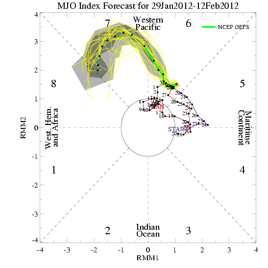
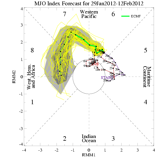
What effect does the MJO have in our neck of the woods again? If it is in octives 7-8-1 does that mean a higher chance of rain here?
It's complex, tropical convection once reaching those octaves brings active weather to the region in which it resides (7-8-1 is the western hemisphere in general). Weather becomes active and stormy. In winter it means enhanced storms and sometimes gives a boost to a stronger than usual PNA+ (higher ridge out west into AK). In the summer it can spark tropical cyclones. This winter it pretty much has sat at 4-6, the worst position for winter (unless you are wxman of course