
Atlantic Sea Surface Temperatures and Anomalies
Moderator: S2k Moderators
Forum rules

The posts in this forum are NOT official forecasts and should not be used as such. They are just the opinion of the poster and may or may not be backed by sound meteorological data. They are NOT endorsed by any professional institution or STORM2K. For official information, please refer to products from the National Hurricane Center and National Weather Service.
-
cycloneye

- Admin

- Posts: 149479
- Age: 69
- Joined: Thu Oct 10, 2002 10:54 am
- Location: San Juan, Puerto Rico
Re: Atlantic Sea Surface Temperatures and Anomalies
For being mid-January,those Atlantic waters for the most part are from slightly to above average. Let's see how they continue in the next few months.
0 likes
Visit the Caribbean-Central America Weather Thread where you can find at first post web cams,radars
and observations from Caribbean basin members Click Here
and observations from Caribbean basin members Click Here
-
cycloneye
- Admin
- Posts: 149479
- Age: 69
- Joined: Thu Oct 10, 2002 10:54 am
- Location: San Juan, Puerto Rico
Re: Atlantic Sea Surface Temperatures and Anomalies

0 likes
Visit the Caribbean-Central America Weather Thread where you can find at first post web cams,radars
and observations from Caribbean basin members Click Here
and observations from Caribbean basin members Click Here
-
HouTXmetro

- Category 5

- Posts: 3949
- Joined: Sun Jun 13, 2004 6:00 pm
- Location: District of Columbia, USA
Re: Atlantic Sea Surface Temperatures and Anomalies
can someone post the new anomaly maps? with the warm winter the gulf coast has had i would assume the water should be above average.
0 likes
[Disclaimer: My Amateur Opinion, please defer to your local authorities or the NHC for Guidance.]
-
cycloneye
- Admin
- Posts: 149479
- Age: 69
- Joined: Thu Oct 10, 2002 10:54 am
- Location: San Juan, Puerto Rico
Re: Atlantic Sea Surface Temperatures and Anomalies
HouTXmetro wrote:can someone post the new anomaly maps? with the warm winter the gulf coast has had i would assume the water should be above average.
Here are the latest sst anomalies and the GOM continues to be very warm.Also,the GulfStream waters off the East Coast are very,very warm.

Uploaded with ImageShack
0 likes
Visit the Caribbean-Central America Weather Thread where you can find at first post web cams,radars
and observations from Caribbean basin members Click Here
and observations from Caribbean basin members Click Here

Re: Atlantic Sea Surface Temperatures and Anomalies
yep I suspected the GOM would be primed as we enter April. Seems incredibly early to see temps like this. Might lead to a fast start to this season. JMO...
0 likes
-
wxman57

- Moderator-Pro Met

- Posts: 23174
- Age: 68
- Joined: Sat Jun 21, 2003 8:06 pm
- Location: Houston, TX (southwest)
Re: Atlantic Sea Surface Temperatures and Anomalies
Latest Euro is predicting near normal SSTs this season across most of the tropical Atlantic. Also, note what the Euro is forecasting in the Tropical Pacific - El Nino.

0 likes
-
cycloneye
- Admin
- Posts: 149479
- Age: 69
- Joined: Thu Oct 10, 2002 10:54 am
- Location: San Juan, Puerto Rico
Re: Atlantic Sea Surface Temperatures and Anomalies
From the CSU Facebook page:
You can see significant cooling has taken place in the tropical Atlantic since the start of last winter. We likely have a positive North Atlantic Oscillation (NAO) to thank for this cooling. Very strong anomalous westerly wind flow and a strong subtropical high have caused increased wind-induced cooling due to mixing and upwelling. In addition strong mid-latitude westerlies cause anomalous ocean currents out of the north, which also drives cooling along the eastern part of the basin.
You can see significant cooling has taken place in the tropical Atlantic since the start of last winter. We likely have a positive North Atlantic Oscillation (NAO) to thank for this cooling. Very strong anomalous westerly wind flow and a strong subtropical high have caused increased wind-induced cooling due to mixing and upwelling. In addition strong mid-latitude westerlies cause anomalous ocean currents out of the north, which also drives cooling along the eastern part of the basin.
0 likes
Visit the Caribbean-Central America Weather Thread where you can find at first post web cams,radars
and observations from Caribbean basin members Click Here
and observations from Caribbean basin members Click Here
-
cycloneye
- Admin
- Posts: 149479
- Age: 69
- Joined: Thu Oct 10, 2002 10:54 am
- Location: San Juan, Puerto Rico
Re: Atlantic Sea Surface Temperatures and Anomalies
A question to wxman57. Are the GOM and Gulfstream waters so warm at this time of the year because of the mild winter or there are other reasons?

Uploaded with ImageShack.us
Uploaded with ImageShack.us
0 likes
Visit the Caribbean-Central America Weather Thread where you can find at first post web cams,radars
and observations from Caribbean basin members Click Here
and observations from Caribbean basin members Click Here
-
wxman57
- Moderator-Pro Met
- Posts: 23174
- Age: 68
- Joined: Sat Jun 21, 2003 8:06 pm
- Location: Houston, TX (southwest)
Re: Atlantic Sea Surface Temperatures and Anomalies
cycloneye wrote:A question to wxman57. Are the GOM and Gulfstream waters so warm at this time of the year because of the mild winter or there are other reasons?
http://polar.ncep.noaa.gov/sst/oper/nat ... _oper0.png
That's just about the whole reason, cycloneye. Lack of deep cold airmasses moving out across the Gulf or off the East U.S. Coast this year has kept the water temps above normal. This doesn't necessarily mean that the same areas will remain so much above normal in the Summer. These same temps we're observing today would be considered to be below normal if this was June. But I do expect that ocean temps across the northern Gulf and along the East U.S. Coast will remain at least a little above normal this summer. Temps in the Caribbean and Tropical Atlantic will likely be near normal or perhaps a little below normal, due to increased trade winds resulting in upwelling of cooler water.
0 likes
-
cycloneye
- Admin
- Posts: 149479
- Age: 69
- Joined: Thu Oct 10, 2002 10:54 am
- Location: San Juan, Puerto Rico
Re: Atlantic Sea Surface Temperatures and Anomalies
Here are the latest sst anomalies update for the North Atlantic and look how it continues to warm in the GOM and off the East Coast of the U.S.

Uploaded with ImageShack.us
Uploaded with ImageShack.us
0 likes
Visit the Caribbean-Central America Weather Thread where you can find at first post web cams,radars
and observations from Caribbean basin members Click Here
and observations from Caribbean basin members Click Here
-
cycloneye
- Admin
- Posts: 149479
- Age: 69
- Joined: Thu Oct 10, 2002 10:54 am
- Location: San Juan, Puerto Rico
Re: Atlantic Sea Surface Temperatures and Anomalies
Is a little bit more warmer west of 40W longitude if you compare the data with last week's graphic at above post. But look how warm are those sst anomalies in the GOM and off the East Coast of the U.S.

Uploaded with imageshack.us
Uploaded with imageshack.us
0 likes
Visit the Caribbean-Central America Weather Thread where you can find at first post web cams,radars
and observations from Caribbean basin members Click Here
and observations from Caribbean basin members Click Here

Re: Atlantic Sea Surface Temperatures and Anomalies
they are warming up nicely compared to last year. With the forecast looking more and more Nuetral during the peak and we havent hit the highest sun angle this could bust some lower number predictions.
0 likes
-
Kingarabian

- S2K Supporter

- Posts: 16365
- Joined: Sat Aug 08, 2009 3:06 am
- Location: Honolulu, Hawaii
Re: Atlantic Sea Surface Temperatures and Anomalies
ROCK wrote:they are warming up nicely compared to last year. With the forecast looking more and more Nuetral during the peak and we havent hit the highest sun angle this could bust some lower number predictions.
I don't know if it will be Neutral during the peak...
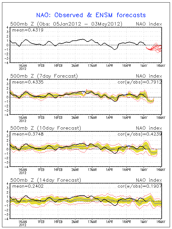
Vertical shear over the Atlantic remains above average:

0 likes
RIP Kobe Bryant
Re: Atlantic Sea Surface Temperatures and Anomalies
yep.....but we are not even close to D-day.....JAS is prime....Felix and Dean come to mind....I think the numbers are to low and they will be adjusted up as we get closer.....JMO.....everyone seems to be dead set on EL Nino come peak.....I would bet that nuetral conditions will prevail in JAS.....this is not an El Nino year. Maybe come Oct into next year. Of course that is if there is a next year.... 
0 likes


Re: Atlantic Sea Surface Temperatures and Anomalies
ROCK wrote:yep.....but we are not even close to D-day.....JAS is prime....Felix and Dean come to mind....I think the numbers are to low and they will be adjusted up as we get closer.....JMO.....everyone seems to be dead set on EL Nino come peak.....I would bet that nuetral conditions will prevail in JAS.....this is not an El Nino year. Maybe come Oct into next year. Of course that is if there is a next year....
The rise in SOI lately could back your ideas. However based on other factors I still say amount wise it might be below neutral or El Nino. That does not mean weaker storms...neutral, el nino, or la nina, water temps come peak season is ALWAYS warm enough to support a big one. The question is will the atmosphere allow their formation, should monitor activity in Africa and surrounding waters early in the season. More waves = more chances for storms to form (even home brews sometimes have origins from there)!
0 likes
The above post and any post by Ntxw is NOT an official forecast and should not be used as such. It is just the opinion of the poster and may or may not be backed by sound meteorological data. It is NOT endorsed by any professional institution including Storm2k. For official information, please refer to NWS products.
Help support Storm2K!
Re: Atlantic Sea Surface Temperatures and Anomalies
Kingarabian wrote:ROCK wrote:they are warming up nicely compared to last year. With the forecast looking more and more Nuetral during the peak and we havent hit the highest sun angle this could bust some lower number predictions.
I don't know if it will be Neutral during the peak...
Vertical shear over the Atlantic remains above average:
its May...
0 likes
-
vbhoutex

- Storm2k Executive
- Posts: 29149
- Age: 74
- Joined: Wed Oct 09, 2002 11:31 pm
- Location: Cypress, TX
- Contact:
Re: Atlantic Sea Surface Temperatures and Anomalies
ROCK wrote:yep.....but we are not even close to D-day.....JAS is prime....Felix and Dean come to mind....I think the numbers are to low and they will be adjusted up as we get closer.....JMO.....everyone seems to be dead set on EL Nino come peak.....I would bet that nuetral conditions will prevail in JAS.....this is not an El Nino year. Maybe come Oct into next year. Of course that is if there is a next year....
LOL @ your last sentence.
It seems more and more are coming around to neutral through the summer which could be a game changer. It is going to be interesting to watch.
0 likes
Skywarn, C.E.R.T.
Please click below to donate to STORM2K to help with the expenses of keeping the site going:

Please click below to donate to STORM2K to help with the expenses of keeping the site going:
Re: Atlantic Sea Surface Temperatures and Anomalies
vbhoutex wrote:ROCK wrote:yep.....but we are not even close to D-day.....JAS is prime....Felix and Dean come to mind....I think the numbers are to low and they will be adjusted up as we get closer.....JMO.....everyone seems to be dead set on EL Nino come peak.....I would bet that nuetral conditions will prevail in JAS.....this is not an El Nino year. Maybe come Oct into next year. Of course that is if there is a next year....
LOL @ your last sentence.
It seems more and more are coming around to neutral through the summer which could be a game changer. It is going to be interesting to watch.
yes it will be.....the Aussie model showed very close to neutral and a very weak EL Nino come peak. I dont think its going to make that much difference. GFS already poppin...
0 likes
Re: Atlantic Sea Surface Temperatures and Anomalies
The TNA (tropical north atlantic index, anomaly average of middle north atlantic) is negative overall. Last negative readings of such duration was in 2009 and before that 2002. Another similar rising analog with similar numbers and data is 1992.
http://www.esrl.noaa.gov/psd/data/correlation/tna.data
http://www.esrl.noaa.gov/psd/data/correlation/tna.data
0 likes
The above post and any post by Ntxw is NOT an official forecast and should not be used as such. It is just the opinion of the poster and may or may not be backed by sound meteorological data. It is NOT endorsed by any professional institution including Storm2k. For official information, please refer to NWS products.
Help support Storm2K!
Help support Storm2K!
Who is online
Users browsing this forum: No registered users and 203 guests