ENSO Updates (2007 thru 2023)

This is the general tropical discussion area. Anyone can take their shot at predicting a storms path.

Moderator: S2k Moderators

Forum rules

The posts in this forum are NOT official forecasts and should not be used as such. They are just the opinion of the poster and may or may not be backed by sound meteorological data. They are NOT endorsed by any professional institution or STORM2K. For official information, please refer to products from the National Hurricane Center and National Weather Service.

Help Support Storm2K
Message
Author
User avatar
Ntxw
Storm2k Moderator
Storm2k Moderator
Posts: 22784
Joined: Wed Oct 21, 2009 6:34 pm
Location: DFW, Texas

Re:

#1961 Postby Ntxw » Mon Apr 09, 2012 9:11 am

Kingarabian wrote:Will see how tomorrows Nino areas update reflect towards the crashing SOI.


Most areas should show slight warming. As seen in the sea surface temperature anomaly map, all areas of ENSO showed continued gradual warming temperatures.

Image
0 likes   
The above post and any post by Ntxw is NOT an official forecast and should not be used as such. It is just the opinion of the poster and may or may not be backed by sound meteorological data. It is NOT endorsed by any professional institution including Storm2k. For official information, please refer to NWS products.

  Help support Storm2K!
Help Support Storm2K

User avatar
cycloneye
Admin
Admin
Posts: 145303
Age: 68
Joined: Thu Oct 10, 2002 10:54 am
Location: San Juan, Puerto Rico

Re: ENSO Updates

#1962 Postby cycloneye » Mon Apr 09, 2012 10:56 am

Climate Prediction Center 4/9/12 Update

Nino 3.4 cooled slightly from -0.2C that was at last week's update to -0.3C in this week's one.

http://www.cpc.ncep.noaa.gov/products/a ... ts-web.pdf

Image
0 likes   
Visit the Caribbean-Central America Weather Thread where you can find at first post web cams,radars
and observations from Caribbean basin members Click Here

User avatar
Ntxw
Storm2k Moderator
Storm2k Moderator
Posts: 22784
Joined: Wed Oct 21, 2009 6:34 pm
Location: DFW, Texas

#1963 Postby Ntxw » Mon Apr 09, 2012 12:23 pm

Well there goes my guess from the last update lol. SOI is low but not as low as the past several days.
0 likes   
The above post and any post by Ntxw is NOT an official forecast and should not be used as such. It is just the opinion of the poster and may or may not be backed by sound meteorological data. It is NOT endorsed by any professional institution including Storm2k. For official information, please refer to NWS products.


  Help support Storm2K!

Help Support Storm2K


User avatar
cycloneye
Admin
Admin
Posts: 145303
Age: 68
Joined: Thu Oct 10, 2002 10:54 am
Location: San Juan, Puerto Rico

Re: ENSO=CPC 4/9/12= La Nina transition to Neutral is underway

#1964 Postby cycloneye » Mon Apr 09, 2012 1:30 pm

Here is a complete global monitoring update on how the Oceans are by CPC. The peeps will find plenty of detailed info here on how things are progressing.

http://www.cpc.ncep.noaa.gov/products/G ... urrent.pdf
0 likes   
Visit the Caribbean-Central America Weather Thread where you can find at first post web cams,radars
and observations from Caribbean basin members Click Here

User avatar
MGC
S2K Supporter
S2K Supporter
Posts: 5899
Joined: Sun Mar 23, 2003 9:05 pm
Location: Pass Christian MS, or what is left.

Re: ENSO=CPC 4/9/12= La Nina transition to Neutral is underway

#1965 Postby MGC » Mon Apr 09, 2012 9:07 pm

GOM positive anomaly is scary going into the 2012 season.....hopefully a stronger El Nino developes and holds down TC formation this year......MGC
0 likes   

User avatar
Ntxw
Storm2k Moderator
Storm2k Moderator
Posts: 22784
Joined: Wed Oct 21, 2009 6:34 pm
Location: DFW, Texas

#1966 Postby Ntxw » Mon Apr 09, 2012 10:32 pm

^ It is a scary thought. Good thing it is April and the above anomalies are relative to this time of year which is still cool compared to June-Sept in terms of raw surface temperatures.
0 likes   
The above post and any post by Ntxw is NOT an official forecast and should not be used as such. It is just the opinion of the poster and may or may not be backed by sound meteorological data. It is NOT endorsed by any professional institution including Storm2k. For official information, please refer to NWS products.


  Help support Storm2K!

Help Support Storm2K


User avatar
Ptarmigan
Category 5
Category 5
Posts: 5313
Joined: Wed Aug 16, 2006 9:06 pm

Re: ENSO=CPC 4/9/12= La Nina transition to Neutral is underway

#1967 Postby Ptarmigan » Mon Apr 09, 2012 11:39 pm

MGC wrote:GOM positive anomaly is scary going into the 2012 season.....hopefully a stronger El Nino developes and holds down TC formation this year......MGC


I have seen less active seasons with weak ENSOs. However, they occurred in a cooler phase of the Atlantic. Since we are in a warm phase and PDO is in a cool phase, I don't think we could see a strong El Nino.
0 likes   

User avatar
Kingarabian
S2K Supporter
S2K Supporter
Posts: 15980
Joined: Sat Aug 08, 2009 3:06 am
Location: Honolulu, Hawaii

#1968 Postby Kingarabian » Tue Apr 10, 2012 3:48 am

The SOI is at almost -4. Isn't it below -8 when we start to see a formation of an El-Nino?
0 likes   
RIP Kobe Bryant

User avatar
Blown Away
S2K Supporter
S2K Supporter
Posts: 10145
Joined: Wed May 26, 2004 6:17 am

Re: ENSO=CPC 4/9/12= La Nina transition to Neutral is underway

#1969 Postby Blown Away » Tue Apr 10, 2012 8:50 am

%'s still higher for Neutral compared to El Nino?
0 likes   
Hurricane Eye Experience: David 79, Irene 99, Frances 04, Jeanne 04, Wilma 05... EYE COMING MY WAY IN 2024…
Hurricane Brush Experience: Andrew 92, Erin 95, Floyd 99, Matthew 16, Irma 17, Ian 22, Nicole 22…

User avatar
Kingarabian
S2K Supporter
S2K Supporter
Posts: 15980
Joined: Sat Aug 08, 2009 3:06 am
Location: Honolulu, Hawaii

Re: ENSO=CPC 4/9/12= La Nina transition to Neutral is underway

#1970 Postby Kingarabian » Tue Apr 10, 2012 3:02 pm

Blown Away wrote:%'s still higher for Neutral compared to El Nino?

Yeah. I guess the SOI is just like a casual indicator of whats happening in regards of the ENSO. Mondays update proved it because even though the SOI is crashing, the temps managed to rise slightly.
0 likes   
RIP Kobe Bryant

User avatar
hurricanetrack
HurricaneTrack.com
HurricaneTrack.com
Posts: 1781
Joined: Tue Dec 02, 2003 10:46 pm
Location: Wilmington, NC
Contact:

#1971 Postby hurricanetrack » Wed Apr 11, 2012 8:54 am

BOM says this from their update yesterday:

"Following the demise of the 2011–12 La Niña, the state of ENSO across the tropical Pacific remains neutral (neither El Niño nor La Niña). Climate models surveyed by the Bureau of Meteorology suggest that, although the Pacific Ocean will continue to warm over the coming months, a neutral ENSO state will persist into the southern hemisphere winter. Historically, about 70% of the time neutral or El Niño conditions have developed in the year following a 2-year La Niña event."
0 likes   

User avatar
wxman57
Moderator-Pro Met
Moderator-Pro Met
Posts: 22978
Age: 67
Joined: Sat Jun 21, 2003 8:06 pm
Location: Houston, TX (southwest)

Re: ENSO Updates

#1972 Postby wxman57 » Wed Apr 11, 2012 3:57 pm

Some of you may have noticed that the CFS ENSO model has been updated recently. The new CFSv2 model which is replacing the older version 1 is much more strongly forecasting an El Nino by mid summer. It's actually in very good agreement with the GFS.

From the paper on the CFS page:
http://journals.ametsoc.org/doi/pdf/10. ... BAMS3001.1

Since the CFS version 1 implementation in 2004(Saha et al. 2006), CPC and many other users have utilized the 4-times-daily seasonal integrations for their monthly and seasonal forecast products. However, the system has many internal inconsistencies. For instance, the R2 atmospheric initial states are made with technology from the 1990s, while the atmospheric model component of CFS is from a decade
later. Thus, the initial states and forecast model are inconsistent, which is a situation that leads to loss of skill during the early part of the integrations.

One of the major goals of executing the new CFSR was to create initial states for the atmosphere, ocean, land, and sea ice that are both state of the art and as consistent as possible with the next version of the CFS version 2.


So the CFSv2 is much more state-of-the-art as far as how it’s initialized. Check out the latest forecast. 3-month average at +.5C by August:

Image

Image
0 likes   

User avatar
SFLcane
S2K Supporter
S2K Supporter
Posts: 10163
Age: 47
Joined: Sat Jun 05, 2010 1:44 pm
Location: Lake Worth Florida

Re: ENSO Updates

#1973 Postby SFLcane » Wed Apr 11, 2012 5:45 pm

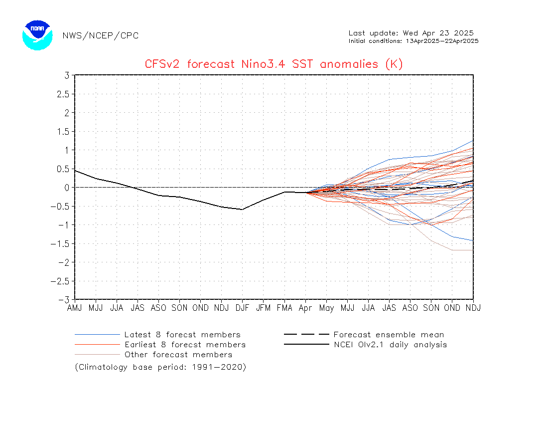
wxman57 wrote:Some of you may have noticed that the CFS ENSO model has been updated recently. The new CFSv2 model which is replacing the older version 1 is much more strongly forecasting an El Nino by mid summer. It's actually in very good agreement with the GFS.

From the paper on the CFS page:
http://journals.ametsoc.org/doi/pdf/10. ... BAMS3001.1

Since the CFS version 1 implementation in 2004(Saha et al. 2006), CPC and many other users have utilized the 4-times-daily seasonal integrations for their monthly and seasonal forecast products. However, the system has many internal inconsistencies. For instance, the R2 atmospheric initial states are made with technology from the 1990s, while the atmospheric model component of CFS is from a decade
later. Thus, the initial states and forecast model are inconsistent, which is a situation that leads to loss of skill during the early part of the integrations.

One of the major goals of executing the new CFSR was to create initial states for the atmosphere, ocean, land, and sea ice that are both state of the art and as consistent as possible with the next version of the CFS version 2.


So the CFSv2 is much more state-of-the-art as far as how it’s initialized. Check out the latest forecast. 3-month average at +.5C by August:

http://www.cpc.ncep.noaa.gov/products/C ... o34Sea.gif

http://www.cpc.ncep.noaa.gov/products/C ... o34Mon.gif


Ouch...
0 likes   

User avatar
cycloneye
Admin
Admin
Posts: 145303
Age: 68
Joined: Thu Oct 10, 2002 10:54 am
Location: San Juan, Puerto Rico

Re: ENSO Updates

#1974 Postby cycloneye » Wed Apr 11, 2012 5:55 pm

cycloneye wrote:I have a question for wxman57 regarding the NCEP models CFS and CFSv2. They look very different with those forecasts. Why is that?

CFS:

http://img638.imageshack.us/img638/2060 ... sstmon.gif

CFSv2:

http://img837.imageshack.us/img837/6981/nino34mon.gif

Both uploaded with imageshack.us


Thank you wxman57 for the long answer to this important question that I had about why the different forecasts by CFS and CFSv2. By the way, CFS will be discontinued in June.
0 likes   
Visit the Caribbean-Central America Weather Thread where you can find at first post web cams,radars
and observations from Caribbean basin members Click Here

User avatar
wxman57
Moderator-Pro Met
Moderator-Pro Met
Posts: 22978
Age: 67
Joined: Sat Jun 21, 2003 8:06 pm
Location: Houston, TX (southwest)

Re: ENSO Updates

#1975 Postby wxman57 » Thu Apr 12, 2012 10:18 am

I was studying Nino 3.4 SST anomalies to compare analog seasons for 2012. Wanted to expand the view to the year before then compare the analog seasons side-by-side. Came up with the following graphics.

First, a comparison of Phil Klotzbach's analogs 1957 and 1965. Not much of a comparison between 1956, 1964 and 2008 leading up to the analog seasons:
Image

But when I compared 2008-2009 to 2011-2012, using the latest CFSv2 2012 predictions, I got a graphic that is almost identical to the 2008-2009 pattern for this season:
Image

Now, Nino 3.4 anomalies are only part of the analog, but the coming season's SST pattern in the Pacific is quite close to that of 2009. We know the Euro is forecasting quite high pressures across the Atlantic this season, stemming from a persistent +NAO - meaning a stronger Bermuda high, stronger easterly trades, more upwelling resulting in cooler SSTs in the MDR. Not sure of the mean sea level pressure anomalies in 2009 (and '57, '65) compared to what is predicted for this year.

Note that 2001 is no longer an analog season. Phil had put that one in because of the possibility 2012 would be a "neutral" year. But it's looking more likely an El Nino will develop. That takes out an analog with 15 named storms, meaning the analog seasons now have 8, 6 and 9 named storms. I still think there's a very good chance 2012 will have fewer than 10 named storms, possibly with only 3-4 hurricanes and 1-2 majors.
0 likes   

User avatar
wxman57
Moderator-Pro Met
Moderator-Pro Met
Posts: 22978
Age: 67
Joined: Sat Jun 21, 2003 8:06 pm
Location: Houston, TX (southwest)

Re: ENSO Updates

#1976 Postby wxman57 » Thu Apr 12, 2012 3:00 pm

May need to include 1951 as an analog season, though it may not match in terms of Atlantic SSTs or the predicted strength of the Bermuda High.

Image
0 likes   

User avatar
cycloneye
Admin
Admin
Posts: 145303
Age: 68
Joined: Thu Oct 10, 2002 10:54 am
Location: San Juan, Puerto Rico

Re: ENSO Updates

#1977 Postby cycloneye » Thu Apr 12, 2012 7:45 pm

The SOI continues to fall and if it crosses negative 8,El Nino will be sonner rather than later.

Image
0 likes   
Visit the Caribbean-Central America Weather Thread where you can find at first post web cams,radars
and observations from Caribbean basin members Click Here

User avatar
Kingarabian
S2K Supporter
S2K Supporter
Posts: 15980
Joined: Sat Aug 08, 2009 3:06 am
Location: Honolulu, Hawaii

Re: ENSO Updates

#1978 Postby Kingarabian » Thu Apr 12, 2012 8:45 pm

cycloneye wrote:The SOI continues to fall and if it crosses negative 8,El Nino will be sonner rather than later.


Jeez it was just 5.1.
0 likes   
RIP Kobe Bryant

User avatar
cycloneye
Admin
Admin
Posts: 145303
Age: 68
Joined: Thu Oct 10, 2002 10:54 am
Location: San Juan, Puerto Rico

Re: ENSO Updates

#1979 Postby cycloneye » Fri Apr 13, 2012 6:32 am

Finnally the crash stopped at the daily SOI.

http://www.longpaddock.qld.gov.au/seaso ... soivalues/
0 likes   
Visit the Caribbean-Central America Weather Thread where you can find at first post web cams,radars
and observations from Caribbean basin members Click Here

User avatar
hurricanetrack
HurricaneTrack.com
HurricaneTrack.com
Posts: 1781
Joined: Tue Dec 02, 2003 10:46 pm
Location: Wilmington, NC
Contact:

#1980 Postby hurricanetrack » Fri Apr 13, 2012 11:54 am

Well, so far, the MDR is not looking all that cool to me:

http://www.osdpd.noaa.gov/data/sst/anomaly/anomwne.gif

Of course, it makes no difference what it looks like out there now, I suppose it really matters when we get to A/S/O. Still, there are some .25 to .50 areas in there and very little negative values.
0 likes   


Return to “Talkin' Tropics”

Who is online

Users browsing this forum: Bing [Bot], Europa non è lontana, riapal and 41 guests