Plains Tornado Outbreak 4/14-15
Moderator: S2k Moderators
Forum rules

The posts in this forum are NOT official forecast and should not be used as such. They are just the opinion of the poster and may or may not be backed by sound meteorological data. They are NOT endorsed by any professional institution or STORM2K.
-
Dave

- Retired Staff

- Posts: 13442
- Age: 75
- Joined: Tue Aug 01, 2006 3:57 pm
- Location: Milan Indiana
- Contact:
BULLETIN - EAS ACTIVATION REQUESTED
TORNADO WARNING
NATIONAL WEATHER SERVICE DODGE CITY KS
417 PM CDT SAT APR 14 2012
THE NATIONAL WEATHER SERVICE IN DODGE CITY HAS ISSUED A
* TORNADO WARNING FOR...
EAST CENTRAL EDWARDS COUNTY IN SOUTH CENTRAL KANSAS...
SOUTHEASTERN PAWNEE COUNTY IN SOUTH CENTRAL KANSAS...
WEST CENTRAL STAFFORD COUNTY IN SOUTH CENTRAL KANSAS...
* UNTIL 445 PM CDT
* AT 416 PM CDT...NATIONAL WEATHER SERVICE DOPPLER RADAR INDICATED
VERY STRONG ROTATION ASSOCIATED WITH A POSSIBLE TORNADO 3 MILES
WEST OF MACKSVILLE. THIS DANGEROUS STORM WAS MOVING NORTHEAST AT 50
MPH. GOLF BALL SIZE HAIL IS ALSO EXPECTED WITH THIS STORM.
* LOCATIONS IMPACTED INCLUDE...
DILLWYN AND ST. JOHN.
PRECAUTIONARY/PREPAREDNESS ACTIONS...
HEAVY RAINFALL MAY OBSCURE THIS TORNADO. DO NOT WAIT TO SEE OR HEAR
THE TORNADO. TAKE COVER NOW.
0 likes
-
cycloneye

- Admin

- Posts: 149508
- Age: 69
- Joined: Thu Oct 10, 2002 10:54 am
- Location: San Juan, Puerto Rico
Re: Plains Tornado Outbreak: High Risk on 4/14-15 at OK,KS,NEB
FYI=The SPC graphic is filling rapidly with reports and the Stormchasers are on full force chasing in the area.
See it all at Sticky Thread
See it all at Sticky Thread
0 likes
Visit the Caribbean-Central America Weather Thread where you can find at first post web cams,radars
and observations from Caribbean basin members Click Here
and observations from Caribbean basin members Click Here


Re: Plains Tornado Outbreak: High Risk on 4/14-15 at OK,KS,NEB
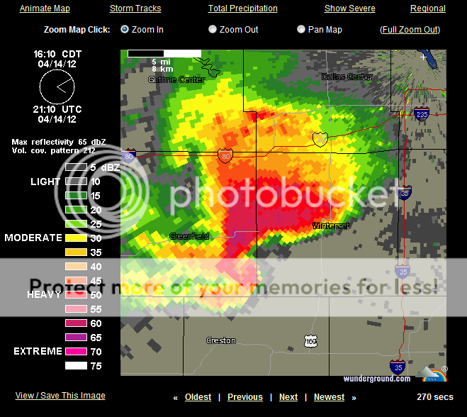
This thing is on a B-line towards the southern portion of Des Moines.
0 likes
NOTICE: I cannot give an expert analysis. Most of my "observations" are made visually with the help of only vital information provided by public advisories.

-
Dave
- Retired Staff
- Posts: 13442
- Age: 75
- Joined: Tue Aug 01, 2006 3:57 pm
- Location: Milan Indiana
- Contact:
Re: Re:
Bunkertor wrote:RL3AO wrote:Do you guys want me to keep posting the radar images?
That would be cool. Can you deliver Supercell-cuts ( those pics that sho how high the clouds reach ) ?
Yes I have very little time to look so I catch yours here.
0 likes
Re:
Dave wrote:I'm watching the Des Moines IA office also.
Has that cell lost some steam? I don't see a new tornado warning on it...
0 likes
NOTICE: I cannot give an expert analysis. Most of my "observations" are made visually with the help of only vital information provided by public advisories.

Re: Re:
Bunkertor wrote:RL3AO wrote:Do you guys want me to keep posting the radar images?
That would be cool. Can you deliver Supercell-cuts ( those pics that sho how high the clouds reach ) ?
I don't have analyst. There is a scan that shows how high the cloud tops are though.
0 likes
-
Dave
- Retired Staff
- Posts: 13442
- Age: 75
- Joined: Tue Aug 01, 2006 3:57 pm
- Location: Milan Indiana
- Contact:
SHORT TERM FORECAST
NATIONAL WEATHER SERVICE NORMAN OK
421 PM CDT SAT APR 14 2012
OKZ004>048-050>052-TXZ083>090-142330-
HARPER-WOODS-ALFALFA-GRANT-KAY-ELLIS-WOODWARD-MAJOR-GARFIELD-
NOBLE-ROGER MILLS-DEWEY-CUSTER-BLAINE-KINGFISHER-LOGAN-PAYNE-
BECKHAM-WASHITA-CADDO-CANADIAN-OKLAHOMA-LINCOLN-GRADY-MCCLAIN-
CLEVELAND-POTTAWATOMIE-SEMINOLE-HUGHES-HARMON-GREER-KIOWA-JACKSON-
TILLMAN-COMANCHE-STEPHENS-GARVIN-MURRAY-PONTOTOC-COAL-COTTON-
JEFFERSON-CARTER-JOHNSTON-ATOKA-LOVE-MARSHALL-BRYAN-HARDEMAN-
FOARD-WILBARGER-WICHITA-KNOX-BAYLOR-ARCHER-CLAY-
INCLUDING THE CITIES OF...BUFFALO...ALVA...CHEROKEE...MEDFORD...
PONCA CITY...ARNETT...WOODWARD...FAIRVIEW...ENID...PERRY...
CHEYENNE...TALOGA...WEATHERFORD...CLINTON...WATONGA...
KINGFISHER...GUTHRIE...STILLWATER...ELK CITY...SAYRE...CORDELL...
ANADARKO...YUKON...EL RENO...MUSTANG...OKLAHOMA CITY...CHANDLER...
CHICKASHA...PURCELL...NORMAN...MOORE...SHAWNEE...SEMINOLE...
HOLDENVILLE...HOLLIS...MANGUM...HOBART...ALTUS...FREDERICK...
LAWTON...DUNCAN...PAULS VALLEY...SULPHUR...ADA...COALGATE...
WALTERS...WAURIKA...ARDMORE...TISHOMINGO...ATOKA...MARIETTA...
MADILL...DURANT...QUANAH...CHILLICOTHE...CROWELL...VERNON...
WICHITA FALLS...MUNDAY...KNOX CITY...SEYMOUR...ARCHER CITY...
HOLLIDAY...LAKESIDE CITY...HENRIETTA
421 PM CDT SAT APR 14 2012
.NOW...
SEVERAL SUPERCELLS HAVE DEVELOPED IN THE LAST FEW HOURS ACROSS FAR
NORTHWEST OKLAHOMA. AT 415 PM...THE MOST SEVERE STORMS WERE
LOCATED NEAR FREEDOM IN WOODS COUNTY AND SOUTH OF ARNETT IN
SOUTHERN ELLIS COUNTY. THESE SUPERCELLS HAVE HAD A HISTORY OF
PRODUCING HAIL TO 3 INCHES IN DIAMETER AND DAMAGING WINDS IN
EXCESS OF 70 MPH. BRIEF TORNADOES HAVE ALSO BEEN REPORTED WITH THE
STORM NEAR FREEDOM.
ADDITIONAL STORMS WILL FORM IN THE TEXAS PANHANDLE AND WESTERN
OKLAHOMA AND MOVE NORTHEASTWARD RAPIDLY INTO PARTS OF WEST CENTRAL
AND NORTHWEST OKLAHOMA. ANY STORM THAT DEVELOPS WILL HAVE THE
POTENTIAL TO PRODUCE STRONG TORNADOES...VERY LARGE AND DESTRUCTIVE
HAIL...AND DAMAGING WINDS. REMAIN ALERT AND MONITOR NOAA WEATHER
RADIO IF THREATENING WEATHER APPROACHES YOUR AREA.
$$
0 likes

-
WeatherGuesser
- Category 5

- Posts: 2672
- Joined: Tue Jun 29, 2010 6:46 am
-
CrazyC83
- Professional-Met

- Posts: 34315
- Joined: Tue Mar 07, 2006 11:57 pm
- Location: Deep South, for the first time!
Re: Plains Tornado Outbreak: High Risk on 4/14-15 at OK,KS,NEB
ZCZC SPCPWOSPC ALL
WOUS40 KWNS 142020
KSZ000-NEZ000-OKZ000-150200-
PUBLIC SEVERE WEATHER OUTLOOK
NWS STORM PREDICTION CENTER NORMAN OK
0320 PM CDT SAT APR 14 2012
...A SIGNIFICANT OUTBREAK OF STRONG TO VIOLENT TORNADOES IS EXPECTED
OVER PARTS OF THE CENTRAL AND SOUTHERN PLAINS THIS AFTERNOON AND
TONIGHT...
THE NWS STORM PREDICTION CENTER IN NORMAN OK IS FORECASTING THE
DEVELOPMENT OF SEVERAL STRONG TO VIOLENT...LONG-TRACK TORNADOES OVER
PARTS OF THE CENTRAL AND SOUTHERN PLAINS THIS AFTERNOON AND TONIGHT.
CONDITIONS WILL REMAIN FAVORABLE FOR STRONG TO VIOLENT AND POSSIBLY
LONG-LIVED TORNADOES INTO THE OVERNIGHT HOURS.
TORNADOES DURING THE OVERNIGHT HOURS CAN BE PARTICULARLY DANGEROUS
BECAUSE THEY ARE USUALLY FAST-MOVING AND OBSCURED BY RAIN AND
DARKNESS.
THE AREAS MOST LIKELY TO EXPERIENCE THIS ACTIVITY INCLUDE
CENTRAL AND EASTERN KANSAS
CENTRAL AND EASTERN NEBRASKA
CENTRAL AND NORTH CENTRAL OKLAHOMA
STATE AND LOCAL EMERGENCY MANAGERS ARE MONITORING THIS DEVELOPING
SITUATION. THOSE IN THE THREATENED AREA ARE URGED TO REVIEW SEVERE
WEATHER SAFETY RULES AND TO LISTEN TO RADIO...TELEVISION...AND NOAA
WEATHER RADIO FOR POSSIBLE WATCHES...WARNINGS...AND STATEMENTS
TONIGHT.
..COHEN/WEISS.. 04/14/2012
$$
0 likes
-
Dave
- Retired Staff
- Posts: 13442
- Age: 75
- Joined: Tue Aug 01, 2006 3:57 pm
- Location: Milan Indiana
- Contact:
STAFFORD KS-PAWNEE KS-
429 PM CDT SAT APR 14 2012
...A TORNADO WARNING REMAINS IN EFFECT FOR SOUTHEASTERN PAWNEE AND
WEST CENTRAL STAFFORD COUNTIES UNTIL 445 PM CDT...
AT 425 PM CDT...TRAINED WEATHER SPOTTERS REPORTED A TORNADO 1 MILE
SOUTHEAST OF SEWARD. DOPPLER RADAR SHOWED THIS TORNADIC STORM MOVING
NORTHEAST AT 40 MPH. GOLF BALL SIZE HAIL IS ALSO EXPECTED WITH THIS
STORM.
LOCATIONS IMPACTED INCLUDE...
MAINLY RURAL AREAS OF SOUTHEASTERN PAWNEE AND WESTERN STAFFORD
COUNTIES.
PRECAUTIONARY/PREPAREDNESS ACTIONS...
MOTORISTS SHOULD NOT TAKE SHELTER UNDER HIGHWAY OVERPASSES. AS A LAST
RESORT...EITHER PARK YOUR VEHICLE AND STAY PUT...OR ABANDON YOUR
VEHICLE AND LIE DOWN IN A LOW LYING AREA.
0 likes
-
WeatherGuesser
- Category 5
- Posts: 2672
- Joined: Tue Jun 29, 2010 6:46 am

Return to “USA & Caribbean Weather”
Who is online
Users browsing this forum: No registered users and 98 guests