ATL: BERYL - Post-Tropical

Moderator: S2k Moderators

Message
Author
Aric Dunn
Category 5
Category 5
Posts: 21238
Age: 42
Joined: Sun Sep 19, 2004 9:58 pm
Location: Ready for the Chase.
Contact:

Re:

#141 Postby Aric Dunn » Thu May 24, 2012 11:35 am

'CaneFreak wrote:VERY strong mid level center to the SE of Miami...let's see if it can make it down to the surface 8-)

http://radar.weather.gov/radar.php?rid= ... 1&loop=yes


thats not very midlevel being the radar is really close. somewhere is the 950mb range.

looks like 1500 ft or so.
0 likes   
Note: If I make a post that is brief. Please refer back to previous posts for the analysis or reasoning. I do not re-write/qoute what my initial post said each time.
If there is nothing before... then just ask :)

Space & Atmospheric Physicist, Embry-Riddle Aeronautical University,
I believe the sky is falling...

User avatar
'CaneFreak
Category 5
Category 5
Posts: 1486
Joined: Mon Jun 05, 2006 10:50 am
Location: New Bern, NC

Re: Re:

#142 Postby 'CaneFreak » Thu May 24, 2012 11:42 am

Never mind...yeah...you're right...this could become the dominant LLC to track.

Aric Dunn wrote:
'CaneFreak wrote:VERY strong mid level center to the SE of Miami...let's see if it can make it down to the surface 8-)

http://radar.weather.gov/radar.php?rid= ... 1&loop=yes


thats not very midlevel being the radar is really close. somewhere is the 950mb range.

looks like 1500 ft or so.
0 likes   

Aric Dunn
Category 5
Category 5
Posts: 21238
Age: 42
Joined: Sun Sep 19, 2004 9:58 pm
Location: Ready for the Chase.
Contact:

Re: Re:

#143 Postby Aric Dunn » Thu May 24, 2012 11:45 am

'CaneFreak wrote:Never mind...yeah...you're right...this could become the dominant LLC to track.

Aric Dunn wrote:
'CaneFreak wrote:VERY strong mid level center to the SE of Miami...let's see if it can make it down to the surface 8-)

http://radar.weather.gov/radar.php?rid= ... 1&loop=yes


thats not very midlevel being the radar is really close. somewhere is the 950mb range.

looks like 1500 ft or so.


at this rate. we will probably see a continuation of the last couple days of new vort develop then another as it follows each burst of convection .
0 likes   
Note: If I make a post that is brief. Please refer back to previous posts for the analysis or reasoning. I do not re-write/qoute what my initial post said each time.
If there is nothing before... then just ask :)

Space & Atmospheric Physicist, Embry-Riddle Aeronautical University,
I believe the sky is falling...

User avatar
hurricanefloyd5
Category 5
Category 5
Posts: 1659
Age: 44
Joined: Sun May 02, 2004 10:53 am
Location: Spartanburg
Contact:

Re: ATL: INVEST 94L

#144 Postby hurricanefloyd5 » Thu May 24, 2012 11:46 am

remember tropical storm fay it strengthened over south florida because it swampy areas down there so what if this happens again with 94L
0 likes   

lebron23
Category 1
Category 1
Posts: 389
Age: 31
Joined: Sat May 24, 2008 11:58 am
Contact:

#145 Postby lebron23 » Thu May 24, 2012 11:46 am

I'm shocked at how it looks today, it was so elongated yesterday
0 likes   

Aric Dunn
Category 5
Category 5
Posts: 21238
Age: 42
Joined: Sun Sep 19, 2004 9:58 pm
Location: Ready for the Chase.
Contact:

#146 Postby Aric Dunn » Thu May 24, 2012 11:48 am

doppler estimates of that convection nearly ontop of miami beach are showing winds of nearly 70mph new severe t'storm warning for it.
0 likes   
Note: If I make a post that is brief. Please refer back to previous posts for the analysis or reasoning. I do not re-write/qoute what my initial post said each time.
If there is nothing before... then just ask :)

Space & Atmospheric Physicist, Embry-Riddle Aeronautical University,
I believe the sky is falling...

User avatar
Evil Jeremy
S2K Supporter
S2K Supporter
Posts: 5463
Age: 31
Joined: Mon Apr 10, 2006 2:10 pm
Location: Los Angeles, CA

Re: ATL: INVEST 94L

#147 Postby Evil Jeremy » Thu May 24, 2012 11:55 am

hurricanefloyd5 wrote:remember tropical storm fay it strengthened over south florida because it swampy areas down there so what if this happens again with 94L


Fay was a strong and well organized tropical storm. This is a weak invest with barely an LLC. No comparison.
0 likes   
Frances 04 / Jeanne 04 / Katrina 05 / Wilma 05 / Fay 08 / Debby 12 / Andrea 13 / Colin 16 / Hermine 16 / Matthew 16 / Irma 17

User avatar
TeamPlayersBlue
Category 5
Category 5
Posts: 3444
Joined: Tue Feb 02, 2010 1:44 am
Location: Denver/Applewood, CO

#148 Postby TeamPlayersBlue » Thu May 24, 2012 11:56 am

I think this will form quickly once the circulation is over water. Very Quickly.
0 likes   
Personal Forecast Disclaimer:
The posts in this forum are NOT official forecast and should not be used as such. They are just the opinion of the poster and may or may not be backed by sound meteorological data. They are NOT endorsed by any professional institution or storm2k.org. For official information, please refer to the NHC and NWS products.

lebron23
Category 1
Category 1
Posts: 389
Age: 31
Joined: Sat May 24, 2008 11:58 am
Contact:

Re:

#149 Postby lebron23 » Thu May 24, 2012 11:58 am

TeamPlayersBlue wrote:I think this will form quickly once the circulation is over water. Very Quickly.


It needs to form a strong LLC first. There isnt much of one
0 likes   

User avatar
Evil Jeremy
S2K Supporter
S2K Supporter
Posts: 5463
Age: 31
Joined: Mon Apr 10, 2006 2:10 pm
Location: Los Angeles, CA

#150 Postby Evil Jeremy » Thu May 24, 2012 11:59 am

Code orange

000
ABNT20 KNHC 241654
TWOAT

SPECIAL TROPICAL WEATHER OUTLOOK
NWS NATIONAL HURRICANE CENTER MIAMI FL
1255 PM EDT THU MAY 24 2012

FOR THE NORTH ATLANTIC...CARIBBEAN SEA AND THE GULF OF MEXICO...

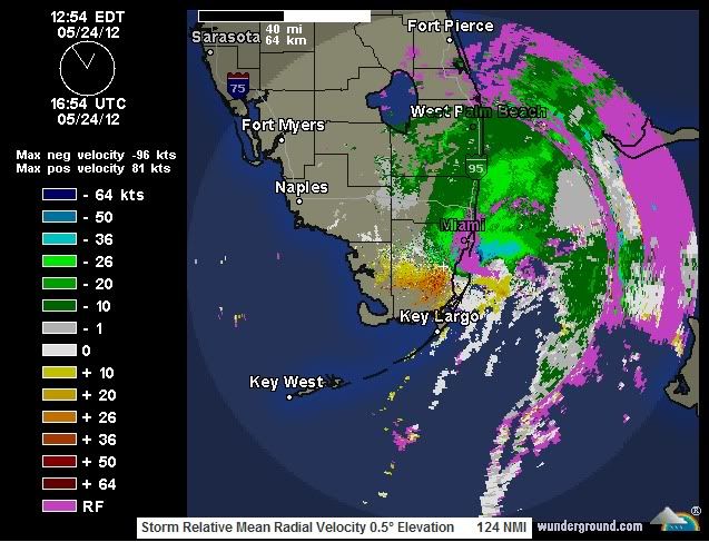
SATELLITE AND SURFACE OBSERVATIONS INDICATE THAT THE AREA OF LOW
PRESSURE...CURRENTLY LOCATED OVER THE MIDDLE FLORIDA KEYS AND
FLORIDA BAY...HAS BECOME BETTER DEFINED OVER THE PAST FEW HOURS.
THIS SYSTEM IS PRODUCING SUSTAINED WINDS OF AROUND 30 MPH AND WIND
GUSTS OF TROPICAL STORM FORCE...MAINLY TO THE EAST OF THE CENTER
OVER WATER. CURRENTLY...THE LARGE AREA OF SHOWERS AND THUNDERSTORMS
ASSOCIATED WITH THE LOW REMAINS DISORGANIZED DUE TO STRONG
UPPER-LEVEL WINDS. HOWEVER...ENVIRONMENTAL CONDITIONS ARE EXPECTED
TO BECOME MORE CONDUCIVE FOR THE FORMATION OF A SUBTROPICAL OR
TROPICAL CYCLONE BY SATURDAY
AS THIS SYSTEM MOVES NORTHEASTWARD AT
10 TO 15 MPH INTO THE SOUTHWESTERN ATLANTIC OCEAN. THIS SYSTEM HAS
A MEDIUM CHANCE...40 PERCENT...OF BECOMING A TROPICAL OR
SUBTROPICAL CYCLONE DURING THE NEXT 48 HOURS.

REGARDLESS OF ANY DEVELOPMENT...LOCALLY HEAVY RAINFALL...
FLOODING...AND GUSTY WINDS ARE POSSIBLE OVER SOUTH FLORIDA...THE
FLORIDA KEYS...PORTIONS OF CUBA...AND THE BAHAMAS. ANOTHER SPECIAL
TROPICAL WEATHER OUTLOOK FOR THIS SYSTEM WILL BE ISSUED ON FRIDAY.
FOR ADDITIONAL INFORMATION ON THIS SYSTEM...PLEASE SEE HIGH SEAS
FORECASTS ISSUED BY THE NATIONAL WEATHER SERVICE...AND PRODUCTS
FROM YOUR LOCAL WEATHER OFFICE.

ELSEWHERE...TROPICAL CYCLONE FORMATION IS NOT EXPECTED DURING THE
NEXT 48 HOURS.

&&

HIGH SEAS FORECASTS ISSUED BY THE NATIONAL WEATHER SERVICE CAN BE
FOUND UNDER AWIPS HEADER NFDHSFAT1 AND WMO HEADER FZNT01 KWBC.

$$
FORECASTER BRENNAN/FRANKLIN
Last edited by Evil Jeremy on Thu May 24, 2012 12:00 pm, edited 1 time in total.
0 likes   
Frances 04 / Jeanne 04 / Katrina 05 / Wilma 05 / Fay 08 / Debby 12 / Andrea 13 / Colin 16 / Hermine 16 / Matthew 16 / Irma 17

lebron23
Category 1
Category 1
Posts: 389
Age: 31
Joined: Sat May 24, 2008 11:58 am
Contact:

#151 Postby lebron23 » Thu May 24, 2012 11:59 am

40 percent hmm
0 likes   

Aric Dunn
Category 5
Category 5
Posts: 21238
Age: 42
Joined: Sun Sep 19, 2004 9:58 pm
Location: Ready for the Chase.
Contact:

#152 Postby Aric Dunn » Thu May 24, 2012 12:01 pm

yeah not surprised. been trying to get better organized. but with shear of nearly 70 mph pretty much not going to happen.
0 likes   
Note: If I make a post that is brief. Please refer back to previous posts for the analysis or reasoning. I do not re-write/qoute what my initial post said each time.
If there is nothing before... then just ask :)

Space & Atmospheric Physicist, Embry-Riddle Aeronautical University,
I believe the sky is falling...

ozonepete
Professional-Met
Professional-Met
Posts: 4743
Joined: Mon Sep 07, 2009 3:23 pm
Location: From Ozone Park, NYC / Now in Brooklyn, NY

Re:

#153 Postby ozonepete » Thu May 24, 2012 12:06 pm

Aric Dunn wrote:doppler estimates of that convection nearly ontop of miami beach are showing winds of nearly 70mph new severe t'storm warning for it.


Here's a storm relative velocity radar image from just before 1PM. You can see at least 50 knot winds just offshore from Miami. It also shows the curvature of the LLC feature pretty well.

Image
0 likes   

User avatar
tailgater
S2K Supporter
S2K Supporter
Posts: 3339
Joined: Sun Jul 11, 2004 9:13 pm
Location: St. Amant La.

Re: ATL: INVEST 94L:Special Tropical Weather Outlook-Orange-40%

#154 Postby tailgater » Thu May 24, 2012 12:12 pm

yeah looks like it's (llc) has shifted right, to just the east of Miami, NOW REPORTING NNE winds at 18mph.
0 likes   
The following post is NOT an official forecast and should not be used as such. It is just the opinion of the poster and may or may not be backed by sound meteorological data. It is NOT endorsed by any professional institution including storm2k.org For Official Information please refer to the NHC and NWS products.

User avatar
northjaxpro
S2K Supporter
S2K Supporter
Posts: 8900
Joined: Mon Sep 27, 2010 11:21 am
Location: Jacksonville, FL

Re: ATL: INVEST 94L:Special Tropical Weather Outlook-Orange-40%

#155 Postby northjaxpro » Thu May 24, 2012 12:20 pm

tailgater wrote:yeah looks like it's (llc) has shifted right, to just the east of Miami, NOW REPORTING NNE winds at 18mph.


Looking at radar and visible satellite imagery, indeed it looks as if the LLC is due south-southeast of Miami right now.
0 likes   
NEVER, EVER SAY NEVER in the tropics and weather in general, and most importantly, with life itself!!

________________________________________________________________________________________

Fay 2008 Beryl 2012 Debby 2012 Colin 2016 Hermine 2016 Julia 2016 Matthew 2016 Irma 2017 Dorian 2019

lebron23
Category 1
Category 1
Posts: 389
Age: 31
Joined: Sat May 24, 2008 11:58 am
Contact:

#156 Postby lebron23 » Thu May 24, 2012 12:22 pm

With all the shear I really have to doubt chances for development.
0 likes   

User avatar
Riptide
Category 2
Category 2
Posts: 753
Age: 33
Joined: Fri Jul 23, 2010 3:33 pm
Location: Cape May, New Jersey
Contact:

Re: ATL: INVEST 94L:Special Tropical Weather Outlook-Orange-40%

#157 Postby Riptide » Thu May 24, 2012 12:25 pm

The structure of Invest 94L is changing at lightspeed, i'm surprised by the rate of organization. It was a hot mess only 12 hours ago.
0 likes   

User avatar
Fyzn94
Tropical Storm
Tropical Storm
Posts: 190
Joined: Thu Jul 07, 2011 10:00 pm
Location: Central AR, USA

Re: ATL: INVEST 94L:Special Tropical Weather Outlook-Orange-40%

#158 Postby Fyzn94 » Thu May 24, 2012 12:26 pm

In the event that it does develop.....when did we last have 2 pre-season tropical cyclones in the ATL?
0 likes   
NOTICE: I cannot give an expert analysis. Most of my "observations" are made visually with the help of only vital information provided by public advisories.

seahawkjd
S2K Supporter
S2K Supporter
Posts: 632
Joined: Wed Sep 10, 2003 4:12 pm
Location: Morehead City, NC
Contact:

Re: ATL: INVEST 94L:Special Tropical Weather Outlook-Orange-40%

#159 Postby seahawkjd » Thu May 24, 2012 12:27 pm

It was in the 1800's so its been a while.
0 likes   
Gloria, Hugo, Emily, Bertha, Bonnie, Dennis (twice), Fran, Floyd, Isabel, Irene, Arthur, Matthew, Florence, Dorian (and many tropical storms and nor'easters).

Aric Dunn
Category 5
Category 5
Posts: 21238
Age: 42
Joined: Sun Sep 19, 2004 9:58 pm
Location: Ready for the Chase.
Contact:

Re: ATL: INVEST 94L:Special Tropical Weather Outlook-Orange-40%

#160 Postby Aric Dunn » Thu May 24, 2012 12:29 pm

northjaxpro wrote:
tailgater wrote:yeah looks like it's (llc) has shifted right, to just the east of Miami, NOW REPORTING NNE winds at 18mph.


Looking at radar and visible satellite imagery, indeed it looks as if the LLC is due south-southeast of Miami right now.


unfortunately there are no west wind reports associated with that feature. All still east to ene. albeit at over 40mph right now.
0 likes   
Note: If I make a post that is brief. Please refer back to previous posts for the analysis or reasoning. I do not re-write/qoute what my initial post said each time.
If there is nothing before... then just ask :)

Space & Atmospheric Physicist, Embry-Riddle Aeronautical University,
I believe the sky is falling...


Return to “2012”

Who is online

Users browsing this forum: No registered users and 35 guests